Key Points
- Cabinet Approval Secured: Cardiff Council’s cabinet has formally approved progression to a competitive tender process for Phase 1a of the Cardiff to Newport Sustainable Transport Corridor.
- Kingsway Transformation: The initial phase features a major redevelopment of Kingsway, transforming the vehicle-dominated thoroughfare into a pedestrian-prioritised, tree-lined boulevard and landmark civic square.
- Strategic Infrastructure: The project will deliver a permanent segregated cycleway extending from the city centre to the county boundary at St Mellons, replacing existing temporary “pop-up” cycle infrastructure.
- Multimodal Integration: Infrastructure designs incorporate dedicated bus priority measures to enhance service reliability and link key transit hubs, including Queen Street railway station and future regional stations.
- Congestion Concerns Raised: Opposition councillors have formally questioned whether the reduction of traffic lanes and revised junction sequencings will inadvertently exacerbate commuter gridlock within central Cardiff.
- Funding and Timeline: Funded via the Regional Transport Fund, the Burns Grant Fund, and local capital allocations, construction is slated to commence in early 2027 for completion by summer 2028.
Cardiff (Cardiff Daily) June 20, 2026 – A major inter-city infrastructure project linking two of south Wales’ principal urban centres has cleared its first major legislative hurdle after municipal leaders formally greenlit the procurement process for its foundational phase. As detailed in official cabinet papers published by Cardiff Council, the executive body has sanctioned a move to competitive tender for Phase 1a of the Cardiff to Newport Sustainable Transport Corridor. The sweeping cross-boundary initiative aims to establish a high-quality, permanent environmental corridor prioritising active travel and public transit over private automobile usage along the crucial eastern arterial network.
- Key Points
- Why Is The First Phase Of The Cardiff To Newport Corridor Moving To Competitive Tender?
- How Will The Kingsway Redevelopment Alter Cardiff’s City Centre Layout?
- What Transport Infrastructure Upgrades Are Planned For Cyclists And Buses?
- What Operational and Congestion Concerns Have Been Raised by Officials?
- Background of the Sustainable Transport Corridor Development
- Predictions: How This Infrastructure Development Will Affect Regional Commuters and Residents
- Environmental and Public Realm Impact for City Residents
Why Is The First Phase Of The Cardiff To Newport Corridor Moving To Competitive Tender?
As reported by staff writers at Nation.Cymru, the Cabinet of Cardiff Council convened on June 18, 2026, to evaluate comprehensive engineering and environmental assessments before ultimately authorizing the project team to launch the formal procurement cycle.
This administrative sign-off transitions the long-discussed transport link from a conceptual design framework into an active infrastructure procurement operation.
The competitive tender process will invite commercial civil engineering firms to bid on constructing Phase 1a, which encompasses the critical western terminus of the corridor within the heart of Cardiff’s urban core.
Writing for Wales 247, journalist Rhys Gregory noted that the initial construction package is designed to radically alter the public realm.
The core objective of this primary phase is to deliver sustainable infrastructure linking the city centre directly to West Grove junction, which will eventually scale across subsequent phases to Cypress Drive in St Mellons and the definitive administrative boundary separating Cardiff and Newport.
According to municipal planning logs, the broader project is slated for delivery across six distinct geographic phases, ensuring that local traffic disruption is mitigated as the civil works advance eastwards.
How Will The Kingsway Redevelopment Alter Cardiff’s City Centre Layout?
The architectural and spatial centerpieces of Phase 1a involve a complete structural reconfiguration of Kingsway, an essential yet historically vehicle-dominated transit artery in central Cardiff. According to project specifications verified by Safer Highways, the approved designs call for the removal of the existing Kingsway pedestrian subway.
This subterranean crossing, long criticized by active travel advocates as an inaccessible and poorly lit bottleneck, will be entirely backfilled and replaced with wide, step-free, street-level pedestrian crossings designed to optimize accessibility for individuals with limited mobility.
The re-engineered streetscape will feature a tree-lined boulevard configured with extended footways, integrated rain gardens, and sustainable urban drainage features (SuDS). Council engineering briefs indicate these drainage mechanisms are systematically designed to manage localized surface water runoff, improve urban biodiversity, and provide a cooling effect to combat the “urban heat island” phenomenon during periods of high summer temperatures.
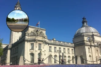
Furthermore, the newly created civic space will establish an unobstructed, seamless visual and physical link between the commercial city centre and the historic civic centre. This public realm transformation is intended to function as an “event-ready” square capable of hosting public markets, outdoor performances, and community gatherings, whilst simultaneously framing enhanced views of regional heritage landmarks such as City Hall and the National Museum of Wales.
What Transport Infrastructure Upgrades Are Planned For Cyclists And Buses?
A fundamental objective of the corridor scheme is the implementation of dedicated, physically segregated active travel routes. As confirmed by Councillor Dan De’Ath, Cardiff Council’s Cabinet Member for Climate Change, Strategic Planning and Transport, the newly tendered phase will construct a permanent, high-quality cycleway.
This asset will permanently replace the temporary “pop-up” cycle lanes that were rapidly deployed during pandemic-era restructuring.
The new route is engineered to integrate seamlessly into Cardiff’s expanding strategic cycle network, forming immediate junctions with Cycleway 1 (which routes toward the University Hospital of Wales in Heath), the Roath Park cycleway (Cycleway 6), and the established Rhymney Trail.
Beyond cycling infrastructure, the corridor integrates extensive bus priority allocations to address long-standing transit delays. Local bus operators have consistently signaled to transport planners that the existing 15-mile journey between Cardiff and Newport regularly exceeds one hour due to acute peak-time congestion. The tendered infrastructure introduces dedicated bus lanes and reconfigured junction priorities designed to isolate public transit vehicles from general traffic delays.
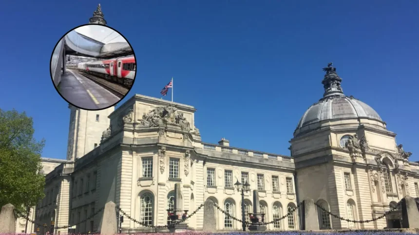
According to council documents, these improvements are aimed at securing reliable, predictable journey times while enhancing future connectivity to vital regional transport hubs, including Cardiff Queen Street railway station, the newly opened central bus interchange, Churchill Way, and the projected future rail stations at Cardiff East and Cardiff Parkway.
What Operational and Congestion Concerns Have Been Raised by Officials?
Despite the cabinet’s definitive approval to progress the project to the tender stage, the scheme has encountered political pushback regarding its potential impact on urban traffic flow.
Reporting on the proceedings of Cardiff Council’s Environmental Scrutiny Committee, Wales Online journalist Kieran Molloy disclosed that the leader of the city’s Conservative opposition group, Councillor John Lancaster, raised formal apprehensions that the re-allocation of road space could inadvertently exacerbate gridlock within the municipal boundaries.
The scrutiny documentation explicitly acknowledges these operational hazards, stating under a dedicated “current challenges and issues” section:
“Cardiff’s constrained road network, alongside concurrent schemes, creates risks of congestion during and after construction, although transport modelling has informed the design.”
To counter these concerns, Cardiff Council’s Chief Officer for Transport, Philip Belcher, clarified during the scrutiny sessions that the authority has executed rigorous transport modeling to balance vehicular capacity against pedestrian demand.
Officer Belcher explained that at the vital Park Place junction, engineers are introducing two additional pedestrian crossing facilities tailored to mirror precise foot-traffic data. Furthermore, by deliberately reallocating the strategic cycleway to the northern side of the West Grove junction and altering the signal-staging sequence of the automated traffic lights, the council asserts it has successfully optimized the intersection so that overall vehicular throughput and active travel safety effectively balance out for this specific phase of the deployment.
Background of the Sustainable Transport Corridor Development
The conceptual origin of the Cardiff to Newport Sustainable Transport Corridor is rooted in the structural cancellation of the proposed M4 Relief Road around Newport by the Welsh Government in 2019, which cited severe environmental concerns regarding the protected Gwent Levels and escalating capital costs.
Following that cancellation, the South East Wales Transport Commission—frequently referred to as the Burns Commission—was established under the chairmanship of Professor Lord Burns to devise alternative strategic methods for alleviating chronic congestion across the regional interstate network.
In its final recommendations published on November 26, 2020, the Commission advocated for the rapid deployment of a “network of alternatives.”
This framework recommended a comprehensive, multi-million-pound investment into public transport and active travel infrastructure to give commuters viable alternatives to private car dependency.
Out of this mandate emerged the £50 million Metro Plus Regional Transport Authority Programme, jointly funded by a £15 million allocation from the Welsh Government, £15 million via the Cardiff Capital Region City Deal, and an additional £20 million aggregated from local authorities and private capital partners.
The current corridor project represents the direct execution of those recommendations by Cardiff Council, Newport City Council, and Transport for Wales (TfW). Previous cross-boundary consultations launched in 2022 explored multiple structural options for the A48 arterial link and the National Cycle Network Route 88 (NCN88), evaluating varying levels of bus segregation, lane reallocations, and speed limit reductions from 50 mph to 30 mph through key commuter settlements like Castleton and Marshfield.
The authorization of Phase 1a marks the definitive transition from these regional multi-agency consultations into localized structural implementation.
Explore More Cardiff Council News
Savills Cladding Safety Works Approved at Prospect Place, Cardiff Bay 2026
Cardiff Council Approves Prospect Place Cladding Upgrades: Cardiff Bay 2026
Predictions: How This Infrastructure Development Will Affect Regional Commuters and Residents
The progression of Phase 1a into active tendering signals a profound, long-term shift in how daily commuters, local businesses, and regional residents will navigate the transport architecture between Cardiff and the eastern boundaries of the capital region.
For the thousands of daily commuters who regularly traverse the Newport Road and A48 corridors, the project will introduce a multi-year period of transitional friction. Under the current municipal timeline, following the conclusion of the summer 2026 procurement cycle, major civil engineering works are scheduled to commence in early 2027, with an estimated completion window stretching to the summer of 2028.
During this construction phase, motorists must anticipate localized lane closures, temporary traffic diversions, and altered signal sequences around Kingsway and West Grove, which will likely elevate travel times in the short term.
However, once operational, the infrastructure is structurally designed to reshape modal splits. Commuters utilizing public bus networks will see a marked improvement in journey times and schedule reliability. By insulating buses from standard traffic queues via dedicated priority lanes and signal pre-emption at major roundabouts, the corridor will directly address the chronic unpredictability that has historically hindered regional bus operators.
Conversely, private motorists will experience a permanently constrained highway environment; as multi-lane approaches are reallocated to accommodate segregated cycleways and bus paths, single-occupant vehicle travel will likely become slower and more restrictive, explicitly designed by planners to disincentivize short-to-medium-distance car journeys.
Environmental and Public Realm Impact for City Residents
For local residents and urban citizens within the central and eastern wards of Cardiff, the completion of Phase 1a will radically alter the immediate sensory and physical environment.
The replacement of the Kingsway subway with street-level crossings and the introduction of an open, event-ready civic square will significantly improve pedestrian safety and connectivity between the commercial center and the civic precinct.
The inclusion of extensive tree planting, urban rain gardens, and integrated sustainable drainage architecture will contribute directly to localized climate resilience, reducing surface water flooding risks during severe weather events and mitigating intense heat signatures within the built environment.