Key Points
- A flood alert covered parts of the River Leadon catchment on Thursday, November 19, 2026.
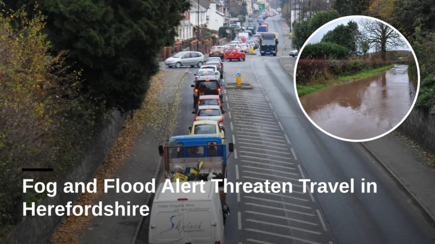
- Low-lying land and roads near the River Leadon faced possible flooding, with water reported over the road at Upleadon Court.
- Locations potentially affected included Ledbury, Much Marcle, Staunton, Tibberton and Wedderburn Bridge.
- Official guidance urged people not to walk, cycle or drive through flood water.
- Fog and rain created additional risks for motorists, including reduced visibility and possible travel disruption.
Herefordshire (Cardiff Daily) November 19, 2026 — Drivers and other travellers in and around Herefordshire faced disruption risks as fog, rain and a flood alert affected roads near the River Leadon catchment. The alert warned that rising river levels could flood low-lying land and roads, while visibility was reduced in places by fog. The Environment Agency advised people to avoid walking, cycling or driving through flood water and to monitor updates.
Which areas were affected by the flood alert?
As reported by the Hereford Times in its live traffic and travel coverage, flooding was possible along the River Leadon and nearby watercourses. Ledbury, Much Marcle, Staunton, Tibberton and Wedderburn Bridge were listed among the locations that could be affected.
Information supplied by the Environment Agency stated that Wedderburn Bridge might become impassable and that water was over the road at Upleadon Court. Further rainfall was forecast over the following 48 hours, with officials monitoring conditions.
What did official flooding information say?
Government flood information recorded 15 flood alerts in England at 6.05am on November 19. It said flooding was possible and that land, roads and some properties could be affected, potentially causing travel disruption.
A separate flood-alert report for the River Leadon catchment said flooding could affect low-lying land and roads adjacent to the river. The alert was due to be updated by 9am or sooner if conditions changed.
How could fog and flooding affect travel?
Fog could reduce visibility for motorists, making it harder to identify standing water, road hazards and other vehicles. Flooding could result in temporary restrictions, slower journeys and the closure of roads or bridges in low-lying areas.
Drivers should allow additional travel time, reduce speed and avoid routes covered by flood water. People travelling through affected areas should check current road and flood information before setting out and follow any signs or instructions from emergency authorities.
What is the background to the development?
The River Leadon catchment spans parts of Herefordshire, Gloucestershire and Worcestershire. The Environment Agency issued the alert after forecast rising river levels created a risk of flooding on Thursday, November 19. Recent and forecast rainfall increased the possibility of water affecting roads beside the river and its tributaries. Officials said the situation was being monitored and that the alert would be updated as conditions changed.
What could happen to traffic and travel?
Traffic may remain slower around low-lying roads and bridges near the River Leadon if water levels rise. Fog could compound delays by reducing visibility, particularly during morning journeys and on rural roads. Wedderburn Bridge or other affected crossings could become unsuitable for vehicles if flooding worsens, requiring diversions. Travellers should check live traffic information and official flood updates before leaving and should never drive through flood water.