Key Points
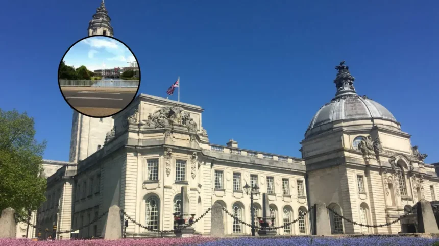
- Active Travel Infrastructure: Plans have been formally approved for a 165-metre-long, 6-metre-wide pedestrian and cycle bridge spanning the River Taff in Cardiff.
- Community Connection: The new crossing will directly link The Marl in Grangetown with Hamadryad Park in Butetown, establishing a critical east-west connection.
- Regeneration Strategy: The bridge serves as a key infrastructure milestone within the wider Channel View regeneration masterplan, which underpins Cardiff Council’s broader target to build 4,000 new homes across the city.
- Funding Status: While planning permission has been secured, the project is moving into a secondary phase focused entirely on establishing a viable funding strategy, with local authorities exploring all available options.
- Network Integration: The design will integrate with existing active travel infrastructure, intended to eventually establish a comprehensive link between the Taff Trail and the Ely Trail.
Cardiff (Cardiff Daily) June 8, 2026 – A major new pedestrian and cycle bridge over the River Taff has moved a step closer to reality following formal planning approval from Cardiff Council’s Planning Committee. The infrastructure project is designed to connect The Marl recreation ground in Grangetown directly to Hamadryad Park in Butetown. Dictated by the city’s broader urban development strategy, the approval represents a pivotal milestone in the comprehensive regeneration of the Channel View estate. This masterplan is embedded within an ambitious municipal housing initiative aimed at delivering 4,000 new homes across the Welsh capital.
- Key Points
- How Will the New River Taff Crossing Impact Grangetown and Butetown?
- What Role Does the Bridge Play in the Channel View Masterplan?
- What Has Cardiff Council Said About the Infrastructure Approval?
- How Will the Project Be Funded and What Are the Next Steps?
- Background of the Channel View Regeneration
- Prediction: How This Development Can Affect Local Residents and Commuters
The newly approved crossing will feature an overall length of approximately 165 metres and a width of six metres. Engineered to accommodate both pedestrians and cyclists simultaneously, the structure incorporates gentle gradients to ensure universal accessibility for users walking, wheeling, or cycling. Aside from connecting the two immediately adjacent neighbourhoods, the bridge is intended to plug existing gaps in Cardiff’s active travel network by strengthening local trails and eventually solidifying a key connection between the established Taff Trail and the Ely Trail.
With planning consent secured, Cardiff Council officials have confirmed that the immediate next stage of the scheme will center on securing an explicit funding strategy to advance from design approval to physical construction.
How Will the New River Taff Crossing Impact Grangetown and Butetown?
The structural introduction of the crossing aims to alter the physical relationship between Grangetown and Butetown, two historically distinct neighbourhoods separated by the natural barrier of the River Taff.
By establishing a direct link between The Marl and Hamadryad Park, the infrastructure will establish an alternative east-west route designed to bring the communities closer together.
According to documentation released by the Cardiff Council Planning Committee, the primary objective of the bridge is to create a more connected, accessible neighbourhood layout that serves both the current population and future residents moving into the impending housing developments.
By creating a dedicated, car-free transit corridor, the project aims to render local amenities, employment hubs, and regional leisure opportunities substantially more accessible to residents living on either side of the riverbank.
What Role Does the Bridge Play in the Channel View Masterplan?
The development of the bridge is explicitly tied to the wider Channel View housing and estate regeneration masterplan. This estate-wide overhaul represents one of the largest single components of Cardiff Council’s overarching municipal housing strategy, which is working toward a city-wide output of 4,000 new homes.
The integration of improved public spaces and dedicated sustainable transit links is being treated by planners as a prerequisite for the high-density residential developments planned for the area.
Municipal data indicates that the bridge is intended to complement, rather than replace, existing river crossings by offering a safer, entirely segregated path dedicated to active travel, thereby easing potential congestion on nearby road bridges.
What Has Cardiff Council Said About the Infrastructure Approval?
Following the decision by the Planning Committee, local authority leaders underscored the strategic importance of the infrastructure for the city’s environmental and transport goals.
As reported by official statements published by Cardiff Council, Cabinet Member for Housing and Communities, Councillor Lynda Thorne, stated that:
“The new bridge plays an important role in our vision for the regeneration of Channel View and the wider area, as well as improving active travel across the city. It will provide a safe, dedicated route for walking and cycling, creating a new east–west connection across the river that will encourage more sustainable journeys and reduce reliance on cars.”
Councillor Thorne further commented on the operational next steps for the local authority, adding:
“It’s great news that Planning Committee has granted approval. We will continue to explore funding options to help deliver the bridge and strengthen key routes in our active travel network.”
How Will the Project Be Funded and What Are the Next Steps?
Despite successfully navigating the regulatory planning process, the physical delivery of the River Taff crossing remains contingent on securing capital investment. Cardiff Council’s housing and planning departments have noted that the project is now transitioning into a dedicated strategy formulation phase.
The immediate focus for municipal officers will be the development of a comprehensive funding framework. Representatives from the Council have stated that they are actively exploring all available avenues, which historically includes combinations of active travel grants from the Welsh Government, developer contributions via Section 106 agreements tied to the Channel View housing scheme, and capital allocations from central infrastructure funds.
A definitive timeline for the commencement of construction has not been confirmed, pending the outcome of these funding evaluations.
Background of the Channel View Regeneration
The approval of the pedestrian and cycle bridge represents the latest phase in a multi-year effort by Cardiff Council to address aging housing stock and fractured transport links in south Cardiff.
The Channel View estate, originally built decades ago, has faced structural challenges, prompting the council to design a comprehensive masterplan to completely redevelop the site.
The estate’s regeneration strategy relies on a phased demolition and rebuilding process to prevent widespread displacement of existing tenants while significantly increasing overall housing density and energy efficiency.
Historically, the riverfront areas of Grangetown and Butetown developed independently around Cardiff’s industrial docks, creating modern urban layouts where east-west movement is constrained by the River Taff.
Over the past decade, Cardiff Council has increasingly prioritised “active travel” networks under the mandates of the Active Travel (Wales) Act 2013, which requires Welsh local authorities to continuously improve facilities for walkers and cyclists.
The proposed 165-metre bridge was conceived not only as a localized estate asset but as a vital missing link to bridge the geographic divide between the major recreational and commuter corridors of the Taff and Ely trails.
Explore More Cardiff Council News
Paul Orders Standing Down as Cardiff Council Chief Executive 2026
Chris Weaver Backed as New Cardiff Council Leader, Cardiff 2026
Prediction: How This Development Can Affect Local Residents and Commuters
If fully funded and constructed, this infrastructure asset will directly alter the daily transit patterns of local residents and active commuters in south Cardiff. For residents of Grangetown, the bridge will provide direct, low-stress access to the open green spaces of Hamadryad Park and the Cardiff Bay wetlands without requiring detours via busy vehicular routes such as the A4119 or Clarence Road Bridge.
Conversely, Butetown residents will gain direct access to the sports pitches and recreational facilities at The Marl.
For school children and daily commuters traveling between these two districts, the six-metre-wide segregated path will eliminate proximity to vehicular exhaust and traffic hazards, likely increasing the modal share of walking and cycling in the immediate area.
However, because the council has explicitly stated that a funding strategy is still being developed, residents may experience a multi-year gap between this planning approval and any physical construction.