Key Points
- Cardiff Council has formally submitted plans to transform a central junction on Kingsway into a green, tree-lined public square.
- Planning documentation highlights that heavy traffic, poor crossings, and an ageing subway have turned the area into a space perceived as run-down, neglected, and unsafe.
- The proposed transformation includes removing the Boulevard De Nantes pedestrian subway and replacing it with well-lit, street-level crossings.
- The scheme will introduce wide footways, new cycle paths, rain gardens, sustainable drainage, outdoor seating, and space for cafe spill-outs.
- The upper section of Kingsway will be closed to general motor traffic, creating an “event-ready” space capable of hosting markets, performances, and public gatherings.
- Historical monuments, including the 2nd Marquis of Bute statue, will be relocated to the square to reinforce local heritage and civic pride.
- Construction for Phase 1a is targeted to begin in early 2027 with completion expected by summer 2028, forming part of the broader Cardiff to Newport Sustainable Transport Corridor.
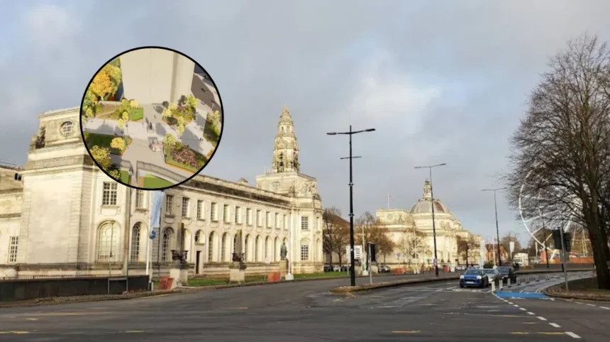
Cardiff (Cardiff Daily) August 19, 2026 — Major regeneration plans to completely overhaul a traffic-dominated space in Cardiff city centre have advanced following a formal planning application submission by Cardiff Council. The project aims to convert an area near Kingsway—previously described in official planning documentation as “neglected and unsafe”—into a tree-lined public boulevard featuring open space, pedestrian crossings, cycle infrastructure, and framed views toward historic landmarks such as City Hall and the National Museum.
- Key Points
- What are the key details of the Kingsway transformation plans?
- How will the public square integrate green infrastructure and civic heritage?
- How does Kingsway fit into Cardiff’s broader transport strategy?
- What is the official delivery timeline for the Kingsway project?
- Background of the Kingsway Development
- Prediction: How this development will affect local residents, businesses, and commuters
What are the key details of the Kingsway transformation plans?
As reported by journalist Kieran Molloy of WalesOnline, official planning submission documents prepared by landscape architecture firm TACP reveal that the project will completely replace a car-centric junction with an accessible, pedestrian-first urban space. The documentation notes that historical issues surrounding Kingsway have contributed to negative public perception.
According to the planning statement submitted to Cardiff Council,
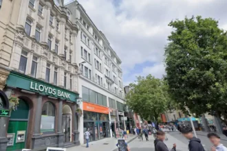
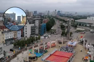
“Around Kingsway heavy traffic, poor pedestrian crossings, and an ageing underpass has created an environment that feels neglected and unsafe and spaces often associated with anti-social behaviour. Poor maintenance such as worn road markings and dated surfaces reinforce the sense of decline, while vehicle pollution added to the area’s unappealing character. As a result, Kingsway has become a place that people pass through rather than a destination, contributing to a long-term perception of it as run-down.”
To resolve these issues, the upper section of Kingsway between Boulevard De Nantes and Greyfriars Road will be closed to general vehicular traffic, leaving access solely for servicing and pre-approved events.
The existing subterranean pedestrian subway on Boulevard De Nantes will be completely removed, alongside its ramps and steps, to be replaced by at-grade, step-free crossings with high-visibility street lighting.
How will the public square integrate green infrastructure and civic heritage?
The design introduces extensive urban greening, including new tree plantings, rain gardens, integrated sustainable drainage systems (SuDS), and enhanced physical connections to nearby Friary Gardens and Cathays Park. Benches, wide stone footways, dedicated cycle parking, and designated space for small cafe spill-outs are also embedded within the master plan.
In addition to environmental features, the public realm design incorporates historic artwork and statues. Cardiff Council confirmed that the 2nd Marquis of Bute statue will be relocated from Callaghan Square to a central focal point within the new Kingsway square, while the Nereid Statue will be moved to an accessible green space nearby.
How does Kingsway fit into Cardiff’s broader transport strategy?
As reported by senior reporter Bryana Francis of WalesOnline, the Kingsway public realm project forms Phase 1a of the overarching Cardiff to Newport Sustainable Transport Corridor scheme.
This wider regional infrastructure program intends to deliver continuous high-quality cycleways and bus priority measures stretching from Cardiff city centre to the county boundary at St Mellons, eventually connecting with Newport’s transport network.
Phase 1a spans from the city centre along Boulevard De Nantes, Stuttgarter Strasse, Dumfries Place, and Newport Road up to the West Grove junction. The cycle infrastructure will link into pre-existing corridors, including the route towards the University Hospital of Wales in Heath, the Roath Park cycleway, and the Rhymney Trail.
Addressing the strategic necessity of the project, Councillor Dan De’Ath, Cabinet Member for Climate Change, Strategic Planning and Transport, stated:
“The first phase of this scheme will be an important step towards significantly improving Kingsway and creating sustainable transport options from Cardiff to the eastern boundary of the city. We must build the infrastructure needed to make sustainable travel more attractive, including walking, cycling and public transport, to encourage people to leave their cars at home. This will support healthier lifestyles and help tackle climate change.”
What is the official delivery timeline for the Kingsway project?
Cardiff Council outlines that following formal planning consideration and procurement steps, the tender process for Phase 1a will be conducted in mid-to-late 2026. Construction work on-site is scheduled to commence in early 2027, with full operational completion expected by the summer of 2028.
Funding for Phase 1a is secured through a combination of capital contributions, including the Welsh Government’s Regional Transport Fund, the Burns Grant Fund, and Cardiff Council’s Capital Programme. Public engagement mechanisms, including consultation with the council’s representative Citizen Panel, remain ongoing to refine the detailed layouts of future phases along the corridor.
Explore More City Centre News
Cardiff Council Approves 33-Storey Co-Living Skyscraper in Cardiff 2026
Cardiff City Centre Sales Surge 4.3% in June, Cardiff 2026
Background of the Kingsway Development
The area around Kingsway and Boulevard De Nantes has historically functioned as a primary arterial ring-road for vehicular traffic navigating Cardiff’s civic center and retail core.
Over recent decades, the dominance of motor vehicles, combined with sub-surface pedestrian underpasses constructed during mid-20th-century urban planning initiatives, created significant physical barriers between the retail heart of the city and the historic Cathays Park civic precinct.
In June 2024, Cardiff Council unveiled preliminary conceptual designs aimed at reallocating highway space to active travel and pedestrian infrastructure.
The strategy aligns with Cardiff’s One Planet strategy and Transport White Paper, which target a modal shift toward public transport, walking, and cycling to achieve net-zero carbon targets.
The progression from preliminary concepts to detailed planning applications marks the operational phase of integrating the civic quarter into the wider urban footprint.
Prediction: How this development will affect local residents, businesses, and commuters
The transition of Kingsway from a traffic conduit into a public square is anticipated to have distinct operational and economic effects across multiple user groups in Cardiff:
- Pedestrians and Local Residents: The removal of the Boulevard De Nantes subway in favour of well-lit, street-level crossings directly addresses long-standing safety concerns regarding anti-social behavior. Residents and visitors navigating between the city centre, Cardiff Castle, and the National Museum will experience step-free, safer access, while the addition of mature trees and rain gardens will improve local microclimate conditions and air quality.
- Local Businesses and Hospitality: Retailers and food-and-drink operators along Greyfriars Road and upper Kingsway are likely to benefit from increased footfall generated by cafe spill-out space, outdoor markets, and public events. Transitioning the space from a transit-only zone into a destination square increases dwell time for visitors, potentially boosting revenue for nearby commercial establishments.
- Commuters and Motorists: Motorists relying on Kingsway as a primary thoroughfare will face altered traffic routes due to the closure of the upper section to general traffic. Conversely, bus users and cyclists are predicted to see improved travel consistency and safety as dedicated cycle lanes and bus priority infrastructure take effect across the wider Newport Road transport corridor.