Key Points
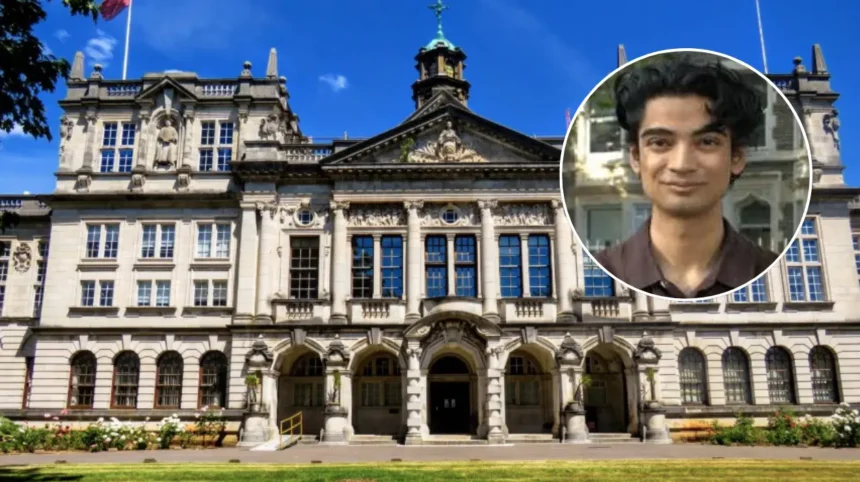
- Undergraduate Achievement: Arsalaan Ahmad, a 23-year-old Computer Science graduate from Cardiff University, has managed to publish his first research article as a principal author in the journal of Frontiers in Remote Sensing.
- Motivation from Oman: Born and raised in Musandam Peninsula, Oman, Arsalaan grew an intense passion for natural disasters and landslides, and this had a significant impact on the field of his research.
- The “Black Box Problem” Solved: Along with Dr. Oktay Karakuş and Professor Paul Rosin, Arsalaan’s research is trying to address large bloated AI mapping models by proposing a compact 8-channel model which performs just as accurately and much faster on cheaper hardware.
- Business Endeavors: After graduating from the university, Arsalaan has been accepted into the selective 2026 Autumn Cohort of Entrepreneurs First, and has decided to start a business in the energy and climate technology space, not going for PhD straight away.
Cardiff University (Cardiff Daily) September 25, 2026 – Childhood spent amidst the rugged terrain of Oman’s mountains has catalysed an undergraduate’s journey from self-taught machine-learning enthusiast to published lead author in a top-tier academic journal, sparking a pathway toward the UK’s burgeoning climate-tech startup sector.
- Key Points
- How Did Arsalaan Ahmad’s Childhood in Oman Inspire His Research?
- What is the “Black Box Problem” in Satellite AI Mapping?
- How Did Cardiff University Mentors Respond to the Undergraduate Success?
- What Are Arsalaan Ahmad’s Future Plans in the UK Startup Sector?
- Background of the Particular Development
As reported by Cardiff University news representatives, publishing original research has been a primary ambition for 23-year-onal Arsalaan Ahmad since he first enrolled on a Bachelor of Science degree in Computer Science within the School of Computer Science and Informatics. Prior to this milestone, Arsalaan’s achievements included self-teaching machine-learning and developing a Roblox game that amassed 50 million visits. Reflecting on his publication, Arsalaan stated that “the first thing I did was print the paper out so I could keep it in my room alongside the poster I had made about our findings.”
How Did Arsalaan Ahmad’s Childhood in Oman Inspire His Research?
Born and raised in Oman, Arsalaan noted that the geography of his homeland profoundly shaped his academic pursuits. As noted by Cardiff University publications, Arsalaan remembers that he “developed a real interest in landslides living among the mountains,” observing first-hand that “in Oman, authorities take extensive measures during road and settlement construction to prevent natural disasters, which are increasing because of the effects of climate change.”
Building upon these early observations, the young researcher applied for an on-campus internship to explore landslide segmentation. While initial approaches to professors yielded some skepticism, Professor Paul Rosin—module leader for Computational Maths—recognized the merit of the concept and encouraged a formal proposal, allowing Arsalaan to take full ownership of the project from conception to completion.
What is the “Black Box Problem” in Satellite AI Mapping?
The resulting research paper, published in Frontiers in Remote Sensing and co-authored by mentors Dr Oktay Karakuş and Professor Paul Rosin, investigates the limitations of current satellite artificial intelligence systems used for mapping natural disasters. According to university disclosures, the research team examined a critical “black box problem” where existing AI models are bloated by up to 30 layers of data. This architectural bloat renders current models slow, expensive, and difficult to audit.
To counter this, the team devised an optimized framework that strips away redundant data to produce a streamlined, 8-channel AI model. As detailed in the findings, this compact model matches the accuracy of massive systems while running significantly faster on cheaper hardware, delivering rapid and explainable maps to emergency teams operating in resource-constrained environments.
How Did Cardiff University Mentors Respond to the Undergraduate Success?
Reflecting on the rarity of an undergraduate securing a first-author publication, Professor Paul Rosin, Professor of Computer Vision at Cardiff University, praised the achievement. As reported by Cardiff University, Professor Paul Rosin stated that “the ideal outcome of our on-campus internships is to create something which might be publishable but, in my experience, it is rarely achieved.” Professor Paul Rosin added that “given that Arsalaan rose to this challenge then I expect he will continue to succeed in the future. I wish him the best of luck!”
Similarly, Arsalaan emphasised the importance of proactive outreach and practical problem-solving for fellow students, advising peers not to wait for postgraduate studies before engaging with meaningful academic research.
Explore more Local Cardiff News:
Professor Cathy Holt Elected Fellow Royal Academy of Engineering Cardiff 2026
Major Roadworks Cause Severe Traffic Gridlock in Cardiff City Centre Cardiff 2026
What Are Arsalaan Ahmad’s Future Plans in the UK Startup Sector?
While postgraduate education remains a future consideration, Arsalaan has chosen to pivot towards the commercial technology market. Having been selected among the top 2% of candidates from an international pool of over 3,000 applicants, Arsalaan was recently accepted onto the Autumn 2026 cohort of Entrepreneurs First, an international business incubator and venture capital firm.
As stated by Arsalaan regarding his immediate career trajectory, “I have thought about a PhD, and I love publishing papers but right now, I’m thinking of taking my skills into the vast startup market in the UK.” He intends to focus on translating remote sensing and computer vision research into deployed commercial products within the energy and climate technology sectors.
Background of the Particular Development
The integration of artificial intelligence into remote sensing and geospatial disaster management has accelerated rapidly over recent years, driven by the escalating frequency of extreme weather events linked to global climate change. Academic institutions and private enterprises alike have increasingly sought ways to process high-resolution satellite imagery efficiently. However, traditional machine-learning models in geospatial analysis have historically suffered from massive computational overhead, requiring expensive graphical processing units (GPUs) and extensive cloud infrastructure.
Cardiff University’s School of Computer Science and Informatics has actively promoted practical, on-campus research initiatives designed to bridge the gap between theoretical computer vision and real-world deployment. By addressing computational bottlenecks such as redundant data layers—the “black box problem”—researchers are attempting to make advanced disaster-monitoring tools accessible to local authorities and emergency services in developing regions and resource-constrained environments, where expensive proprietary hardware is often prohibitive.
This development highlights a growing trend of academic institutions fostering entrepreneurial pathways directly from undergraduate programmes, potentially accelerating the commercialisation of academic research in the United Kingdom. For the higher education sector and prospective computer science students, Arsalaan Ahmad’s trajectory serves as a template for undergraduate research capabilities, demonstrating that rigorous contributions to top-tier journals are attainable prior to postgraduate specialisation.
For the energy and climate technology sector, the introduction of lightweight, 8-channel AI frameworks could significantly lower the financial barriers associated with deploying satellite-based environmental monitoring systems. If young innovators and startup incubators like Entrepreneurs First successfully commercialise these compact models, cash-strapped local governments and disaster relief agencies may soon gain cost-effective, rapid-deployment software tools to mitigate climate-induced natural disasters globally, shifting cutting-edge disaster response from expensive corporate software to agile, accessible hardware platforms.