The River Taff, flowing through Cardiff, has a long history of flooding due to its location in a low-lying catchment prone to heavy rainfall and tidal influences. Major events, such as the 1979 burst affecting suburbs like Canton and Pontcanna, highlight recurring risks exacerbated by urbanization and climate change.
River Taff Geography and Hydrology
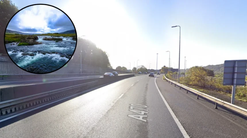
The River Taff originates in the Brecon Beacons and spans 40 miles before joining the River Ely at Cardiff Bay. Its catchment covers 669 square kilometers, characterized by steep upper valleys transitioning to flatter floodplains near Cardiff. Annual rainfall averages 1,500-2,000 mm in upland areas, fueling rapid runoff during storms.
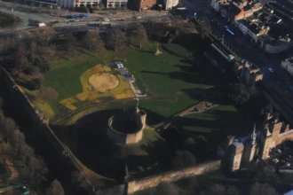
In Cardiff, the river meanders through urban zones, with Sophia Gardens and Pontcanna Fields on historic floodplains. Historical records note frequent overflows, as the river’s banks consolidate on one side while eroding others, as seen in 1820s diversions reclaiming land for Cardiff Arms Park. The floodplain’s low elevation, often below 10 meters above sea level amplifies risks when combined with Bristol Channel tides.
Hydrologically, peak flows can exceed 500 cubic meters per second during extreme events, surpassing channel capacity designed for 1-in-30-year floods (3.3% annual probability). Northern riverbanks lack formal protections in sections, allowing overtopping that conveys water southward toward Cardiff Road properties. Surface water from overwhelmed drains compounds this, with depths reaching 1.5-2.5 meters in low points.
Historical Flood Events
Flooding along the River Taff dates to at least 1797, when magistrates proposed straightening the channel east of Sophia Gardens to curb health issues from inundations. By the mid-1820s, new cuts reduced meadow flooding but shifted risks downstream.
The 1979 event, post-Christmas, saw the Taff burst after days of downpours, flooding Canton, Pontcanna, and Grangetown with up to 5 feet of water. Over 1,000 evacuations occurred, two deaths reported, and the bus fleet served as shelters; sewers welled up with seawater during high tides.
More recently, January 2023 flooding submerged Pontcanna Fields, intended as a storage area protecting the city center. February 2020 storms (Ciara, Dennis) impacted 3,130 Welsh properties, with Taff surges to 3.3 meters flooding Upper Boat residences via overtopping and sewer surcharging. Taff’s Well saw 25 homes and 9 businesses affected on Cardiff Road.
Primary Causes of Flooding
Overtopping remains the dominant mechanism, as the Taff exceeds channel capacity in un-defended sections, breaching toward Park Lane and rear gardens. Heavy rainfall up to Q200 return periods triggers this, with 2020 events overwhelming formal barriers.
Urbanization adds pluvial flooding: hard surfaces like car parks reduce soil absorption, increasing runoff. Cardiff’s drainage, outdated for population growth, fails during downpours, conveying water from highways into low-lying areas.
Tidal interactions exacerbate risks; spates meet high Bristol Channel tides, as in past city-center inundations. The Cardiff Bay barrage (1999) encloses Taff-Ely flows, but rising Ely levels now surpass Taff in some scenarios, straining systems. Combined sewer overflows deposit debris like wet wipes, further clogging banks.
Flood Impacts on Cardiff Communities
Cardiff holds the UK’s highest flood risk, with 33,000 properties (17% rise from 15% in 2020) threatened by 2050 per Fathom models factoring climate change. This tops lists including Rhondda Cynon Taff. Suburbs like Canton face repeated residential flooding, with 1979 depths displacing thousands.
Economic tolls include property damage, business closures, and infrastructure disruption; 2020 saw Taff’s Well Park inundated alongside 34 structures. Health risks from saltwater residue and sewage persist, as evaporation leaves corrosive salts. Pontcanna Fields’ role absorbs water but limits upstream spread, protecting downtown at local cost.
Socially, evacuations strain resources 1,000 in 1979 alone and erode resident confidence. Wildlife suffers from debris-choked habitats, per Cardiff Rivers Group reports post-Dennis.
Flood Defenses and Infrastructure
Post-1979, defenses improved: the Cardiff Bay barrage manages Taff-Ely outflows, completed 1999 after bank bursts. Pontcanna Fields act as designated flood storage, intentionally flooding to shield central Cardiff.
Formal protections exist along much of the Taff, but gaps at northern banks allow breaches up to 2.5m deep. Local strategies target Ely-Taff-Rhymney catchments, with modeling for Lower Taff (Pontypridd to Cardiff) underway. Natural Resources Wales coordinates repairs, including Cardiff defenses damaged in 2020.
Climate Change Projections
Warming intensifies rainfall, projecting 20-30% peak flow increases by 2050, per UK climate models. Cardiff’s 33,000 at-risk properties underscore vulnerability, with sea-level rise compounding tidal surges. Fathom data predicts escalation from current 15% baseline.
Upper Taff areas face 1-in-30-year events more frequently, while downstream relies on storage like Pontcanna. Long-term, permeable surfaces and upgraded drains are essential.
Mitigation Strategies and Future Plans
Strategies emphasize resilience: reviewing Lower Taff modeling, repairing defenses, and enhancing surface water management. Community efforts include debris clean-ups post-Storm Dennis.
Property-level measures like flood barriers complement basin-wide plans. Cardiff’s Local Flood Risk Management Strategy integrates Ely-Taff catchments, prioritizing high-risk zones. Investments target sustainable drainage to absorb runoff.
Ongoing monitoring via Natural Resources Wales flood warnings aids evacuations. Public education on risks fosters preparedness. Residents document surges on social media, aiding post-event reports. Groups like Cardiff Rivers Group advocate bank clean-ups, removing drums and sanitary waste to protect ecosystems.
Local authorities collate data from health teams and Welsh Water, informing reports like RCT17 on Taff’s Well. Collaboration with Dŵr Cymru addresses sewer surcharging.
Case Study: Taff’s Well and Upper Boat
In RCT17, Taff overtopping flooded 25 homes and 9 non-residential sites, with Park Lane hit by 1.5-2.5m depths from fluvial and pluvial sources. No northern bank defenses enabled southward flow to Cardiff Road. Upper Boat saw 3.3m surges risking homes via channel exceedance and sewers.
This exemplifies upstream-downstream linkages, with conveyed water amplifying Cardiff risks. Remediation focuses on bank reinforcement.