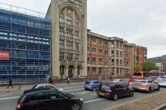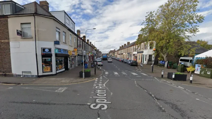
Splott Road is a major residential and commercial street in the Splott district of Cardiff, laid out in the 1880s as part of the Tredegar Estate’s housing programme for workers in the East Moors steel industry. Today it remains a key artery linking Splott with the city centre, lined with Victorian terraced housing, community facilities, and local shops.
- What is Splott Road and where is it located in Cardiff?
- How did Splott Road develop in the 19th century?
- What role did the Tredegar Estate play in creating Splott Road?
- How did the East Moors Steelworks influence Splott Road’s growth?
- What types of buildings and housing line Splott Road today?
- Which schools and community institutions have been located on Splott Road?
- How has Splott Road changed during the 20th and 21st centuries?
- Why is Splott Road historically important in Cardiff’s urban development?
What is Splott Road and where is it located in Cardiff?
Splott Road is a long, straight street in south-east Cardiff that runs from the city centre toward the waterfront areas of Splott and Tremorfa, forming part of the historic core of the Splott community. It is situated within the Splott electoral ward, in postcode district CF24, and serves as a primary route between central Cardiff and the East Moors industrial zone.
Splott Road lies within the urban area that developed from the medieval farms of Upper and Lower Splott, historically part of the manor held by the Bawdrips and later incorporated into the Tredegar Estate. The road itself was planned and laid out by the architects Habershon & Fawckner for Lord Tredegar in the 1880s, alongside a network of new streets, schools, and churches.
The street functions as a spine for the neighbourhood, connecting residential terraces with community institutions such as schools, churches, and local shops. Its orientation and layout reflect the broader 19th-century urban expansion of Cardiff driven by industrial growth, particularly the iron and steel sectors.
How did Splott Road develop in the 19th century?
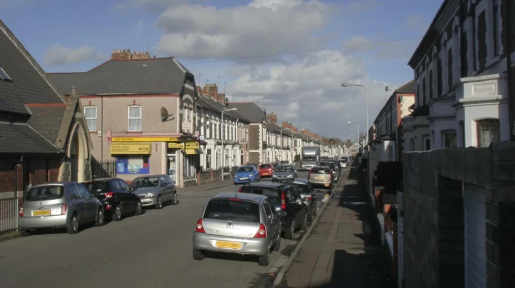
Splott Road was developed in the 1880s as part of a coordinated housing and infrastructure programme by the Tredegar Estate to accommodate workers at the rapidly expanding East Moors steelworks and associated industries. The street formed part of a new suburban grid laid out on former farmland, with terraced housing, schools, shops, and public buildings constructed to support an influx of industrial labour.
Prior to the 1880s, the area between Cardiff and the Bristol Channel (known as the East Moors) was largely marshland, apart from the farms of Pengam and Splott. No residential or industrial development occurred here until the late 19th century. In 1880, the Tredegar Estate commissioned Habershon & Fawckner to design and lay out new streets and housing, creating the foundation for modern Splott.
Splott Road was one of the principal streets in this scheme, designed to provide direct access from Splott to the city centre and to the newly developing industrial zones. Alongside it, streets such as Sanquar Street, Habershon Street, Portmanmoor Road, and Moorland Road were developed, forming a dense network of Victorian terraced housing. By the early 1920s, the area was well established, with a rail link to Roath Dock further enhancing its connectivity.
The development of Splott Road was closely tied to the growth of the East Moors Steelworks, which opened on 4 February 1891. The steelworks, built on land donated by Lord Bute in Tremorfa, became a major employer and drove demand for nearby housing. Splott Road and its surrounding streets were built to house the workers who came to operate the plant, many of whom arrived from Dowlais and other parts of South Wales.
What role did the Tredegar Estate play in creating Splott Road?
The Tredegar Estate owned the land on which Splott Road was built and directly commissioned its planning and development as part of a large-scale suburban expansion programme in the 1880s. Godfrey Charles Morgan, Lord Tredegar, controlled much of Splott and appointed architects Habershon & Fawckner to lay out streets, houses, and community facilities, turning former farmland into a working residential district.
The Tredegar Estate had acquired the Splott lands in 1676 after a series of sales and transfers that began with the Bawdrip family. For centuries, the area remained rural, divided between Upper and Lower Splott Farms. It was only in the late 19th century, as Cardiff expanded and industrial demand grew, that the estate decided to develop the land for housing and commercial use.
Habershon & Fawckner, as architects for the Tredegar Estate, designed the street pattern and housing layout for Splott, including Splott Road. Their work established a coherent grid of terraced housing and public buildings, integrating schools, churches, and shops into the residential fabric. This approach reflected contemporary best practices in urban planning and responded to the urgent need for worker housing near the steelworks.
Through this development, the Tredegar Estate transformed Splott from a collection of farms into a densely populated urban district. Splott Road became a central feature of this transformation, serving as a main route and a focal point for community life. The estate’s involvement ensured that the street and surrounding neighbourhood were planned as an integrated whole, rather than as a series of ad hoc developments.
How did the East Moors Steelworks influence Splott Road’s growth?
The East Moors Steelworks, opened in 1891 just east of Splott, created a massive demand for worker housing and directly drove the rapid expansion of Splott Road and its surrounding streets in the late 19th and early 20th centuries. The steelworks employed thousands of workers, many of whom settled in newly built terraced housing along Splott Road, Sanquar Street, and Habershon Street.
The parent company of the East Moors Steelworks was based at Dowlais near Merthyr Tydfil. As the plant grew, especially during the First World War and through the 1930s, it required a large and stable workforce. This led to continuous housing development in Splott, with families moving in from other parts of South Wales and beyond. The proximity of Splott Road to the steelworks made it a key location for residential expansion.
The steelworks also influenced the social and cultural character of Splott Road. Welsh-speaking workers from Dowlais brought their language and religious traditions to the area, leading to the establishment of Welsh-language chapels such as Ainon on Walker Road, Bethlehem on Eyre Street, and Jerusalem on Manon Street/Walker Street. These institutions became part of the wider community network centred on Splott Road.
When the East Moors Steelworks ceased production in 1978, Splott Road and the wider district lost a major economic anchor. The closure led to job losses and a decline in local industry, but the housing and community infrastructure that had developed during the steelworks’ operation remained. Splott Road continued to function as a residential and commercial street, albeit in a post-industrial context.
What types of buildings and housing line Splott Road today?
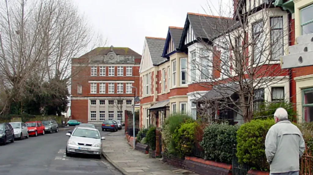
Splott Road is lined primarily with Victorian terraced housing built in the 1880s and 1890s, alongside a mix of local shops, community buildings, schools, and churches that reflect its long history as a working-class district. The terraces are tightly knit, with most properties being non-detached, consistent with the overall housing pattern of Splott where only a small minority of households are detached homes.
The residential buildings along Splott Road were constructed to accommodate steelworkers and their families, using standard Victorian designs typical of Cardiff’s industrial suburbs. These terraces feature stone or brick facades, small rear yards, and shared access patterns. Many of the original houses remain in use, though some have been altered or upgraded over time.
In addition to housing, Splott Road includes community facilities such as schools, churches, and local shops. Historically, the road was served by institutions such as Splottlands School (opened 1882) and various denominational churches. Today, the street continues to serve as a hub for local services, with shops and community venues supporting daily life in the area.
The architectural character of Splott Road reflects the broader pattern of 19th-century urban development in Cardiff: dense, functional housing supported by a network of public and religious buildings. This mix of uses has helped maintain the street’s role as a central part of the Splott community, even as industry declined and the district underwent regeneration.
Which schools and community institutions have been located on Splott Road?
Splott Road has long been home to key educational and community institutions, including Splottlands School (opened 1882), later replaced by the STAR Centre, and a range of churches and social facilities that supported the local population. These institutions formed the backbone of community life in Splott, serving families who worked in the nearby steelworks and other industries.
Splottlands School, located on Splott Road, opened in 1882 with 1,500 pupils. It was one of the earliest schools built in the area and played a central role in educating the children of steelworkers and their families. The school was demolished in 1971, and the site was subsequently occupied by the STAR (Splott, Tremorfa, Adamsdown and Roath) Centre, which continues to provide community and leisure services.
Other schools in the vicinity, such as Moorland Road School, were also closely connected to the Splott community. Moorland Road School gained a reputation for its sporting achievements and was attended by Shirley Bassey when her family moved to Portmanmoor Road. These schools, along with churches and social clubs, helped create a strong sense of local identity along Splott Road and its surrounding streets.
Religious institutions were also prominent along Splott Road and nearby streets. Denominations such as Welsh Baptists, Welsh Independents, and Calvinistic Methodists established chapels to serve the growing population, many of whom were Welsh-speaking workers from Dowlais. These chapels, including Ainon, Bethlehem, and Jerusalem, contributed to the cultural and spiritual life of the area, reinforcing Splott Road’s role as a community centre.
Explore More Area Guide
Cathedral Road Walking Guide Cardiff: History, Landmarks And Nearby Routes
Whitchurch Road Restaurant Guide Cardiff Best Places to Eat Now
How has Splott Road changed during the 20th and 21st centuries?
Splott Road has undergone significant changes since the 20th century, shifting from an industrial worker’s district to a post-industrial community with mixed housing, some regeneration, and new commercial developments, while retaining much of its Victorian street pattern. The closure of the East Moors Steelworks in 1978 marked a major turning point, leading to job losses and a transformation of the local economy.
In the post-war period, many of the old industrial sites around Splott were redeveloped. Portmanmoor Road, once lined with Victorian housing, became an industrial estate, and streets such as Enid Street, Layard Street, and Menelaus Street were demolished. These changes altered the physical layout of parts of Splott but did not erase the core residential fabric centred on Splott Road.
The 2010s and 2020s saw further regeneration, including the opening of the new STAR Hub in September 2016, which replaced the former STAR Centre and incorporated library and community facilities. The Grangetown link-road, completed in 2017, improved connectivity between Ely, Cardiff Bay, and Rover Way in Tremorfa, indirectly affecting access to and from Splott Road. Business parks and a Tesco superstore on the outskirts of Pengam Green added new jobs and commercial activity to the wider area.
Despite these changes, Splott Road remains largely residential, with its Victorian terraces still forming the dominant housing type. The street continues to serve as a central route for locals, connecting homes with shops, schools, and community facilities. Regeneration efforts have focused on improving shared spaces and community infrastructure rather than replacing the existing housing stock, helping to preserve the historical character of Splott Road.
Why is Splott Road historically important in Cardiff’s urban development?
Splott Road is historically important because it embodies Cardiff’s late 19th-century industrial expansion, demonstrating how the Tredegar Estate and the East Moors Steelworks shaped the city’s southern suburbs through planned housing, infrastructure, and community institutions. It represents a clear example of how industrial growth drove urbanisation in Cardiff, transforming rural farmland into a dense working-class district.
The development of Splott Road in the 1880s was part of a coordinated episode of urban planning that linked housing, industry, and public services. The street’s layout, terraced housing, and associated schools and churches reflect the deliberate efforts of the Tredegar Estate to create a stable, self-contained community for steelworkers. This approach helped establish Splott as a distinct and cohesive part of Cardiff, rather than an ad hoc extension of the city.
Splott Road also illustrates the social and cultural impact of the steel industry on Cardiff. The arrival of Welsh-speaking workers from Dowlais and other parts of South Wales led to the establishment of Welsh-language chapels and a strong community identity. This cultural dimension, combined with the physical layout of the street, makes Splott Road a key site for understanding the intersection of industry, migration, and urban life in Cardiff’s history.
Today, Splott Road remains a tangible link to this period of Cardiff’s development. Its Victorian terraces, community buildings, and street pattern preserve the legacy of the 1880s planning programme and the steelworks era. As Cardiff continues to grow and regenerate, Splott Road stands as a historical marker of how industrial forces shaped the city’s modern form.
What is Splott Road in Cardiff?
Splott Road is one of the main streets in the Splott district of Cardiff, connecting the neighbourhood with the city centre and serving as a residential and commercial corridor. Developed during the 1880s, it became the centre of a growing community built to support workers employed in nearby heavy industries.