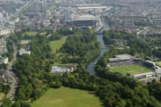

Ely is a historic residential suburb in western Cardiff, Wales, situated around the River Ely and the western approaches to the Welsh capital. Its development reflects several important periods of Welsh history, including Roman settlement, medieval rural life, nineteenth-century industrialisation, horse racing, interwar housing expansion and modern urban regeneration. Once a relatively small village surrounded by agricultural land, Ely gradually developed into one of Cardiff’s established residential communities.
- Where Is Ely in Cardiff and What Is Its Historical Background?
- What Is the Connection Between Ely and Cardiff’s Roman History?
- How Did Ely Develop During the Medieval Period?
- The Influence of Llandaff
- Medieval Caerau and Its Defensive Landscape
- Agriculture and Traditional Occupations
- How Did the Industrial Revolution Transform Ely?
- Why Was Ely Railway Station Important to the Area’s Growth?
- What Was the Historical Significance of Ely Racecourse?
- The Opening of Ely Racecourse in 1855
- When Was the First Welsh Grand National Held at Ely?
- Racecourse Improvements During the Victorian Period
- The 1937 Fire and Closure in 1939
- How Did the First World War Change Ely’s Residential Development?
- What Happened to Ely During the Second World War?
- Anti-Aircraft Defence at the Former Racecourse
- Barrage Balloons and Cardiff’s Protection
- The Postwar Transition
- How Did Ely Become a Major Residential Suburb After 1945?
- The Development of Postwar Housing
- When Did the Former Racecourse Become Trelai Park?
- Industrial Employment and Population Growth
- Which Historic Buildings and Landmarks Represent Ely’s Past?
- Ely Bridge
- St David’s Church
- Ely Methodist Church
- The Former Ely Paper Works
- The Historic Ely Railway Landscape
- How Did Ely’s Schools, Churches and Community Facilities Develop?
- The Development of Local Education
- Dusty Forge and Community History
- The Role of Churches and Community Organisations
- How Has Ely Changed in Recent Decades?
- Industrial Decline and Redevelopment
- Housing and Urban Change
- The Importance of Local Heritage Research
- What Is the Historical and Cultural Importance of Ely to Cardiff Today?
- Preserving Industrial Heritage
- Protecting Archaeological Heritage
- The Importance of Oral History
- Ely’s Continuing Role in Cardiff
- How Does the History of Ely Explain Cardiff’s Growth?
The history of Ely, Cardiff, is closely connected to the River Ely, the neighbouring communities of Caerau and St Fagans, and Cardiff’s wider economic growth. Its nineteenth-century railway connections, historic breweries, paper manufacturing works and famous racecourse transformed the area’s character. During the twentieth century, large-scale council housing developments brought thousands of residents into the suburb and established much of its present-day identity.
Today, Ely combines residential neighbourhoods, community facilities, green spaces and surviving historical landmarks. Understanding its development provides a wider picture of how Cardiff expanded westwards and how former rural settlements became part of a modern Welsh city.
Where Is Ely in Cardiff and What Is Its Historical Background?
Ely is a residential suburb in western Cardiff, Wales, named after the River Ely, which runs along the western side of the area. Its historical development began as a rural settlement before transport improvements, industrial employment and twentieth-century housing transformed it into an established Cardiff community.
Ely is located approximately four miles west of Cardiff city centre. It lies close to Caerau, Fairwater, Canton and the communities surrounding the River Ely valley. Cowbridge Road West is one of its principal historical and modern routes, connecting the suburb with central Cardiff and neighbouring settlements.
The River Ely has played an important role in the area’s geographical and economic development. The river provided a natural landscape feature, supported historic industrial activity and influenced settlement patterns. Its valley also connected communities in the western part of Glamorgan with Cardiff and the surrounding countryside.
The name Ely derives from the river. Historically, the surrounding landscape consisted of agricultural holdings, small settlements, mills and rural routes. The settlement developed within the wider historical and ecclesiastical landscape associated with Llandaff.
Ely’s position between Cardiff and the Vale of Glamorgan influenced its development. Roads connecting Cardiff with Cowbridge and western Glamorgan passed through the surrounding area. These routes supported local trade, movement and communication long before modern suburban development.
Ely as a Rural Settlement
Before large-scale housing development, Ely was a comparatively small rural settlement. Historical descriptions identify it as a hamlet with a railway station rather than a major urban centre.
The older settlement developed around Ely Bridge, Mill Road and the routes leading towards Cowbridge. Small cottages, agricultural properties and local businesses formed part of its early built environment.
The historical record also identifies Ely Corn Mill as an important feature of the area’s earlier economic landscape. Water-powered milling connected rural production with local communities and demonstrates how the River Ely supported traditional occupations.
The historic village gradually expanded as Cardiff’s population and industrial economy increased.
What Is the Connection Between Ely and Cardiff’s Roman History?
Ely’s wider surroundings contain evidence of Roman activity, particularly along routes connecting Cardiff with settlements in western Glamorgan. Archaeological records identify a Roman road near Ely and Roman remains within neighbouring Caerau, demonstrating the area’s importance within the wider regional landscape.
Roman occupation transformed parts of south-east Wales during the first centuries AD. The Roman settlement at Cardiff developed around the Roman fort near the River Taff, while roads connected military, administrative and agricultural locations across the region.
The western Cardiff landscape also contains evidence of Roman activity. One important archaeological feature is the Roman road associated with Ely Villa Road, recorded in the historic environment assessment for Ely.
The road formed part of the wider network connecting communities and settlements across the region. Roman roads supported military movement, administration, trade and communication.
The Roman Villa at Caerau
Neighbouring Caerau contains particularly important archaeological evidence. The CAER Heritage Project, supported by Cardiff University, identifies a Roman villa established in the first century AD.
The villa remains beneath Trelai playing fields. Its L-shaped building complex provides evidence of Roman domestic occupation and the presence of an established household in the area.
A Roman villa was a substantial rural residence associated with agricultural production and local economic activity. Its presence demonstrates that the western Cardiff landscape contained organised settlement beyond the Roman fort at central Cardiff.
The archaeological importance of Caerau also extends beyond the Roman period. Its Iron Age hillfort represents an earlier centre of settlement and regional activity.
Roman Roads and Local Development
Roman roads influenced the geography of later settlements because communities continued using established routes long after Roman administration ended.
The historical route towards Cowbridge and western Glamorgan remained important for communication and transport. Ely’s location along this wider corridor contributed to its eventual development as a village and, later, a Cardiff suburb.
The Roman evidence provides an important starting point for understanding the history of western Cardiff, although the modern suburb of Ely developed primarily through later rural, industrial and housing expansion.
How Did Ely Develop During the Medieval Period?
During the medieval period, Ely formed part of the rural landscape associated with Llandaff and the wider Glamorgan region. Agriculture, local milling, religious institutions and established transport routes shaped settlement, while neighbouring Caerau and Llandaff contained important medieval religious and defensive sites.
Following the end of Roman administration in Britain, the political and social organisation of south-east Wales changed considerably. Local communities developed under Welsh rulers before the Norman expansion into Glamorgan.
The Norman conquest of Glamorgan during the late eleventh and early twelfth centuries introduced new systems of landholding, castle construction and manorial administration.
Ely became associated with the wider manor and parish structures of Llandaff. Medieval land management influenced agricultural production, ownership and settlement patterns across the surrounding countryside.
The Influence of Llandaff
Llandaff was an important religious centre in medieval Glamorgan. Its cathedral and ecclesiastical institutions influenced surrounding settlements through religious administration, landholding and community organisation.
Ely’s historical relationship with Llandaff reflects the way smaller rural settlements operated within larger ecclesiastical and manorial structures.
The parish system also influenced local administration before modern local government developed. Churches, parish boundaries and agricultural estates formed important elements of everyday life.
Medieval Caerau and Its Defensive Landscape
Neighbouring Caerau contains some of the strongest evidence of medieval activity in western Cardiff.
The CAER Heritage Project identifies a medieval church dedicated to St Mary and a ringwork within the earlier Iron Age hillfort. A ringwork is a medieval defensive earthwork consisting of an enclosed area protected by a bank and ditch.
The location demonstrates how earlier prehistoric sites continued to influence medieval settlement and land use.
Although Caerau and Ely are closely connected geographically, their archaeological histories should be distinguished. The medieval remains at Caerau provide evidence of the wider historical importance of western Cardiff rather than proof that every medieval structure stood within modern Ely.
Agriculture and Traditional Occupations
Agriculture remained central to the local economy for centuries. Farms, grazing land and small-scale rural businesses supported the surrounding population.
The River Ely also provided opportunities for milling and other water-related activities. Ely Corn Mill represents this earlier relationship between the natural environment and local production.
These rural economic arrangements continued until nineteenth-century industrial development and transport improvements began changing the settlement.
How Did the Industrial Revolution Transform Ely?
The nineteenth-century Industrial Revolution changed Ely through railway construction, brewing, paper manufacturing, improved road connections and expanding employment. Industrial businesses established around the River Ely attracted workers, encouraged residential growth and connected the former rural settlement with Cardiff’s expanding economy.
Cardiff experienced substantial economic expansion during the nineteenth century. Coal exports, iron production, shipping and railway construction transformed the city into an important industrial and commercial centre.
Ely benefited from this wider economic growth because of its location near Cardiff and the transport routes connecting the capital with western Glamorgan.
The industrial landscape developed around the River Ely and Ely Bridge. Manufacturing businesses required access to transport, labour and suitable sites, making the area increasingly attractive for commercial investment.
Ely Brewery and Nineteenth-Century Brewing
Ely Brewery became one of the notable industrial establishments associated with the suburb.
Historical accounts identify 1855 as an important year in the development of brewing activity in Ely. The brewery formed part of a wider pattern of industrial expansion that included manufacturing, food production and local commercial businesses.
Breweries required supplies of agricultural ingredients, water, labour and transport. Their operations also generated employment beyond the manufacturing process through distribution and related services.
The brewery became a recognisable part of the historical industrial landscape around Ely Bridge.
The Ely Paper Works
Paper manufacturing became another important part of Ely’s industrial history.
The Ely Paper Works developed during the early 1870s. According to Coflein, the national archaeological record maintained by the Royal Commission on the Ancient and Historical Monuments of Wales, papermaking became firmly established when Samuel Evans and Thomas Owen took over the works in 1877.
By 1889, production had reached approximately 145–150 tons of paper each week.
This production figure demonstrates the industrial scale achieved by the works during the late nineteenth century.
The factory benefited from its location beside the River Ely. Water was an important resource for traditional paper manufacturing, while railway sidings connected the works with the Great Western, Taff Vale, London and North Western, and Midland railway networks.
The paper works therefore represented an important connection between natural resources, industrial technology and national transport infrastructure.
The factory continued through different periods of ownership and industrial change. Its later history included associations with Wiggins Teape and Arjo Wiggins. The works eventually closed in 2000.
Why Was Ely Railway Station Important to the Area’s Growth?
Ely’s railway connections supported industrial expansion, horse racing and residential development during the nineteenth and early twentieth centuries. Railway services connected the suburb with Cardiff and other parts of Wales, making it easier for workers, visitors, businesses and racecourse spectators to travel.
Railway development was central to Cardiff’s nineteenth-century economic expansion. The Taff Vale Railway, established in 1836, supported the movement of coal, iron and industrial goods across Glamorgan.
Ely benefited from its position within this growing transport network. Railway access improved connections between the industrial establishments around the River Ely and Cardiff’s wider commercial economy.
The railway also supported the area’s growing popularity as a destination for sporting events.
Railway Connections and Industrial Employment
Industrial businesses needed reliable transport for raw materials and finished products. The Ely Paper Works used private railway sidings to connect with several major railway companies.
These connections allowed paper products to reach markets beyond Cardiff. Railway infrastructure also supported the movement of machinery, supplies and industrial workers.
The relationship between the railway and manufacturing encouraged economic activity around Ely Bridge and the surrounding industrial sites.
Residential Development Around the Railway
Railway connections also influenced housing expansion.
By the late nineteenth century, Ely remained a relatively small village, but new residential terraces began appearing around the settlement.
A 2025 heritage assessment of Ely Methodist Church identifies the railway and station on historical Ordnance Survey mapping from the nineteenth century. The 1901 mapping shows additional housing development around Ely.
These changes demonstrate how improved transport gradually connected Ely with Cardiff’s urban expansion.
The railway was therefore important not only for industrial activity but also for the transition from rural village to residential suburb.
What Was the Historical Significance of Ely Racecourse?
Ely Racecourse opened on 30 May 1855 and became one of Wales’s important National Hunt horse-racing venues. It hosted the first Welsh Grand National in 1895, attracted large crowds and remained operational until its final race meeting on 27 April 1939.
Ely Racecourse is one of the most significant features in the suburb’s sporting history. Its development reflected the growing popularity of organised horse racing among landowners, spectators and sporting communities during the Victorian period.
The Cardiff Race Club was associated with the establishment of the racecourse. Its early supporters included prominent sporting landowners such as the Homfrays, Lindsays and Copes.
The venue attracted spectators from Cardiff, other parts of Wales and England.
The Opening of Ely Racecourse in 1855
National Hunt racing began at Ely on 30 May 1855.
National Hunt racing is a form of horse racing involving obstacles such as hurdles and fences. The sport became particularly popular in Britain and Ireland during the nineteenth century.
Ely’s railway connections helped the racecourse attract visitors from outside Cardiff. Special travel arrangements and railway services supported the movement of horses, jockeys, trainers and spectators.
The racecourse quickly became an important sporting destination.
When Was the First Welsh Grand National Held at Ely?
The first Welsh Grand National took place at Ely in 1895.
The event attracted an exceptionally large crowd. Historical accounts describe spectators breaking down the entrance during the meeting, requiring police intervention to control access.
The winning horse was Deerstalker, ridden in the race for T. Cannon.
The event strengthened Ely’s position within Welsh horse-racing history. It also demonstrated the importance of the racecourse to Cardiff’s sporting and entertainment economy.
Racecourse Improvements During the Victorian Period
The racecourse underwent improvements in 1897 and 1910.
Further redevelopment followed after the First World War in 1921. These improvements included a grandstand with a director’s box, members’ lounge and refreshment rooms.
The facilities reflected the popularity of the venue and the importance of providing accommodation for visitors and members.
Race days also became important social occasions for local residents. Oral histories collected by the CAER Heritage Project and records preserved by People’s Collection Wales describe the excitement surrounding race meetings.
The 1937 Fire and Closure in 1939
A major fire damaged the racecourse’s principal stands in 1937. The grandstand was among the structures destroyed.
Temporary wooden stands allowed racing to continue, but the venue never recovered its earlier position.
The final race meeting took place on 27 April 1939. The winning horse was Grasshopper, ridden by Keith Piggott, the father of future champion jockey Lester Piggott.
Ely Racecourse subsequently closed permanently.
The closure ended an important chapter in Cardiff’s sporting history, although the former racecourse land continued to influence the suburb’s development.
How Did the First World War Change Ely’s Residential Development?
The First World War created new housing needs across Cardiff, including accommodation for returning servicemen and families living in overcrowded inner-city conditions. Ely became an important location for interwar housing development, with land provided for planned residential expansion after the war.
Before the First World War, Ely remained comparatively rural despite its industrial establishments, railway connections and racecourse.
Cardiff’s expanding population created increasing pressure on housing. Industrial workers and their families needed affordable accommodation close to employment and transport.
The war intensified these challenges. Returning servicemen required homes, while overcrowding in established Cardiff neighbourhoods created additional demand.
The Garden Suburb Approach
The development of Ely during the interwar period followed the principles of planned suburban housing.
A garden suburb is a residential development designed to combine housing with open spaces, planned streets and access to community facilities.
The approach formed part of wider British housing reform during the early twentieth century. It aimed to provide healthier living conditions than those found in overcrowded industrial districts.
The Earl of Plymouth, whose ancestral home was St Fagans Castle, provided land to Cardiff for housing development.
The land supported plans to accommodate people returning from the First World War and residents requiring rehousing from overcrowded parts of the city.
Ely’s Incorporation into Cardiff in 1922
A major administrative change took place in 1922 when Ely became part of Cardiff.
This incorporation strengthened the connection between the former rural settlement and the city’s expanding residential and administrative structure.
The addition of Ely to Cardiff’s boundaries allowed the city to pursue larger housing and infrastructure programmes.
Development extended across land that had previously been agricultural or associated with the racecourse.
New roads, residential streets and public facilities gradually established the suburban layout that characterises much of Ely today.
The Impact on Local Communities
Interwar housing transformed the area’s population and social structure.
Families moved into newly constructed homes, creating demand for schools, shops, churches, public transport and community organisations.
The suburb developed a stronger residential identity as more people established permanent homes in the area.
The First World War therefore represents an important turning point in Ely’s history because it accelerated the transition from a small village and industrial settlement into a planned residential suburb.
What Happened to Ely During the Second World War?
During the Second World War, Ely contributed to Cardiff’s wider civil defence arrangements. The former racecourse was used for anti-aircraft defence installations, while Caerau Lane became associated with barrage balloon operations protecting Cardiff against aerial attacks.
Cardiff became an important target during the Second World War because of its docks, industrial facilities, railway connections and strategic position.
German bombing raids targeted the city and its surrounding industrial areas. The Cardiff Blitz, particularly the raids of January 1941, caused extensive damage and civilian casualties.
Ely’s location on the western side of Cardiff placed it within the wider defensive landscape protecting the city.
Anti-Aircraft Defence at the Former Racecourse
The former Ely Racecourse was used for an anti-aircraft battery during the war.
Anti-aircraft batteries were military installations equipped with guns designed to attack enemy aircraft. Their purpose was to defend important locations against aerial bombardment.
The former sporting grounds therefore acquired a new military function after the closure of the racecourse in 1939.
Barrage Balloons and Cardiff’s Protection
Barrage balloons were another part of Britain’s wartime air-defence system.
These large tethered balloons carried cables designed to obstruct low-flying enemy aircraft. Their presence forced attacking aircraft to fly at greater heights, making accurate bombing more difficult.
Historical research associated with the CAER Heritage Project identifies Caerau Lane as a base for barrage balloons during the defence of Cardiff.
These wartime activities demonstrate how Ely and neighbouring Caerau contributed to the protection of the wider city.
The Postwar Transition
After 1945, Cardiff faced substantial housing demand and reconstruction challenges.
The wartime use of land ended, and residential development continued across Ely and the surrounding communities.
The former racecourse eventually became a major recreational space, creating a new use for land that had previously supported horse racing and military defence.
How Did Ely Become a Major Residential Suburb After 1945?
After the Second World War, Ely experienced further residential expansion through public housing, prefabricated homes and later private development. The former racecourse became Trelai Park in 1953, while new housing, schools and community facilities supported the area’s growing population.
The postwar period brought major changes to Cardiff’s urban geography. Housing shortages, population growth and changing public policy encouraged the construction of new residential neighbourhoods.
Ely had already experienced substantial interwar development. However, additional housing was required to accommodate families and support the city’s expanding population.
The Development of Postwar Housing
Postwar housing programmes introduced different types of accommodation across Ely.
Prefabricated homes, commonly called prefabs, formed part of Britain’s response to the housing shortage after 1945.
These homes were manufactured using standardised components and assembled quickly. Their construction provided an immediate response to the demand for accommodation.
Later developments introduced more permanent housing and expanded existing residential streets.
By the 1960s, Ely had developed into a substantial Cardiff suburb.
An archaeological interim report concerning the 2022 Trelai Park excavations records that the area’s population had exceeded 10,000 by the 1960s.
The same research identifies major manufacturing employers operating around Ely Bridge, including the paper mill, Ely Brewery and Chivers’ Jam and Pickle Factory.
When Did the Former Racecourse Become Trelai Park?
The former Ely Racecourse was officially opened as Trelai Park in 1953.
Trelai Park became an important recreational destination for residents of Ely and neighbouring communities.
The conversion marked a significant change in land use. A site once associated with organised horse racing and wartime defence became public recreational space.
The park provides open areas for outdoor activities and contributes to the suburb’s green infrastructure.
Its history also preserves the connection between modern Ely and the former racecourse.
Industrial Employment and Population Growth
During the postwar decades, industrial employers continued supporting employment in Ely.
Manufacturing businesses around Ely Bridge provided jobs for local residents and contributed to the area’s economic activity.
However, industrial decline eventually affected the suburb.
Falling demand and wider changes in British manufacturing contributed to the closure of several major local employers during the late 1970s and early 1980s.
The decline of these businesses changed the economic structure of Ely. Manufacturing employment became less important, while retail, public services and other occupations assumed a greater role in the local economy.

Which Historic Buildings and Landmarks Represent Ely’s Past?
Ely’s historical identity is reflected in its churches, former industrial sites, historic road network, Ely Bridge and surviving traces of its railway and racecourse. These landmarks document the suburb’s transition from a rural village into an industrial and residential part of Cardiff.
Although much of historic Ely has changed, several locations preserve evidence of its earlier development. Historic buildings, archaeological records and old photographs help explain how the suburb evolved.
Ely Bridge
Ely Bridge is closely associated with the early settlement and transport history of the area.
The bridge provided an important crossing over the River Ely and connected local roads leading towards Cardiff and western Glamorgan.
The surrounding settlement included cottages, mills and other buildings associated with traditional village life.
The bridge also became associated with the industrial development of the nineteenth century. Its proximity to manufacturing sites and railway connections made the surrounding area an important transport and commercial location.
St David’s Church
St David’s Church on Cowbridge Road West represents an important part of Ely’s religious and architectural history.
The historic environment records identify the church as a post-medieval heritage asset.
Churches played important roles in nineteenth-century communities. They provided places of worship, supported local organisations and served as centres of community activity.
St David’s Church also reflects the expansion of religious institutions alongside residential and commercial development.
Ely Methodist Church
Ely Methodist Church provides further evidence of the area’s religious history.
A heritage assessment published in July 2025 records the historical Methodist chapel and its appearance on nineteenth-century mapping.
The original Methodist presence developed during a period when religious institutions were expanding across industrial communities in Wales.
Methodist chapels played important roles in education, worship, social organisation and community life.
The church’s historical development also demonstrates how religious buildings became established features of Ely’s expanding residential landscape.
The Former Ely Paper Works
The former paper works represent one of Ely’s most important industrial heritage sites.
The factory’s nineteenth-century origins, railway connections and large production capacity demonstrate the area’s contribution to Cardiff’s industrial economy.
Although the works closed in 2000, the site remains important to understanding the industrial transformation of western Cardiff.
Historical photographs document the factory’s buildings, railway infrastructure and relationship with the River Ely.
The Historic Ely Railway Landscape
The railway landscape represents another important part of the suburb’s history.
Historic railway routes connected the paper works and other businesses with Cardiff and wider transport networks.
Old photographs of Ely railway station and the industrial railway infrastructure provide evidence of how transport supported local economic development.
These surviving records are important because much of the original industrial environment has disappeared or been redeveloped.docs.
How Did Ely’s Schools, Churches and Community Facilities Develop?
Ely’s schools, churches and community organisations expanded alongside residential development during the twentieth century. Growing housing estates created demand for education, healthcare, recreation and local services, helping establish the social infrastructure of the modern Cardiff suburb.
The development of Ely was not limited to housing construction. A growing residential population required public facilities and institutions capable of supporting everyday community life.
Schools became particularly important as families moved into the suburb during the interwar and postwar periods.
The Development of Local Education
The expansion of residential streets increased demand for primary and secondary education.
Schools became important community institutions, providing education while also supporting local events, activities and social connections.
Educational development reflected wider changes in Cardiff’s population and the increasing importance of accessible public services.
The CAER Heritage Project also demonstrates the historical importance of involving younger generations in local heritage research.
Its First World War project worked with pupils from Michaelston Community College and older Ely residents to investigate the history of the suburb.
Dusty Forge and Community History
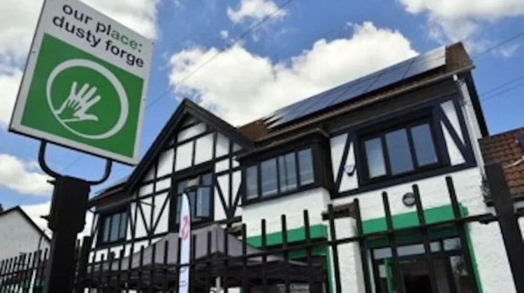
Dusty Forge is an important community landmark associated with modern Ely.
Its historical significance is connected to the development of the area’s residential communities and the social experiences of local families.
Cardiff University’s CAER Heritage team worked with community organisations, residents and young people to investigate Ely’s history through the Dusty’s First World War project.
The project collected photographs, letters, diaries, newspaper reports, family memories and oral histories.
This approach helped preserve experiences that are not always represented in official government records.
The Role of Churches and Community Organisations
Churches and community organisations have supported the suburb’s social development.
They provide spaces for meetings, religious activities, community events and voluntary initiatives.
Their continued presence reflects the importance of local institutions in neighbourhoods that developed through large-scale public housing.
Community facilities also help preserve local identity by connecting different generations of residents with the area’s history.
How Has Ely Changed in Recent Decades?
Since the late twentieth century, Ely has experienced industrial decline, changing employment patterns, residential redevelopment and investment in community facilities. Its former manufacturing landscape has increasingly given way to residential, retail, recreational and service-based uses.
The late twentieth century brought significant economic changes to Ely.
Several established manufacturing businesses closed as British industry experienced restructuring, changing production costs and declining demand.
The paper works, brewery and other manufacturing establishments had previously provided important employment opportunities.
Their decline affected the local economy and changed the character of the industrial landscape.
Industrial Decline and Redevelopment
The closure of major industrial employers during the late 1970s and early 1980s marked an important turning point.
Manufacturing became less central to local employment, and former industrial sites increasingly attracted attention for redevelopment.
The closure of Ely Paper Works in 2000 represented the end of a particularly long industrial chapter.
Historical photographs and redevelopment records preserve evidence of the former factory and its surrounding railway infrastructure.
Housing and Urban Change
Residential development continued to shape Ely during the late twentieth and early twenty-first centuries.
Existing housing estates, schools, roads and community facilities became part of a more established suburban environment.
The suburb also experienced changing social and economic circumstances as Cardiff expanded and employment patterns changed.
These developments demonstrate the wider relationship between industrial decline and the changing economies of traditional working communities.
The Importance of Local Heritage Research
Modern research has helped preserve Ely’s historical identity.
The CAER Heritage Project brings together archaeologists, historians, residents and educational organisations to investigate the area’s past.
Its work includes archaeological research, historical photographs, oral histories and community participation.
The project is particularly important because it considers Ely and neighbouring Caerau within a shared historical landscape.
Its research provides evidence extending from prehistoric settlement to Roman occupation, medieval activity, industrial development and modern housing.
Explore More Area Guide
The History of Llandaff Cardiff: Cathedral, Heritage and Medieval Past
History of Cathays Cardiff: From Rural Land to University District
What Is the Historical and Cultural Importance of Ely to Cardiff Today?
Ely is an important part of Cardiff’s historical development because it preserves evidence of Roman activity, medieval settlement, nineteenth-century industrial growth, Victorian horse racing and twentieth-century housing expansion. Its history also reflects the experiences of generations of working families.
Ely’s importance extends beyond its geographical position as a residential suburb.
Its historical development illustrates how Cardiff expanded from an established commercial and industrial centre into a larger urban area incorporating former villages and agricultural settlements.
Preserving Industrial Heritage
Ely’s industrial history provides valuable information about the development of manufacturing in Cardiff.
The paper works demonstrate the importance of water resources, railway infrastructure and industrial labour during the nineteenth century.
The brewery and other manufacturing businesses also illustrate the range of economic activities that supported local employment.
Preserving historical photographs, records and archaeological evidence helps document these industries for future generations.
Protecting Archaeological Heritage
The wider Ely and Caerau landscape contains archaeological remains from different historical periods.
The Roman villa beneath Trelai playing fields and the Iron Age hillfort at Caerau demonstrate the long history of settlement in western Cardiff.
Archaeological investigation provides opportunities to understand how people lived, worked and organised communities before the development of modern Cardiff.
These remains also demonstrate why historic landscapes require careful assessment during construction and redevelopment projects.
The Importance of Oral History
Oral history is particularly valuable for understanding twentieth-century Ely.
Residents’ memories provide information about schools, housing, workplaces, family experiences, race days and community activities.
The CAER Heritage Project has shown how local people contribute to historical research through photographs, personal documents and recorded memories.
These materials complement archaeological findings and official records by preserving experiences from everyday life.
Ely’s Continuing Role in Cardiff
Ely remains an established residential community within western Cardiff.
Its historical development continues to influence the layout of roads, the location of recreational spaces and the character of its neighbourhoods.
Trelai Park preserves the site of the former racecourse, while the River Ely maintains its importance as a geographical feature connecting the suburb with the wider Cardiff landscape.
Understanding Ely’s past also provides context for future regeneration, heritage conservation and community development.
How Does the History of Ely Explain Cardiff’s Growth?
The history of Ely demonstrates how a small rural settlement developed into an established residential suburb through centuries of geographical, economic and social change.
Its early history connects with the Roman and medieval landscapes of western Cardiff, particularly the archaeological sites around neighbouring Caerau. During the nineteenth century, railway expansion, brewing, paper manufacturing and horse racing transformed Ely into an important industrial and sporting location.
The opening of Ely Racecourse in 1855, the first Welsh Grand National in 1895 and the development of the Ely Paper Works illustrate the suburb’s importance during the Victorian period.
The First World War accelerated residential development, while incorporation into Cardiff in 1922 established its administrative connection with the expanding city. Following the Second World War, further housing construction and the conversion of the former racecourse into Trelai Park shaped the modern suburb.
Today, Ely’s history remains visible through its historic buildings, archaeological heritage, community institutions and recreational landscape. Its story forms an important part of Cardiff’s wider history and provides valuable insight into the development of Welsh urban communities.
Where is Ely located in Cardiff?
Ely is a residential suburb in western Cardiff, Wales. It is situated approximately four miles west of Cardiff city centre, near Caerau, Fairwater and the River Ely.