Cardiff has a strong network of parks, riverside paths, coastal routes, green spaces and active-travel corridors that suit different running distances and abilities. The Welsh capital combines compact urban routes with longer paths extending towards the countryside and Cardiff Bay.
- Which Cardiff areas have the best running routes?
- What is the best running route around Bute Park and the River Taff?
- Is Pontcanna and Llandaff good for running?
- What is the best running route around Roath Park and Penylan?
- Where can runners train around Cardiff Bay and the Barrage?
- Which Cardiff routes are best for longer-distance training?
- What are the best running routes in north Cardiff?
- Which Cardiff parks are suitable for short running sessions?
- How should runners choose a Cardiff route for different training goals?
- How accessible are Cardiff’s main running routes?
- How can runners use Cardiff’s routes safely and responsibly?
- How will Cardiff’s running network develop in the future?
- What makes Cardiff one of the best cities in Wales for varied running routes?
The city’s public rights-of-way network covers approximately 200 kilometres, including footpaths, bridleways and restricted byways. Cardiff Council manages and maintains this network, while its Active Travel Network Map identifies routes designed for walking, wheeling and cycling.
Several of Cardiff’s most useful running areas follow major natural features. The River Taff creates a north-south corridor through the city. Roath Park provides a central eastern running environment around its lake and gardens. Cardiff Bay offers waterside running, while western districts such as Llandaff provide access to riverside and parkland routes.
The city also connects with longer-distance trails. The Taff Trail runs between Cardiff and Brecon for approximately 55 miles (88.5 kilometres). The Cardiff Bay Trail covers approximately 4.5 miles (7.3 kilometres), while the Cardiff-to-Castell Coch route is approximately 9 miles (14.5 kilometres) according to Sustrans route information.
For runners, this creates a practical choice between short park loops, measured road-based training, riverside distances, coastal routes and longer trail sessions.
Which Cardiff areas have the best running routes?
Cardiff’s strongest running areas include Bute Park, Pontcanna, Llandaff, Roath, Penylan, Cardiff Bay, Grangetown, Victoria Park and the Taff corridor, providing short loops, longer distances, riverside paths, parkland running and accessible urban training options.
Cardiff’s geography makes route selection relatively straightforward. Central runners have immediate access to Bute Park and the River Taff. Eastern runners can use Roath Park, Penylan and routes towards Rumney. Western runners have Llandaff, Llandaff Fields and the Taff corridor.
The southern part of the city provides access to Cardiff Bay and the Barrage. These areas are particularly useful for runners who prefer open waterfront surroundings and longer uninterrupted sections.
Northern Cardiff provides access to routes heading towards Tongwynlais, Castell Coch and the Taff Valley. These routes become more suitable for runners seeking longer distances and greater variation in terrain.
Cardiff Council’s parks network includes numerous established green spaces, while the city’s rights-of-way network provides additional connections beyond formal parks.
The best route therefore depends on the training objective. A beginner seeking a manageable session benefits from a park loop. A distance runner benefits from the Taff corridor or Cardiff Bay. A trail runner benefits from routes heading towards northern Cardiff and the surrounding countryside.
What is the best running route around Bute Park and the River Taff?
Bute Park and the River Taff form one of Cardiff’s most convenient central running corridors, linking green parkland with riverside paths and providing flexible distances for easy runs, tempo sessions, longer outings and connections towards Pontcanna and Llandaff.
Bute Park sits immediately north of Cardiff Castle and forms a major green corridor through the city centre. Its location makes it practical for runners staying in central Cardiff, working nearby or arriving by public transport.
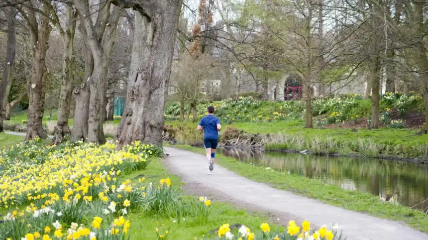
The River Taff runs alongside the park. This creates a natural linear route rather than requiring runners to remain inside a fixed loop.
A short run can stay within the park. Longer sessions can continue north along the Taff corridor towards Blackweir, Pontcanna and Llandaff.
The main advantage is route flexibility. Runners can turn around after a chosen distance instead of completing a fixed circuit. This makes the corridor useful for distance progression.
The wider Taff Trail extends far beyond central Cardiff. Sustrans lists the complete Cardiff-to-Brecon route at approximately 55 miles, or 88.5 kilometres. The route connects Cardiff with communities and landscapes further north.
The riverside environment also reduces the need for runners to navigate busy urban roads continuously. However, path conditions, shared use and crossings require attention.
Cardiff Council provides walking and cycling mapping resources to help users plan journeys through the city.
Is Pontcanna and Llandaff good for running?
Pontcanna and Llandaff provide strong western Cardiff running options because their parks, riverside paths and connections with the Taff corridor create routes suitable for easy mileage, longer training runs and links between central Cardiff and north-western neighbourhoods.
Pontcanna is closely connected to Bute Park and the River Taff. This makes it particularly useful for runners who want to extend a central-city run without relying entirely on roads.
Llandaff adds another layer of route variety. The area contains established green spaces and historic surroundings, while the Taff corridor provides a direct running connection towards the north.
Llandaff Fields is another useful starting point. Cardiff Council identifies Llandaff Fields among its city parking and park facilities, demonstrating its established role within the local open-space network.
Runners can combine Llandaff Fields with the Taff corridor to create longer sessions. The route can also connect towards Llandaff village and northern Cardiff.
Llandaff is particularly suitable for runners who want a mixture of parkland and riverside terrain. The area also provides connections towards Radyr and Castell Coch for longer-distance sessions.
Cardiff Council’s cycleway plans include a north-west corridor connecting the city centre with Llandaff, Danescourt and the north-western strategic development area.
Although cycleway infrastructure is not automatically a dedicated running facility, the development demonstrates the importance of this corridor within Cardiff’s wider active-travel network.
What is the best running route around Roath Park and Penylan?
Roath Park and Penylan offer some of eastern Cardiff’s most established running environments, combining lake-side scenery, gardens, residential streets and active-travel connections with options for short steady runs and longer routes towards Cyncoed and north-east Cardiff.
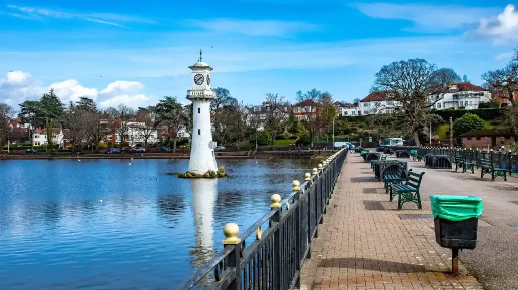
Roath Park is one of Cardiff’s best-known green spaces. The park incorporates Roath Park Lake, gardens and recreational areas. Historical Cardiff Council records also document separate areas including Roath Park Wild Gardens, Roath Park Lake, Roath Park Botanic Garden, Roath Park Pleasure Garden and Roath Park Recreation Ground.
The lake provides a natural focal point for running. Runners can use the surrounding paths for controlled sessions before extending into Penylan and neighbouring districts.
Roath Park works particularly well for runners who prefer a recognisable landmark and an urban park setting. The surrounding residential network allows routes to be extended without committing to a long-distance trail.
Cardiff Council’s proposed Cycleway 6 connects the city centre with Plasnewydd, Penylan, Cyncoed and Roath Park. Phase 1 has already started.
This corridor is significant because it connects several densely populated eastern neighbourhoods with one of Cardiff’s major recreational spaces.
For structured training, runners can use repeated park sections for intervals and controlled efforts. Longer runs can combine Roath Park with Penylan, Cyncoed and routes towards north-east Cardiff.
Runners should account for other park users, especially around popular sections of the lake and gardens. Keeping pace controlled and maintaining awareness is important on shared paths.
Where can runners train around Cardiff Bay and the Barrage?
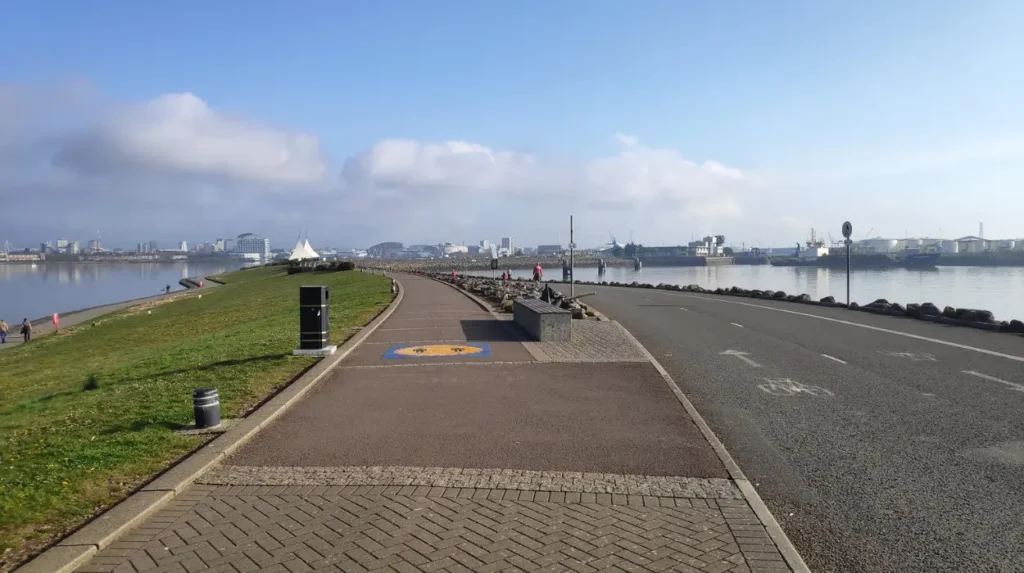
Cardiff Bay provides a long, relatively open waterfront running environment, while the Cardiff Bay Trail offers approximately 4.5 miles of National Cycle Network route through the bay area, supporting steady runs and longer coastal training sessions.
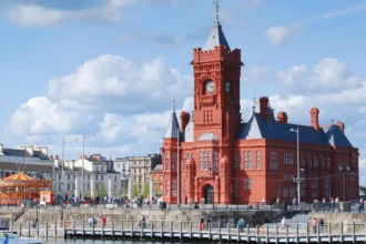
Cardiff Bay is one of the most distinctive running environments in the city. The waterfront connects several major destinations and provides a different setting from Cardiff’s inland parks.
The Cardiff Bay Trail is listed by Sustrans at approximately 4.5 miles (7.3 kilometres). The route forms part of the National Cycle Network.
The route is useful for runners who want a longer continuous session without repeatedly returning to a small park loop.
The Cardiff Bay area also connects with the Barrage. Cardiff Council identifies the Barrage as part of the Bay Circular Walk area, with facilities located around Cardiff Bay.
Waterfront running requires attention to weather conditions. Wind exposure is greater around open water than in enclosed city parks. Wet surfaces also require additional care.
Cardiff Bay is especially useful for steady-state running. The relatively open environment makes it easier to maintain a consistent pace across longer sections.
The wider coastal network also has national significance. The Wales Coast Path was opened in 2012 and forms an approximately 870-mile continuous coastal route around Wales. Natural Resources Wales states that the route passes through major cities, towns, beaches, wildlife areas and historical locations.
Not every section of the Wales Coast Path is designed specifically for running. Route users should follow local signage and access restrictions.
Which Cardiff routes are best for longer-distance training?
Long-distance runners can use the Taff Trail, Cardiff Bay Trail, Cardiff-to-Castell Coch corridor and connected public rights of way to build mileage progressively, with options ranging from approximately 7 kilometres around Cardiff Bay to much longer northbound trail sessions.
The Taff Trail is Cardiff’s most important long-distance running corridor. Sustrans lists the Cardiff-to-Brecon route at 55 miles (88.5 kilometres).
Runners do not need to attempt the entire trail. Cardiff’s urban section provides opportunities for shorter out-and-back training. Turning around at predetermined distances creates controlled sessions such as 5K, 10K, 15K and half-marathon training.
The Cardiff-to-Castell Coch route is approximately 9 miles (14.5 kilometres) according to Sustrans.
Castell Coch is located north-west of Cardiff near Tongwynlais. The route introduces a more rural character as it leaves the central urban environment.
Long-distance runners can also combine separate sections. A run can start in central Cardiff, follow the Taff corridor and continue towards Llandaff, Radyr or Castell Coch.
The city’s public-rights-of-way network provides additional opportunities. Cardiff Council records approximately 200 kilometres of public rights of way and bridleways.
This network is important for runners because it provides access beyond formal parks and cycle routes.
Surface conditions change across the network. Tarmac, compacted paths, grass and uneven trail surfaces require different footwear and pacing strategies. Runners should inspect current conditions before undertaking longer trail sessions.
What are the best running routes in north Cardiff?
North Cardiff offers longer and more varied running through the Taff corridor, Llandaff, Radyr, Tongwynlais and routes towards Castell Coch, with greater access to countryside landscapes and longer-distance trail connections than central urban neighbourhoods.
North Cardiff is particularly valuable for runners who want to progress beyond short urban loops.
The Taff corridor provides the main north-south connection. From central Cardiff, runners can travel towards Llandaff and further north while remaining connected to established trail infrastructure.
The Cardiff-to-Castell Coch route provides another major option. At approximately 9 miles, it gives runners a substantial training distance without requiring a full ultra-distance trail commitment.
Castell Coch is an important landmark within the northern Cardiff landscape. Beyond the urban boundary, the terrain becomes more varied and introduces woodland, hills and open countryside.
The wider area connects with routes towards Taffs Well and the South Wales valleys. Sustrans mapping identifies the Taff Trail and other National Cycle Network routes around Cardiff and neighbouring communities.
North Cardiff routes therefore suit runners training for trail races, longer road races and endurance events.
The terrain also requires greater preparation than a flat park loop. Climbs increase cardiovascular demand, while uneven surfaces require greater control.
Runners should distinguish between public rights of way, permissive paths and other routes. Cardiff Council states that the Definitive Map is the legal record for public rights of way. Its online representation helps users understand route locations but is not itself the legal document.
Which Cardiff parks are suitable for short running sessions?
Cardiff parks provide practical locations for short runs, interval sessions and beginner training, with Bute Park, Roath Park, Victoria Park, Llandaff Fields and other established green spaces offering alternatives to longer riverside or coastal routes.
Short running sessions work best where runners can repeat a familiar section. Cardiff has numerous parks that provide this structure.
Bute Park is particularly convenient for central Cardiff. Its location beside the River Taff allows runners to transition from a park session into a longer riverside run.
Roath Park is useful in eastern Cardiff because the lake and surrounding gardens create an identifiable running environment. The park also connects with Penylan and Cyncoed.
Llandaff Fields serves western Cardiff and connects naturally with the Taff corridor. Victoria Park provides another established recreational space in western Cardiff.
Historical Cardiff Council records show that the city had a substantial network of public parks and open spaces by the twentieth century. The council’s 1938 parks inventory includes Roath Park, Victoria Park, Llandaff Fields, Ely Recreation Ground, Maindy Recreation Ground, Splott Park and other locations.
Modern Cardiff continues to maintain a broad parks network. Cardiff Council provides a searchable list of parks and play areas across the city.
For runners, park-based sessions have a practical advantage. Distance can be controlled through repeated loops, while the surrounding facilities provide convenient starting and finishing points.
Short routes are also appropriate for recovery runs. A runner can reduce distance without changing the training location.
How should runners choose a Cardiff route for different training goals?
Runners should select Cardiff routes according to distance, surface, terrain, traffic exposure and training purpose, using parks for controlled sessions, riverside corridors for mileage, Cardiff Bay for steady runs and northern trails for longer or hillier training.
Route selection becomes easier when the training objective is defined first.
A beginner building consistency benefits from a short park-based route. Bute Park, Roath Park, Victoria Park and Llandaff Fields provide controlled environments.
A runner preparing for a 5K benefits from repeatable sections where pace can be monitored. Park loops and riverside paths provide suitable structures.
A 10K runner benefits from the Taff corridor and Cardiff Bay. The Cardiff Bay Trail provides approximately 7.3 kilometres, while additional waterfront sections can extend the distance.
Half-marathon preparation requires longer continuous mileage. The Taff corridor provides an efficient foundation because runners can travel north or south without completing a small loop repeatedly.
Trail runners benefit from routes towards Castell Coch, Tongwynlais and the northern Taff corridor. These areas provide greater variation in surface and elevation.
Runners also need to consider access. Cardiff Council distinguishes between public rights of way, permissive routes, cycle tracks, parks and other access opportunities.
Shared paths require responsible behaviour. Cardiff’s active-travel network is designed around walking, wheeling and cycling, so runners should expect other users on many established routes.
Route conditions should also influence planning. Natural Resources Wales states that walking routes can be affected by weather and that trail conditions change over time.
How accessible are Cardiff’s main running routes?
Cardiff’s main running areas are accessible from different neighbourhoods through public transport, walking and active-travel connections, while Cardiff Council provides maps for walking and cycling and maintains approximately 200 kilometres of public rights of way across the city.
Accessibility is one of Cardiff’s strongest advantages for runners. Many major routes sit within or near established residential districts.
Central Cardiff provides direct access to Bute Park and the River Taff. Eastern neighbourhoods connect with Roath Park and Penylan. Western districts connect with Llandaff and Llandaff Fields. Southern districts connect with Cardiff Bay.
Cardiff Council provides a free walking and cycling map for planning journeys across the city.
The Active Travel Network Map also shows existing and future routes for walking and cycling. Cardiff Council states that the current network was approved by the Welsh Government in December 2022, with further updates forming part of a longer-term planning process.
Public transport provides another access option. Cardiff Council directs residents and visitors to Cardiff Bus, rail services and Traveline Cymru for transport information.
Parking is available near several major running areas, although arrangements and charges differ by location. Cardiff Council lists facilities around Llandaff Fields, Llandaff, Roath and other districts.
Runners should check current parking restrictions, road closures and major-event arrangements before travelling. Cardiff hosts organised running events, including the Cardiff 10K, which can introduce temporary road closures in central areas.
How can runners use Cardiff’s routes safely and responsibly?
Runners should check route conditions, respect pedestrians and cyclists, follow public-access rules, use marked crossings, remain aware of changing surfaces and check current council or trail information before longer runs, especially around shared paths, coastal areas and countryside routes.
Safety depends on understanding the type of route being used.
Cardiff’s public rights-of-way network contains different legal categories. Footpaths are rights of way for walkers. Bridleways allow walkers, horse riders and cyclists, with cyclists required to give way to other users.
The Definitive Map is the legal reference for public rights of way. Runners should not assume that every visible path has the same legal status.
Shared-use routes require particular awareness. The Taff corridor and Cardiff Bay contain routes used by pedestrians and cyclists. Runners should maintain predictable movement and avoid blocking the full width of paths.
Weather is also important. Riverside, coastal and countryside routes experience changing conditions. Wet surfaces can become slippery, while exposed waterfront areas can experience strong winds.
Long-distance runners should carry enough water for the planned distance and ensure they can navigate back to their starting point. Mobile navigation is useful, but runners should not depend entirely on phone connectivity.
Countryside routes require additional care around livestock, gates and narrow paths. Natural Resources Wales promotes responsible trail use and provides guidance covering access categories and countryside behaviour.
The safest approach is simple: select an appropriate route, check current conditions, respect other users and understand the access status before starting.
Explore More Area Guide
Tennis Courts Open to the Public in Bristol 2026
Cardiff Skate Parks Compared: Best Places to Skate 2026
How will Cardiff’s running network develop in the future?
Cardiff’s running environment is set to benefit from continued investment in active travel, with planned walking and cycling connections linking neighbourhoods such as Roath, Llandaff, Cardiff Bay, Rumney, Llanrumney and north-west Cardiff to established urban routes.
Cardiff’s active-travel planning provides an important indication of how the city’s movement network is developing.
The council’s Active Travel Network Map is based on a long-term strategy for walking, wheeling and cycling. Cardiff states that proposed routes form part of a 15-year plan.
The planned network includes several corridors that are relevant to runners. Cycleway 3 connects the city centre with Cardiff Bay. Cycleway 4 connects the city centre with Llandaff and Danescourt. Cycleway 6 connects the city centre with Plasnewydd, Penylan, Cyncoed and Roath Park.
These routes are primarily transport infrastructure rather than dedicated running trails. Their importance for runners comes from improved connectivity between residential areas, parks and major destinations.
The council also continues to maintain its public-rights-of-way network through the Rights of Way Improvement Plan 2020–2030.
The future direction therefore supports a more connected city. Runners can increasingly link parks, riverside corridors and neighbourhoods without relying exclusively on busy roads.
For visitors, this makes Cardiff easier to explore on foot. For residents, it creates more options for incorporating running into everyday travel and recreation.
What makes Cardiff one of the best cities in Wales for varied running routes?
Cardiff combines urban parks, riverside corridors, waterfront trails, public rights of way and countryside connections within one city, allowing runners to move from short park sessions to multi-hour trail runs without leaving the wider Cardiff network.
The defining feature of Cardiff’s running network is variety.
Bute Park provides central green space. The River Taff creates a long north-south corridor. Roath Park serves eastern Cardiff. Llandaff and Pontcanna provide western connections. Cardiff Bay provides waterfront running. Northern Cardiff provides access towards Castell Coch and the Taff Valley.
The distances also support different training levels. The Cardiff Bay Trail is approximately 4.5 miles. Cardiff-to-Castell Coch is approximately 9 miles. The complete Taff Trail from Cardiff to Brecon reaches approximately 55 miles.
This range makes Cardiff suitable for runners with different objectives.
The city also benefits from its relationship with the wider Welsh landscape. The Wales Coast Path provides an 870-mile coastal network around Wales, while the Taff Trail connects Cardiff with the South Wales valleys.
For visitors, the best approach is to choose a route based on location and distance. Central visitors can start with Bute Park and the Taff. Bay visitors can use the Cardiff Bay Trail. Eastern visitors can use Roath Park. Western visitors can combine Llandaff Fields with the Taff corridor. Experienced runners can extend north towards Castell Coch and beyond.
Cardiff therefore offers a complete running environment rather than one single signature route. Its combination of parks, rivers, coast, active-travel infrastructure and long-distance trails creates a flexible network for regular training and recreational running.
What is the best running route in Cardiff?
Bute Park and the River Taff are among the most practical running areas in Cardiff. They provide central access, green space, riverside paths and flexible distances for beginners, regular runners and long-distance training.