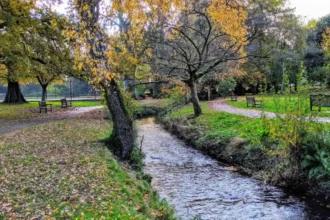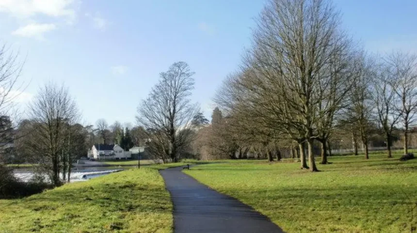
Quiet walks in Llandaff function as designated pedestrian pathways traversing the historical and ecological zones of Llandaff, an ancient cathedral district within the city of Cardiff. These pedestrian routes combine urban green infrastructure, medieval architecture, and riparian corridors along the River Taff. Walkers utilize these paths for recreation, low-impact exercise, and historical exploration within a protected conservation zone established to preserve local heritage.
- What defines the geographical boundaries and layout of Llandaff walking routes?
- How does the historical context of Llandaff shape modern walking paths?
- What are the primary ecological and environmental components along these trails?
- What specific steps and navigation methods ensure an optimal walking experience?
- What real-world examples illustrate the diversity of walking routes in Llandaff?
- What data, statistics, and research insights characterize usage patterns in Llandaff?
- What are the broader impacts, economic implications, and future relevance of these green spaces?
What defines the geographical boundaries and layout of Llandaff walking routes?
Llandaff walking routes encompass a network of pedestrian paths bounded by the River Taff to the east, Hailey Park to the north, Cardiff Road to the west, and Llandaff Fields to the south, integrating urban conservation zones with continuous riverside greenways.
The geographical arrangement of Llandaff relies on a topography defined by a river terrace carved by the River Taff. The historic core sits elevated above the riverbed, creating natural gradients for descending paths toward the water. Key access points include Cathedral Close, High Street, and Hailey Park.
Pedestrian infrastructure consists of tarmac paths, gravel tracks, and historic stone bridges. The layout accommodates dual-use recreational activities, separating heavy cyclist traffic on the Taff Trail from contemplative walkers utilizing interior village lanes. Urban planners designed these routes to link residential sectors directly with ecclesiastical monuments, municipal parks, and former industrial canals.
How does the historical context of Llandaff shape modern walking paths?
Llandaff walking paths intersect centuries of ecclesiastical, industrial, and literary history, incorporating 6th-century Christian foundations, 12th-century cathedral architecture, and 18th-century industrial canal remnants into contemporary pedestrian itineraries.
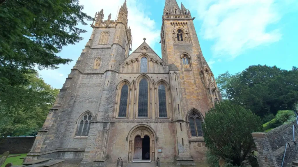
The historical evolution of Llandaff began when Dubricius established a monastic settlement in the 6th century. Subsequent construction of Llandaff Cathedral commenced in 1107 under Urban, the first Bishop of Llandaff. Walking paths through Cathedral Close follow medieval alignments originally used by clergy and pilgrims.
Industrial development during the late 18th and 19th centuries introduced the Glamorganshire Canal, constructed in 1790 to transport coal and iron from Merthyr Tydfil to Cardiff Docks. Modern walking routes utilize the former canal towpath, which features designated rows of lime trees marking the historic waterway.
Furthermore, literary heritage marks the area. Roald Dahl was born in Llandaff in 1916 and baptized at Llandaff Cathedral, embedding literary landmarks into local streetscapes. Walkers frequently pass architectural entities such as Insole Court, a 19th-century Gothic Revival mansion saved by community action, and the Bishop’s Palace ruins dating to the 13th century.
What are the primary ecological and environmental components along these trails?
Ecological components along Llandaff walking trails comprise riparian woodland along the River Taff, mature hardwood tree canopies, wetland habitats, and managed parklands supporting diverse local flora and fauna.
The natural environment surrounding Llandaff is dominated by the River Taff ecosystem. Riparian zones feature native tree species, including alder, willow, ash, and sycamore. These trees stabilize riverbanks and provide habitats for wildlife populations, such as kingfishers, otters, and various migratory bird species.
Parkland spaces like Llandaff Fields and Hailey Park contribute urban canopy cover through mature plantings of Japanese Larch, Corsican Pines, and flowering chestnuts. Soil composition varies from well-drained alluvial soils near the river to compacted urban loams within park interiors.
Environmental management initiatives by Cardiff Council and local volunteer groups protect these habitats against urban encroachment. Conservation measures maintain wildflower meadows, monitor water quality in the River Taff, and protect ancient trees within the Llandaff conservation area.
What specific steps and navigation methods ensure an optimal walking experience?
Optimal navigation of Llandaff walking trails requires utilizing established municipal signage, tracking mileage via the Taff Trail network markers, and adhering to designated multi-user code of conduct protocols.
Walkers execute successful excursions by following a structured sequence of route planning, trail entry, and pace regulation:
- Route selection based on distance capabilities, utilizing specific options such as the 3.3-mile River Taff loop from Llandaff or the 4.3-mile Taff and Glamorgan Canal loop.
- Trailhead entry via designated access points at Cardiff Road, Hailey Park at Radyr Road, or Cathedral Close.
- Wayfinding via physical fingerposts, metal heritage trail plaques, and digital mapping tools containing exact coordinates.
- Pace regulation to accommodate shared spaces, yielding to cyclists on designated sections of the National Cycle Network.
- Post-walk transition into local commercial districts for amenities along High Street.
Adherence to these operational steps prevents path erosion, minimizes user conflict, and preserves the structural integrity of historical surfaces.
What real-world examples illustrate the diversity of walking routes in Llandaff?
Real-world examples of walking routes in Llandaff include the River Taff and Glamorganishire Canal loop, the Bishop’s Palace and Cathedral Close heritage trail, and the Insole Court parkland circuit.
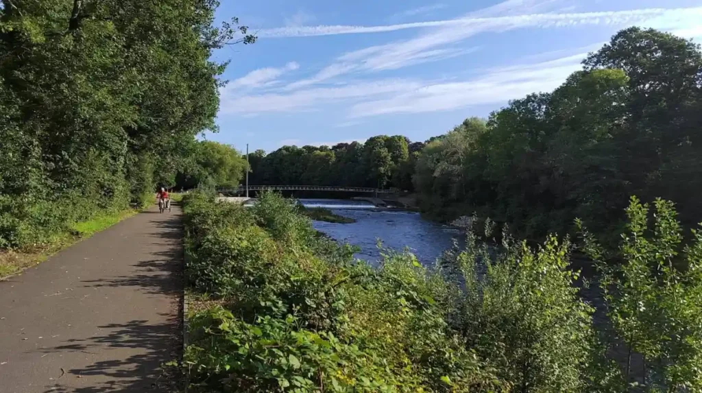
The River Taff and Glamorganishire Canal loop represents a 4.3-mile (6.9 km) path taking approximately 1 hour and 47 minutes to complete. This route guides walkers past Radyr Weir, historical lock structures, and the Melingriffith Water Wheel, an 18th-century industrial pumping apparatus.
The Cathedral Close and Bishop’s Palace route offers a shorter, architecture-focused walk. Pedestrians navigate the ruined stone walls of the medieval Bishop’s Palace, destroyed during the Glyndŵr Rising in the early 15th century, before entering the nave of Llandaff Cathedral.
The Insole Court circuit provides a 160-year-old estate experience. Walkers traverse the stable yard, formal gardens, and surrounding parkland featuring Victorian-era arboriculture. Each route offers distinct terrain characteristics, ranging from flat tarmac towpaths to gravel park tracks.
Explore More Area Guide
Best Cardiff Viewpoints: Scenic Spots and Panoramas Cardiff 2026
Hidden Cafés & Coffee Gems in Pontcanna Cardiff 2026
What data, statistics, and research insights characterize usage patterns in Llandaff?
Quantitative data indicates that Llandaff walking routes receive high community engagement, demonstrated by komoot community user scores averaging 4.6 out of 5 stars across hundreds of reviews and thousands of recorded hiking uses.
Geospatial and recreational research highlights the socio-economic and health impacts of urban green spaces in Cardiff. Statistical insights regarding the area include:
- Over 3,000 distinct hikers utilize digital platforms to navigate the Llandaff North and Llandaff trail networks annually.
- The Taff Trail accommodates millions of recreational trips per year across its entire length, with the Llandaff segment serving as a primary commuter and leisure bottleneck.
- Conservation boundaries protect over 71 acres of open space within adjacent Llandaff Fields alone, originally secured for public recreation following municipal acquisition in 1898.
- Tree inventories record hundreds of cataloged mature specimens, including coronation oak trees planted in 1938 to commemorate the crown of King George VI.
These metrics confirm that local trails function as vital urban infrastructure balancing high-density residential pressure with ecological preservation.
What are the broader impacts, economic implications, and future relevance of these green spaces?
The future relevance of quiet walks in Llandaff involves mitigating urban heat island effects, supporting public health initiatives, and driving cultural tourism within the Cardiff metropolitan region.
Urban planning models project that protected green corridors will remain essential for climate change adaptation. Riparian trees along the River Taff absorb excess stormwater runoff, reducing flood risks for vulnerable residential zones such as Mary Street.
Economically, the presence of maintained walking infrastructure enhances surrounding property values and supports local commerce. Walkers frequently patronize independent businesses, restaurants, and tearooms located along High Street and near Insole Court.
Future municipal strategies prioritize upgrading path lighting, improving wheelchair accessibility across historic thresholds, and expanding biodiversity corridors. By maintaining these standards, Llandaff preserves its dual identity as an ancient ecclesiastical sanctuary and a modern, walkable urban neighborhood.
What are the best quiet walks in Llandaff?
The best quiet walks in Llandaff include the River Taff riverside route, Cathedral Close heritage walk, Bishop’s Palace trail, Glamorgan Canal pathway, and Insole Court parkland circuit. These routes combine natural landscapes, historic architecture, and peaceful walking environments within Cardiff.