Cardiff is not uniformly flat. The city rises steadily toward its northern and north-western edges, where residential communities sit on higher ground close to hills, ridges and upland landscapes. The highest residential locations are concentrated around Pentyrch, Gwaelod-y-Garth, Thornhill, Lisvane, Rhiwbina, Radyr and nearby northern districts. Cardiff Council recognises communities including Pentyrch, Radyr, Rhiwbina, Lisvane, Thornhill and Cyncoed within the city’s administrative area.
- What are Cardiff’s highest residential areas?
- Why is north-west Cardiff higher than central and southern Cardiff?
- How high is Pentyrch compared with other Cardiff residential areas?
- Which residential streets around Pentyrch are particularly high?
- Is Gwaelod-y-Garth one of Cardiff’s highest residential areas?
- How high is Thornhill in Cardiff?
- Is Lisvane one of the highest residential suburbs in Cardiff?
- How high is Rhiwbina compared with other Cardiff suburbs?
- How high is Radyr compared with Cardiff’s northern suburbs?
- Which other Cardiff residential areas sit on higher ground?
- How does Cardiff’s elevation affect residential geography?
- How should residents compare the elevation of Cardiff properties?
- Why is Garth Hill important when discussing Cardiff’s highest homes?
- What does Cardiff’s high residential geography mean for the future?
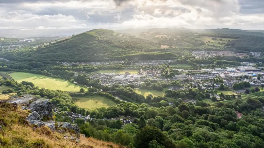
The city’s highest natural point is Garth Hill, which reaches about 307 metres above sea level. Garth Hill sits near Pentyrch and Gwaelod-y-Garth, making the north-western edge of Cardiff the clearest concentration of high ground.
Residential elevation is different from the elevation of a hill summit. A neighbourhood can contain streets at substantially different heights. For that reason, comparisons of Cardiff’s highest residential areas use settlement elevations and representative postcode or street elevations rather than treating a whole district as one exact height.
What are Cardiff’s highest residential areas?
Cardiff’s highest residential areas are concentrated in the north and north-west, with Pentyrch and streets near Garth Hill occupying the highest positions. Thornhill, Lisvane, Rhiwbina, Radyr, Cyncoed and Creigiau also contain residential land at notably higher elevations.
Pentyrch forms the strongest example of high-level residential settlement within Cardiff. A representative location in Pentyrch is recorded at about 142 metres above sea level, while some individual postcodes on higher streets reach around 170 metres.
Gwaelod-y-Garth occupies lower ground close to the River Taff, but its wider topographic area extends onto substantially higher terrain. Topographic data records an average elevation of about 124 metres for the wider area and a maximum approaching 303 metres.
Thornhill is another significant high residential district. A representative elevation is approximately 120 metres, placing parts of Thornhill considerably above central Cardiff.
Lisvane sits at about 92 metres at its mapped locality point, while Rhiwbina is recorded at approximately 89 metres at one locality reference.
Radyr is also elevated, with a representative locality elevation of about 68 metres. Individual streets rise higher, including Blaen-y-Coed, where sampled elevation data reaches around 80 metres.
These figures show why “highest residential area” should be understood as a geographic description rather than a formal Cardiff Council classification.
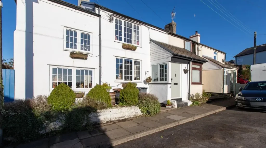
Why is north-west Cardiff higher than central and southern Cardiff?
North-west Cardiff is higher because the city rises from the low-lying coastal and river environments toward the South Wales uplands. The terrain becomes progressively more elevated around Pentyrch, Gwaelod-y-Garth, Tongwynlais and the slopes surrounding Garth Hill.
Cardiff’s physical geography explains the pattern. The southern part of the city extends toward Cardiff Bay and the Severn Estuary, while the northern edge approaches the valleys and upland landscapes of South Wales.
The River Taff provides an important geographical corridor through western Cardiff. Gwaelod-y-Garth occupies part of this corridor, while Pentyrch rises onto higher ground west of the river valley.
Garth Hill is the most important elevation marker. It reaches 307 metres and is officially recognised in geographical datasets as the highest point of the Cardiff local authority area.
The terrain around Garth Hill is not entirely residential. Large areas consist of open countryside, woodland and protected or undeveloped land. The residential settlements occupy lower sections and ridges around this higher landscape.
This creates a distinct north-western elevation pattern. Pentyrch contains homes on high ground. Gwaelod-y-Garth combines valley settlement with steep surrounding slopes. Creigiau occupies elevated land farther west. Tongwynlais sits near the Taff Valley and the base of higher hills.
Northern Cardiff follows a different pattern. Thornhill, Lisvane, Rhiwbina and Llanishen occupy rising ground north of the central urban area. Their elevations are lower than Garth Hill but higher than many inner-city districts.
Central Cardiff has much lower representative elevations. Cathays, for example, is recorded at about 18 metres at its locality reference, while Gabalfa is around 23 metres.
The contrast demonstrates how strongly Cardiff’s terrain changes across relatively short distances.
How high is Pentyrch compared with other Cardiff residential areas?
Pentyrch is one of Cardiff’s highest residential settlements, with mapped locality elevations around 142–148 metres and individual postcodes reaching about 170 metres. Its position beside Garth Hill places it within Cardiff’s most elevated residential landscape.
Pentyrch is a village and community in north-west Cardiff. It sits close to the boundary of the built-up city and the rural landscape around Garth Hill.
A mapped Pentyrch locality is recorded at approximately 148 metres, while another reference point gives 142 metres.
Individual residential locations can be higher. CF15 9PQ on Mountain Road is recorded at approximately 170 metres above sea level. The elevation is derived from Ordnance Survey terrain data through postcode-level geographic processing.
Another Pentyrch postcode, CF15 9PQ, demonstrates why settlement-wide figures cannot describe every home. Streets on the surrounding slopes can sit substantially above the central village.
The wider Pentyrch topographic area extends from low ground to a maximum of about 303 metres.
This does not mean houses stand at 303 metres. The highest point represents the area’s terrain rather than its residential footprint. Garth Hill itself reaches about 307 metres and is the major summit within the Cardiff authority.
Pentyrch therefore has two separate geographic identities. It is a residential settlement and also part of a much larger upland landscape.
Which residential streets around Pentyrch are particularly high?
Higher residential streets around Pentyrch include locations on Mountain Road and elevated roads on the surrounding slopes. Individual postcode measurements reach roughly 170 metres, while streets such as Brodeg are recorded at average elevations around 141 metres.
Street-level data provides a more useful picture of residential elevation than a single settlement figure.
Brodeg in Pentyrch has an average recorded height of about 140.6 metres, with sampled points ranging from approximately 134.7 to 144.6 metres.
Mountain Road contains postcode locations around 170 metres above sea level. CF15 9QP is one example of a residential postcode at this level.
Panteg is another elevated Pentyrch location. CF15 9TL is recorded at approximately 140 metres above sea level.
These locations demonstrate the vertical variation inside Pentyrch. Two streets separated by a relatively short distance can have different elevations because the settlement follows the natural contours of the hill.
The area’s high position is closely associated with Garth Hill and the wider upland landscape. The hill rises to 307 metres, creating a substantial elevation gradient between the valley and surrounding residential roads.
Is Gwaelod-y-Garth one of Cardiff’s highest residential areas?
Gwaelod-y-Garth is one of Cardiff’s most elevated residential landscapes because it lies beside Garth Hill and extends across steep terrain. The settlement itself includes lower valley locations, while surrounding slopes rise toward elevations exceeding 200 metres.
Gwaelod-y-Garth is a village within the Pentyrch community in Cardiff. It sits near the River Taff and below the slopes of Garth Hill.
A representative postcode on Main Road is recorded at about 70 metres above sea level.
That figure does not represent the entire village or its surrounding terrain. Topographic mapping records an average elevation of approximately 124 metres across the wider Gwaelod-y-Garth area, with a maximum around 303 metres.
The distinction is important. Houses near the valley floor occupy lower ground. Properties on higher roads and slopes occupy substantially greater elevations.
Gwaelod-y-Garth therefore belongs to Cardiff’s highest residential landscape geographically, even though not every residential street is high.
The settlement also demonstrates how Cardiff’s highest terrain interacts with residential development. The urban area transitions rapidly into woodland, hillsides and open countryside.
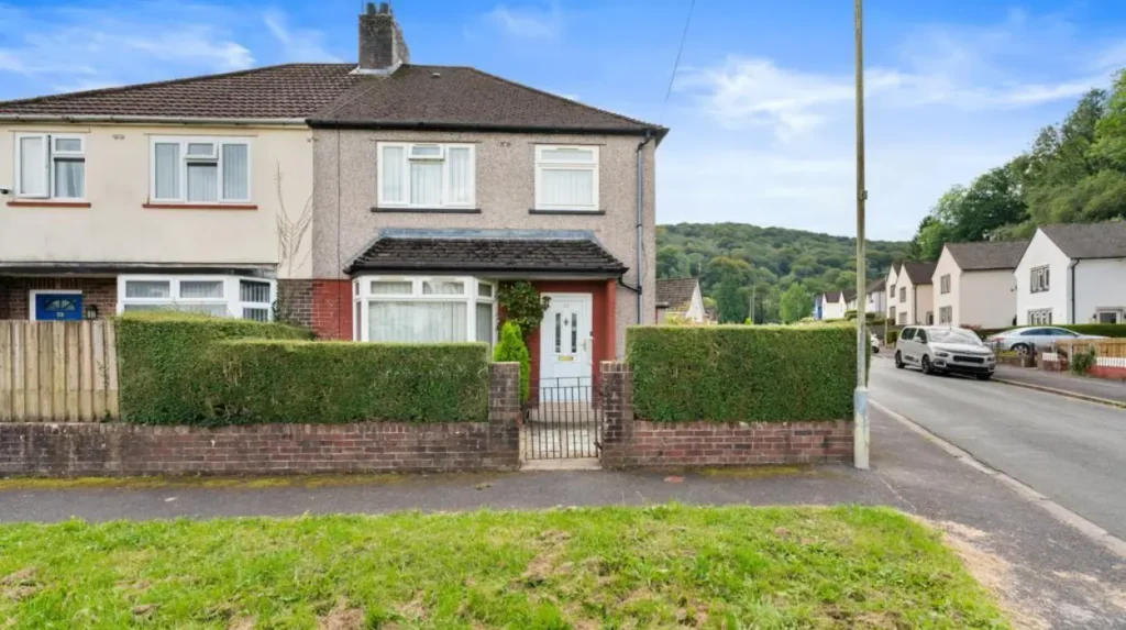
How high is Thornhill in Cardiff?
Thornhill is one of Cardiff’s highest established northern residential districts, with a representative elevation of about 120 metres. Its elevated position places it substantially above central Cardiff and close to the higher terrain around northern Cardiff and Caerphilly.
Thornhill lies north of Llanishen and forms part of Cardiff’s northern residential belt.
A locality reference records Thornhill at approximately 120 metres above sea level.
This makes Thornhill one of the most clearly elevated suburban areas within the main built-up part of Cardiff.
Its position also places it near higher land beyond the city. Craig Llanishen, located north of Thornhill, reaches about 270 metres.
The surrounding topography explains the district’s elevation. Thornhill sits on rising northern ground rather than the low-lying plain around Cardiff Bay and the city centre.
Thornhill’s residential geography differs from Pentyrch. Pentyrch is closely associated with a rural village landscape and Garth Hill, while Thornhill forms part of a larger suburban area.
The elevation remains significant because it places homes on higher terrain without removing them from Cardiff’s main urban network.
Is Lisvane one of the highest residential suburbs in Cardiff?
Lisvane is among Cardiff’s higher residential suburbs, with a representative locality elevation of approximately 92 metres. Its northern position places it close to rising terrain, while the Lisvane and Thornhill area reaches substantially higher levels than central Cardiff.
Lisvane is a residential community in north Cardiff. It lies east of Rhiwbina and north of Llanishen.
A mapped locality point places Lisvane at approximately 92 metres above sea level.
The surrounding railway station area is also elevated. Lisvane and Thornhill railway station is recorded at approximately 89 metres.
Lisvane’s elevation is therefore consistent across several geographic reference points.
The district is part of a broader northern landscape where terrain rises toward the Cardiff-Caerphilly boundary. This helps explain why northern communities have higher average elevations than central neighbourhoods.
Lisvane is also distinct from the high slopes around Pentyrch. Its elevation is significant within suburban Cardiff but remains well below the summit of Garth Hill.
How high is Rhiwbina compared with other Cardiff suburbs?
Rhiwbina occupies elevated northern Cardiff terrain, with locality data placing a representative point at about 89 metres above sea level. Higher parts of the surrounding Rhiwbina and Pantmawr landscape rise further toward the northern hills.
Rhiwbina is a long-established residential community in northern Cardiff. It lies west of Llanishen and near Whitchurch, Pantmawr and the Wenallt landscape.
A locality reference places Rhiwbina at approximately 89 metres.
Pantmawr, immediately within the wider Rhiwbina area, is recorded at approximately 56 metres at one locality point.
The variation demonstrates the importance of using precise locations when discussing residential elevation.
Rhiwbina also sits close to Wenallt. Ordnance Survey mapping identifies the highest point of Wenallt at approximately 229 metres, although another source gives 232 metres.
The nearby high ground contributes to the area’s northern topography.
Rhiwbina’s residential streets therefore occupy a transition between established suburban development and higher wooded terrain.
How high is Radyr compared with Cardiff’s northern suburbs?
Radyr is elevated compared with central Cardiff, with a representative locality elevation of about 68 metres and individual streets reaching around 80 metres. Its position beside the River Taff creates a mixture of valley and hillside residential terrain.
Radyr lies north-west of Cardiff city centre and forms part of the Radyr and Morganstown community.
A mapped locality reference places Radyr at approximately 68 metres above sea level.
Individual streets rise higher. Blaen-y-Coed in Radyr has sampled elevations ranging around 80 metres, based on Ordnance Survey Terrain 50 data.
Radyr’s terrain is closely connected with the River Taff. The river occupies lower ground while residential areas extend across higher land.
This creates a clear difference between Radyr and Cardiff’s central districts. Radyr has a more elevated suburban setting without reaching the heights found around Pentyrch.
The community also connects Cardiff’s urban landscape with the rural areas toward Gwaelod-y-Garth and the Taff Valley.
Which other Cardiff residential areas sit on higher ground?
Other elevated Cardiff residential areas include Creigiau, Cyncoed, Llanishen and Tongwynlais. Their representative elevations range from roughly 57 to 70 metres, while nearby roads and surrounding terrain reach higher levels.
Creigiau is a village in the north-west of Cardiff. Its representative elevation is approximately 70 metres.
Cyncoed is an established residential area in north-east Cardiff. A locality reference places it at approximately 57 metres. Individual parts of Cyncoed rise higher, with postcode-level data recording approximately 60 metres at one location.
Llanishen occupies higher ground than much of central Cardiff. Its mapped locality elevation is around 51–58 metres, while the railway station area reaches about 70 metres.
Tongwynlais is another northern settlement with varied terrain. Locality data records around 43 metres at one reference point, while another geographic reference gives approximately 84 metres.
These variations demonstrate that residential elevation changes across individual neighbourhoods and streets.
How does Cardiff’s elevation affect residential geography?
Elevation affects Cardiff’s residential geography through terrain, drainage, road gradients, views, development patterns and proximity to open countryside. The strongest elevation changes occur around northern and north-western communities, where residential streets meet hills, valleys and wooded slopes.
Higher residential areas often sit close to open landscapes because steep slopes and hilltops restrict dense urban development.
Pentyrch demonstrates this pattern most clearly. Residential streets occupy elevated land, while Garth Hill and surrounding countryside remain largely undeveloped.
Thornhill and Lisvane show a different pattern. Their higher ground supports extensive suburban development, with roads and housing estates following the northern topography.
Radyr combines elevated housing with a river-valley setting. This creates changes in height across relatively short distances.
Elevation also affects transport. Steeper roads require different walking and cycling conditions from the flatter streets of central Cardiff.
Drainage is another geographic consideration. Cardiff’s planning system considers flood risk, surface water and development impacts across the city. High ground does not automatically eliminate flood-related considerations because runoff can move downhill toward lower areas.
The practical meaning of elevation therefore depends on the exact property rather than the neighbourhood name alone.
How should residents compare the elevation of Cardiff properties?
Residents should compare individual streets and postcodes rather than relying only on suburb names. Ordnance Survey terrain data, topographic maps and postcode elevation information provide more precise evidence because Cardiff neighbourhoods contain substantial changes in height.
A suburb can cover several terrain levels. Pentyrch provides the clearest example, with locality measurements around 142–148 metres and individual postcode measurements around 170 metres.
Gwaelod-y-Garth also contains a large elevation range because its settlement extends around the Taff Valley and the surrounding hills.
Property searches should therefore use the exact street or postcode when elevation is an important requirement.
Ordnance Survey terrain information is particularly useful because it provides structured geographic elevation data. Postcode datasets derived from OS Terrain 50 also allow individual locations to be compared.
Local geography should then be considered alongside elevation. A property on a 100-metre contour can have different access conditions from another property at the same height depending on road gradients and surrounding terrain.
Elevation is one geographic variable rather than a complete description of residential conditions.
Explore More Area Guide
Oldest Streets in Cardiff: Roman and Medieval History
Cardiff Areas with the Strongest Village Feel | 2026
Why is Garth Hill important when discussing Cardiff’s highest homes?
Garth Hill is the key geographical reference for Cardiff’s highest residential landscape because it is the highest point in the Cardiff authority at about 307 metres. Pentyrch and Gwaelod-y-Garth sit around its lower and middle slopes.
Garth Hill is located near Pentyrch and Llantwit Fardre. The hill reaches approximately 307 metres and has a prominence of about 211 metres.
Its height is substantially greater than the elevations recorded in most Cardiff residential districts.
The hill also explains the geography of the north-western Cardiff fringe. Pentyrch occupies elevated land close to its western side, while Gwaelod-y-Garth sits below the surrounding slopes.
The highest point itself is not a residential neighbourhood. It is a hill summit and open landscape.
This distinction matters for SEO searches such as “highest residential areas in Cardiff.” The highest residential streets are not necessarily located at the city’s highest natural point.
Instead, residential development follows accessible terrain around the hill.
What does Cardiff’s high residential geography mean for the future?
Cardiff’s elevated residential areas will remain important because northern and north-western communities combine established housing with access to open landscapes. Planning decisions must balance housing demand, transport, landscape protection, drainage and the physical limits imposed by steep terrain.
Cardiff’s administrative geography includes established communities such as Pentyrch, Radyr, Rhiwbina, Lisvane, Thornhill and Cyncoed.
The council’s planning framework also recognises conservation and landscape considerations in several northern and western areas. Cardiff Council identifies conservation areas including Gwaelod-y-Garth and Craig y Parc in Pentyrch.
These designations demonstrate the relationship between residential development and local character.
Future development in elevated areas must account for terrain, road access, landscape setting and infrastructure capacity. The geography of Cardiff means that additional housing cannot be considered separately from the physical structure of the city.
The distinction between high ground and buildable residential land will remain important.
For residents, buyers and visitors, the main geographic pattern is straightforward: Cardiff rises toward the north and north-west, with Pentyrch and the slopes around Garth Hill forming the highest residential landscape, followed by elevated northern communities including Thornhill, Lisvane and Rhiwbina. Radyr, Creigiau, Cyncoed and Llanishen also occupy noticeably higher ground than central Cardiff.
What is the highest residential area in Cardiff?
Pentyrch is one of Cardiff’s highest residential areas. Parts of Pentyrch sit around 140–170 metres above sea level, with the community located close to Garth Hill.