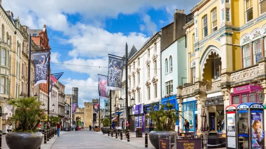
Cardiff’s oldest streets preserve the layout of a settlement that developed around Cardiff Castle, the River Taff and successive Roman, Norman and medieval town structures. Streets including High Street, St Mary Street, Womanby Street, Working Street and St John Street retain historic routes or names.
- What are the oldest streets in Cardiff?
- How old is Cardiff’s historic street layout?
- Is High Street one of Cardiff’s oldest streets?
- Why is Womanby Street historically important?
- What is the history of Working Street in Cardiff?
- Why does St John Street matter to Cardiff’s early history?
- How did St Mary Street develop?
- What role did Church Street and Quay Street play in medieval Cardiff?
- What happened to Cardiff’s medieval town walls?
- How did Cardiff’s oldest streets change during the nineteenth century?
- Which Cardiff streets still show the medieval street pattern?
- Why are Cardiff’s oldest streets important today?
- How can visitors explore Cardiff’s oldest streets?
- What is the historical importance of Cardiff’s oldest streets?
What are the oldest streets in Cardiff?
The oldest surviving street routes in central Cardiff include High Street, Womanby Street, Working Street, St John Street, Church Street, Quay Street and parts of St Mary Street. Their present buildings are newer than the routes themselves, which developed through Roman and medieval settlement.
The phrase “oldest streets in Cardiff” does not identify one officially ranked street. Historic evidence instead shows a group of streets associated with the earliest urban layout.
Cardiff developed beside the River Taff and around the site now occupied by Cardiff Castle. Archaeological and historical interpretation identifies Roman and medieval phases in the city’s development. The surviving street pattern reflects several periods rather than one single foundation date.
The Museum of Wales explains that the medieval town developed from the castle’s south gate and that High Street follows a line associated with the earlier Roman settlement. The same research identifies Womanby Street and Working Street as important boundaries within the early medieval town.
This makes Cardiff’s historic streets different from streets created during the city’s major nineteenth-century expansion. Modern Cardiff contains extensive Victorian and Edwardian development, but its central street framework includes much older routes.
The important distinction is between a historic street route and a historic building. A street can retain an ancient alignment while its buildings have been demolished and replaced many times.
How old is Cardiff’s historic street layout?
Cardiff’s central street layout contains evidence from Roman and medieval periods, although individual streets do not all have precisely documented foundation dates. The medieval settlement expanded from the castle area, while parts of the modern street pattern follow earlier routes.
Cardiff’s history begins long before the Victorian city associated with docks, railways and industrial expansion.
A Roman fort occupied the area around what became Cardiff Castle. The Roman settlement established an important strategic location beside the River Taff and near routes through south-east Wales.
The later medieval settlement developed around Cardiff Castle. According to Museum Wales research, the first Norman town was probably smaller than the later medieval settlement. Its approximate boundaries included present-day Womanby Street, Quay Street, Church Street and St John Street.
This early town gradually expanded southwards.
The street pattern therefore records the physical growth of Cardiff. Streets that now appear to be ordinary city-centre routes once defined the edges, entrances and commercial spaces of a fortified medieval settlement.
The medieval town was also protected by physical features. The River Taff formed a natural defensive boundary on the west, while a bank, ditch and later stone defences protected the eastern side.
The development of the town created a compact network of streets around Cardiff Castle. Some routes survived while others disappeared through later redevelopment.
Is High Street one of Cardiff’s oldest streets?
High Street is one of Cardiff’s most historically significant streets because its alignment appears to follow an earlier Roman route rather than simply the medieval castle entrance. It later became part of the principal medieval town network south of Cardiff Castle.
High Street runs directly south from the Cardiff Castle area and forms one of the most recognisable historic routes in central Cardiff.
Its significance comes from its alignment.
Museum Wales notes that High Street lines up with the Roman rather than the medieval south gate of Cardiff Castle. This provides an important clue about the continuity of the city’s urban geography.
The modern street therefore sits within a much older landscape.
High Street has also remained connected to Cardiff’s commercial centre. Its position beside St John’s Church, Cardiff Market and the castle places it within an area where religious, civic, commercial and defensive functions historically overlapped.
The surrounding buildings have changed substantially. Modern shops, restaurants and commercial premises occupy a streetscape that has experienced repeated redevelopment.
Cardiff Council continues to identify High Street as part of the city’s central pedestrian priority network.
The street also remains physically connected with Cardiff Castle through the junction with Castle Street. Cardiff Council’s current transport improvement programme includes paving, cycling and pedestrian changes around the High Street and Castle Street junction.
Why is Womanby Street historically important?
Womanby Street is historically important because it formed part of the early medieval town’s boundary and is associated with Cardiff’s Old Norse-influenced street-name history. Its position within the medieval town survives in the modern city centre.
Womanby Street is one of Cardiff’s strongest surviving links with the medieval town plan.
The Museum of Wales records the earlier form Hummanbye Street and associates the name with Old Norse linguistic influence.
The street formed part of the first-stage medieval town enclosure. Along with Working Street, it helped define a relatively small early urban area.
This is significant because Cardiff’s medieval town was not initially as large as the later settlement. Its expansion took place in stages.
Womanby Street also demonstrates how historic routes survive within modern commercial districts. The buildings and businesses around the street have changed, but the street remains part of the historic central network.
Today, Womanby Street is also recognised in Cardiff’s transport and street-management infrastructure. Cardiff Council includes it among streets affected by current city-centre improvement works and lists it among designated consent streets for street trading.
Its modern role is therefore both historic and commercial.
What is the history of Working Street in Cardiff?
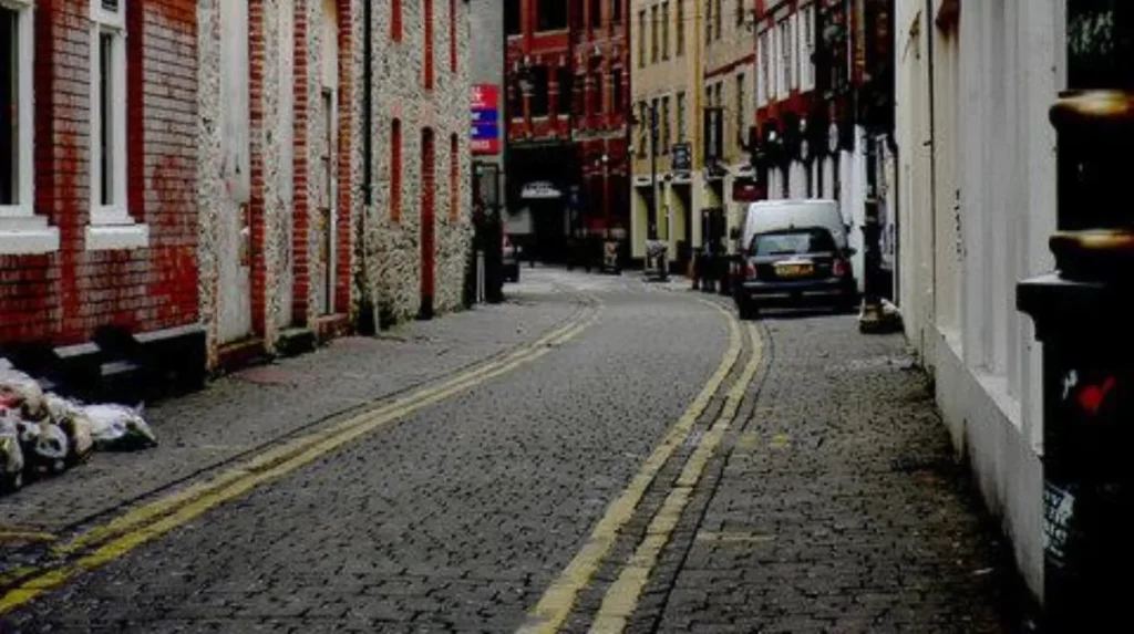
Working Street belongs to Cardiff’s historic central street network and formed part of the early medieval town enclosure. Its location beside High Street and St John Street reflects the compact structure of Cardiff’s medieval settlement.
Working Street is another important surviving route from Cardiff’s medieval urban framework.
Museum Wales identifies Working Street and Womanby Street as part of the first stage of medieval Cardiff’s development.
The early town occupied a relatively restricted area south of the castle. Its streets were closely connected with the castle, town gates, river and defensive boundaries.
Working Street remains in the central city today.
Its historic importance is easy to overlook because the present streetscape contains modern commercial buildings. However, the location of the route itself contributes to understanding how Cardiff expanded from a small medieval settlement into a major Welsh city.
Cardiff Council currently includes Working Street among the central pedestrian routes receiving priority winter maintenance.
The street also appears in the council’s current list of consent streets for street trading.
These modern administrative references confirm that Working Street remains an active component of Cardiff’s central street system rather than a purely archaeological feature.
Why does St John Street matter to Cardiff’s early history?
St John Street is significant because it formed part of the proposed boundary of Cardiff’s first Norman town and remains connected to the historic core beside St John’s Church. Its present route therefore preserves an important element of medieval Cardiff’s urban structure.
St John Street occupies an important position in the centre of Cardiff.
Museum Wales identifies it as one of the streets likely to have bordered the first Norman town. The proposed early town was probably smaller than the later medieval enclosure and was concentrated immediately south of the castle.
St John’s Church adds another historic layer.
The church sits within an area where religious activity, commerce and urban movement have remained connected for centuries. The relationship between St John Street, High Street and Working Street illustrates the compact character of medieval Cardiff.
The modern street remains part of the city’s central pedestrian network. Cardiff Council lists St John Street among the priority routes treated during winter maintenance.
Its continued role demonstrates the longevity of Cardiff’s central street framework.
How did St Mary Street develop?
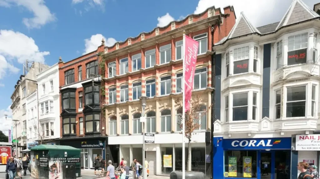
St Mary Street is one of Cardiff’s principal historic routes, but its present form reflects centuries of rebuilding and urban change. Its name derives from St Mary’s Church, which stood near the southern medieval town before the River Taff progressively affected the site.
St Mary Street is among the best-known streets in modern Cardiff.
Its historical significance comes partly from the former St Mary’s Church. The medieval church stood at the southern end of the medieval town.
Museum Wales records that by 1610 the River Taff had reached Hummanbye Street and was beginning to disrupt St Mary’s Church. By the early nineteenth century, the church had disappeared completely, leaving its name preserved in St Mary Street.
The history of St Mary Street therefore illustrates the importance of the River Taff in shaping Cardiff.
The river was not simply a geographical feature. Its changing course affected buildings, routes and settlement patterns.
Museum Wales collections also preserve photographic records of St Mary Street from the twentieth century. A 1921 photograph shows the street looking towards Cardiff Castle, while another collection item records a view from High Street.
St Mary Street also contains evidence of later civic development. Cardiff’s former town hall on St Mary Street was built in 1849 and demolished in 1913.
The street therefore combines medieval associations with nineteenth- and twentieth-century urban history.
What role did Church Street and Quay Street play in medieval Cardiff?
Church Street and Quay Street formed part of the compact street network associated with Cardiff’s first Norman town. Their positions help identify the approximate limits of the early settlement that developed immediately south of Cardiff Castle.
Church Street and Quay Street are important when reconstructing medieval Cardiff.
The early Norman town was probably bordered by Womanby Street, Quay Street, Church Street and St John Street. This interpretation comes from archaeological and historical study of Cardiff’s medieval development.
These streets therefore provide more than individual historic names. Together they help establish the shape of the earliest known Norman urban area.
The town expanded later.
This expansion explains why some streets now appear central to Cardiff while historical evidence places them at the edge of earlier settlement phases.
Quay Street also reflects Cardiff’s relationship with the river and commercial movement. Cardiff’s location beside the Taff contributed directly to its development as a settlement and later trading centre.
The survival of the route contributes to the city’s historic character even where medieval buildings no longer survive.
What happened to Cardiff’s medieval town walls?
Cardiff’s medieval walls enclosed parts of the growing town, but most of the original defensive structure disappeared through later development. Two sections are known to survive, while the historic street pattern provides additional evidence of the former medieval enclosure.
Medieval Cardiff was a defended settlement.
The town expanded south from the castle and was eventually enclosed. On the eastern side, a bank and ditch were developed and later replaced or supplemented by a stone wall and gate. The River Taff provided protection on the west.
Only limited physical remains survive.
Museum Wales identifies two known surviving sections of the medieval wall. One supports a flower bed east of the Roman fort wall, while another larger section survives behind modern retail premises.
Much of the medieval fabric disappeared during later redevelopment.
This includes the destruction of foundations and small medieval alleyways during the construction of modern shopping centres.
The surviving streets therefore become especially important.
Even when walls and buildings disappear, street alignments preserve evidence of the shape and organisation of the earlier town.
How did Cardiff’s oldest streets change during the nineteenth century?
Cardiff’s historic streets underwent major rebuilding during the nineteenth century as the town expanded rapidly through industrialisation, port development, railways and population growth. Older routes remained while new buildings, wider streets and commercial premises transformed their appearance.
Cardiff changed dramatically during the nineteenth century.
The development of Cardiff Docks, coal exports, railway connections and industrial commerce transformed the settlement from a relatively small town into a major urban centre.
Historic streets became commercial corridors.
Older routes such as St Mary Street and High Street received new buildings, shops, civic facilities and transport infrastructure. Their medieval or earlier alignments remained while their architectural character changed.
The former St Mary Street town hall demonstrates this process. Built in 1849, it belonged to a period of substantial civic development and was later demolished in 1913.
This pattern explains why visitors should not expect every old Cardiff street to contain medieval buildings.
The street itself can be historically old even when most visible architecture dates from the nineteenth or twentieth century.
This distinction is central to understanding Cardiff’s urban heritage.
Which Cardiff streets still show the medieval street pattern?
High Street, Womanby Street, Working Street, St John Street, Church Street and Quay Street provide the clearest group of modern routes associated with Cardiff’s early medieval and Norman urban structure. St Mary Street adds another historic route linked to medieval Cardiff.
The historic pattern is easiest to understand as a network rather than a list of isolated streets.
High Street connects directly with the castle area and follows an alignment associated with the Roman settlement. Womanby Street and Working Street relate to the first-stage medieval enclosure. St John Street, Church Street and Quay Street form part of the proposed boundary of the first Norman town.
St Mary Street extends the historic network southwards.
The arrangement demonstrates successive phases of urban growth.
The first settlement was compact. The medieval town expanded. Later development extended Cardiff far beyond its original core.
Modern Cardiff therefore contains several layers of urban geography within a relatively small central area.
Why are Cardiff’s oldest streets important today?
Cardiff’s oldest streets provide physical evidence of how the city developed from a Roman and medieval settlement into the modern Welsh capital. Their surviving alignments connect Cardiff Castle, historic churches, commercial areas, river routes and later civic development.
Historic streets are important because urban history is not preserved only inside museums.
The route of a street can preserve evidence of earlier settlement even when buildings, walls and gates have disappeared.
Cardiff provides a strong example.
The city centre still contains streets associated with the earliest medieval town. Modern transport schemes, pedestrian routes and commercial activity operate within this inherited urban structure. Cardiff Council continues to manage High Street, St Mary Street, St John Street, Working Street, Womanby Street and other central routes as active parts of the contemporary city.
Cardiff Council also maintains formal conservation information for historic areas and streets, including St Mary Street and Queen Street.
This creates an important connection between archaeology, conservation and modern planning.
The oldest streets are therefore not simply remnants of the past. They remain functioning urban routes.
Explore More Area Guide
Cardiff Areas with the Strongest Village Feel | 2026
Where Retirees Choose to Live in Cardiff
How can visitors explore Cardiff’s oldest streets?
Visitors can explore Cardiff’s oldest central streets on foot by starting around Cardiff Castle and following High Street, Womanby Street, St John Street, Working Street and St Mary Street. The route connects medieval history with Cardiff’s modern shopping and civic centre.
Cardiff’s historic core is compact enough to explore through a walking route.
Start beside Cardiff Castle, which provides the principal historical reference point for understanding the medieval town. From the castle area, High Street leads into the historic centre.
Continue towards Womanby Street and Working Street to understand the approximate structure of the early medieval settlement.
St John Street provides another connection with the medieval town’s proposed boundary.
St Mary Street then demonstrates the later development of the city and preserves the name of the former St Mary’s Church.
Historical interpretation is strongest when the streets are considered together.
Visitors can also compare present-day streets with historic photographs held by Amgueddfa Cymru – Museum Wales. Its collections contain twentieth-century photographs of St Mary Street, including images dating from 1921 and 1929.
Cardiff’s historic streets are therefore best understood as layers of urban evidence.
The visible buildings represent different centuries, while the routes beneath them preserve much older patterns.
What is the historical importance of Cardiff’s oldest streets?
Cardiff’s oldest streets document the city’s transition from Roman settlement to Norman town, medieval market centre and modern capital. Their surviving alignments reveal how Cardiff expanded around its castle, river, defensive boundaries, religious sites and commercial routes.
The strongest historical evidence points to a network rather than a single “oldest street”.
High Street has an important Roman connection through its alignment. Womanby Street and Working Street belong to the early medieval enclosure. St John Street, Church Street and Quay Street help define the likely extent of the first Norman town. St Mary Street preserves the name of a medieval church that disappeared as the River Taff affected the southern part of the settlement.
Together, these routes explain Cardiff’s urban evolution.
The medieval town expanded beyond its original limits. Defensive structures were constructed. Religious and commercial institutions developed. Later industrialisation and nineteenth-century growth transformed the streetscape.
Modern Cardiff inherited this framework.
That continuity gives the city’s oldest streets their significance. Their value comes not only from surviving buildings but from the historic relationships between streets, castle, river, church sites and commercial spaces.
For anyone researching oldest streets in Cardiff, the most accurate approach is therefore to examine the surviving street network and its documented historical phases rather than assign an unsupported exact age to one road.
What is the oldest street in Cardiff?
High Street is one of Cardiff’s oldest and most historically significant street routes. Its alignment is associated with the earlier Roman settlement and it later became part of the medieval town network south of Cardiff Castle.