Penylan Road is a major municipal highway and residential corridor located in northeastern Cardiff, Wales, running through the CF23 and CF24 postal districts. The road acts as a primary link between urban Roath and the elevated suburb of Penylan.
- How did Penylan Road develop historically?
- What are the architectural characteristics of Penylan Road?
- What role does Penylan Road play in Cardiff’s transport network?
- What community amenities are located on Penylan Road?
- How do planning policies affect properties on Penylan Road?
- What are the environmental and infrastructure challenges on Penylan Road?
- What is the future outlook for the Penylan Road corridor?
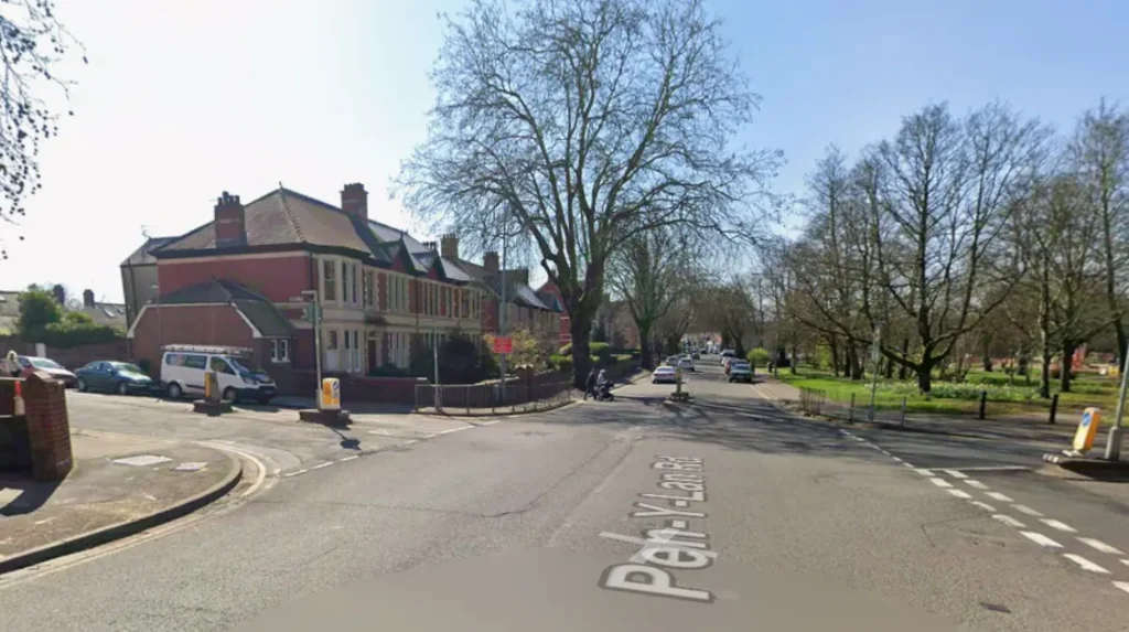
Penylan Road is a core component of the strategic highway network managed by Cardiff County Council. The thoroughfare begins at the junction of Albany Road and Marlborough Road, extending northeastward up Penylan Hill to connect with Cyncoed Road. Geographically, it transitions from low-lying alluvial plains near Roath Brook to an elevated ridge that stands 60 metres above sea level. This elevation provides panoramic views across the Cardiff city centre and the Severn Estuary.
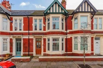
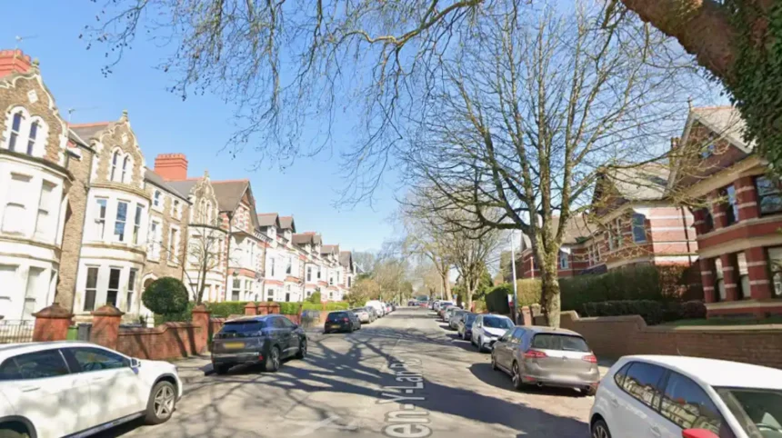
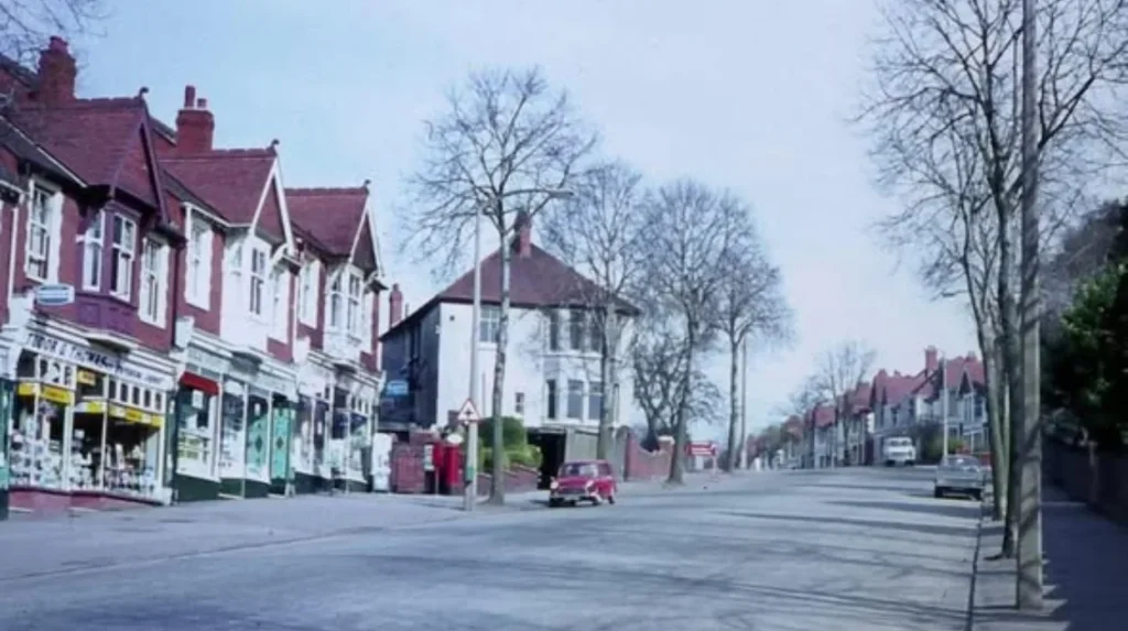
The corridor serves dual functions as a critical local transportation route and a premium residential zone. The built environment along Penylan Road consists primarily of substantial Victorian, Edwardian, and interwar domestic architecture. These structures reflect the rapid industrial and suburban expansion of Cardiff during the late 19th and early 20th centuries. Today, Penylan Road is designated as a key asset within local municipal development plans, balancing heavy commuter traffic with conservation area status.
How did Penylan Road develop historically?
Penylan Road developed during the late 19th century as Cardiff expanded past its medieval boundaries. The transformation turned a rural track on the Tredegar Estate into a premium Victorian residential avenue designed for the city’s wealthy merchant class.
Originally, the land comprising modern Penylan belonged to the agricultural manor of Roath-Keynsham. Following the Dissolution of the Monasteries in the 16th century, the estate passed to the Morgan family of Tredegar. For over three centuries, the area remained pastoral farmland dominated by agricultural operations, including Ty-Mawr Farm and Penylan Farm. Penylan Road existed only as a dirt track linking agricultural holdings to the historic parish church of St Margaret’s.
The industrialization of the Cardiff Docks by the Marquesses of Bute in the 19th century triggered a population boom. This population increase created an urgent demand for high-status housing outside the congested urban core. In 1875, Cardiff officially incorporated Roath as a suburb. Lord Tredegar subsequently leased parcels of land along Penylan Hill for villa development.
The opening of Roath Park in 1894 by the Cardiff Corporation accelerated local development. Engineers formalised Penylan Road to provide direct access to the new parklands and adjacent municipal spaces, including Waterloo Gardens and Mill Gardens. Prominent regional architects designed large villas along the lower and middle sections of the road. These developments established the affluent character that continues to define the corridor.
What are the architectural characteristics of Penylan Road?
The architectural characteristics of Penylan Road feature an intact collection of Victorian terraces, Edwardian semi-detached villas, and 1930s detached residences. These buildings prominently feature local building materials like Radyr stone, red brick, and Welsh slate roofing.
The structural fabric of Penylan Road reflects a clear chronological progression as the road moves uphill. The lower section near the intersection of Wellfield Road features late-Victorian domestic architecture dating from 1880 to 1901. These three-storey properties display detailed stone masonry, splayed bay windows, decorative plaster cornices, and tiled entrance porches. Builders heavily utilised Radyr stone—a purplish Triassic conglomerate quarried locally—alongside Devonian red sandstone imported from the Brecon Beacons.
The middle section of Penylan Road transitions into Edwardian architecture built between 1901 and 1914. These homes are characterized by wider plots, timber-framed gables, and stained-glass sash windows. Many of these properties retain their original boundary walls and stone gate piers, which are protected under local planning regulations.
The upper section of Penylan Road near Cyncoed features interwar housing stock built in the 1920s and 1930s. These detached and semi-detached homes provide driveways and large rear gardens, diverging from the dense urban terracing found at the bottom of the hill. Because much of the road sits within the Penylan Conservation Area, strict Article 4 Directions apply to these properties. These legal directives restrict alterations to front elevations, fenestration, and original chimney stacks to preserve the historical integrity of the streetscape.
What role does Penylan Road play in Cardiff’s transport network?
Penylan Road serves as a critical northeast-to-southwest distributor road within Cardiff’s urban transport network. The highway connects the commercial districts of Roath and Newport Road directly to the A48 Eastern Avenue bypass.
Cardiff County Council classifies Penylan Road as an urban distributor highway. The road accommodates significant daily traffic volumes, acting as a feeder route for commuters traveling between the northern residential suburbs of Cyncoed and Llanishen and the city centre. The southern terminus connects directly to Albany Road and Wellfield Road, which are primary retail high streets in the CF24 area.
Public transportation providers heavily utilise Penylan Road to maintain connectivity across northeastern Cardiff. Cardiff Bus operates regular scheduled services along the corridor, specifically the 57 and 58 bus routes. These services link the city centre to East-03 bus corridors and the Pontprennau transport interchange.
The steep gradient of Penylan Hill presents distinct civil engineering and traffic management challenges. The presence of multiple signal-controlled intersections, including the junction at Melrose Avenue, regulates vehicle speeds on the descent. To improve safety, municipal authorities have implemented traffic calming infrastructure along the route. This infrastructure includes modern speed cushions, electronic speed warning indicators, and pedestrian crossing islands. These elements are designed to protect users near local schools and community centers.
What community amenities are located on Penylan Road?
Community amenities on Penylan Road include specialized educational facilities, extensive Victorian public parklands, senior residential care institutions, and independent commercial services. These facilities support both local residents and the wider city population.
Penylan Road contains a high concentration of institutional and recreational assets. At the lower end of the road lies the Marlborough Road primary school catchment area, while the upper section sits within the strict geographic boundary for Cardiff High School. This secondary school is the most oversubscribed educational institution in Cardiff, receiving 500 applications for 240 available places. St David’s Catholic Sixth Form College occupies a substantial site just off Penylan Road, built on land previously held by the Convent of the Good Shepherd.
The road provides direct access to the Roath Park recreational corridor. This public green space contains three distinct municipal gardens:
- Waterloo Gardens, which features a Edwardian pavilion and independent local businesses.
- Mill Gardens, which follows the natural course of the Roath Brook.
- Roath Park Pleasure Gardens, which provides bowling greens and tennis courts.
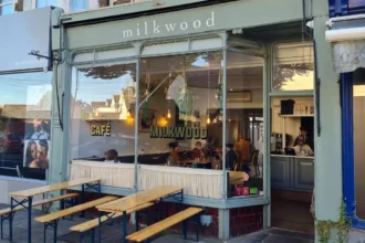
Healthcare and social care facilities also maintain a prominent presence on the road. Penylan House Care Home, managed by Hallmark Care Homes, provides 75 beds for residential, nursing, and dementia care. Additionally, the Penylan Residential Hotel operates at 82 Penylan Road, offering private residential care for up to 15 older persons. Commercial activity concentrates near Waterloo Gardens, where the Waterloo Tea House serves as a key community hub.
How do planning policies affect properties on Penylan Road?
Planning policies affect properties on Penylan Road through strict conservation area regulations, tree preservation orders, and the statutory requirements of the Cardiff Local Development Plan. These frameworks restrict development to preserve local character.
Development along Penylan Road is heavily regulated by the Cardiff Adopted Local Development Plan. Because a significant portion of the streetscape lies within the Penylan Conservation Area, property owners must secure Conservation Area Consent before executing demolition or structural alteration works. Planning officers assess all applications against strict design guidelines to ensure that new materials match the existing Victorian and Edwardian stone and brickwork.
Domestic extensions and property conversions face rigorous scrutiny along this corridor. For example, architectural projects handled by firms like Design Line Partnership must achieve specific environmental and design compliance levels, such as the Code for Sustainable Homes Level 3. These regulations require design modifications to maximize natural light through glazed areas while maintaining external proportions that respect neighboring properties.
Tree Preservation Orders protect the mature horse chestnut, lime, and oak trees that line the avenue. Landowners must obtain written permission from Cardiff County Council before performing any arboricultural work on these specimens. Furthermore, local planning policies discourage the conversion of single-family Edwardian villas into multiple flats or Houses in Multiple Occupation. These restrictions prevent increased parking congestion and protect the low-density character of the CF23 residential market.
Explore More Area Guide
Broadway Cardiff Local Guide: Things to Do, Eat, Shop, and Explore
Splott Road History Cardiff: Origins, Development, and Urban Legacy
What are the environmental and infrastructure challenges on Penylan Road?
Environmental and infrastructure challenges on Penylan Road focus on urban flood mitigation along the Roath Brook corridor, traffic-related air pollution, and the preservation of aging Victorian utility networks.
The primary environmental challenge affecting the lower section of Penylan Road is urban water management. The road runs adjacent to the Roath Brook watercourse, which historically presented a severe risk of fluvial flooding to nearby properties. In response, Natural Resources Wales executed extensive flood defense works between 2016 and 2019. This civil engineering project involved constructing concrete flood walls, widening the brook channels through Mill Gardens, and installing automated debris screens to protect low-lying homes on Sandringham Road and Westville Road.
Air quality and traffic management constitute another ongoing infrastructure challenge. Due to the high volume of peak-hour commuter traffic traveling toward the A48, the lower junctions experience elevated nitrogen dioxide levels. Cardiff County Council monitors these emissions via localized air-sampling stations.
The age of the underlying utility infrastructure also requires regular maintenance interventions. The Victorian brick-barrel sewer systems and cast-iron water mains beneath Penylan Road require ongoing structural reinforcement. These maintenance projects frequently necessitate temporary lane closures and traffic diversions, impacting local commuting times. Additionally, changing weather patterns put extra stress on the hillside highway, requiring highway engineers to perform regular inspections of road surfaces and retaining walls to prevent subsidence.
What is the future outlook for the Penylan Road corridor?
The future outlook for the Penylan Road corridor involves integrating localized transport infrastructure with the Cardiff Metro network, implementing sustainable urban drainage schemes, and managing high property values driven by school catchments.
Penylan Road will maintain its status as one of the most stable and high-value residential corridors in Cardiff. Property market analyses indicate that demand for housing along the road remains insulated from broader economic volatility. This stability is driven primarily by the guaranteed catchment alignment with Cardiff High School and primary schools like Marlborough and Roath Park. Residential properties will continue to command premium prices, with buyers willing to pay substantial premiums for authentic Edwardian and Victorian architecture.
Transportation infrastructure along the corridor will adapt to meet the sustainability goals of the Welsh Government’s Liwybr Newydd transport strategy. The phased rollout of the Cardiff Metro system will introduce integrated smart ticketing and improved bus-to-rail interchange options at nearby stations like Heath High Level and Cardiff Central. These upgrades aim to reduce private vehicle dependencies along Penylan Hill.
Urban design initiatives will focus on expanding the green infrastructure network. Future council projects plan to install rain gardens and permeable pavements along secondary feeder streets to reduce surface water runoff into Roath Brook. These sustainable drainage systems will work alongside existing flood defenses to ensure long-term climate resilience for the entire Penylan Road corridor.
What is Penylan Road in Cardiff?
Penylan Road is a major residential and transport route in northeast Cardiff that links Roath with Penylan and Cyncoed. It is known for its Victorian and Edwardian homes, conservation areas, and direct access to parks, schools, and local amenities.