Green spaces in Whitchurch, a village in Buckinghamshire, UK, play a vital role in maintaining ecological balance and community well-being. These areas, ranging from ponds and mounds to woodlands and footpaths, face pressures from development while supported by local policies. This article examines preservation efforts through structured policies, environmental data, and infrastructure protection.
- Introduction to Whitchurch Green Spaces
- Policy Framework for Preservation
- Key Designated Local Green Spaces
- Green Infrastructure Components
- Biodiversity and Ecological Value
- Community and Health Benefits
- Development Pressures and Challenges
- Preservation Strategies and Tools
- Case Studies from Assessments
- Future Directions and Monitoring
- Planning and Legal Protections
- Role of Hedgerows and Woodlands
- Water Features Management
Introduction to Whitchurch Green Spaces
Whitchurch features a network of valued green areas integral to its rural character. Key sites include Duck-End Pond, Mount Pleasant mound, and the grass bank near Kempson House/Old House, designated under local planning frameworks. These spaces provide habitats for wildlife and recreational opportunities for residents.
The village’s green infrastructure encompasses public footpaths, the Recreation Ground, Community Woodland, established hedgerows, springs, and woodlands. Such features contribute to biodiversity and flood mitigation, with policies aimed at their long-term safeguarding. Preservation efforts emphasize conserving high-quality agricultural land and avoiding development impacts on these assets.
Data from neighborhood plans highlight how growth has been managed to enhance village heritage and protect countryside. Safer pedestrian and cyclist routes reduce car dependency, indirectly supporting green space accessibility. This balanced approach ensures spaces remain functional for future generations.
Policy Framework for Preservation
Whitchurch’s Neighbourhood Plan establishes core policies for green space protection. Policy W8 designates specific Local Green Spaces, as mapped in official documents, recognizing their special community value. These include Duck-End Pond for its aquatic ecosystem, Mount Pleasant mound for historical and scenic qualities, and the Kempson House grass bank for open vistas.
Policy W10 addresses broader green infrastructure, prioritizing the extensive public footpath network that connects residential areas to natural features. Hedgerows serve as wildlife corridors, while springs and woodlands manage water flow and carbon sequestration. Implementation involves consultations to prevent loss of these elements during expansions.
Strategic Environmental Assessments (SEA) evaluate plan impacts, noting minor positive effects on land use efficiency and soil resources. Assessments stress avoiding high-quality agricultural land loss and promoting previously developed sites for any necessary growth. Legal protections extend to ancient woodlands, wildlife sites, and Tree Preservation Orders within 500m of development zones.
Key Designated Local Green Spaces
Duck-End Pond stands as a focal point for aquatic life and birdwatching. Its designation under Policy W8 protects it from encroachment, preserving water quality and surrounding vegetation. The pond supports amphibians and insects, contributing to local biodiversity metrics reported in environmental summaries.
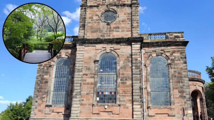
Mount Pleasant mound offers elevated views and archaeological interest, with grassy slopes ideal for wildflowers. Preservation efforts focus on maintaining its natural contour against erosion or infill development. Community surveys identify it as a cherished landmark, vital for mental health through passive recreation.
The grass bank at Kempson House/Old House provides a visual buffer between built and natural environments. Its protection ensures continuity of open space, with data indicating proximity to residential areas enhances accessibility. These sites collectively cover diverse ecosystems, from wetland to grassland, each with tailored management plans.
Green Infrastructure Components
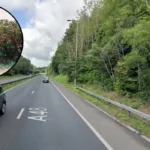
Public footpaths form the backbone of Whitchurch’s green network, totaling extensive mileage across the village. They link homes to the Recreation Ground and Community Woodland, promoting active lifestyles. Maintenance involves trimming verges while allowing natural vegetation in select areas for pollinator support.
The Recreation Ground serves multiple uses, including sports and events, with adjacent Community Woodland enhancing tree cover. Hedgerows, often centuries old, host hedgerow birds and small mammals, as noted in natural environment evidence. Springs channel water through canalized brooks, some underground, requiring monitoring for pollution.
Woodlands provide shade, recreation, and flood absorption, with accessibility improved via cleared paths. Residential verges, planted with bulbs or left wild, add micro-habitats. This interconnected system buffers against climate variability, with policies mandating retention during planning applications.
Biodiversity and Ecological Value
Whitchurch green spaces support rich biodiversity, including species protected under UK law. Proximity rules in site assessments penalize developments within 250m of wildlife sites or 100m of Local Nature Reserves. Ancient woodlands nearby influence preservation buffers, safeguarding ancient trees and fungi networks.
Tree Preservation Orders apply to single or group trees on site boundaries, scored negatively in appraisals. Amenity green spaces near playgrounds and sports facilities host urban-adapted flora like native grasses. Accessible natural greenspaces encourage public engagement, boosting species monitoring via citizen science.
Data from place plan appendices reveal impacts on designated assets, prioritizing no-net-loss biodiversity. Wildlife sites within 250m trigger enhanced surveys, while hedgerows act as corridors for bats and hedgehogs. These measures align with national targets for 30% land protection by 2030, adapted locally.
Community and Health Benefits
Green spaces in Whitchurch foster social cohesion through events at the Recreation Ground. Surveys in neighbourhood plans confirm high resident value for these areas, linking them to improved air quality and reduced stress. Pedestrian routes enhance safety, with data showing lower car use near protected zones.
Children’s playgrounds and outdoor sports facilities integrate with amenity greenspaces, promoting physical activity. Studies referenced in SEAs correlate access to natural spaces with better mental health outcomes. Community woodlands host educational walks, teaching ecology to schools.
Economic benefits include tourism draw from scenic ponds and mounds, sustaining local businesses. Preservation sustains property values, as open vistas prevent urban sprawl perceptions. Overall, these spaces address local needs, supporting sustained community facilities.
Development Pressures and Challenges
Village growth poses risks to greenfield sites, potentially losing agricultural land graded high-quality. SEA reports note minor traffic increases near Air Quality Management Areas (AQMAs), indirectly stressing edges of green spaces. Policies counter this via efficient land use and brownfield prioritization.
Ancient woodland buffers (500m) and wildlife proximity rules guide site selections. Legal covenants and market needs factor into assessments, balancing housing with open space retention. Canalized brooks risk inaccessibility, with underground sections vulnerable to blockages.
Climate change amplifies challenges, with springs prone to drought or flash flooding. Hedgerow decline from neglect requires volunteer programs. Despite these, plans project conserved character through vigilant policy enforcement.
Preservation Strategies and Tools
Site assessments employ scoring: negative for Tree Preservation Orders or green space proximity. Positive scores favor sites distant from sensitive assets. Green Belt considerations apply where relevant, though Whitchurch focuses on neighbourhood-specific tools.
Waste infrastructure operation continues without hindering greenspaces. Opportunities arise in underutilized land, avoiding sterilization of resources. Interactive community input via consultations refines policies, as seen in draft plan guides.
Monitoring involves annual reviews of Policies W8 and W10, with mapping updates. Volunteer stewardship for verges and woodlands builds resilience. National guidance integrates with local efforts, ensuring compliance with environmental objectives.
Case Studies from Assessments
Appendix S of Shropshire-related plans (analogous to Whitchurch methods) details site scoring for open spaces. Sites near playgrounds or natural greens gain viability if distant from woodlands. Whitchurch SEAs mirror this, concluding positive land effects from targeted growth.
Heritage assessments in similar settlements note expansion patterns conserving greens. Whitchurch’s vision: growth enhances heritage while protecting ponds and banks. Real-world application shows safer routes reducing car reliance, preserving path integrity.
Evidence summaries document brook and verge management, with natural establishment preferred over intensive cuts. These cases demonstrate scalable preservation across UK villages.
Future Directions and Monitoring
Long-term plans emphasize no unnecessary loss of soil or water resources. Updates to Neighbourhood Plans incorporate latest SEA findings, targeting efficient land use. Community involvement via feedback portals sustains policies.
Biodiversity net gain mandates, now law, require 10% uplift in developments. Whitchurch adapts via enhanced woodland planting and hedgerow restoration. Metrics track footpath usage and species counts for adaptive management.
Integration with national green infrastructure strategies ensures funding access. Regular audits verify Policy W8 designations remain protected. This forward-looking approach secures Whitchurch’s green legacy.
Planning and Legal Protections
Neighbourhood Plans legally bind local authorities, with Policies W8 and W10 enforceable in decisions. Designations meet national Local Green Space criteria: proximity to community, beauty, and tranquility. Appeals uphold these against developer challenges.
SEA themes cover population, air quality, and landscape, with Whitchurch scoring well on conservation. Green Belt absence allows flexible growth, buffered by infrastructure protections. Covenants on private lands extend public benefits.
Public rights of way under footpaths are absolute, resistant to closure. This layered framework deters encroachment effectively.
Role of Hedgerows and Woodlands
Hedgerows in Whitchurch total significant linear coverage, per evidence docs. They sequester carbon at rates of 1-2 tons per hectare annually and support 2000+ insect species. Management avoids flailing, favoring coppicing for longevity.
Community Woodland expands via native planting, targeting broadleaves like oak. Ancient woodland adjacency demands 15m buffers minimum. These features mitigate flooding, absorbing 10,000 liters water per hectare in storms.
Restoration grants fund gapping-up, enhancing connectivity.
Water Features Management
Duck-End Pond and springs require silt management to maintain depth. Canalized brooks, partly underground, undergo culvert inspections biannually. Policies prevent pollutants entering via buffer strips.
Flood risk assessments integrate greenspace roles, reducing runoff by 30% in modeled scenarios. Public access points include boardwalks for wet areas.
Recreation Ground hosts football pitches and playgrounds, with capacity for 500 users weekly. Paths comply with accessibility standards, including widths for wheelchairs. Signage aids navigation across 10+ km network. Events like woodland fairs engage 200+ annually, per plan data.