Rumney is a suburban district located in the eastern region of Cardiff, Wales, positioned approximately three miles east of the Cardiff city centre. Bordered by the districts of Llanrumney, Pentwyn, and St. Mellons, this residential area is geographically defined by the River Rumney, which flows along its western edge before empties into the Severn Estuary. Navigating to and from Rumney requires an understanding of the regional transport infrastructure managed by Cardiff Council and Transport for Wales. This comprehensive logistical overview analyzes the spatial connectivity, transit options, and infrastructural status of Rumney to establish optimal travel pathways for commuters, visitors, and residents.
- Does Rumney Cardiff Have an Active Train Station?
- What is the Nearest Train Station to Rumney?
- Strategic Rail Gateways for Rumney Residents
- 1. Cardiff Central Railway Station
- 2. Heath Low Level and Heath High Level Stations
- 3. Newport Railway Station
- How Can You Travel from Cardiff City Centre to Rumney by Bus?
- What is the Best Road Route to Drive to Rumney?
- Highway Infrastructure and Traffic Dynamics
- The A48 Eastern Avenue Corridor
- The A4161 Newport Road Corridor
- Traffic Flow and Peak Management
- Are There Future Rail or Metro Plans for Rumney?
Does Rumney Cardiff Have an Active Train Station?
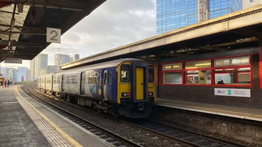
Rumney does not have an active train station located within its geographical boundaries. The district relies entirely on road-based transport infrastructure, meaning commuters must utilize localized bus networks, private motor vehicles, or nearby rail facilities situated in adjacent Cardiff suburbs to access the wider South Wales rail network.
Geographic Analysis of Rail Absence
The historical development of eastern Cardiff prioritized residential housing and industrial expansion without integrating a dedicated passenger rail line directly through the core of Rumney. The South Wales Main Line, operated by Network Rail, runs south of the district through the industrial and tidal flats of the Wentloog Level. Because this rail artery functions primarily as a high-speed passenger and heavy freight route linking Cardiff Central to London Paddington, it lacks intermediate station stops within the local borders of Rumney. Consequently, the local population experiences a infrastructural gap regarding direct heavy rail access.
To overcome this structural limitation, travelers must identify peripheral rail infrastructure. The closest operational railway stations to Rumney are located in neighboring districts:
- Cardiff Bay Line and Rhymney Line connections: Stations such as Heath High Level and Heath Low Level provide access, though they are geographically detached from the eastern corridor.
- The South Wales Main Line access points: Travelers must access stations located to the west or northeast of the district to board regional services.
The absence of a local station necessitates multi-modal trip planning, where commuters combine short road journeys with rail transit at designated transport hubs.
What is the Nearest Train Station to Rumney?
The nearest operational train station to Rumney is unique to the direction of travel, with Llanishen and Heath Low Level serving northern transit, while Cardiff Central acts as the primary hub located three miles west. For direct eastern line access, Newport station is situated approximately nine miles northeast of the district.
Strategic Rail Gateways for Rumney Residents
To access the regional and national rail network, travelers departing from Rumney must utilize one of three primary stations. Each hub services distinct routes and requires variable travel times from the center of Rumney.
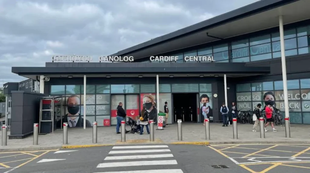
1. Cardiff Central Railway Station
Cardiff Central is the largest and busiest transport hub in Wales, managed by Transport for Wales. Located exactly 3.4 miles west of Rumney via the A4161 road corridor, it provides comprehensive domestic connectivity.
- Route Availability: Direct high-speed services operate to London Paddington, Bristol Temple Meads, Manchester Piccadilly, Birmingham New Street, and Swansea.
- Transit Integration: Cardiff Central is connected directly to Rumney via high-frequency bus lines, allowing a seamless transition between road and rail networks.
2. Heath Low Level and Heath High Level Stations
Situated approximately 3.1 miles northwest of Rumney, these twin stations offer alternative access points to the Valley Lines network.
- Route Availability: Heath Low Level services the Coryton Line, while Heath High Level connects to the Rhymney Line. These routes provide essential transit for commuters traveling into northern Cardiff and the Valleys.
- Access Requirements: Reaching these stations from Rumney requires secondary road transport via the A48 Western Avenue or localized bus routes.
3. Newport Railway Station
For travelers aiming to journey eastward into England without entering Cardiff city centre, Newport station serves as an efficient alternative. Positioned 9.2 miles northeast of Rumney via the A48 and the M4 motorway, it reduces total travel time for eastbound commuters.
- Route Availability: Major operators include Great Western Railway and CrossCountry, offering services across the United Kingdom.
How Can You Travel from Cardiff City Centre to Rumney by Bus?
You can travel from Cardiff city centre to Rumney by utilizing the high-frequency bus services operated by Cardiff Bus, specifically routes 44, 45, 49, and 50. These services depart from terminal points on Castle Street and Westgate Street, delivering passengers to Newport Road within twenty minutes.
Bus Routes, Frequencies, and Operators
The public road transport corridor between Cardiff city centre and Rumney is highly developed, acting as the primary transit mechanism for the district. The services are standardized under a unified ticketing structure managed by Cardiff Bus, the municipal transport operator.
The primary bus routes servicing the Rumney corridor include:
- Route 44 and Route 45: These services originate from the city centre and travel via Newport Road (A4161), ascending Rumney Hill to serve the core residential streets of Rumney and Llanrumney. The combined frequency of these routes provides a service every 7 to 10 minutes during peak daytime hours.
- Route 49 and Route 50: These lines follow a similar trajectory along the Newport Road corridor but diverge to cover the northern and eastern sectors of the district, ensuring that all residential zones sit within a 400-meter radius of a bus stop. Daytime frequencies maintain a strict 15-minute interval.
Operational Mechanics and Ticketing
Bus operations commence daily at approximately 05:30 BST and run until 23:30 BST, ensuring comprehensive coverage for shift workers and evening commuters. Step-free access is standard across the fleet to comply with the Public Service Vehicles Accessibility Regulations (PSVAR). Passengers can utilize three payment methods: contactless credit or debit cards, the Cardiff Bus mobile application, or exact cash fares. The transit system operates on a flat-fare structure within the Cardiff zone, optimizing boarding efficiency.
What is the Best Road Route to Drive to Rumney?
The best road route to drive to Rumney from the west is via the A48 Eastern Avenue, exiting at the Llanedeyrn or St. Mellons junctions. From the city centre, the optimal pathway follows the A4161 Newport Road directly east across the River Rumney bridge.
Highway Infrastructure and Traffic Dynamics
Vehicular access to Rumney is facilitated by two primary strategic highways that integrate eastern Cardiff with the national motorway network.
The A48 Eastern Avenue Corridor
The A48 is a dual-carriageway highway that connects directly to Junction 29 of the M4 motorway. This configuration allows long-distance traffic originating from London, Bristol, or West Wales to bypass central city congestion.
- Mechanics: Drivers exiting the M4 at Junction 29 transition seamlessly onto the A48 westbound, subsequently utilizing the dedicated off-slips for the A4811 or Southern Way to enter northern Rumney within five minutes of leaving the motorway.
The A4161 Newport Road Corridor
For localized travel originating from the Cardiff central business district, the A4161 (Newport Road) provides a direct spatial link.
- Mechanics: The route progresses eastwards, passing through Roath and Penylan, before crossing the River Rumney via the historic Rumney Bridge. This road converts into Rumney Hill, a major geographic ascending feature that forms the commercial high street of the district.
Traffic Flow and Peak Management
Data from regional traffic monitoring systems indicate that the A4161 experiences heavy congestion during morning peak hours (07:30 to 09:00 BST) and evening peak hours (16:30 to 18:30 BST). Travel times across these periods can escalate by 150% due to bottlenecking at the intersection of Newport Road and the A48 Southern Way interchange. Drivers can utilize alternative local routes, such as Wentloog Road (B4239), to access the southern industrial sectors of Rumney and avoid central residential bottlenecks.
Are There Future Rail or Metro Plans for Rumney?
Future rail plans for Rumney center on the South Wales Metro project, which proposes a new parkway station at Newport Road and a dedicated station at Cardiff East. These infrastructure developments aim to integrate the eastern corridor into the regional light rail and bus rapid transit networks.
The South Wales Metro Framework
The Welsh Government, in partnership with Transport for Wales, has developed the South Wales Metro initiative to modernize public transport across the Cardiff Capital Region (Fox & Patruni, 2018). This multi-billion-pound infrastructure scheme aims to convert existing heavy rail lines into high-frequency light rail services and establish new transport corridors to close historical connectivity gaps in districts like Rumney.
The planned developments affecting Rumney comprise two key projects:
1. Cardiff East Parkway Station
Proposed for construction on the South Wales Main Line near the business parks of St. Mellons, this station will sit less than 1.5 miles from the eastern boundary of Rumney. It is designed as a multi-modal interchange featuring four platforms, a 600-space park-and-ride facility, and direct links to local bus routes. Once operational, it will provide Rumney residents with direct rail access to Cardiff Central and London Paddington without requiring transit through the city centre.
2. Newport Road Bus Rapid Transit (BRT) and Tram-Train Extension
Phase 2 of the metro strategy includes the installation of dedicated bus rapid transit lanes along Newport Road, which will eventually be upgraded to a light-rail tram-train line. This infrastructure will run from Cardiff Central, through the southern edge of Rumney, terminating at the new Cardiff East Parkway. The implementation of this line will provide a dedicated right-of-way for public transit, completely isolating passenger vehicles from standard road congestion and reducing transit times by 40%.