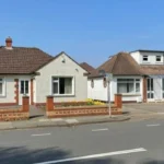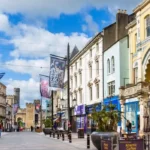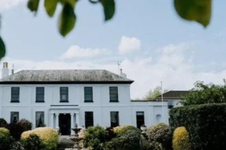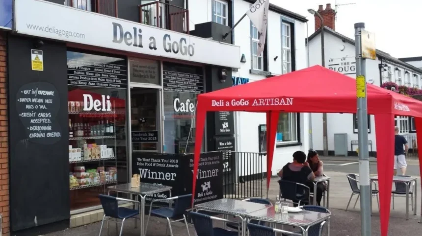
Cardiff combines the functions of a modern capital city with neighbourhoods that retain the character of historic villages, garden suburbs and former rural settlements. Areas such as Whitchurch, Rhiwbina, Llandaff, Radyr, Lisvane, St Fagans, Pentyrch and Old St Mellons contain distinct combinations of older buildings, local centres, green spaces, community facilities and historic landscapes.
- What gives a Cardiff neighbourhood a strong village feel?
- Which Cardiff areas have the strongest village characteristics?
- Why does Whitchurch have such a strong village feel?
- Why is Rhiwbina different from Cardiff’s historic villages?
- How does Llandaff retain a village atmosphere inside Cardiff?
- What makes Radyr and Morganstown feel more like villages?
- Why does Lisvane retain a village-like identity?
- How does St Fagans provide a village feel within Cardiff?
- Which other Cardiff communities have notable village characteristics?
- How does Cardiff’s growth affect its village-like neighbourhoods?
- How should visitors and residents identify Cardiff’s genuine village-feel areas?
The term village feel describes a neighbourhood where local identity remains visible through traditional buildings, compact shopping streets, community institutions, green spaces, churches, village greens, historic routes or a strong separation from the surrounding urban landscape. It does not mean that an area is outside Cardiff. Many of Cardiff’s village-like districts are fully integrated into the city.
Cardiff had a population of about 362,300 at the 2021 Census, an increase of 4.7% from 2011. The city was also the most densely populated local authority area in Wales in 2021. This wider urban growth makes the survival of distinct neighbourhood identities particularly significant.
What gives a Cardiff neighbourhood a strong village feel?
A strong village feel in Cardiff comes from historic buildings, compact local centres, community institutions, green spaces, traditional street patterns and identifiable neighbourhood boundaries. Whitchurch, Llandaff, Rhiwbina and Radyr demonstrate these characteristics particularly clearly.
Village character is not determined by one architectural feature. It develops through several connected elements. A historic church, older houses, independent shops, public spaces and nearby countryside can collectively create a recognisable local identity.
Planning policy also protects some of these characteristics. Cardiff Council maintains conservation areas where special architectural or historic interest requires additional planning controls. Its current conservation-area list includes Whitchurch’s Church Road, Rhiwbina Garden Village, Llandaff, St Fagans, Old St Mellons and several areas around Pentyrch.
This provides an important distinction between a genuinely historic village environment and a newer suburban development designed with village-style housing.
Transport also affects the experience. A neighbourhood with a concentrated high street, railway station, bus services and pedestrian routes can operate as a self-contained community even when it sits within a large metropolitan area.
Green infrastructure is another major factor. Cardiff’s village-like districts often sit beside parks, river corridors, woodland, farmland or open countryside. These spaces create physical separation between neighbourhoods and reinforce local character.
The result is a city containing several different settlement patterns. Central Cardiff has dense urban streets and major commercial districts, while outer areas retain characteristics associated with older villages and rural settlements.
Which Cardiff areas have the strongest village characteristics?
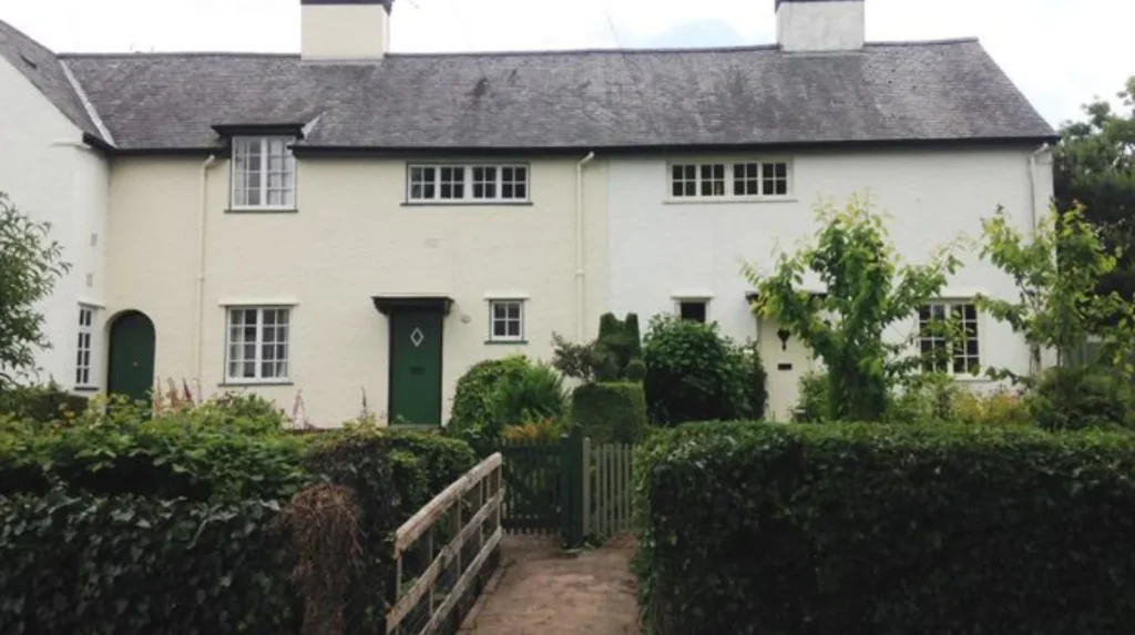
Whitchurch, Rhiwbina, Llandaff, Radyr, Lisvane, St Fagans, Pentyrch and Old St Mellons contain some of Cardiff’s clearest village characteristics, although each area expresses village identity through different buildings, landscapes, histories, local centres and community structures.
Whitchurch is one of the clearest examples of a traditional village centre absorbed into the wider Cardiff urban area. Its historic core around Church Road remains identifiable, and Cardiff Council recognises Church Road as a conservation area.
Rhiwbina provides a different form of village character. The neighbourhood is strongly associated with Rhiwbina Garden Village, a planned residential development with distinctive housing, green spaces and an established community identity. Cardiff Council lists Rhiwbina Garden Village as a conservation area.
Llandaff has a much older historical foundation. Its identity is closely connected with Llandaff Cathedral, historic buildings, older streets and the River Taff landscape. Cadw also describes Llandaff as a quaint village in its Victorian cycle itinerary, reflecting its distinctive historic townscape within modern Cardiff.
Radyr and Morganstown retain a semi-rural character on the western side of Cardiff. The area has a separate local identity, railway access and proximity to open landscapes.
Lisvane retains a more spacious suburban and semi-rural character in north Cardiff. The area is officially recognised as a parish, while the wider Lisvane and Thornhill area forms a Cardiff electoral ward.
St Fagans is closely associated with its historic village setting and St Fagans National Museum of History. The village is also protected through a designated conservation area.
Pentyrch and nearby Gwaelod-y-garth retain stronger rural and hillside characteristics. Cardiff Council lists both Pentyrch-related conservation areas, including Gwaelod y Garth and Craig y Parc.
Old St Mellons provides another example of an historic settlement incorporated into the modern city. The area has a recognised community identity and its own conservation area.
Why does Whitchurch have such a strong village feel?
Whitchurch has a strong village feel because its historic centre retains traditional buildings, a recognisable local shopping area, community facilities and Church Road conservation-area status within an established Cardiff neighbourhood connected to wider transport and services.
Whitchurch sits in north Cardiff and has developed from an older settlement into a substantial urban neighbourhood. Its historic identity remains particularly visible around Church Road and the village centre.
Cardiff Council identifies Church Road as a conservation area and has also implemented specific traffic and footway improvements around Whitchurch Village. The current scheme covers Merthyr Road, Penlline Road, Church Road and Bishop’s Road.
The council’s consultation evidence also shows the practical pressures created by a busy village centre. More than half of respondents to the 2023 consultation reported congestion issues, while residents raised concerns involving narrow footways, parking, pedestrian crossings and loading activity.
These issues are characteristic of historic village centres that became surrounded by modern urban development. Older streets were established for a smaller population and different transport patterns.
Whitchurch’s village identity is therefore not based on isolation. It comes from the continued concentration of local services and community activity around a recognisable historic core.
The neighbourhood also has access to wider north Cardiff services and transport links. Its location makes it possible to combine a local-centre lifestyle with access to Cardiff’s central employment, cultural and educational facilities.
Whitchurch therefore demonstrates how an historic village can remain recognisable after becoming part of a large capital city.
Why is Rhiwbina different from Cardiff’s historic villages?
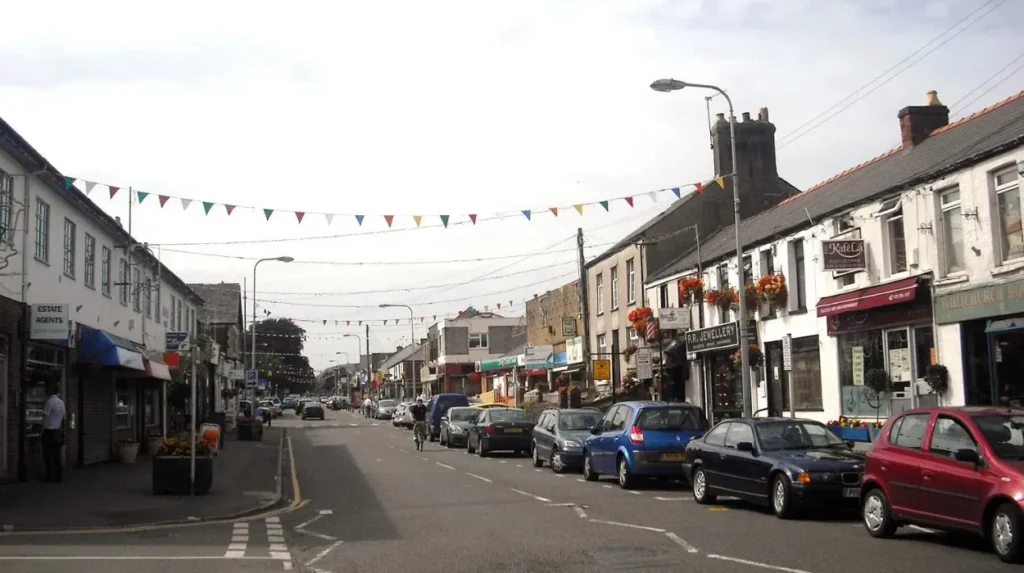
Rhiwbina has a village feel through planned garden-suburb design rather than an entirely medieval or rural settlement pattern. Rhiwbina Garden Village combines distinctive housing, landscaped spaces, community facilities and conservation protection within Cardiff’s northern urban area.
Rhiwbina is important because its village character reflects twentieth-century planning. The garden village concept promoted residential environments with access to green space, community facilities and carefully planned housing.
Cardiff Council formally recognises Rhiwbina Garden Village as a conservation area. This designation identifies the architectural and historic qualities that distinguish the neighbourhood from ordinary modern suburban development.
The area’s character comes from the relationship between houses, streets, planted spaces and community facilities. Instead of relying on a medieval church or historic rural crossroads, Rhiwbina creates its identity through planned neighbourhood design.
This makes Rhiwbina particularly relevant to people researching Cardiff areas with village character but who also want an established urban environment.
The wider Rhiwbina area is part of Cardiff North for several council service purposes and sits close to Llanishen, Lisvane, Thornhill and other northern districts. Cardiff Council’s current service information groups Rhiwbina with these communities for planning and childcare purposes.
Rhiwbina also benefits from Cardiff’s wider active-travel planning. Cardiff Council publishes a dedicated Active Travel Network Map for the Rhiwbina ward, alongside maps for Lisvane and Thornhill, Radyr and other districts.
Its village feel is therefore closely linked to design, landscaping and community structure rather than simply age.
How does Llandaff retain a village atmosphere inside Cardiff?
Llandaff retains a village atmosphere through its historic cathedral district, older buildings, landscaped spaces, conservation area, river setting and compact historic streets. Its medieval religious heritage remains visible despite its integration into modern Cardiff.
Llandaff is one of Cardiff’s most historically distinctive districts. Its identity developed around the historic cathedral and the ecclesiastical settlement associated with the Diocese of Llandaff.
Cadw identifies Llandaff as one of the historic places encountered on its Victorian cycle itinerary and specifically describes its village character.
The area also contains important historic properties. Insole Court, a Victorian mansion in Llandaff, is associated with the city’s social and architectural history. Cadw records the site’s connection with Cardiff’s emergency services during the Second World War and the later construction of the Llandaff Sub-Control Centre nearby.
Cardiff Council identifies Llandaff as a conservation area. Conservation status protects the character of places where historic buildings, streets and spaces have special architectural or historic interest.
The River Taff provides another defining element. The river corridor separates and connects parts of the district while providing access to green landscapes and walking routes.
Llandaff’s village identity therefore combines religious history, architecture, landscape and public space. It differs from Whitchurch because its strongest defining features are associated with a historic cathedral settlement rather than primarily with a village shopping centre.
Its proximity to central Cardiff also demonstrates that village character does not require geographical distance from the city centre.
What makes Radyr and Morganstown feel more like villages?
Radyr and Morganstown retain village characteristics through their western Cardiff location, established community identity, railway connection, open landscapes and separation from the denser central urban area. Their setting provides a clear transition between suburban Cardiff and surrounding countryside.
Radyr and Morganstown form a distinct community in western Cardiff. The area is represented within Cardiff’s current administrative structure and appears as Radyr and Morganstown in the city’s parish information.
Its geography contributes strongly to its character. Western Cardiff has greater access to open land and rural landscapes than the densely developed central districts.
Radyr also has a railway station, giving the area a direct transport relationship with Cardiff’s wider urban network. This combination of local identity and regional connectivity is characteristic of mature commuter settlements.
The community has recreational infrastructure as well. Cardiff Council lists Radyr Skatepark at Moundfield in Morganstown, demonstrating the presence of facilities serving the local population rather than relying entirely on central Cardiff amenities.
The area also sits close to the River Taff and wider green corridors. These landscapes strengthen the physical distinction between Radyr and more intensively developed parts of Cardiff.
New development has changed the surrounding landscape. Cardiff Council’s planning information records strategic development activity in north-west Cardiff, including areas connected with Creigiau, St Fagans, Radyr, Morganstown and Fairwater.
Radyr and Morganstown therefore illustrate a village-like environment that continues to evolve within a growing capital city.
Why does Lisvane retain a village-like identity?
Lisvane retains a village-like identity through its historic settlement structure, lower-density residential environment, open land, established community facilities and separation from denser northern Cardiff neighbourhoods. Its identity remains distinct even as development continues elsewhere in north-east Cardiff.
Lisvane is one of Cardiff’s northern communities and has its own parish identity in the city’s administrative geography. The Office for National Statistics lists Lisvane separately among Cardiff’s parishes and identifies Lisvane and Thornhill as an electoral ward.
The area’s physical setting contributes strongly to its character. It contains established residential streets alongside open spaces and countryside on the northern edge of the city.
Lisvane also has a railway station, creating an important transport connection with Cardiff and surrounding communities. This provides urban accessibility without removing the area’s lower-density character.
The neighbourhood is experiencing development pressure as Cardiff expands. Cardiff Council identifies a strategic development area north and east of Lisvane, with approximately 4,500 homes planned within the broader North East Cardiff strategic site.
This development context is important when considering the future meaning of village character. New housing increases the urban footprint while planning policy seeks to provide transport, schools, community facilities and green spaces alongside development.
Lisvane’s existing identity therefore sits alongside a changing metropolitan environment.
The distinction between Lisvane and newer suburban areas is largely historical and spatial. Older settlement patterns, established community institutions and open landscapes create continuity that newer developments do not yet possess.
How does St Fagans provide a village feel within Cardiff?
St Fagans provides a village feel through its historic settlement, conservation-area status, rural surroundings and nationally important heritage setting. St Fagans National Museum of History reinforces the area’s connection with traditional Welsh buildings, landscapes and community history.
St Fagans occupies a distinctive position in western Cardiff. It retains a village environment despite being within the administrative boundaries of the capital.
Cardiff Council lists St Fagans as a conservation area, recognising the special architectural and historic interest of the settlement.
The area’s strongest heritage association is St Fagans National Museum of History. The museum preserves and interprets buildings, crafts, traditions and aspects of everyday life from across Wales.
Cadw also references St Fagans in connection with historic Welsh architecture. Its material on medieval royal sites notes that reconstructions associated with Llys Rhosyr are being completed at St Fagans National Museum of History.
The surrounding landscape contributes to the area’s rural character. St Fagans is located west of the denser Cardiff urban area and sits close to Creigiau, Pentyrch and Radyr.
The village is also part of a wider area experiencing development pressure. Cardiff Council’s planning documentation identifies strategic development around south-west and north-west Cardiff, including areas connected with Creigiau and St Fagans.
St Fagans therefore provides a particularly strong example of village identity based on historic buildings, cultural heritage and landscape.
Which other Cardiff communities have notable village characteristics?
Pentyrch, Gwaelod-y-garth and Old St Mellons also retain notable village characteristics through historic buildings, conservation areas, open landscapes and distinct community identities. Their locations demonstrate how Cardiff contains several different forms of village-style settlement.
Pentyrch is located in the north-west of Cardiff and retains a stronger rural identity than many inner-city districts. Its surrounding landscape includes hills, woodland and open countryside.
Cardiff Council identifies Pentyrch and Gwaelod-y-garth conservation areas, reflecting their architectural and historic importance.
Gwaelod-y-garth is particularly distinctive because of its position near the River Taff and the wooded landscape around Castell Coch. The settlement forms part of a wider landscape where historic industry, transport routes and rural communities developed alongside each other.
Old St Mellons provides a contrasting eastern example. Cardiff Council lists Old St Mellons as a conservation area and identifies the Old St Mellons community separately in current school-admissions arrangements.
Its community identity remains visible despite substantial modern development around the wider St Mellons and Pontprennau area.
These communities demonstrate that village character in Cardiff is not limited to one side of the city. Historic settlement patterns survive in northern, western and eastern districts.
They also show why the term should be used carefully. A neighbourhood can feel village-like because of historic buildings and green space even when it has significant modern housing, busy roads and urban services.
Explore More Area Guide
Where Retirees Choose to Live in Cardiff
Cardiff’s Most Scenic Residential Streets: Historic Areas to Explore
How does Cardiff’s growth affect its village-like neighbourhoods?
Cardiff’s population growth increases pressure on land, housing, transport and community facilities, while planning controls and conservation designations help retain distinctive historic environments. The city’s village-like neighbourhoods therefore face simultaneous development, regeneration and heritage-preservation pressures.
Cardiff’s population increased from approximately 346,100 in 2011 to around 362,300 in 2021, representing 4.7% growth. The city was also the most densely populated Welsh local authority in the 2021 Census.
Population growth increases demand for housing and services. Cardiff Council’s Local Development Plan identifies strategic development sites containing 500 or more homes or significant employment uses. These sites are planned with supporting infrastructure such as schools, sustainable transport corridors, community facilities and green spaces.
This process affects areas surrounding established villages. New housing can bring additional services and facilities, but it also changes traffic patterns, settlement boundaries and the relationship between historic communities and open land.
Conservation areas provide one mechanism for managing change. Cardiff Council states that conservation areas contain special architectural or historic interest and provides character appraisals for designated locations.
Planning controls also cover listed buildings, tree preservation orders, conservation areas and village greens through the local land-charge system.
The future of Cardiff’s village-like areas therefore depends on how new development connects with existing settlement patterns.
The strongest village characteristics are likely to remain most visible where historic buildings, local centres, community institutions and protected landscapes continue to function together.
How should visitors and residents identify Cardiff’s genuine village-feel areas?
Visitors and residents can identify Cardiff’s strongest village environments by examining historic buildings, conservation status, local centres, green spaces, community facilities, transport connections and settlement boundaries rather than relying only on property descriptions or informal neighbourhood labels.
A practical assessment begins with the historic environment. Cardiff Council’s conservation-area register provides an authoritative starting point because it identifies locations where architectural or historic character receives additional planning protection.
The next factor is the local centre. A traditional village environment usually has a recognisable concentration of shops, services, community buildings or public spaces.
Green infrastructure is another useful indicator. Parks, rivers, woodland, farmland and protected open land can create physical separation from surrounding development.
Transport provides another distinction. Areas such as Radyr, Lisvane and Rhiwbina combine village-style neighbourhood characteristics with established public transport connections. Cardiff Council’s active-travel mapping also covers these communities.
Historic institutions provide further evidence. Llandaff Cathedral, St Fagans National Museum of History and the historic centres of Whitchurch and Old St Mellons connect present-day neighbourhoods with earlier settlement patterns.
Finally, residents and visitors should distinguish between village character and new-build village branding. A newly constructed development can use traditional architectural styles without possessing the historic continuity associated with places such as Llandaff, Whitchurch or St Fagans.
Cardiff’s village-like neighbourhoods are valuable because they demonstrate the city’s layered development. Medieval settlements, rural communities, planned garden villages, Victorian suburbs and modern housing districts now form one metropolitan area.
The result is a Cardiff residential landscape where urban accessibility and local identity often exist within the same neighbourhood.
Which Cardiff areas have the strongest village feel?
Whitchurch, Rhiwbina, Llandaff, Radyr, Lisvane, St Fagans, Pentyrch, Gwaelod-y-Garth and Old St Mellons are among Cardiff’s most village-like areas. Their character comes from historic buildings, local centres, green spaces, conservation areas and established communities.