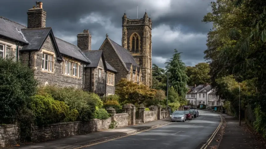
Cardiff is a city built through centuries of expansion. Its modern urban area contains districts that were once separate villages, parishes, rural communities and estates. Places such as Canton, Roath, Grangetown, Llandaff, Whitchurch, Llanishen, Rumney, Lisvane, St Fagans, Tongwynlais, Radyr and Pentyrch developed independently before becoming part of the wider Cardiff administrative area.
- What does it mean when a village was absorbed into Cardiff?
- Why did Cardiff expand beyond its original borough?
- Which villages and settlements entered Cardiff during the 1875 expansion?
- How did Victorian Cardiff change the former villages?
- When did Llandaff become part of Cardiff?
- Which areas were incorporated during Cardiff’s 1922 boundary expansion?
- When was Rumney absorbed into Cardiff?
- Which former villages entered Cardiff during the 1951, 1967 and 1974 changes?
- How did Cardiff absorb Radyr, St Fagans, Lisvane and Tongwynlais?
- When did Pentyrch and Creigiau become part of Cardiff?
- Why do former villages still feel different from central Cardiff?
- How can Cardiff’s current neighbourhoods reveal its former villages?
- What does Cardiff’s boundary history show about the city’s development?
- Why are Cardiff’s former villages important to the city’s identity today?
The process did not happen in a single event. Cardiff expanded through a series of boundary changes between the nineteenth and twentieth centuries. A historical map produced by Cardiff University shows major extensions in 1875, 1922, 1938, 1951, 1967, 1974 and 1996. These changes transformed Cardiff from a compact borough around the River Taff into a much larger city.
Understanding these former villages explains why Cardiff contains such varied local identities. The historic character of Llandaff differs from Roath. Whitchurch retains a village-centre character, while Rumney reflects its former position beyond the historic Cardiff boundary. Pentyrch and Creigiau retain strong community identities despite becoming part of the City and County of Cardiff in 1996.
What does it mean when a village was absorbed into Cardiff?
A village was absorbed into Cardiff when its land or civil administration became part of Cardiff through a formal boundary extension, parish change or local-government reorganisation, while its historic name and community identity often continued.
The word “absorbed” describes a process of administrative expansion rather than the physical disappearance of a settlement.
Before the major Victorian expansions, Cardiff was a much smaller borough. A nineteenth-century report recorded that the municipal borough originally consisted of the parishes of St John the Baptist and St Mary the Virgin. The Cardiff Improvement Act of 1875 expanded the borough to include Roath and the part of Llandaff known as Canton.
Later boundary legislation incorporated additional areas. Some settlements entered Cardiff as complete parishes, while others were divided and transferred in stages.
This distinction matters because Cardiff’s modern neighbourhoods do not all have the same administrative history. Some were incorporated during the rapid industrial expansion of the nineteenth century. Others entered Cardiff during twentieth-century boundary reforms.
The result is a city containing former independent settlements whose names remain visible in roads, churches, schools, conservation areas, electoral wards and local organisations.
Why did Cardiff expand beyond its original borough?
Cardiff expanded because industrial growth, population increases, housing development, transport infrastructure and demand for coordinated public services pushed the borough beyond its nineteenth-century boundaries into surrounding settlements and rural parishes.
Cardiff’s expansion was closely connected to its emergence as a major coal-exporting port.
During the nineteenth century, the docks, railways, coal trade and associated industries generated rapid population growth. A report presented at the 1891 International Congress of Hygiene and Demography recorded that Cardiff’s population had risen to 128,849 by 1891, compared with 82,761 in 1881. The report linked this growth to boundary expansion and the prosperity generated by the coal and iron trades.
Transport infrastructure reinforced this growth. The Glamorganshire Canal connected Cardiff with the industrial valleys, while the docks expanded to handle increasing coal exports. Roath Dock opened in 1887, adding substantial dock capacity to the eastern side of the town.
Housing development then spread into surrounding villages and rural land.
Cardiff needed administrative boundaries that reflected the expanding built-up area. Areas that had previously been separated by fields increasingly became connected by streets, tramways, railways and industrial development.
Boundary extensions therefore followed urban growth, but they also encouraged coordinated services such as roads, sanitation, libraries, schools and public health.
Which villages and settlements entered Cardiff during the 1875 expansion?
The 1875 expansion brought important settlements and districts including Roath, Canton and Grangetown into Cardiff’s enlarged borough, while Cathays, Penylan and adjoining developing areas became closely integrated into the expanding urban administration.
The Cardiff Improvement Act of 1875 represents the most important early expansion of modern Cardiff.
The historical record is particularly clear about Roath and Canton. The Cardiff Medical Officer’s 1897 report states that the original borough was extended under the 1875 Act to include the parish of Roath and the part of Llandaff known as Canton.
Another nineteenth-century account records the addition of Canton, Roath and Grangetown and notes that the borough’s area increased to 8,409 acres.
Roath
Roath was historically a separate settlement east of Cardiff’s original centre. Its development accelerated rapidly during the Victorian period.
The area became closely connected to Cardiff through housing, industry, transport and the docks. Roath’s later identity became associated with Roath Park, Roath Dock, Newport Road and dense Victorian residential streets.
The incorporation of Roath placed a rapidly developing eastern settlement under Cardiff’s municipal administration.
Canton
Canton developed west of the River Taff and had much older roots than its Victorian urban appearance suggests.
The Roath Local History Society records Canton as an established settlement before the Norman period. Its historic manor and mills were associated with the Bishops of Llandaff.
After incorporation, Canton became one of Cardiff’s major residential and commercial districts.
Grangetown
Grangetown developed south of the central borough and remained comparatively open in the mid-nineteenth century.
Local historical records describe Grangetown as becoming a Cardiff suburb in 1875 while fields still separated parts of the district from the town centre.
Its position near the docks and the River Taff helped drive later residential and industrial development.
How did Victorian Cardiff change the former villages?
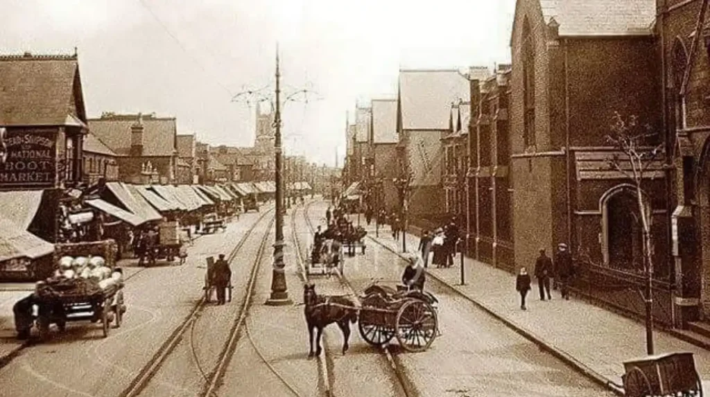
Victorian Cardiff changed former villages by connecting them to expanding streets, housing estates, railways, tram routes, schools, libraries, industrial sites and public services, turning separate settlements into an increasingly continuous urban area around the original borough.
The transformation was particularly rapid after 1875.
The Roath Local History Society records that around 20,000 houses were built between 1881 and 1902 in areas incorporated into or developing around Cardiff, excluding Llanedeyrn.
This housing expansion changed the physical relationship between Cardiff and surrounding settlements.
A village could retain its historic church, crossroads or local name while becoming surrounded by Victorian terraces and new municipal infrastructure.
Canton provides a clear example. Its historic landscape was gradually incorporated into a dense urban district. Grangetown experienced a similar transformation as housing and transport networks expanded southwards.
Roath developed even more extensively because of its relationship with Cardiff’s eastern industrial and dock areas.
Municipal services followed the population. Cardiff’s early branch library system expanded into the new districts. Historical records show branch libraries opening in Cathays and Roath in 1889, followed by Canton and Grangetown in 1891.
This pattern demonstrates that incorporation was not simply a change on a map. It changed how residents accessed public services and how the city managed rapidly growing communities.
When did Llandaff become part of Cardiff?
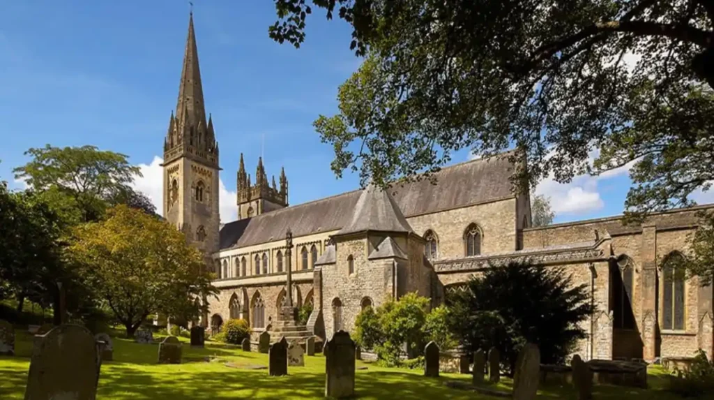
Llandaff became part of Cardiff through twentieth-century local-government reorganisation, although parts of the historic parish had already entered Cardiff earlier; the ancient cathedral settlement retained its distinctive identity after incorporation into the expanding city.
Llandaff has a particularly complex relationship with Cardiff.
The settlement developed around Llandaff Cathedral and the River Taff. Its ecclesiastical history stretches back many centuries, making it substantially older than modern Cardiff’s industrial expansion.
Canton was historically associated with the parish of Llandaff, but the 1875 Cardiff expansion incorporated the part of Llandaff known as Canton.
Llandaff itself remained distinct for longer.
The Cardiff University historical map of boundary extensions identifies Llandaff among the areas within the expanded Cardiff geography by the twentieth century.
Today, Llandaff remains recognisable as a distinct Cardiff community. Cardiff Council lists Llandaff as a current ward and identifies a Llandaff conservation area.
Its cathedral, historic streets, green spaces and surviving older buildings preserve evidence of the settlement’s pre-urban history.
Llandaff demonstrates that administrative incorporation does not necessarily remove a settlement’s independent historical character.
Which areas were incorporated during Cardiff’s 1922 boundary expansion?
The 1922 Cardiff boundary extension brought substantial northern and western areas into the borough, including large parts of Llanishen and smaller sections of Llanedeyrn, Michaelston-super-Ely, St Fagans and Whitchurch.
The 1922 extension was one of the most significant stages in Cardiff’s expansion.
Historical administrative records show that Cardiff gained the parish of Llanishen in 1922, covering approximately 1,707 acres. Cardiff also gained part of Llanedeyrn, approximately 70 acres, part of Michaelston-super-Ely covering about 230 acres, part of St Fagans covering about 129 acres and part of Whitchurch covering about 310 acres.
Llanishen
Llanishen was historically a rural settlement north of Cardiff. Its incorporation reflected the city’s movement towards the northern edge of the urban area.
Its later development included residential estates, schools, transport routes and commercial areas.
Today, Llanishen remains an identifiable Cardiff district. Cardiff Council lists Llanishen among the city’s current areas and service districts.
Whitchurch
Whitchurch developed as a distinct settlement north of the central city.
Its historic village centre remains an important part of its identity. Cardiff Council continues to refer to Whitchurch Village as a defined locality and maintains a conservation area covering Church Road.
Llanedeyrn
Llanedeyrn entered Cardiff through a more complicated sequence of boundary changes.
Part of Llanedeyrn was transferred in 1922, while further areas were incorporated during later twentieth-century changes.
The modern Llanedeyrn district therefore represents several stages of Cardiff’s geographical growth rather than a single act of incorporation.
When was Rumney absorbed into Cardiff?
Rumney became part of Cardiff on 1 April 1938 under the Cardiff Extension Act 1937, transferring the historic community from Monmouthshire into Cardiff County Borough and creating a lasting eastern Cardiff district.
Rumney provides one of Cardiff’s clearest examples of a former village crossing an historic county boundary.
The settlement lies east of the River Rhymney. Before incorporation, it was historically associated with Monmouthshire rather than Glamorgan.
The Cardiff Extension Act 1937 brought Rumney into Cardiff County Borough on 1 April 1938. Historical administrative records confirm the abolition of the Rumney civil parish and its incorporation into Cardiff at that date.
The change was significant because Cardiff’s eastern boundary moved beyond the Rhymney area.
Rumney retained its own village identity despite becoming part of the city. St Augustine’s Church and older settlement patterns continue to distinguish the area from newer Cardiff neighbourhoods.
The incorporation also illustrates why historical Cardiff cannot be understood only through today’s administrative boundaries. A resident of Rumney in the early twentieth century lived within a different local-government framework from a resident of central Cardiff.
Which former villages entered Cardiff during the 1951, 1967 and 1974 changes?
Further boundary changes in 1951, 1967 and 1974 incorporated parts of Lisvane, Radyr, St Mellons, St Fagans, Whitchurch and other surrounding communities, extending Cardiff beyond its earlier county-borough footprint.
Cardiff’s expansion continued after the major 1922 and 1938 changes.
The 1951 boundary adjustments transferred parts of Lisvane, Penarth, Radyr and St Mellons into Cardiff. Historical boundary records identify these transfers under the Cardiff Extension Act 1950.
The 1967 changes transferred additional areas from surrounding parishes into Cardiff. These included parts of Leckwith, Lisvane, Llanedeyrn, Michaelston-le-Pit, Radyr, St Fagans, Wenvoe and Whitchurch.
The 1974 reorganisation created a different administrative structure.
The Local Government Act 1972 replaced the former county-borough system with new local-government arrangements. The Cardiff district became part of South Glamorgan and included the former Cardiff county borough together with communities including Lisvane, Llanedeyrn, Radyr, St Fagans, Tongwynlais and St Mellons.
This period is important because “Cardiff” could refer to different administrative boundaries depending on the date.
How did Cardiff absorb Radyr, St Fagans, Lisvane and Tongwynlais?
Radyr, St Fagans, Lisvane and Tongwynlais became associated with Cardiff through successive boundary changes and the 1974 local-government reorganisation, bringing formerly rural communities into the wider Cardiff administrative area.
These settlements demonstrate the gradual nature of Cardiff’s west, north and northwest expansion.
Radyr
Radyr developed as a historic village west of the central city. Its position beside the River Taff and later railway connections encouraged growth.
Parts of Radyr entered Cardiff through the 1951 and later boundary arrangements. The modern area retains a separate community identity despite its inclusion within Cardiff.
St Fagans
St Fagans is a historic village west of central Cardiff, known internationally for the National Museum of History.
Parts of the parish entered Cardiff in earlier boundary changes, while the wider administrative connection strengthened during the twentieth century. Cardiff Council continues to identify St Fagans as a distinct community area.
Lisvane
Lisvane lies north of the main urban core.
Parts of Lisvane entered Cardiff in 1951, followed by broader administrative incorporation during later reorganisations. Cardiff Council currently recognises Lisvane as a distinct area and lists it within Cardiff’s northern service geography.
Tongwynlais
Tongwynlais sits at the northern edge of Cardiff near the Taff Valley.
It became part of the Cardiff district in the 1974 local-government reorganisation. Its historic village setting remains visible despite its inclusion within the city authority.
When did Pentyrch and Creigiau become part of Cardiff?
Pentyrch and surrounding communities including Creigiau became part of the modern City and County of Cardiff in 1996, making this the latest major territorial expansion of Cardiff and adding historically rural settlements west of the existing city area.
The 1996 reorganisation created the present City and County of Cardiff.
The Local Government (Wales) Act 1994 reorganised Welsh local government, replacing the previous South Glamorgan structure with unitary authorities.
Cardiff’s new unitary authority included the former Cardiff district and added Pentyrch. Historical sources identify 1996 as the point when Pentyrch became part of Cardiff’s unitary authority.
Cardiff University describes 1996 as the final major boundary-extension stage shown on its historical map, with Creigiau and Pentyrch among the areas brought into the modern city.
The significance of 1996 extends beyond administrative geography.
Pentyrch, Creigiau and surrounding rural communities had distinct settlement histories and landscapes. Their incorporation expanded Cardiff’s western boundary into an area that remained less urbanised than the central and eastern districts.
Today, Cardiff Council continues to recognise Pentyrch and St Fagans, Creigiau and other western communities within the city’s administrative structure.
Why do former villages still feel different from central Cardiff?
Former villages retain distinct identities because historic churches, village centres, street patterns, conservation areas, local names, community organisations and surviving rural landscapes remained after administrative incorporation into Cardiff.
Administrative boundaries changed faster than local identity.
A settlement could become part of Cardiff while retaining its historic name and built environment.
Whitchurch provides a strong example. Cardiff Council identifies Church Road as a conservation area and continues to use the term “Whitchurch Village” in current planning and infrastructure work.
Llandaff also retains a strong historic identity through its cathedral, older buildings and conservation area.
St Fagans retains its village character and historic landscape.
Pentyrch remains recognisable as a former rural community within western Cardiff.
Rumney preserves a separate historic identity linked to its former position in Monmouthshire.
Roath and Canton underwent much greater urbanisation. Their original village landscapes were largely surrounded by Victorian and twentieth-century development, but their names survived as major Cardiff districts.
The survival of these identities is therefore connected to both physical heritage and continued use of historic place names.
How can Cardiff’s current neighbourhoods reveal its former villages?
Modern Cardiff neighbourhoods reveal their former village origins through historic street layouts, churches, village centres, conservation areas, place names, community boundaries and surviving rural landscapes that remain visible within the contemporary city.
Cardiff Council’s current administrative and planning information demonstrates how many historic identities remain embedded within the city.
The council lists areas including Canton, Grangetown, Ely, Llandaff, Llanishen, Lisvane, Radyr, Rumney, St Fagans, Tongwynlais and Whitchurch within Cardiff’s current geography.
Several of these places also contain designated conservation areas.
Cardiff Council identifies conservation areas in Llandaff, Whitchurch, Old St Mellons, St Fagans and Roath, among others.
These designations protect areas with distinctive architectural or historic character.
Place names provide another layer of evidence.
Roads, schools, parks and public buildings frequently preserve older settlement names. Cardiff’s current school transport information, for example, continues to group routes through places such as Llandaff North, Whitchurch, Rhiwbina and Llanishen.
The modern city therefore contains a geographical record of its own expansion.
Explore More Area Guide
How Cardiff’s Neighbourhoods Got Their Names
Cardiff Historic Tram Routes: Cardiff Corporation Tramways
What does Cardiff’s boundary history show about the city’s development?
Cardiff’s boundary history shows a transition from a compact nineteenth-century borough into a large metropolitan city through repeated incorporation of neighbouring settlements, driven by industrial growth, population expansion, housing and twentieth-century local-government reform.
Before 1875, Cardiff’s borough was concentrated around the historic centre and covered only a small area.
By 1891, the borough population had reached approximately 128,915 according to Cardiff’s Medical Officer of Health report.
The city’s geographical growth continued throughout the twentieth century.
Cardiff University’s historical geography research maps boundary extensions from 1875 through 1996 and identifies major stages in the city’s expansion.
The sequence demonstrates that Cardiff did not grow solely through new construction inside one fixed boundary. It repeatedly changed its administrative territory.
This produced a layered urban geography.
The oldest parts of Cardiff developed around the original borough.
Victorian expansion incorporated Roath, Canton and Grangetown.
The 1922 expansion pushed into areas such as Llanishen and Whitchurch.
Rumney entered Cardiff in 1938.
Further changes incorporated parts of Lisvane, Radyr, St Fagans and St Mellons.
The 1974 reorganisation created a wider Cardiff district within South Glamorgan.
The 1996 reorganisation created the present City and County of Cardiff and brought Pentyrch into the unitary authority.
Cardiff’s modern geography therefore contains the combined histories of numerous older settlements.
Why are Cardiff’s former villages important to the city’s identity today?
Former villages are important because they preserve Cardiff’s historical geography, explain the city’s boundary expansion and provide identifiable communities whose names, buildings, landscapes and local institutions continue to shape how residents understand Cardiff.
The history of Cardiff is not limited to Cardiff Castle, the city centre or the docks.
Its wider history is also recorded in former villages that became urban districts.
Canton records the westward growth of Victorian Cardiff.
Roath records the city’s eastern expansion and industrial development.
Grangetown records the southward movement of housing towards the docks and River Taff.
Llandaff preserves an older ecclesiastical settlement within the modern city.
Whitchurch and Llanishen demonstrate the northward expansion of Cardiff.
Rumney records the incorporation of a settlement historically associated with Monmouthshire.
Radyr, St Fagans, Lisvane and Tongwynlais demonstrate later expansion into formerly rural communities.
Pentyrch and Creigiau represent the most recent major stage of Cardiff’s geographical growth.
The survival of these place names makes Cardiff’s expansion visible in everyday life.
Residents still identify with individual districts, while Cardiff Council administers them as parts of one city and county.
That combination of historic local identity and unified administration is one of the defining characteristics of modern Cardiff.
Cardiff’s former villages are therefore not simply places that disappeared into an expanding city. They are historic settlements whose administrative status changed while many elements of their identity continued.
The city’s current geography is the result of this layered process of incorporation, boundary reform, urbanisation and community continuity.
Understanding that process makes modern Cardiff easier to read as a historical landscape. Streets, churches, parks, village centres and district names often mark the boundaries between older settlements and later urban growth.
From the 1875 incorporation of Roath, Canton and Grangetown to the 1996 addition of Pentyrch, Cardiff expanded through successive stages. Each stage added land, population and communities to the city’s administrative structure.
The result is today’s Cardiff: a single city containing the historical footprints of many former villages.
Which villages were absorbed into Cardiff?
Several historic villages and settlements became part of Cardiff through successive boundary changes. Important examples include Roath, Canton, Grangetown, Llandaff, Whitchurch, Llanishen, Rumney, Radyr, St Fagans, Lisvane, Tongwynlais, Pentyrch and Creigiau.