Butetown is one of Cardiff’s most historically significant neighbourhoods. It developed beside Cardiff’s docks during the nineteenth century and became internationally connected through the coal trade, shipping and migration. The district is closely associated with Tiger Bay, the historic name used for the wider docklands community.
- What is the history of old Butetown?
- Why was Butetown known as Tiger Bay?
- What can you see when walking along Bute Street?
- What is the history of Mount Stuart Square?
- Where did Cardiff’s coal trade operate in old Butetown?
- Which historic buildings are important in Butetown?
- How did migration shape old Butetown?
- What happened to old Butetown during the twentieth century?
- How can you walk through old Butetown today?
- Why is old Butetown important to Cardiff’s heritage?
- What does old Butetown reveal about modern Cardiff?
Walking through old Butetown reveals layers of Cardiff’s industrial, architectural and social history. Bute Street, Mount Stuart Square, Loudoun Square, the former Cardiff Coal Exchange, the Norwegian Church and surviving Victorian buildings each represent a different part of the neighbourhood’s development.
The area also demonstrates how Cardiff changed from a Welsh market town into a major international port. Coal from the South Wales Valleys travelled through Cardiff Docks to overseas markets, while sailors, dockworkers, traders and migrants arrived from many parts of the world.
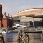
Today, Butetown sits within the wider Cardiff Bay regeneration area. Modern cultural buildings and waterfront developments stand alongside nineteenth-century streets and surviving dockside architecture. The result is a neighbourhood where industrial heritage, multicultural history and contemporary Cardiff exist within a compact walking area.
What is the history of old Butetown?
Old Butetown developed alongside Cardiff’s nineteenth-century docks, becoming a densely populated residential and commercial district shaped by coal exports, shipping, railways and international migration. Its historic landscape still contains buildings and streets connected with Cardiff’s industrial expansion.
Butetown’s modern identity is closely connected with the development of Cardiff Docks. Before the nineteenth century, Cardiff’s maritime activity centred on the town quay. Industrial growth in the South Wales Valleys increased the need for larger dock facilities capable of handling coal and other goods.
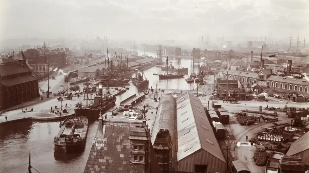
The Bute West Dock opened in 1839. The Bute East Dock followed, with construction completed between 1855 and 1859. Roath Dock opened in 1887, while Queen Alexandra Dock opened in 1907. These facilities created the infrastructure that connected Cardiff directly with international maritime trade.
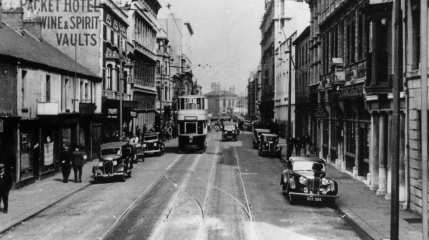
The docks transformed the southern edge of Cardiff. Warehouses, offices, public houses, workshops, transport facilities and housing developed around the port. Butetown became both a working neighbourhood and a gateway between Cardiff and the wider world.
The Marquess of Bute played an important role in dock development. The Bute Estate controlled substantial land around the docks and planned residential and commercial development alongside industrial infrastructure.
Mount Stuart Square demonstrates this relationship between planned housing and later commercial expansion. The square was developed by the Bute Estate in 1858 as housing for skilled workers. Its original layout included dwellings arranged around an open central space.
As Cardiff became wealthier, some residential buildings around Mount Stuart Square were replaced or adapted for commercial purposes. The surviving architecture therefore records different stages of the district’s economic development.
The Royal Commission on the Ancient and Historical Monuments of Wales describes Butetown as a landscape that changed repeatedly over almost two centuries. Its buildings range from modest nineteenth-century structures to major Victorian commercial architecture and modern Cardiff Bay landmarks.
Why was Butetown known as Tiger Bay?
Tiger Bay was the historic name associated with Cardiff’s docklands and the multicultural community that developed around Butetown. The district attracted residents and seafarers from many parts of the world, creating one of Britain’s longest-established multicultural port communities.
The name Tiger Bay became associated with the Cardiff docklands rather than representing a separate modern administrative district. Butetown formed the residential heart of much of this historic community.
Cardiff’s expanding port required workers across shipping, transport, dock labour, hospitality, retail and related industries. International seafarers also passed through the docks, with some settling permanently in Cardiff.
Museum Wales records that people from at least 50 nationalities settled around Cardiff’s docklands. Cardiff University also describes Tiger Bay, or Butetown, as one of Britain’s oldest multicultural communities.
The community included people with connections to Africa, the Caribbean, the Middle East, Asia and Europe. Welsh and English families also formed an important part of the neighbourhood.
This history is visible through the social geography of old Butetown. Boarding houses, cafés, clubs, shops, religious institutions and public houses served residents and visiting sailors. The district developed a distinctive cultural environment connected to the international nature of the port.
The term Tiger Bay also carries historical complexity. It has been used positively to describe the area’s multicultural identity, but historical academic research also records discrimination, poverty, racial tension and unequal employment conditions within Cardiff’s docklands.
Understanding old Butetown therefore requires more than focusing on colourful descriptions of maritime life. Its heritage includes both international cultural exchange and the difficult social conditions experienced by working-class and migrant communities.
What can you see when walking along Bute Street?
Bute Street provides one of the clearest routes through old Butetown because it connects surviving historic buildings, former commercial premises, community facilities and transport infrastructure. Its architecture reflects the neighbourhood’s transition from Victorian dockland to modern Cardiff Bay.
Bute Street has long been an important route through Butetown. Its position connected residential areas with docks, commercial premises and transport links.
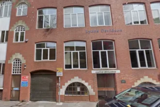
The street contains surviving examples of nineteenth-century commercial architecture. The Royal Commission identifies the former Midland Bank building as an important Victorian structure associated with the coal-export economy.
The building was constructed in 1874 for the Cory Brothers, a major Cardiff coal-owning and exporting business. The company later moved to a purpose-built building known as Cory’s Building, constructed in 1889 on the opposite corner.
These buildings demonstrate the scale of Cardiff’s coal industry. Businesses operating around Bute Street were not simply serving local residents. They were connected to international coal markets, shipping companies and commercial networks.
Walking Bute Street also reveals the importance of railway infrastructure. Cardiff’s dock system depended on railways to transport coal from the South Wales coalfield to ships waiting in the docks.
Some historic residential buildings have disappeared. Widespread demolition during the twentieth century removed substantial areas of older housing. The surviving structures therefore represent only part of the original built environment.
Modern community facilities now occupy spaces within this historic neighbourhood. Bute Street remains an important local route, while its relationship with Cardiff Bay makes it useful for visitors exploring the wider docklands heritage landscape.
What is the history of Mount Stuart Square?
Mount Stuart Square was planned by the Bute Estate in 1858 as housing for skilled workers and later became a major commercial centre. Its surviving Victorian buildings and Coal Exchange preserve the architectural history of Cardiff’s nineteenth-century coal economy.
Mount Stuart Square is one of the most important heritage spaces in Butetown. Its original development reflected the planned expansion of the dockside community.
The Bute Estate constructed housing around the square in 1858. The homes were associated with skilled workers connected with the growing industrial economy.
The character of the square changed as Cardiff’s coal trade expanded. From the 1880s, residential buildings were increasingly replaced or supplemented by commercial structures.
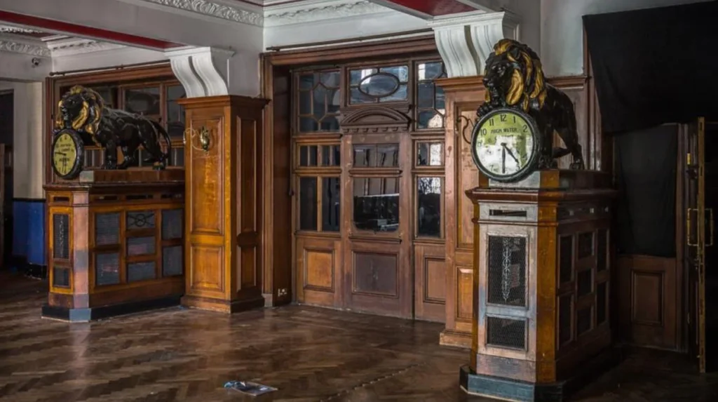
The Coal Exchange became the most important building associated with this transformation. The Cardiff Chamber of Commerce and Coal Exchange opened in 1886.
The building provided a dedicated location where coal merchants, mine owners, shipping interests and commercial agents negotiated business.
At the height of Cardiff’s coal trade, the Coal Exchange operated as an international commercial centre. Cadw records that during the peak trading period, as many as 200 men could be trading coal in the building between noon and 1pm.
The building demonstrates how a local dockside neighbourhood became part of an international economic system.
Mount Stuart Square also contains surviving architectural details from different periods. Perch Buildings, for example, incorporates nineteenth-century phases that demonstrate how the square developed over time.
Cardiff Council identifies Mount Stuart Square as a conservation area. Its historic character is therefore recognised within the city’s wider approach to protecting important architectural environments.
Where did Cardiff’s coal trade operate in old Butetown?
Cardiff’s coal trade operated through a connected system of docks, railways, warehouses, offices and commercial exchanges. Butetown stood at the centre of this system, linking South Wales coalfields with ships, merchants and international markets.
Coal was the principal force behind Cardiff’s nineteenth-century expansion. Coal from valleys such as the Rhondda and Taff areas travelled by railway and canal towards Cardiff.
Cardiff’s geographical position made it an effective export port. The docks provided sheltered facilities where coal could be loaded onto ships for overseas markets.
Railway infrastructure was essential to this process. The Taff Vale Railway was incorporated in 1836 to connect the South Wales coalfield with Cardiff Docks.
The development of railways increased the volume of mineral traffic reaching Cardiff. Coal wagons, locomotives, sidings, warehouses and dock facilities became part of the industrial landscape.
Cardiff became one of the world’s major coal-exporting ports. Museum Wales records that more than 10 million tons passed through Cardiff in 1913, when the port reached its peak.
This economic system created employment but also produced significant environmental and social change. Industrial traffic affected streets, waterways and residential areas, while large numbers of workers were required to operate the docks and associated businesses.
Walking through Butetown today therefore means walking through the former infrastructure of a global energy economy.
Which historic buildings are important in Butetown?
Important historic buildings in Butetown include the Coal Exchange, Bute Dock Hotel, surviving Mount Stuart Square buildings, former commercial premises on Bute Street and the Norwegian Church. Together they represent trade, housing, migration, religion and everyday dockside life.
The Coal Exchange is the most prominent commercial heritage building in Mount Stuart Square. Its history is directly connected with the international coal trade.
The Bute Dock Hotel dates from 1839, the same year that Bute West Dock opened. The Royal Commission identifies it as a surviving example of its type and an important part of the early dockside landscape.
Mount Stuart Square retains several nineteenth-century buildings. Numbers 6–9 on the eastern side and numbers 20–23 in the south-west corner preserve elements of the original residential development.
Bute Street contains surviving commercial architecture associated with coal companies. The former Midland Bank building and Cory’s Building demonstrate the importance of financial and commercial services within the docklands economy.
The Norwegian Church represents another part of Butetown’s international history. Scandinavian sailors visiting Cardiff used the church as a place of worship and community connection.
The building also has a strong connection with Cardiff’s maritime heritage and remains one of the recognised historic landmarks around Cardiff Bay.
The Norwegian Church later became associated with the cultural history of the area and with the wider regeneration of Cardiff Bay.
Together, these buildings show that Butetown was not simply a workplace. It was a residential, commercial, religious and social environment shaped by international trade.
How did migration shape old Butetown?
Migration shaped Butetown by creating a diverse dockside population connected to international shipping, employment and family settlement. Residents from different countries established homes, businesses, religious communities and social networks within the neighbourhood.
Cardiff’s port created regular contact between Wales and overseas destinations. Ships brought sailors and workers from across the world, while the coal trade connected Cardiff businesses with international markets.
Some seafarers settled in Butetown after arriving through the port. Others stayed temporarily in boarding houses and returned to sea.
The resulting population included people with African, Caribbean, Middle Eastern, Asian and European connections. Welsh, Irish and English residents were also part of the neighbourhood.
Museum Wales estimates that people from at least 50 nationalities settled in the Cardiff docklands.
This diversity influenced everyday life. Food, music, religion, language and social activities reflected the international character of the community.
The history is also documented through oral-history collections. Museum Wales holds recordings connected with Windrush Cymru and the experiences of people who moved to Cardiff from the Caribbean.
Oral history is important because many aspects of community life do not appear in commercial or architectural records. Personal memories document schools, youth clubs, family life, employment, migration and neighbourhood relationships.
The heritage of old Butetown therefore includes both buildings and lived experience.
What happened to old Butetown during the twentieth century?
Old Butetown experienced major economic and physical change during the twentieth century as Cardiff’s coal-export industry declined. Industrial restructuring, housing clearance and dockland redevelopment transformed the neighbourhood and removed substantial parts of its historic built environment.
Cardiff’s coal trade began to decline after its early twentieth-century peak. Changes in energy markets, industrial structure and transport reduced the importance of coal exports.
The decline affected the docks and surrounding communities. Industrial employment contracted, while some dockside land became underused.
The physical landscape also changed. Large areas of older residential housing were demolished during twentieth-century redevelopment programmes.
The Royal Commission records widespread demolition of Tiger Bay’s humbler residential areas from the 1960s.
This process removed many buildings associated with everyday working-class life. Surviving commercial and institutional buildings therefore provide an incomplete record of the historic neighbourhood.
The changes also affected residents. Academic research on Butetown documents the displacement of residents through redevelopment and housing clearance.
The twentieth century therefore represents a major transition between the historic dock community and modern Cardiff Bay.
Walking old Butetown requires attention to both what survives and what has disappeared. Empty spaces, modern developments and altered streets can form part of the historical evidence.
How can you walk through old Butetown today?
A heritage walk through old Butetown can follow Bute Street, Mount Stuart Square and the dockside area before continuing towards Cardiff Bay’s historic landmarks. The route combines surviving Victorian architecture, community history, maritime heritage and modern waterfront development.
A practical walking route begins around Bute Street. This allows visitors to see the neighbourhood from its residential and commercial side.
Continue towards Mount Stuart Square to examine the historic architecture associated with the Bute Estate and Cardiff’s coal trade.
The Coal Exchange provides an important reference point for understanding the commercial system that developed around the docks.
From Mount Stuart Square, continue towards the waterfront and the Norwegian Church. This section connects the history of Cardiff’s docks with the international communities created by maritime trade.
The wider Cardiff Bay area contains additional heritage landmarks. The Pierhead Building, Senedd and Wales Millennium Centre demonstrate later stages in the transformation of the waterfront.
The route can also connect with Cardiff Bay’s public spaces and waterfront paths.
The best historical reading comes from combining buildings with their original functions. A former bank becomes evidence of coal finance. A dockside hotel becomes evidence of the arrival of workers and sailors. A church becomes evidence of international maritime connections.
Historic maps and archival photographs provide another layer of interpretation. The Royal Commission’s Historic Wales portal allows users to investigate historic buildings, archaeological sites and heritage records across Wales.
A walking route through old Butetown therefore works as both a physical journey and a way to understand Cardiff’s economic transformation.
Explore More Area Guide
Hidden Heritage Around Splott: Cardiff’s Industrial History
Roath Victorian Heritage Trail: Historic Cardiff Buildings
Why is old Butetown important to Cardiff’s heritage?
Old Butetown is important because it preserves evidence of Cardiff’s transformation into a major industrial port and records the development of a long-established multicultural community. Its surviving architecture and oral histories connect economic, social and cultural aspects of Cardiff’s past.
Butetown brings together several major themes in Cardiff’s history.
The first is industrialisation. Cardiff’s docks depended on the growth of coal production in South Wales.
The second is transport. Railways and docks connected the coalfield with international shipping networks.
The third is migration. International maritime activity created a diverse population whose descendants remain part of Cardiff’s cultural landscape.
The fourth is architecture. Buildings such as the Coal Exchange, Bute Dock Hotel and surviving Mount Stuart Square properties demonstrate different stages of dockside development.
The fifth is community memory. Oral-history projects preserve experiences that cannot be fully reconstructed from buildings alone.
The area also demonstrates the consequences of regeneration. Modern Cardiff Bay contains major cultural and civic buildings, but the transformation followed decades of industrial decline and substantial changes to older communities.
Cardiff University’s research and community projects have documented aspects of Butetown’s history through oral history, heritage work and community engagement.
The Butetown Mile, a one-mile community running event on Bute Street, also demonstrates how the street continues to function as a community space. Cardiff University records approximately 580 participants since the event was relaunched in 2014.
This combination of historic evidence and contemporary community activity gives Butetown continuing heritage relevance.
What does old Butetown reveal about modern Cardiff?
Old Butetown reveals how modern Cardiff developed through industrial trade, migration, transport and waterfront redevelopment. The neighbourhood connects the nineteenth-century coal economy with the multicultural city and regenerated Cardiff Bay visible today.
Modern Cardiff is often identified with civic buildings, cultural institutions, universities and a regenerated waterfront. Butetown provides an important historical explanation for how the city reached this position.
The nineteenth-century docks generated wealth and international connections. Cardiff’s population expanded alongside industrialisation, while railways and shipping strengthened the city’s role in global trade.
The port also created a multicultural environment that became a defining feature of the docklands.
The decline of coal changed this relationship. Cardiff’s economy gradually moved away from dependence on coal exports, while former industrial areas entered new phases of development.
The regeneration of Cardiff Bay introduced new cultural, residential and commercial uses. The Wales Millennium Centre, Senedd and modern waterfront developments now occupy parts of the wider docklands landscape.
The contrast between these buildings and surviving Victorian structures is central to understanding Cardiff Bay.
Old Butetown therefore remains relevant to modern urban history. It shows how cities adapt when their dominant industries decline and how regeneration changes the physical relationship between communities, employment and waterfronts.
For visitors, residents and researchers, the district offers a concentrated view of Cardiff’s industrial and multicultural past.
Walking through old Butetown is ultimately an exploration of the physical evidence left by Cardiff’s transformation from a nineteenth-century coal-exporting port into a modern Welsh capital and international city.
What is Old Butetown in Cardiff?
Old Butetown is a historic Cardiff docklands neighbourhood that developed around Cardiff Docks during the nineteenth century. It became an important residential, commercial and maritime community connected to the coal-export industry.