Roath Stream, more commonly identified with Roath Brook and the Nant Fawr system in Cardiff, flows south from the north-east side of the city, passes through Roath Park Lake, continues through Roath Mill Gardens and Waterloo Gardens, and reaches the River Rhymney near Newport Road. This waterway is a key part of Cardiff’s local drainage network and flood-management landscape.
- What is Roath Stream?
- Where does it begin?
- What route does it follow?
- Main places on the route
- Which river does it join?
- Why does it matter?
- How was the stream changed?
- What is its environmental role?
- How does it affect residents?
- What is the wider Cardiff context?
- Why is it still relevant today?
- A clear route in one line
What is Roath Stream?
Roath Stream is a Cardiff urban watercourse that feeds Roath Park Lake and then continues downstream as Roath Brook toward the River Rhymney. It is part of a connected stream system rather than a single isolated channel, and it shapes parks, drainage, ecology, and flood management in the Roath area.
Roath Stream is tied to several local names used for different stretches of the same water system. In practice, people refer to the upper feeding water as Nant Fawr, the middle section around the park system as Roath Brook, and the downstream course as the stream that runs through Roath Mill Gardens and Waterloo Gardens before discharge into the Rhymney.
This matters because local watercourses in Cardiff often carry more than one name. The names reflect location, historic usage, and the way the stream passes through different landscapes, from parkland to urban corridors.coflein.
Where does it begin?
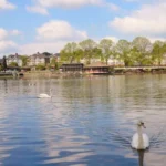
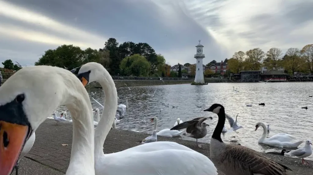
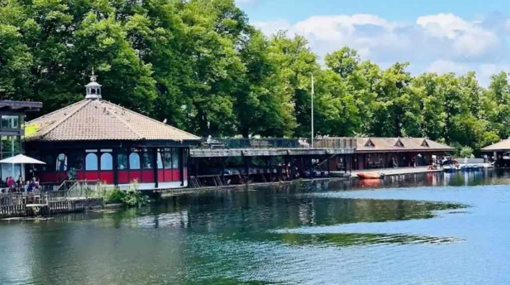
Roath Stream begins in the northern Cardiff catchment as Nant Fawr and flows into Roath Park Lake, which was formed by damming the stream. The lake sits in Roath Park and acts as a major feature in the stream’s route through the city.
Roath Park opened in 1894, and the lake is one of its defining features. The lake is described as being formed from the damming of Nant Fawr stream, with the park built on former bogland.
That upper section is important because it controls how water moves into the rest of the system. The lake stores water, supports amenity use, and influences downstream flow conditions during heavy rain.
What route does it follow?
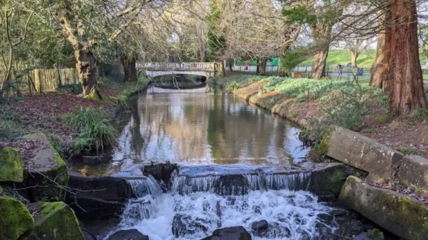
After Roath Park Lake, the stream continues south through a sequence of green spaces including Roath Mill Gardens, Roath Brook Gardens, Waterloo Gardens, and nearby open spaces before joining the River Rhymney. Its route is linear and urban, following a corridor through eastern Cardiff.
Historic and local sources describe the brook as flowing through Roath Mill Gardens, Waterloo Gardens, and onward across the Roath area toward the Rhymney. This corridor separates sections of parkland and shapes the layout of the surrounding neighbourhoods.
The route is not just a natural feature. It also functions as a public landscape element, with bridges, footpaths, and adjoining parks arranged around the watercourse.
Main places on the route
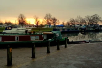
The best-known places along the stream include Roath Park Lake, Roath Mill Gardens, Waterloo Gardens, and the lower discharge area near Newport Road. These sites show how the stream moves from a recreational setting into a more engineered urban channel.
This route also explains why the brook has a high public profile in Cardiff. Residents encounter it in parks, walking routes, and flood-related works, rather than only as a hidden drainage ditch.
Which river does it join?
Roath Stream ultimately joins the River Rhymney. A legal and statutory reference from 1965 records Roath Brook “from Roath Park Lake; Cardiff, to its two points of discharge into the River Rhymney,” confirming the final receiving river.
The River Rhymney is one of South Wales’ main rivers and flows through Cardiff to the Severn Estuary. Roath Brook is therefore part of the Rhymney catchment, not the Taff catchment.
This final connection gives the stream wider environmental significance. Water quality, runoff, flooding, and habitat conditions in Roath affect a larger river system downstream.
Why does it matter?
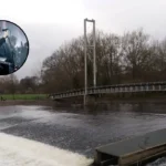
Roath Stream matters because it is both a landscape feature and a flood-risk channel. Natural Resources Wales says flood works on Roath Brook were completed in 2018 and reduced flood risk to more than 300 properties, while the scheme also improved conditions along the brook between Roath Mill Gardens and Newport Road.
The flood scheme is highly relevant to Cardiff because urban streams respond quickly to rainfall and tide conditions. NRW states the scheme reduced risk from high river flows and high tide levels, showing that the brook is connected to both local drainage and wider river dynamics.
Cardiff’s flood concerns are not abstract. The stream corridor has experienced repeated intervention because local watercourses in dense urban areas can overflow, damage property, and disrupt public space.
How was the stream changed?
Roath Brook has been altered several times to manage flooding. Historical records and local heritage sources show that sections were modified in the early 1930s, and later NRW works in 2018 reshaped the brook again with modern flood-defence measures.
The early 1930s alterations created a new northern channel and left the older route in place for a time. That change formed a narrow island within part of the park system, which was accessed by footbridges.
The later 2018 scheme removed obsolete risk points and installed stronger riverbanks. NRW says the work included improvements at several locations along the brook and reduced the estimated number of homes at risk in a 1 in 75-year event to 11.
What is its environmental role?
Roath Stream supports urban ecology by linking parks, gardens, and open spaces across eastern Cardiff. It also carries environmental pressure, because urban runoff, sewage incidents, and pollution affect its water quality and wildlife value.
The brook corridor functions as a green line through the city. Sources describe it as running through parkland and public open spaces, which gives it value for birds, insects, plants, and movement between habitats.
At the same time, the waterway has attracted concern over pollution. BBC reporting noted sewage contamination issues in Roath Park Lake, and a 2026 report described Roath Brook as one of the most polluted urban watercourses in a Cardiff University and Natural Resources Wales research context.
That combination of amenity and stress is typical of urban streams. They provide public space and ecological function while also carrying the burden of city drainage.
How does it affect residents?
For Cardiff residents, Roath Stream affects walking routes, park design, flood risk, and local environmental quality. It also shapes property protection in the Roath area, especially around the brook corridor between the park and the Rhymney.
People living near the brook benefit from its green corridor, but they also live with the realities of surface water and flood management. NRW’s flood scheme was built specifically to protect homes and businesses from recurrence of damaging flood events.
The brook also affects how people experience the neighbourhood. The stream defines park boundaries, creates natural views, and links local landmarks into a continuous walking landscape.coflein.
What is the wider Cardiff context?
Roath Stream sits within Cardiff’s broader network of rivers, brooks, and engineered channels, and it illustrates how the city manages water in a dense coastal capital. Its path into the Rhymney places it within a larger drainage system that matters for flood resilience.
Cardiff contains multiple watercourses that have been shaped by urban growth, land drainage, and flood control. Roath Brook is a clear example because it remains visible in public parks while also being heavily managed below ground and along urban edges.
This makes the brook useful for understanding Cardiff’s relationship with water. The city does not simply sit beside rivers; it is crossed by them, and those channels influence planning, landscaping, and resilience work.
Why is it still relevant today?
Roath Stream remains relevant because it combines heritage, recreation, ecology, and flood management in one corridor. Its role in Cardiff has not ended with park building or engineering works; it continues to matter whenever heavy rain, water quality issues, or park use enter public discussion.
The stream has a long public history through Roath Park, Roath Mill Gardens, and Waterloo Gardens. It also has a modern planning role because flood risk reduction in Cardiff depends on maintaining urban channels and protecting nearby communities.
Its future relevance is tied to climate and city growth. More intense rainfall places extra pressure on streams like Roath Brook, which means their maintenance remains a live issue for Cardiff residents and local authorities.
A clear route in one line
Roath Stream starts as Nant Fawr, feeds Roath Park Lake, flows through Roath Brook’s park corridor, and ends in the River Rhymney. That route defines the stream’s geography, history, and flood-management importance in Cardiff.
This is the simplest accurate answer for search users. The waterway is not a mystery stream with an uncertain destination; it is a mapped Cardiff watercourse with a known path and a documented outflow into the Rhymney.
What is Roath Stream?
Roath Stream is a Cardiff watercourse that is generally associated with Roath Brook and the Nant Fawr system. It flows through Roath Park Lake, continues south through parkland and urban green spaces, and eventually joins the River Rhymney.