Crwys Road is a major residential and commercial street in the Cathays area of Cardiff, running from Death Junction near City Road northwards toward Roath, known for its diverse food scene, historic pubs, churches, and former schools. This guide covers what Crwys Road is, where it is, how to get there, what to eat and drink, its history, and why it matters to Cardiff today.
- What is Crwys Road and where is it in Cardiff?
- How do you get to Crwys Road by public transport?
- What is the history of Crwys Road and Death Junction?
- Which historic buildings and landmarks are on Crwys Road?
- What food and drink options are available on Crwys Road?
- How has Crwys Road changed over time?
- Why is Crwys Road important to Cardiff residents and students?
- What should visitors know before visiting Crwys Road?
What is Crwys Road and where is it in Cardiff?
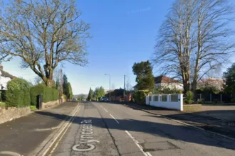
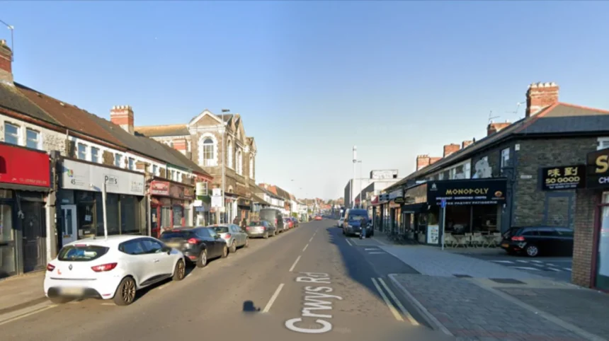
Crwys Road is a long street in south-east Cardiff that starts at the “Death Junction” (City Road, Albany Road, Richmond Road, Mackintosh Place) and runs north through Cathays toward Roath, between the former parishes of Cardiff and Roath. It is lined with shops, restaurants, cafes, pubs, churches, and former schools, and serves as a key local route for residents, students, and visitors.
Crwys Road lies within the Cathays ward, part of the larger Cardiff Central area, and is close to Cardiff University, the University of South Wales, and Cathays Park. The road runs roughly parallel to Albany Road and connects with several smaller streets including Woodville Road, Fanny Street, and Roath Park Road. Its position between the city centre and northern suburbs makes it a natural corridor for walking, cycling, and bus travel.
The street takes its name from the Welsh word “crwys”, meaning “cross”, which is also reflected in the name of the Crwys Hotel, one of its oldest buildings. This naming connects the road to Cardiff’s Welsh-language heritage and local history.
How do you get to Crwys Road by public transport?
You can reach Crwys Road by bus via routes that run along City Road and Albany Road, and by train using Cardiff Central station followed by a short walk or bus journey. The road is not directly served by a railway station, but nearby stops and frequent bus services make it easily accessible for most visitors.
Cardiff’s bus network includes multiple services passing close to Crwys Road, especially along City Road and Albany Road, which intersect at Death Junction at the road’s southern end. Transport apps provide step-by-step directions to Crwys Road using current timetables for Cardiff buses and trains. Typical options involve catching a bus from Cardiff Central, Queen Street, or surrounding areas and alighting near the junction of City Road and Albany Road, then walking north along Crwys Road.
From Cardiff Central railway station, the walk to the start of Crwys Road takes around 15–20 minutes. The route follows Queen Street, then Newport Road, City Road, and finally up Crwys Road. Buses from the station to areas like Roath, Heath, or Llandaff often pass near or along parts of Crwys Road, reducing walking time.
Cycling is also practical, with dedicated and shared routes linking the city centre to northern suburbs. Crwys Road itself is used by local cyclists and forms part of everyday commuter paths for students and residents.
What is the history of Crwys Road and Death Junction?
Crwys Road developed from the late 1860s as a residential and commercial street, with the first house plans approved in 1868, while the junction at its southern end, known as Death Junction, was historically used for public executions spanning hundreds of years. This combination of Victorian development and older judicial practices gives the road a distinctive historical profile within Cardiff.
The boundary of the old parish of Roath ran down the middle of Crwys Road for its entire length, meaning the street physically separated two historic administrative areas. By 1914, the road was densely developed with commercial premises including seven butchers, four grocers, four fruiters, three bookmakers, three bakers and confectioners, plus mixed shops combining confectionery, tobacco, stationery, newsagents, and hairdressing.
Death Junction, at the start of Crwys Road between Cardiff and Roath, was an execution site for centuries. Public executions ended in 1868, after which condemned prisoners were executed inside prison walls. The site is linked to the 1679 execution of two priests, Phillip Evans and John Lloyd, who were hung, drawn, and quartered for practising their faith, which was then considered treason. Local justices of the peace offered reward money for their arrest, and they were eventually imprisoned in Cardiff Castle before being taken to this junction for execution.
The name “Crwys” means “cross” in Welsh, a name echoed in the Crwys Hotel, which dates back to at least 1870. This hotel is one of the oldest pubs in the area and has undergone multiple refurbishments while retaining its historical identity.
Which historic buildings and landmarks are on Crwys Road?
Crwys Road features several historic buildings including the Crwys Hotel (at least 1870), Woodville Road Baptist Church (first church building from the 1870s, main church opened 1887), and Crwys Road Board School (opened 1883, closed 1939). These structures reflect the road’s role as a community hub for housing, worship, education, and social life.
The Crwys Hotel has four bars until the early 2000s and later added a roof-top outdoor seating area after several refurbishments. It was the site where Dr Lougher was taken after being injured by a bolted horse in 1872, and it suffered a gas explosion in 1876 that shattered windows and blew out door frames.
Woodville Road Baptist Church began as an offshoot of Bethany and Tabernacle Baptist churches in the 1870s, with a school room built on the present church site by 1876 and the main church opened in 1887. The church saw over 100 baptisms during the 1904 Revival and had a Sunday school peak of 611 scholars with 45 teachers in the 1920s. The original building was demolished in 1993 after roof damage, and a new Woodville Christian Centre opened in 2002 on part of the same site.
Crwys Road Board School opened in January 1883 and was enlarged in 1890, accommodating 1,255 pupils by 1901. The school closed in 1939 as an elementary school and was used for war purposes, later becoming the College of Food Technology, which gained national reputation before moving in the late 1960s. The building briefly returned to school use around 1972 before demolition in 1973, with the site now occupied by a Co-op foodstore and British Heart Foundation shop.
What food and drink options are available on Crwys Road?
Crwys Road is known for a varied food scene including Greggs (vegan sausage rolls, present since at least 2008), Mowgli’s Indian Restaurant (from around 2010), Kerala Café (newer Indian restaurant in premises formerly occupied by Svago/Lorenza), and Teacups and Cupcakes (cupcake shop from around 2012). These establishments illustrate the road’s shift from traditional local shops to a more diverse, student-friendly, and international culinary profile.
Greggs offers quick, affordable items such as vegan sausage rolls and is a common stop for people wanting food on the hoof. Mowgli’s serves Indian dishes including onion bharji, tarka dal, chana masala, and biryani, appealing to residents and students looking for sit-down meals. Kerala Café occupies a location that previously housed Italian restaurants and provides South Indian options like masala dosa, kadala curry, and veg kuruma curry with rice.
Teacups and Cupcakes specialises in cakes and hot drinks, offering cupcakes such as the “Divine” variety alongside large lattes, making it a popular spot after walks or cemetery visits nearby. The mix of quick takeaway, casual dining, and dessert/tea venues reflects the needs of a mixed population of students, families, and local workers.
Further up the road, there are additional small shops, cafes, and chains that complement these core eateries, though the named venues remain the most frequently cited in local guides and blogs.
How has Crwys Road changed over time?
Crwys Road has evolved from a Victorian residential and high-street area with many independent grocers, butchers, and bakers into a modern mixed-use street dominated by chain food outlets, cafes, and international restaurants serving students and residents. This shift mirrors broader changes in Cardiff’s urban centres, where traditional local shops have been replaced by national brands and diverse food operators.
In 1914, the commercial landscape was heavily based on small, independent businesses, with multiple butchers, grocers, and bakers operating side by side. By the 2000s and 2020s, the same stretch includes Greggs, Mowgli’s, Kerala Café, and cupcake shops, indicating a move towards convenience food, student-oriented dining, and international cuisine.
Educational and institutional buildings have also changed function. Crwys Road Board School, a major local school for decades, became the College of Food Technology and then was demolished, with the site now occupied by a Co-op and charity shop. The original Baptist church was replaced by a modern Christian centre, reflecting changes in religious participation and building use.
Retail and hospitality developments have increased density and variety, while the road’s role as a transport corridor and community link has remained consistent. The historical identity tied to Death Junction and the Crwys Hotel persists, but daily life on the street now reflects contemporary urban Cardiff rather than early 20th-century Roath.
Explore More Area Guide
Cowbridge Road West Business Directory Cardiff Shops Services
Cowbridge Road East Local Guide: Culture, History, and Culinary Highlights
Why is Crwys Road important to Cardiff residents and students?
Crwys Road is important because it provides accessible housing, food, transport, and community facilities for students, families, and workers in Cathays and Roath, while preserving key historical landmarks that connect Cardiff to its past. Its location between the city centre and northern suburbs makes it a practical route for daily travel and a social hub for local life.
For students at Cardiff University and the University of South Wales, Crwys Road offers affordable eateries, quick takeaway options, and cafes suitable for study breaks or group meals. The presence of Greggs, Mowgli’s, Kerala Café, and Teacups and Cupcakes supports varied dietary needs and budgets, from vegan options to full Indian meals and sweet treats.
For local residents, the road provides essential services including a Co-op foodstore, charity shops, and public transport links that connect to Cardiff Central, Queen Street, and other key areas. Historic buildings like the Crwys Hotel and Woodville Christian Centre serve as familiar landmarks and community anchors, reinforcing a sense of place and continuity.
The road’s historical significance, particularly the Death Junction site and its link to 17th-century executions, adds cultural depth to the area. This history is part of Cardiff’s broader narrative about law, religion, and public order, and it contributes to local identity and interest in heritage.
What should visitors know before visiting Crwys Road?
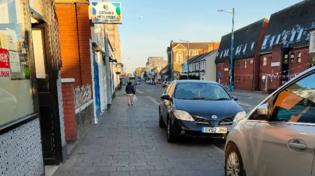
Visitors should know that Crwys Road is a busy urban street with mixed traffic, pedestrian activity, and frequent bus services, and that the main attractions are restaurants, cafes, historic pubs, and churches rather than traditional tourist sites. Planning a short walk or meal stop is the most practical approach, especially if coming from the city centre or university areas.
Public transport is the easiest way to reach the road, with buses running along City Road and Albany Road near Death Junction, and a walk from Cardiff Central station taking around 15–20 minutes. Cycling is also feasible, but pedestrians should be cautious near the junction and along bus-heavy sections.
The road’s main interest lies in its food and drink venues, historic buildings, and local atmosphere. Visitors can combine a meal at Mowgli’s or Kerala Café with a visit to the Crwys Hotel, or stop at Teacups and Cupcakes after exploring nearby areas such as Cathays Cemetery. The area is not a dedicated tourist destination but offers an authentic view of everyday Cardiff life.
Crwys Road is best experienced as part of a broader walk through Cathays and Roath, linking sites such as university campuses, parks, and other residential streets. Its combination of history, food, and transport links makes it a useful and representative part of south-east Cardiff for both residents and visitors.
What is Crwys Road?
Crwys Road is a major residential and commercial street in the Cathays area of Cardiff that connects the busy City Road junction with the Roath district. It is known for its independent restaurants, cafés, historic pubs, churches, local shops, and strong student presence due to its proximity to Cardiff’s universities. The road functions as an important everyday high street serving residents, students, commuters, and visitors.