Pontcanna is one of Cardiff’s most distinctive inner-city neighbourhoods because it combines Victorian and Edwardian residential streets, large historic green spaces, independent local activity, riverside access and close proximity to central Cardiff. Its identity developed through Cardiff’s nineteenth-century expansion and remains strongly connected to its landscape and built heritage.
- Why is Pontcanna considered different from other Cardiff neighbourhoods?
- How did Pontcanna develop historically?
- What makes Pontcanna’s green spaces unusual within Cardiff?
- How important is the River Taff to Pontcanna’s identity?
- What type of architecture defines Pontcanna?
- Why does Pontcanna have a strong local community identity?
- How does Pontcanna compare with Canton and Riverside?
- How does Pontcanna compare with Roath and Penylan?
- What role do Pontcanna Fields and Llandaff Fields play in everyday life?
- Why is Pontcanna’s location important for residents and visitors?
- How does parking and transport affect Pontcanna?
- What makes Pontcanna attractive for people who value green space?
- What does Pontcanna’s historic landscape mean for its future?
- What ultimately makes Pontcanna different from other Cardiff neighbourhoods?
The neighbourhood sits west of Cardiff city centre, close to the River Taff, Bute Park, Sophia Gardens, Llandaff Fields and Pontcanna Fields. Its location creates a particular urban structure. Residential streets sit directly beside substantial open spaces, while major roads connect the district with Canton, Riverside, Llandaff and central Cardiff.
Pontcanna also has an important historical relationship with Canton. Historic records connect the name Pontcanna with Saint Canna, while the wider Canton area developed substantially as Cardiff expanded during the nineteenth century. The development of Cathedral Road and surrounding residential areas added substantial Victorian housing and created the urban character associated with the district today.
Why is Pontcanna considered different from other Cardiff neighbourhoods?
Pontcanna differs through its combination of historic housing, extensive parks, River Taff access, independent commercial activity and central location. These features place substantial residential streets beside major public open spaces while keeping Cardiff city-centre destinations within convenient reach.
Many Cardiff neighbourhoods have one or two defining characteristics. Pontcanna has several within a relatively compact area.
Its physical setting is particularly important. Pontcanna Fields and Llandaff Fields form a large connected open-space system beside the River Taff. The Royal Commission on the Ancient and Historical Monuments of Wales records the fields as a nineteenth-century public park landscape and identifies their relationship with Bute Park and Sophia Gardens as an unusually large area of open space in central Cardiff.
The residential environment adds another layer. Streets around Pontcanna contain substantial nineteenth- and early twentieth-century housing, including terraces and larger properties associated with Cardiff’s urban expansion.
Pontcanna therefore has a different relationship between buildings and landscape from densely built neighbourhoods such as Cathays or central-city districts. Housing is not separated from large recreational landscapes by a long journey. Major green spaces are integrated into the immediate neighbourhood environment.
The location also contributes to its identity. Pontcanna is close to Cardiff city centre while remaining adjacent to the Taff corridor and extensive parks. This creates a combination of urban accessibility and open-space provision.
How did Pontcanna develop historically?
Pontcanna developed as Cardiff expanded during the nineteenth century, with residential growth occurring around established rural land, the River Taff and newly planned public parks. Victorian development, transport connections and public open-space investment shaped the neighbourhood’s present urban form.
Pontcanna’s history is closely connected to the wider transformation of Cardiff from a relatively small settlement into a major industrial and commercial city.
Cardiff’s nineteenth-century expansion accelerated alongside the growth of coal exports and the port. The Bute family played an important role in this transformation. Historic research on Cathedral Road records the area’s development during the late nineteenth century and connects it with the expansion of Cardiff under the 3rd Marquess of Bute.
The creation of public parks formed part of this broader urban transformation. Sophia Gardens was laid out in 1854 on the site of Plasturton Farm and opened in 1858. It became Cardiff’s first public park and is recorded by Coflein as the earliest public park in Wales.
Pontcanna Fields and Llandaff Fields followed as major components of the city’s western open-space system. Their principal development phases are recorded as 1879 and 1899–1901.
This chronology matters because Pontcanna was not simply built as a residential suburb. Its modern character emerged from the interaction between housing development, public parks, the River Taff and Cardiff’s expanding urban economy.
The result is a neighbourhood where nineteenth-century urban planning remains visible in the relationship between streets, buildings, avenues and open land.
What makes Pontcanna’s green spaces unusual within Cardiff?
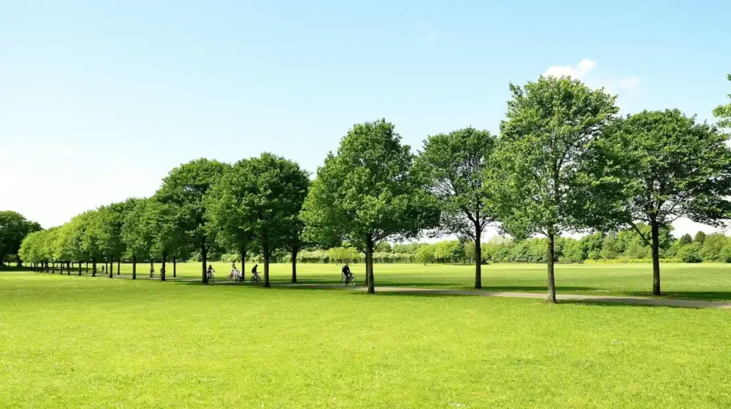
Pontcanna has an unusually strong concentration of interconnected public open space. Pontcanna Fields and Llandaff Fields sit beside the River Taff and connect spatially with Sophia Gardens and Bute Park, creating an extensive green corridor near Cardiff’s urban centre.
Pontcanna Fields is one of the area’s most important defining features.
Coflein records Pontcanna Fields and Llandaff Fields as a Grade II* historic park and garden landscape. The designation recognises their well-preserved central urban park character and their relationship with Bute Park and Sophia Gardens.
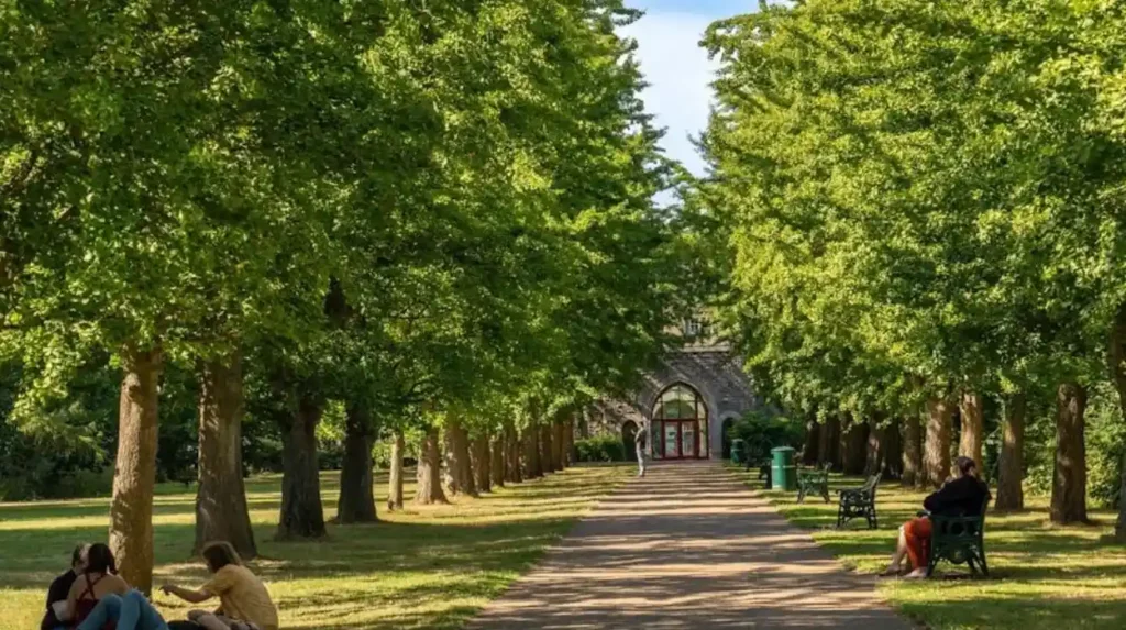
The fields occupy part of the Taff floodplain. The land is predominantly level, which explains the broad open character of the parkland. A major lime avenue provides a strong north-south landscape axis. The avenue was mainly constructed in 1879 and during 1899–1901.
The open-space system also contains recreational facilities. Recorded features include children’s play facilities, bowling provision and tennis courts. The Cardiff Riding School is located within Pontcanna Fields, providing another distinctive land use inside the park environment.
The relationship between Pontcanna Fields, Llandaff Fields, Sophia Gardens and Bute Park is particularly important. Together, these landscapes form a substantial sequence of public open space in central Cardiff.
Bute Park sits across the River Taff from Pontcanna and is itself one of Wales’s largest urban parks. Its historic landscape derives from the former grounds of Cardiff Castle and became public after 1947.
This network gives Pontcanna an unusually strong connection with Cardiff’s wider green infrastructure.
How important is the River Taff to Pontcanna’s identity?
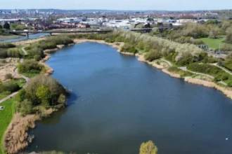
The River Taff gives Pontcanna a strong geographical identity by forming its eastern landscape connection with Cardiff’s central parks. Riverside paths, floodplain landscapes and nearby green spaces make the river an important part of the neighbourhood’s physical structure.
The River Taff is central to understanding Pontcanna’s geography.
Pontcanna Fields occupies the west bank of the river. Bute Park lies across the Taff to the east. Sophia Gardens is also positioned on the west bank, further strengthening the relationship between Pontcanna and the river corridor.
The river also influenced historical land use. Before the modern park system developed, the floodplain supported agricultural and other land uses. Coflein records a historic track within the Pontcanna Fields area that originally served as a public road leading to a ford across the Taff.
Today, the river corridor provides a continuous landscape connection through central Cardiff. It links neighbourhood recreation with the city’s wider walking and cycling environment.
The Taff also contributes to the physical distinction between Pontcanna and several other Cardiff neighbourhoods. Instead of being defined only by streets and commercial centres, Pontcanna has a major natural corridor immediately beside its urban fabric.
That relationship remains relevant to planning, recreation, biodiversity and movement across Cardiff.
What type of architecture defines Pontcanna?
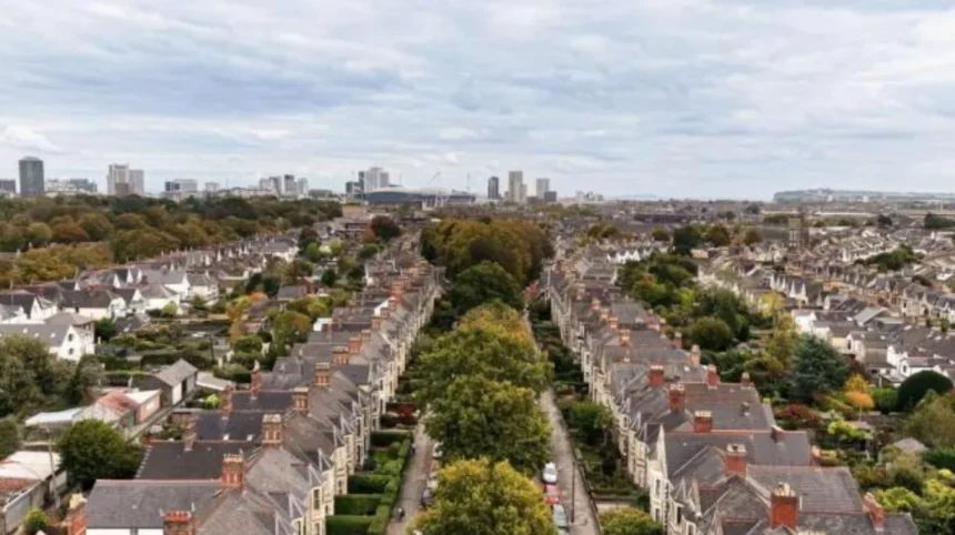
Pontcanna’s built environment is strongly associated with nineteenth- and early twentieth-century residential development. Victorian and Edwardian terraces, villas, mature streetscapes and larger period properties create a recognisable architectural character across much of the neighbourhood.
Architecture is another major reason Pontcanna looks different from many other Cardiff districts.
The neighbourhood’s residential expansion occurred during a period when Cardiff was experiencing rapid economic and population growth. New streets and houses accommodated an expanding urban population and reflected contemporary Victorian and Edwardian planning principles.
Cathedral Road is particularly important to this architectural history. Historic research records its development during the late nineteenth century under the influence of the Bute estate.
The resulting architecture includes substantial residential buildings, terraces and larger properties. Many streets also contain mature trees, front gardens, boundary walls and traditional building details.
This creates a coherent streetscape rather than an environment dominated by modern apartment blocks or large commercial buildings.
The architectural character also affects the area’s planning environment. Cardiff Council operates conservation policies to protect areas with special architectural or historic interest. Cardiff currently has 27 conservation areas across the city, with conservation-area appraisals providing information about the qualities that require protection.
For property owners, this means historic character can have direct planning implications where conservation controls apply.
Why does Pontcanna have a strong local community identity?
Pontcanna’s community identity comes from its established residential streets, local businesses, public parks, community facilities and proximity to major Cardiff destinations. These elements create frequent interaction between residents, visitors, recreational users and independent businesses within a compact neighbourhood.
Community identity develops through physical spaces as well as social activity.
Pontcanna has several types of shared environment. Residential streets provide the everyday neighbourhood setting. Pontcanna Fields and Llandaff Fields provide recreation. Local commercial streets provide services and meeting places. The River Taff provides a wider movement corridor.
This combination creates multiple points of daily interaction.
The presence of independent businesses also contributes to the neighbourhood’s local commercial character. Pontcanna is associated with cafés, restaurants, specialist shops, professional services and other small businesses that serve both local residents and visitors.
The area’s proximity to central Cardiff strengthens this activity. Residents have access to city-centre employment, culture, retail and entertainment without living directly within the central commercial environment.
The distinction is therefore structural. Pontcanna combines neighbourhood-scale streets with city-scale accessibility.
How does Pontcanna compare with Canton and Riverside?
Pontcanna, Canton and Riverside share close geographical relationships but have different urban characteristics. Pontcanna is strongly associated with period residential streets and large parkland, while Canton has a major commercial centre and Riverside has a stronger inner-city residential and student-oriented character.
Neighbourhood boundaries in Cardiff do not always match residents’ everyday perceptions. Pontcanna connects directly with Canton and Riverside, and the transition between districts is sometimes gradual.
Canton has a significant commercial identity centred on Cowbridge Road East and adjoining streets. It contains a mixture of residential, retail and community uses.
Riverside lies closer to the River Taff and central Cardiff. Its location supports strong connections with Cardiff city centre, Cardiff University and other central institutions.
Pontcanna differs through its relationship with the large western park system. Pontcanna Fields and Llandaff Fields occupy a substantial portion of the landscape immediately beside the residential district.
The distinction is therefore not based on a single feature. It comes from the combined relationship between housing, parks, the river and central Cardiff.
How does Pontcanna compare with Roath and Penylan?
Pontcanna shares Cardiff’s established Victorian residential character with areas such as Roath and Penylan, but its western location and extensive Taff-side parkland create a different landscape structure. Its green-space identity is particularly closely connected with the river corridor.
Roath and Penylan are prominent residential areas in eastern Cardiff. They contain established housing, local commercial activity and major green spaces.
Roath is strongly associated with Roath Park, a major historic park and lake. Penylan contains residential streets and access to Cardiff’s eastern green infrastructure.
Pontcanna’s landscape system differs because its open spaces form part of a wider Taff-side sequence. Pontcanna Fields, Llandaff Fields, Sophia Gardens and Bute Park collectively create a large central green-space network.
This produces a different relationship between residential development and public landscape.
Pontcanna also has a direct geographical connection with Cardiff city centre through the River Taff corridor and adjoining parks.
What role do Pontcanna Fields and Llandaff Fields play in everyday life?
Pontcanna Fields and Llandaff Fields provide open space for recreation, walking, sport, play and community use. Their large scale gives nearby residents direct access to public landscape while also serving people from surrounding Cardiff neighbourhoods.
The fields operate as more than conventional local parks.
Their scale allows different activities to occur across a large area. Coflein records children’s play facilities, bowling greens and tennis courts within the park landscape. The fields also contain the Cardiff Riding School and other recreational infrastructure.
Their historic layout remains visible through the lime avenues and broad open grass areas.
The Cardiff Council parks service manages parks and green spaces throughout the city, including public recreation areas and play facilities.
For Pontcanna, the importance of the fields extends beyond recreation. They provide visual separation between urban districts, support outdoor activity and form part of Cardiff’s ecological and landscape infrastructure.
Their location beside the Taff also gives the area a strong relationship with riverside movement.
Why is Pontcanna’s location important for residents and visitors?
Pontcanna occupies a strategically connected position west of Cardiff city centre. Its proximity to the Taff, Bute Park, Sophia Gardens, central Cardiff, Canton and Llandaff provides access to urban services while maintaining a distinct residential and park-based environment.
Location is one of Pontcanna’s strongest practical advantages.
The neighbourhood sits close to central Cardiff without forming part of the city’s most intensely developed commercial core.
Bute Park provides a major green connection towards Cardiff Castle and the city centre. Sophia Gardens lies immediately south of the Pontcanna and Llandaff Fields area. Llandaff lies further north along the Taff corridor.
This geography creates several routes between residential streets and central destinations.
The area also has road connections through routes including Cathedral Road, Western Avenue and Pontcanna Street. Cardiff Council has identified high parking demand in parts of central Pontcanna, demonstrating the pressure created by its residential, commercial and visitor activity. A proposed Pontcanna Central parking zone included streets such as Pontcanna Street, Plasturton Avenue, Kings Road and Cathedral Road.
This planning issue illustrates an important aspect of Pontcanna’s popularity: the same accessibility that supports local activity also creates pressure on limited street space.
How does parking and transport affect Pontcanna?
Pontcanna has strong road, walking and cycling connections, but parking demand is significant. Cardiff Council has investigated controlled parking arrangements in central Pontcanna, while public car parks and routes through the surrounding parks provide additional transport options.
Transport shapes everyday life in an inner-city neighbourhood.
Pontcanna’s proximity to Cardiff city centre reduces the distance between homes, employment areas, parks and cultural destinations. The surrounding park system also provides pedestrian and cycle routes.
Parking remains a specific local planning issue. Cardiff Council’s Pontcanna Central consultation identified high demand for parking and proposed controls designed to prioritise residents and visitors while reducing commuter parking.
The council also operates Pontcanna Fields car parking. The listed facility has 142 spaces, including five Blue Badge bays and two electric-vehicle charging bays.
Llandaff Fields car park provides another 59 spaces, including five Blue Badge spaces and two electric-vehicle charging bays.
These figures demonstrate the practical importance of managing access to major public spaces.
What makes Pontcanna attractive for people who value green space?
Pontcanna provides unusually direct access to large public landscapes without requiring residents to leave the inner Cardiff area. Pontcanna Fields, Llandaff Fields, Sophia Gardens, Bute Park and the River Taff create a connected recreational environment.
The combination of urban housing and extensive green space is central to Pontcanna’s identity.
Residents can reach major parks from surrounding residential streets. The landscape is not an isolated destination outside the neighbourhood. It forms part of the area’s physical structure.
The historic designation of Pontcanna Fields and Llandaff Fields reinforces their long-term significance. Their Grade II* status reflects their historic landscape value.
Sophia Gardens adds another historic layer. It was established in the nineteenth century and forms part of the same broader sequence of public landscapes beside the Taff.
This makes Pontcanna particularly relevant to residents who prioritise walking, outdoor recreation, sports and access to public green space.
Explore More Area Guide
Why People Love Living in Penylan, Cardiff 2026
How Cardiff Expanded Eastwards: Docks, Industry and Suburbs
What does Pontcanna’s historic landscape mean for its future?
Pontcanna’s future identity depends on maintaining its historic buildings, public parks, river corridor and established neighbourhood structure while accommodating modern transport, housing and community requirements. Planning policy plays a central role in balancing these priorities.
Pontcanna’s historic character creates both opportunities and planning responsibilities.
Historic parks require long-term landscape management. Buildings and streets with architectural value require appropriate conservation approaches. The River Taff requires consideration of flood risk, ecology and public access.
Cardiff Council’s conservation framework protects areas with special architectural or historic interest. The council also maintains planning guidance covering residential design, transport impacts, open space and river corridors.
The future of Pontcanna therefore involves more than new development.
It involves maintaining the relationship between buildings and landscape that defines the neighbourhood.
The public park network is especially important. Coflein describes Pontcanna Fields and Llandaff Fields as a well-preserved historic urban park and records their connection with Bute Park and Sophia Gardens.
Future planning decisions that affect housing density, parking, public transport, cycling, parks or riverside land will influence how this relationship evolves.
What ultimately makes Pontcanna different from other Cardiff neighbourhoods?
Pontcanna is distinguished by the combined presence of historic residential architecture, major nineteenth-century parkland, the River Taff, independent local activity and close access to central Cardiff. Its identity comes from this interconnected urban, historic and landscape structure.
Pontcanna does not depend on one landmark to define it.
Its character comes from several connected elements.
The neighbourhood developed during Cardiff’s period of rapid nineteenth-century expansion. Its residential streets reflect that history. Its parks preserve important historic landscapes. The River Taff provides a major geographical corridor. Nearby Bute Park and Sophia Gardens extend the open-space network beyond Pontcanna itself.
Pontcanna Fields and Llandaff Fields are particularly important because they remain substantial areas of public landscape close to the city centre. Their Grade II* historic designation demonstrates their recognised heritage value.
The neighbourhood also demonstrates how Cardiff’s historic expansion continues to influence contemporary urban life. Victorian housing, nineteenth-century parks, modern transport requirements and current community needs operate within the same compact district.
That combination explains why Pontcanna has a distinct identity within Cardiff.
Rather than being defined solely by housing, commerce or recreation, Pontcanna is structured around the relationship between all three. Its historic landscape, river setting and central location remain the core factors that separate it from other Cardiff neighbourhoods.
What makes Pontcanna different from other Cardiff neighbourhoods?
Pontcanna stands out because it combines historic Victorian and Edwardian housing, large public parks, the River Taff, independent businesses and close access to Cardiff city centre. Its strong connection with green space gives the neighbourhood a distinctive urban character.