Cardiff’s eastward expansion transformed the city from a compact settlement around Cardiff Castle, the River Taff and the central docks into a much larger urban area extending through Roath, Adamsdown, Splott, Tremorfa, Rumney, Llanrumney, St Mellons and the north-eastern suburbs.
- Why did Cardiff begin expanding eastwards?
- How did the docks drive Cardiff’s eastward expansion?
- How did railways influence Cardiff’s eastern growth?
- How did Roath become part of the expanding city?
- How did Adamsdown and Splott develop as eastern Cardiff districts?
- How did Cardiff expand beyond Splott towards Rumney and Llanrumney?
- How did St Mellons and the eastern edge become part of Cardiff’s urban structure?
- Why did Cardiff continue expanding towards Pontprennau and north-east Cardiff?
- How has transport shaped Cardiff’s eastern expansion?
- What does Cardiff’s population growth reveal about its eastward expansion?
- How did industrial decline change Cardiff’s eastern districts?
- What does Cardiff’s eastward expansion look like today?
- Why is Cardiff’s eastward expansion important to understanding the city?
The process was closely connected to industrialisation, dock construction, railway development, population growth, housing demand and later strategic planning. Cardiff’s population increased from 5,101 in 1801 to 141,989 in 1891 and 209,634 in 1911. By 2021, the Cardiff local authority area recorded 362,168 residents.
This expansion did not occur through one single development programme. It happened in successive phases. Industrial land first pushed urban activity east and south-east from the historic centre. Residential districts then filled the spaces between the centre and industrial areas. Later twentieth-century planning extended development further towards Rumney, Llanrumney, St Mellons, Pontprennau and Lisvane. Modern transport and strategic development policies continue to shape Cardiff’s eastern edge.
Why did Cardiff begin expanding eastwards?
Cardiff expanded eastwards because industrial growth, dock construction, railway connections and rising population created demand for housing, employment land and transport routes beyond the historic centre. The expansion connected the city centre with Roath, Adamsdown, Splott and later communities further east.
Before industrialisation, Cardiff was considerably smaller than the modern city. Its historic core centred on Cardiff Castle, the River Taff and the medieval town. Large areas beyond the built-up settlement consisted of farmland, estates, marshland and small rural communities.
The Industrial Revolution changed this pattern. The development of coal mining and iron production in the South Wales valleys created a powerful demand for a seaborne export outlet. Cardiff became one of the principal ports serving the coalfield.
The Glamorganshire Canal opened in 1794 and connected Cardiff with the industrial valleys. A sea-lock extension followed in the late eighteenth century. Railways subsequently strengthened the connection between Cardiff, the valleys and the docks.
Industrial growth generated employment. Employment generated migration. Migration generated demand for homes, shops, schools, streets and public services.
The direction of expansion was influenced by geography. The River Taff and dock system strongly shaped the western and southern sides of the central area. To the east, roads, railways and relatively accessible land provided opportunities for new housing and industrial development.
The result was an increasingly extensive urban area rather than a city confined to its historic core.
How did the docks drive Cardiff’s eastward expansion?
Cardiff’s docks drove eastward expansion by increasing coal exports, industrial employment and railway activity. Bute East Dock opened in stages from 1855, Roath Basin followed in 1874, Roath Dock opened in 1887, and Queen Alexandra Dock opened in 1907.
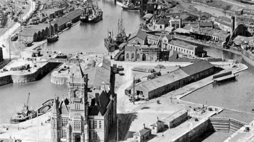
Cardiff’s dock system was central to the city’s nineteenth-century transformation.
Bute West Dock opened in 1839. Bute East Dock followed in stages between 1855 and 1859. The Bute East Dock measured approximately 1,309 metres long and up to 152 metres wide.
Further expansion moved the port infrastructure towards the east. Roath Basin was developed between the late 1860s and 1874. Roath Dock opened in 1887. Queen Alexandra Dock became the final major expansion of Cardiff Docks when it opened in 1907.
Roath Dock covered about 33 acres. Queen Alexandra Dock covered 52 acres. The expansion required extensive infrastructure, including railway sidings, warehouses, engineering facilities, dock offices, cranes and industrial premises.
This infrastructure had a direct geographical effect. Industrial activity no longer concentrated only around the original docks. Employment and transport facilities spread eastwards, strengthening the connection between central Cardiff and Roath, Splott and East Moors.
Coal exports reached exceptional levels during the early twentieth century. Cardiff, Barry and Penarth together handled 24,244,293 tons of coal in 1913, with 15,587,100 tons recorded as exports.
The docks therefore functioned as an economic engine for urban expansion. They created the employment base that supported dense residential neighbourhoods and the transport infrastructure connecting them.
How did railways influence Cardiff’s eastern growth?
Railways accelerated Cardiff’s eastern expansion by connecting docks, industrial sites, coalfields and residential districts. Railway infrastructure supplied freight capacity, supported industrial employment and established corridors along which housing and commercial development subsequently expanded.
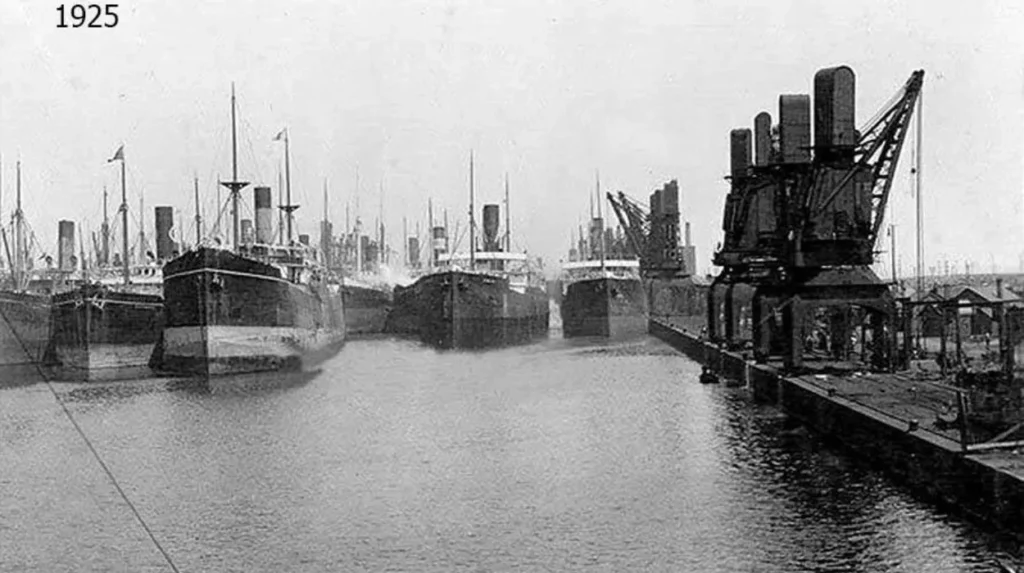
Railways were essential to Cardiff’s industrial economy. Coal and other materials needed efficient movement from inland mining districts to the port.
The Rhymney Railway and other railway companies created connections between Cardiff Docks and the South Wales valleys. Railway infrastructure also penetrated the eastern docklands and industrial areas.
A railway viaduct associated with the Rhymney Railway was constructed around 1858 and carried a tramway and railway towards coal-handling facilities at Bute East Dock.
Railways influenced the physical structure of eastern Cardiff in another important way. Industrial sites needed sidings and freight connections. Factories therefore appeared close to railway infrastructure, while workers required accessible housing nearby.
East Moors became a major industrial zone. Guest, Keen and Nettlefolds established a steelworks there in 1890 because the location provided convenient access to Cardiff’s maritime trade. The works eventually closed in 1978.
The relationship between railway infrastructure and industrial employment reinforced the development of communities such as Splott and Tremorfa.
Railway infrastructure also contributed to the long-term spatial structure of Cardiff. Some original railway facilities disappeared, but their corridors continued to influence roads, industrial estates, development boundaries and transport planning.
How did Roath become part of the expanding city?
Roath became part of expanding Cardiff through nineteenth-century industrialisation, housing construction, dock development and improved transport. Its location east of the historic centre made it an important transition between central Cardiff, the docks and later residential districts further east.
Roath was once distinct from the compact historic centre. Industrialisation gradually reduced that separation.
The construction of Roath Basin and Roath Dock increased economic activity in the surrounding area. Housing development followed the growth of employment and transport.
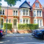
Roath also developed as a substantial residential district. Streets, terraces, schools, shops and community facilities expanded as Cardiff’s population increased.
Public open space became another important part of the district’s development. Roath Park was established as a major Victorian municipal park and is now recognised by Cadw as a Grade I registered historic park and garden.
The park helped establish a different type of urban environment from the dense industrial districts around the docks. Its landscape also illustrates how Cardiff’s nineteenth-century expansion combined housing growth with planned public amenities.
Today, Roath forms part of the continuous urban area extending from central Cardiff towards Penylan, Cyncoed and the north-east.
Its development demonstrates an important feature of Cardiff’s expansion: industrial growth and residential development occurred together, but they did not produce identical landscapes. Docklands contained industrial infrastructure, while nearby neighbourhoods contained terraces, commercial streets, schools and parks.
How did Adamsdown and Splott develop as eastern Cardiff districts?
Adamsdown and Splott developed as densely urban eastern districts as Cardiff’s industrial economy expanded. Housing, factories, railway facilities, schools and commercial streets occupied land between the historic centre and the expanding dock and industrial areas.
Adamsdown occupies an important position immediately east of the central area. Its development formed part of the outward growth of Cardiff during the nineteenth and early twentieth centuries.
Splott developed further east and became strongly associated with industrial employment. The East Moors industrial area included major steel production, while railway sidings and factories created additional employment.
The industrial character of the district is documented by historic records. A biscuit factory was established near railway sidings south of Pengam Junction in the mid-twentieth century. The surviving industrial buildings later became part of Clydesmuir Industrial Estate.
Splott also illustrates how Cardiff’s eastern edge changed repeatedly. Industrial sites expanded during the peak years of heavy industry. Later, some factories closed and their sites were redeveloped for other uses.
The area therefore moved from an industrial-growth landscape towards a mixed urban environment containing homes, community facilities, employment sites and regenerated land.
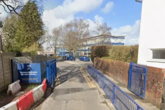
Cardiff Council continues to treat Adamsdown and Splott as an important area for education and community planning. School provision has been expanded and reorganised as part of Cardiff’s wider investment in modern educational facilities.
The historical pattern remains visible in the street layout and surviving industrial buildings.
How did Cardiff expand beyond Splott towards Rumney and Llanrumney?
Cardiff expanded beyond the inner eastern districts towards Rumney and Llanrumney through twentieth-century housing development, road construction, public services and planned suburban growth. These communities extended Cardiff’s built-up area towards the eastern boundary.
The expansion towards Rumney represented a different stage of urban growth from the dense Victorian development around Roath and Splott.
Inner eastern Cardiff was shaped heavily by industrialisation. Further east, large-scale twentieth-century housing development became more important.
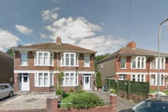
Llanrumney developed substantially as a planned residential community. The district contains extensive housing estates, schools, community facilities and open spaces.
Rumney retained a stronger connection with its older settlement history while becoming integrated into the wider Cardiff urban area. Historic buildings and landscape features remain part of the eastern city.
Cardiff Council places Rumney, Llanrumney and Trowbridge within the Cardiff East neighbourhood planning area.
The area also demonstrates the importance of schools and community infrastructure in suburban expansion. Housing development required corresponding investment in education, recreation, roads, public transport and local services.
Modern Cardiff continues to identify eastern communities as connected parts of the city rather than isolated settlements.
This expansion also created a longer journey between the historic centre and the eastern edge. Transport planning consequently became increasingly important as Cardiff’s population and employment patterns became more geographically dispersed.
How did St Mellons and the eastern edge become part of Cardiff’s urban structure?
St Mellons became increasingly connected to Cardiff through suburban development, business activity, road infrastructure and public transport. Its position near the eastern boundary created a strategic link between Cardiff, Newport and the wider South East Wales urban region.
St Mellons occupies an important position east of the traditional Cardiff urban core.
The area contains both older settlement features and modern development. This combination reflects the gradual transformation of Cardiff from a compact industrial city into a wider metropolitan urban area.
Business development became particularly important around St Mellons. Cardiff Council identifies St Mellons Business Park as a strategic employment location and continues to monitor development and infrastructure in the area.
The eastern corridor also connects Cardiff with Newport and the wider South Wales transport network. Newport Road has historically provided one of the major east-west routes through Cardiff.
Modern transport policy continues to strengthen this corridor. Cardiff Council’s Newport Road sustainable transport proposals include an eastern bus corridor, Cycleway 2 and controlled parking zones. The scheme is designed to connect central Cardiff with Newport and business developments around Cypress Drive.
This demonstrates that eastward expansion is not only a historical process. Transport investment continues to shape the relationship between Cardiff’s central and eastern districts.
Why did Cardiff continue expanding towards Pontprennau and north-east Cardiff?
Cardiff continued expanding towards Pontprennau and north-east Cardiff because later planning policies allocated land for new homes, employment, schools, transport infrastructure and community facilities. Strategic development has extended the urban area beyond older eastern suburbs.
The direction of expansion changed again during the late twentieth and early twenty-first centuries.
Instead of relying primarily on industrial growth, modern development has focused heavily on housing, employment and planned communities.
Pontprennau became one of Cardiff’s significant suburban growth areas. Its development connected the existing city with land towards the M4 corridor and the eastern boundary.
North-east Cardiff is now one of the city’s largest strategic development areas. Cardiff Council identifies a strategic site west of Pontprennau containing approximately 4,500 homes alongside employment and community uses. A separate site east of the Pontprennau Link Road contains approximately 1,300 homes with associated community uses.
These figures demonstrate the scale of contemporary eastern expansion.
Modern strategic development differs from nineteenth-century industrial growth because planning authorities now seek to coordinate housing with infrastructure.
Cardiff Council’s Local Development Plan uses a master-planning approach for strategic sites. This approach links new housing with sustainable transport corridors, schools, community facilities and green spaces.
The north-east therefore represents a planned continuation of Cardiff’s long-term outward growth.
How has transport shaped Cardiff’s eastern expansion?
Transport has consistently determined how Cardiff expanded eastwards. Roads, railways, buses, cycling routes and strategic transport corridors connect central Cardiff with Roath, Splott, Rumney, Llanrumney, St Mellons and north-east Cardiff.
Transport infrastructure has been a central mechanism of Cardiff’s geographical growth for more than two centuries.
The first major phase involved canals and docks. Railways then strengthened industrial connections. Roads later became increasingly important for suburban expansion.
Newport Road remains one of Cardiff’s principal east-west corridors. Modern plans seek to improve bus infrastructure and cycling facilities along this route.
Cardiff’s cycleway programme also reflects the continuing importance of eastern connections. Cycleway 2 is planned to connect the city centre with Adamsdown, Newport Road retail areas, Rumney, Llanrumney and St Mellons Business Park. Cycleway 6 connects central Cardiff with Plasnewydd, Penylan, Cyncoed and Roath Park.
Rail transport also continues to influence eastern Cardiff. Cardiff Parkway opened at St Mellons in 2023 according to Cardiff Council’s transport programme. The wider transport strategy includes additional rail, bus and active-travel improvements.
The pattern is therefore consistent across different periods. New development requires connections, while improved connections increase the practical accessibility of development areas.
What does Cardiff’s population growth reveal about its eastward expansion?
Cardiff’s population growth demonstrates the scale of urban expansion. The population increased from 5,101 in 1801 to 141,989 in 1891, reached 209,634 in 1911, and stood at 362,168 in the 2021 Census.
Population growth provides measurable evidence of Cardiff’s transformation.
The city’s population was only 5,101 in 1801. By 1851 it had reached 15,737. The figure increased rapidly during the industrial period, reaching 93,903 in 1881 and 141,989 in 1891.
By 1911, the Cardiff district recorded 209,634 people. The twentieth century brought further growth, although the rate varied according to economic conditions, housing development and administrative boundaries.
The population reached 266,611 in 1951 and 289,266 in 1961. It later declined during parts of the 1970s and 1980s before increasing again. The 2001 figure was 305,353, while the 2011 Census recorded 346,090. The 2021 Census recorded 362,168.
Population growth created continuous pressure for additional housing.
This pressure helped shift development from inner-city terraces towards suburban estates and later strategic housing sites.
The figures also show why Cardiff’s expansion cannot be understood solely through individual neighbourhood histories. The city’s geographical growth was a response to a long-term increase in population, employment and economic activity.
How did industrial decline change Cardiff’s eastern districts?
Industrial decline changed eastern Cardiff by reducing the dominance of coal, steel and dock-related employment. Former industrial sites were progressively closed, cleared, reused or redeveloped, creating opportunities for housing, business, transport infrastructure and environmental improvement.
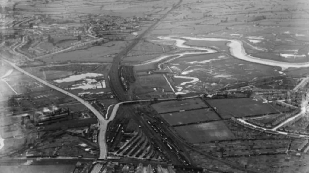
Cardiff’s eastern expansion was initially powered by heavy industry. Its later transformation was shaped by industrial decline.
The East Moors steelworks closed in 1978 after decades of operation.
The decline of coal exports also weakened the economic foundations that had driven Cardiff’s nineteenth-century growth. Research on Cardiff’s docklands records a major reduction in coal exports after their 1913 peak, with exports falling sharply by the mid-1930s as economic conditions and industrial technology changed.
The physical consequences were substantial.
Large industrial sites occupied land close to the city centre and eastern communities. Once industrial activity declined, these areas required new economic uses.
Some dock infrastructure survived. Cardiff’s Roath and Queen Alexandra docks remain commercially important, while other historic dock areas have undergone major redevelopment.
This transition produced a more diverse eastern Cardiff. Industrial estates, retail areas, housing, schools, recreation spaces and transport infrastructure now occupy land that was once dominated by heavy industry.
The history of eastward expansion therefore includes both outward growth and internal regeneration.
Explore More Area Guide
History of Grangetown: Cardiff’s Victorian Past and Heritage
Why Roath Became Victorian Cardiff: History & Heritage 2026
What does Cardiff’s eastward expansion look like today?
Today, Cardiff’s eastern urban area extends through established inner districts, suburban communities and strategic development sites. Roath, Splott, Tremorfa, Rumney, Llanrumney, St Mellons, Pontprennau and north-east Cardiff form connected parts of the city’s wider eastern structure.
Modern Cardiff is considerably larger than the nineteenth-century industrial city.
Established districts such as Roath, Adamsdown and Splott form the inner eastern urban area. Tremorfa and East Moors retain strong industrial and employment connections. Rumney and Llanrumney contain extensive residential communities. St Mellons combines established settlements with employment areas. Pontprennau and north-east Cardiff contain newer suburban development.
Cardiff Council groups the city into neighbourhood planning areas. Cardiff East includes Llanrumney, Rumney and Trowbridge, while Cardiff North includes Lisvane, Pentwyn, Pontprennau and Old St Mellons. Cardiff South East includes Adamsdown and Splott.
The administrative structure confirms the geographical importance of the eastern side of Cardiff.
The city’s planning system also demonstrates that eastward growth remains active. Cardiff Council currently monitors strategic sites containing thousands of planned homes and associated employment and community facilities.
Transport planning remains central to this process. New bus corridors, cycleways, rail investment and road improvements are intended to connect eastern communities with central Cardiff and neighbouring urban areas.
Why is Cardiff’s eastward expansion important to understanding the city?
Cardiff’s eastward expansion explains how industrialisation, population growth, transport infrastructure, housing demand and planning transformed the capital from a compact historic settlement into a large urban area extending towards Newport and north-east Cardiff.
The eastward development of Cardiff was a cumulative process.
The first major change came from industrialisation and the demand for coal exports. The docks expanded eastwards, followed by railway infrastructure and industrial employment. Residential neighbourhoods developed around these economic activities.
The nineteenth-century expansion produced districts such as Roath, Adamsdown and Splott. Twentieth-century suburbanisation extended the built-up area towards Rumney, Llanrumney and St Mellons. Later strategic planning expanded development towards Pontprennau and north-east Cardiff.
The population figures demonstrate the scale of the transformation. Cardiff grew from a small town of just over 5,000 people in 1801 to more than 200,000 by 1911 and more than 360,000 by 2021.
The physical evidence remains visible in streets, railway corridors, docks, industrial buildings, parks, housing estates and surviving historic settlements.
Cardiff’s eastern expansion also remains relevant to future planning. Current strategic sites include thousands of planned homes, while transport programmes are designed to connect existing and future communities.
Understanding this history therefore provides a clear explanation of why Cardiff’s eastern districts look different from the historic centre and why development continues to focus on transport, housing, employment, community facilities and sustainable growth.
Cardiff did not simply become larger. Its eastern expansion reflects successive economic and planning changes that reshaped the capital over more than two centuries.
Why did Cardiff expand eastwards?
Cardiff expanded eastwards because rapid industrialisation, dock construction, railway development and population growth created demand for housing, employment land and transport connections. Areas including Roath, Adamsdown and Splott became increasingly integrated with the expanding city.