Cardiff is the capital and largest local authority area in Wales. The 2021 Census recorded 362,308 usual residents in Cardiff, making it the most populous local authority in Wales. The population increased by about 4.7% from 2011 to 2021. Cardiff is also Wales’s most densely populated local authority, creating strong conditions for walking, cycling and public transport.
- What makes a Cardiff neighbourhood suitable for living without a car?
- Which Cardiff areas are closest to the city centre without needing a car?
- Is Canton a good location for living in Cardiff without a car?
- Is Roath suitable for a car-free lifestyle in Cardiff?
- Is Cathays a practical place to live without a car?
- Which Cardiff neighbourhoods work well for cycling without a car?
- Which Cardiff areas offer good access to trains without a car?
- Can you live in Cardiff without a car if you work outside the city centre?
- What should students consider when choosing a car-free area in Cardiff?
- What should families consider when living in Cardiff without a car?
- How should you choose where to live in Cardiff without owning a car?
- How is Cardiff’s transport network changing for future car-free living?
Living in Cardiff without a car involves choosing a neighbourhood according to everyday destinations rather than road access. The key factors include proximity to Cardiff city centre, railway stations, frequent bus corridors, schools, workplaces, shops, parks and active-travel routes.
Cardiff Council’s transport policies support walking, cycling and public transport. Its Local Transport Plan includes walking and cycling infrastructure, bus network improvements, junction improvements, 20mph limits and road-safety schemes. The council also maintains an Active Travel Network Map covering existing and proposed walking and cycling routes.
What makes a Cardiff neighbourhood suitable for living without a car?
A car-free Cardiff neighbourhood provides practical access to daily destinations through walking, cycling, buses and trains. The strongest factors are short distances to shops and services, reliable public transport, nearby employment centres, safe active-travel routes and convenient connections to the city centre.
Car-free living depends on the location of everyday activities. A neighbourhood close to a supermarket but distant from employment, education or healthcare still creates longer journeys. A neighbourhood with several transport options provides greater flexibility.
Cardiff’s compact urban structure supports this approach. The city centre contains major employment, retail, cultural, civic and transport destinations. Surrounding districts such as Canton, Riverside, Roath, Cathays and Grangetown provide residential areas within practical walking or cycling distance of central Cardiff.
Rail is another important factor. Cardiff Central is the principal railway station in the city centre. Transport for Wales operates the Core Valley Lines, which form a major part of Cardiff’s regional rail network. The 2026 Core Valley Lines network statement lists 57 stations on the network.
Bus connections remain important because many Cardiff neighbourhoods do not have a railway station. Cardiff Council directs residents towards Traveline Cymru for public-transport journey planning and Cardiff Bus for local bus information.
Walking also forms an important part of car-free travel. Cardiff Council provides a walking and cycling map and continues to develop its active-travel network.
Which Cardiff areas are closest to the city centre without needing a car?
Cardiff city centre, Cathays, Riverside, Canton, Roath and Grangetown provide direct access to central destinations through walking, cycling, buses and rail. Their urban locations place homes close to employment, education, retail, culture, healthcare and major transport interchanges across central Cardiff.
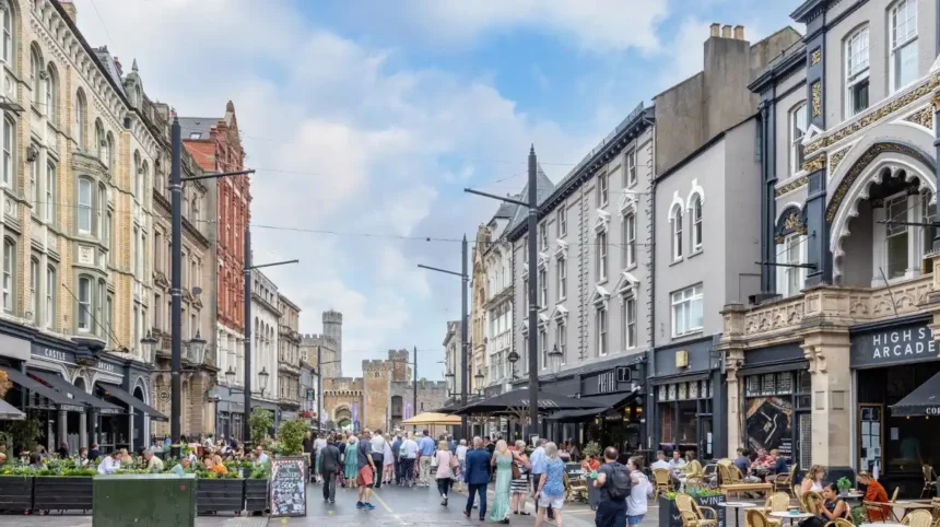
Cardiff city centre is the most direct option for residents who want to minimise travel distances. Cardiff Central station, the main bus interchange facilities and major commercial streets sit within the central area. Many workplaces, shops, restaurants, civic buildings and cultural venues are also concentrated there.
Cathays sits immediately north of the city centre. The district contains Cardiff University facilities, student accommodation, residential streets, shops and bus connections. Its location reduces the distance between homes and central employment and education destinations.
Riverside lies west of the city centre and connects residential streets with central Cardiff through walking and cycling routes. The district is close to Cardiff’s riverside areas and provides access towards Canton and Pontcanna.
Grangetown occupies an important position south of the city centre. Its location provides access towards Cardiff Central, Cardiff Bay and surrounding residential areas. Cardiff Bay also has rail and bus connections, creating additional travel options for residents.
Canton is west of the central area. It has a large concentration of housing, shops, food businesses and local services along and around major roads. Its proximity to the city centre makes walking and cycling practical for many central journeys.
Roath lies east of the city centre and contains established residential streets, local shops and community facilities. The district is also connected to the city’s developing cycling network.
These neighbourhoods differ in housing type, local environment and transport patterns. The relevant consideration for car-free living is the distance between a home and the destinations used most often.
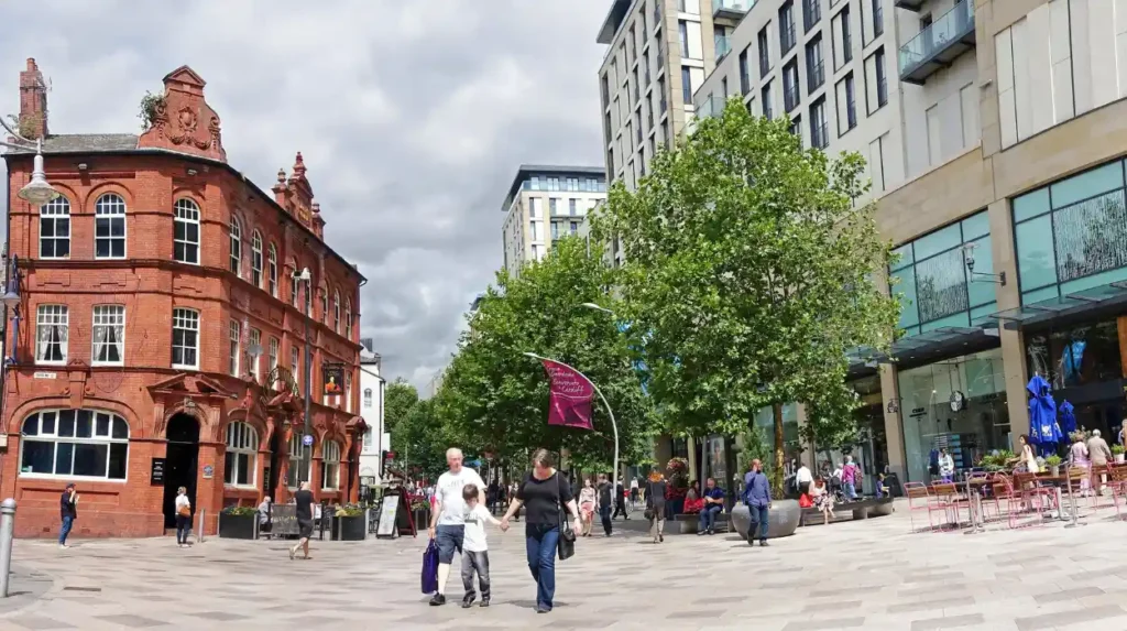
Is Canton a good location for living in Cardiff without a car?
Canton supports car-free living through its proximity to central Cardiff, local shops, services, parks and public transport corridors. Its position west of the city centre provides practical walking and cycling connections while bus routes extend access to other Cardiff districts.
Canton is one of Cardiff’s established inner-city districts. Its position beside the River Taff places it close to Riverside, Pontcanna and central Cardiff.
The area has a dense network of residential streets and local businesses. Cowbridge Road East provides a major commercial corridor with shops, food businesses and services. This reduces the need to travel elsewhere for routine purchases.
Canton also provides access to Victoria Park, one of Cardiff’s major urban parks. The park creates recreational space within the wider residential area.
The district’s transport structure combines walking, cycling and bus travel. Central Cardiff is close enough for many journeys to be completed on foot or by bicycle. Longer journeys use bus services connecting Canton with other parts of the city.
Canton is also relevant for people who work in central Cardiff but do not want to live directly in the city centre. The distance between the two areas allows commuting without depending on a private vehicle.
The exact experience depends on the property location. Homes closer to Cowbridge Road East and central Cardiff have different walking distances from homes deeper inside residential streets.
Is Roath suitable for a car-free lifestyle in Cardiff?
Roath offers established residential streets, local shopping, parks, schools and connections towards central Cardiff. Its location east of the city centre supports walking and cycling, while bus services provide longer connections across Cardiff for residents who do not own a car.
Roath is an established residential district east of Cardiff city centre. It includes a mixture of traditional housing, flats, student accommodation and local commercial areas.
Albany Road is a major local shopping street. It provides shops, food businesses, services and other everyday facilities. Having these destinations within the neighbourhood reduces the number of journeys requiring transport.
Roath Park provides another important local destination. The park and lake form a significant recreational area north of the main commercial streets.
Transport links are supported by Cardiff’s wider bus and active-travel network. Cardiff Council’s Cycleway 6 project connects the city centre towards Plasnewydd, Penylan, Cyncoed and Roath Park.
This planned and developing infrastructure is relevant to residents who cycle for commuting or local errands. Cardiff’s Active Travel Network Map provides the formal framework for existing and future walking and cycling routes. The map was approved by the Welsh Government in December 2022 following public consultation.
Roath therefore provides a residential environment where many routine activities occur locally while central Cardiff remains accessible without a car.
Is Cathays a practical place to live without a car?
Cathays is closely connected to central Cardiff and contains housing, shops, education facilities and public transport services. Its location beside Cardiff city centre makes walking practical for many journeys, while nearby railway stations and bus routes provide connections beyond the immediate neighbourhood.
Cathays is particularly associated with Cardiff University and its surrounding education infrastructure. The district has a high concentration of student housing and private rented accommodation.
Its location immediately north of central Cardiff reduces commuting distances for residents working or studying in the city centre. Many journeys can be completed on foot.
Cathays also has local shops and food businesses. This creates a neighbourhood-level service network for daily purchases and routine activities.
Rail is relevant to residents living around the northern side of central Cardiff. Heath High Level and Heath Low Level stations serve northern parts of the city, while Cardiff Queen Street provides another central-east rail connection.
The Core Valley Lines are particularly important for regional travel. Transport for Wales describes the network as connecting with Cardiff Central and other parts of the South Wales rail system. The network statement for 2026 records 57 stations on the Core Valley Lines network.
Cathays therefore suits a car-free routine where work, education and leisure destinations are concentrated in central and northern Cardiff.
Which Cardiff neighbourhoods work well for cycling without a car?
Cardiff’s active-travel network connects residential communities with central destinations through walking and cycling routes. Areas including Roath, Penylan, Riverside, Canton, Grangetown, Llandaff and Caerau feature within Cardiff’s cycleway plans and wider active-travel programme.
Cardiff Council is developing six major cycleways linking residential communities with destinations including Cardiff city centre and Cardiff Bay. The proposed routes cover corridors towards Roath Park, North East Cardiff, St Mellons Business Park, Cardiff Bay, North West Cardiff and Caerau.
Cycleway 1 connects the city centre towards Cathays, University Hospital of Wales, Heath High Level and Heath Low Level stations and North East Cardiff.
Cycleway 2 follows an eastern corridor through Adamsdown, Newport Road, Rumney, Llanrumney and St Mellons Business Park.
Cycleway 3 connects central Cardiff with Cardiff Bay.
Cycleway 4 extends towards Llandaff and Danescourt.
Cycleway 5 connects the city centre with Riverside, Ely and Caerau.
Cycleway 6 connects the city centre towards Plasnewydd, Penylan, Cyncoed and Roath Park.
The network is part of Cardiff’s broader active-travel policy under the Active Travel (Wales) Act 2013. Cardiff’s approved Active Travel Network Map identifies existing routes that meet Welsh Government standards and future routes planned over a 15-year period.
For residents, this means cycling decisions should focus on proximity to completed routes as well as proposed infrastructure. Existing infrastructure provides current travel options, while future routes indicate the direction of transport planning.

Which Cardiff areas offer good access to trains without a car?
Rail access is concentrated around Cardiff Central, Cardiff Queen Street and the wider Core Valley Lines network. Neighbourhoods near stations such as Cathays, Heath, Grangetown, Ninian Park, Llandaff and Radyr provide rail options for journeys across Cardiff and South Wales.
Rail is valuable for residents whose work, education or family commitments extend beyond their neighbourhood.
Cardiff Central is the city’s principal railway station and provides national and regional connections. The station has step-free access, ticket facilities, shops and other passenger facilities.
Cardiff Queen Street is important for eastern and central parts of the city. Its position makes it relevant to residents of areas such as Roath, Adamsdown and the central-east districts.
Cathays station serves the northern inner-city area. Heath stations provide connections for residents around Heath, Cathays North and neighbouring districts.
Grangetown and Ninian Park stations provide rail access for southern and south-western communities.
Llandaff and Radyr provide rail options further west. These locations offer a different residential setting from the dense inner-city neighbourhoods while retaining rail access.
The Core Valley Lines connect Cardiff with communities across the South Wales Valleys. Their role extends beyond commuting because the network links residential communities with employment, education and leisure destinations.
Station distance is important. A home several kilometres from a station has a different car-free transport profile from a home within a short walking or cycling distance.
Can you live in Cardiff without a car if you work outside the city centre?
Yes. Cardiff’s combination of local buses, rail services, walking routes and cycling infrastructure supports travel beyond the city centre. The practical choice depends on the employment location, nearest station or bus corridor, journey frequency and required interchange.
Not every car-free journey in Cardiff is a city-centre journey. Residents working in Cardiff Bay, Heath, Llandaff, the University Hospital of Wales, St Mellons or neighbouring authorities need transport connections matched to their workplace.
Rail can reduce journey times when both the home and workplace are close to stations. Bus services provide broader geographic coverage because many employment areas are not directly beside railway stations.
Cardiff Council’s transport information identifies buses and trains as key public-transport options and directs residents towards Traveline Cymru for journey planning.
The Newport Road corridor illustrates how transport planning is being structured around alternatives to private vehicles. Cardiff Council’s proposals include an eastern bus corridor, Cycleway 2 and controlled parking zones. The project aims to connect Cardiff city centre with Newport Road employment and business areas while improving bus and cycling infrastructure.
For a commuter, the relevant test is the complete door-to-door journey. This includes walking from home to a bus stop or station, waiting time, the public-transport journey, transfers and the final walk to work.
What should students consider when choosing a car-free area in Cardiff?
Students should prioritise distance to their campus, reliable public transport, local shops, affordable housing options and safe walking or cycling routes. Cathays, Roath, Riverside, Plasnewydd and central Cardiff provide different combinations of these factors around Cardiff University and the wider city.
Cardiff has a large student population and several major education destinations. Cardiff University has campuses around Cathays and the city centre, making neighbourhood location important for students without cars.
Cathays provides particularly direct access to university facilities and central Cardiff. Roath and Plasnewydd provide additional residential options east of the centre, with local shops and bus connections.
Riverside and parts of Canton provide access west of the central area. Walking and cycling connections across the River Taff are important for these neighbourhoods.
Students should also consider evening travel. A neighbourhood with daytime transport connections needs suitable evening services for people returning from university, work, social activities or part-time employment.
Housing location within each district also matters. Two properties carrying the same neighbourhood name can have different distances from campuses, railway stations, bus stops and supermarkets.
Cardiff’s walking and cycling network is continuously developing. The council states that the city’s walking and cycle network contains many routes and provides a free map for journey planning.
What should families consider when living in Cardiff without a car?
Families should assess schools, childcare, supermarkets, healthcare, parks, public transport and walking routes together. Areas such as Canton, Roath, Penylan, Llandaff and Riverside provide different combinations of residential amenities and transport connections within Cardiff’s urban network.
Family car-free living involves more than commuting. School journeys, shopping, healthcare appointments, recreation and children’s activities all influence daily transport requirements.
A neighbourhood with a primary school and supermarket nearby reduces routine travel. Parks and pedestrian routes provide additional value because recreational trips can also remain local.
Penylan and Roath provide access to parks, residential streets and east Cardiff services. Canton and Riverside provide proximity to central Cardiff and the River Taff corridor.
Llandaff provides a more suburban residential environment while retaining rail and bus connections. Its position in western Cardiff creates access to central areas without requiring every journey to start by car.
Families should also examine pavement quality, crossings, cycle infrastructure and road conditions around their particular home. These details influence independent walking and cycling for older children.
Cardiff Council’s Local Transport Plan includes walking and cycling infrastructure, bus improvements, 20mph limits and road-safety schemes. These policies form part of the city’s broader transport framework.
The most practical family location is therefore determined by the combination of home, school, work and everyday services rather than by neighbourhood name alone.
Explore ore Area Guide
Cardiff Neighbourhoods: Rent, Transport and Lifestyle Guide
Best Areas to Live in Cardiff: Complete Neighbourhood Guide
How should you choose where to live in Cardiff without owning a car?
Choose a Cardiff home by mapping your regular destinations and measuring walking, cycling, bus and rail connections before moving. Compare actual journey distances, service frequency, interchange requirements, local shops, schools and employment access rather than relying on neighbourhood reputation.
Start with the most frequent journey. For many residents, this is work or education. Identify the destination and calculate the walking, cycling, bus and rail options.
Next, identify essential weekly destinations. These include supermarkets, pharmacies, healthcare facilities, schools, childcare, parks and community services.
Then examine public transport. Cardiff Council provides transport information covering buses, trains, walking and cycling, while Traveline Cymru provides journey-planning information.
Rail users should identify the nearest station and check the complete journey rather than simply measuring straight-line distance.
Cyclists should check existing active-travel routes. Cardiff’s Active Travel Network Map separates existing routes from future proposals, making it possible to distinguish current infrastructure from planned improvements.
Walking should be assessed at street level. A short distance on a map does not automatically represent the same experience as a direct, continuous pedestrian route.
Finally, consider occasional journeys. Airports, regional hospitals, large shopping trips, visits outside Cardiff and late-night travel require additional planning. Taxi services and car-sharing can cover occasional trips without requiring permanent car ownership.
Cardiff’s transport strategy continues to emphasise sustainable travel. The council states that it is improving bus access to the city centre, links between the city centre and Cardiff Bay, cycling infrastructure and neighbourhood walkability.
How is Cardiff’s transport network changing for future car-free living?
Cardiff is continuing to expand walking, cycling and public-transport infrastructure through its Local Transport Plan and Active Travel Network Map. Future investment focuses on connected routes, bus improvements, rail integration and neighbourhood access, supporting alternatives to private-car travel across the city.
Cardiff’s transport planning is shaped by population growth and urban development. The 2021 Census recorded 362,308 residents, compared with around 346,100 in 2011. Cardiff remained the largest local authority in Wales by population.
The Active Travel Network Map provides a 15-year framework for improving walking and cycling. The council uses the map to prioritise future schemes, while existing routes are assessed against Welsh Government active-travel standards.
Cardiff’s cycleway programme covers six strategic corridors. These routes connect central Cardiff with communities across the north, east, west, south and Cardiff Bay.
Rail development also forms part of the wider South Wales Metro programme. Transport for Wales describes Metro Central as a transport hub designed to improve connections between bus, rail, walking and cycling in central Cardiff.
The Newport Road sustainable transport corridor is another example. Its proposals combine bus infrastructure, cycling infrastructure and controlled parking measures.
For people choosing a home without a car, these developments make transport infrastructure an important part of long-term neighbourhood planning. Existing connections remain the foundation for today’s decisions, while approved and funded projects provide additional context for future accessibility.
Cardiff therefore offers several types of car-free living. Central neighbourhoods minimise distances. Inner-city districts combine walking with buses and cycling. Rail-connected western and northern districts extend car-free travel beyond the central area.
The practical principle remains consistent: choose a home close to the destinations and transport services used most often. Cardiff’s dense urban structure, established public-transport network and expanding active-travel infrastructure provide the foundation for living without depending on a private car.
Can you live in Cardiff without a car?
Yes. Cardiff has an extensive network of buses, railway services, walking routes and cycling infrastructure. Central areas such as Cathays, Canton, Roath, Riverside and Grangetown provide access to shops, workplaces, education and leisure facilities without requiring regular car use.