Roath is one of Cardiff’s most historically significant residential districts, located east of the city centre in South Wales. Its history stretches from a small rural settlement and medieval parish to a densely developed Victorian suburb shaped by industrial expansion, population growth, religious institutions and public parks. Today, Roath retains important historical buildings, traditional streets, community landmarks and green spaces that reflect more than a thousand years of local development.
- Where Is Roath in Cardiff and What Makes Its History Important?
- What Was Roath Like Before Cardiff’s Industrial Expansion?
- How Did St Margaret’s Church Shape the History of Roath?
- Who Designed the Present St Margaret’s Church?
- Why Is St Margaret’s Church Important to Local Heritage?
- What Was Roath Court and Who Owned the Historic Estate?
- How Did the Industrial Revolution Transform Roath During the Nineteenth Century?
- What Do Historical Population Figures Reveal About Roath?
- Which Landowning Families Influenced Roath’s Urbanisation?
- Why Did Roath Become Part of Cardiff in 1875?
- How Did the Mackintosh Estate Shape the Development of Roath?
- How Did Roath Park Become One of Cardiff’s Most Important Historic Landmarks?
- What Historical Features Can Visitors Find in Roath Park?
- How Did Roath Park Support Cardiff’s Growing Population?
- How Did Victorian Housing and Architecture Change Roath?
- How Did Religious and Community Institutions Develop in Roath?
- What Role Did Schools Play in Roath’s Development?
- How Did Public Houses and Local Businesses Support Community Life?
- What Happened to Roath During the Twentieth Century?
- How Did the First World War and Later Conflicts Influence Roath?
- How Did Post-War Housing Change Roath?
- How Has Roath Developed into a Modern Cardiff Neighbourhood?
- Why Does Roath’s Historical Architecture Still Matter?
- What Is the Importance of Roath’s Parks and Green Spaces Today?
- Why Is Preserving the History of Roath Important for Cardiff’s Future?
- How Does Roath Reflect the Wider History of Cardiff?
The history of Roath Cardiff is closely connected to the wider transformation of Cardiff from a relatively small market town into a major industrial port and modern Welsh capital. Its development reflects changes in land ownership, transport, housing, employment, education and public recreation. Historic locations such as St Margaret’s Church, Roath Court, Albany Road and Roath Park provide evidence of these different periods.
Understanding Roath’s past also explains its present-day character. The district combines historic residential architecture, independent commercial streets, religious heritage and established public spaces. Its evolution demonstrates how Cardiff’s eastern settlements became integrated into the expanding city during the nineteenth and twentieth centuries.
Where Is Roath in Cardiff and What Makes Its History Important?
Roath is an established district in eastern Cardiff, situated beyond the city centre and historically associated with the ancient parish of Roath. Its development reflects Cardiff’s expansion during the Victorian period, when rural settlements became residential and commercial neighbourhoods.
Roath forms part of the eastern urban area of Cardiff, the capital city of Wales. It sits close to districts including Cathays, Adamsdown, Plasnewydd, Penylan and Cyncoed. Its location connects the historic centre of Cardiff with the residential communities that expanded towards the east during the nineteenth century.
The name Roath is associated with the historic parish and settlement that existed before modern urban development. The original village was considerably smaller than the present district. Its landscape included agricultural land, cottages, estates, streams and religious buildings.
Roath’s historical importance comes from its transformation across different periods. Medieval settlement patterns established its early identity, while landowning families influenced its agricultural and residential development. Industrial Cardiff subsequently created demand for housing, transport and commercial services.
How Did Roath Become Part of Cardiff?
Roath developed from a separate rural settlement into an urban suburb as Cardiff expanded eastwards during the nineteenth century. The growth of employment around Cardiff’s docks, railway facilities and industrial districts increased demand for housing beyond the historic town centre.
The expansion of the city gradually connected Roath with neighbouring settlements. Streets, residential estates and commercial routes replaced much of the agricultural landscape.
Today, Roath is closely integrated into Cardiff’s urban structure, although its historic identity remains visible through its parish church, historic estates and Victorian architecture.
What Was Roath Like Before Cardiff’s Industrial Expansion?
Before nineteenth-century urbanisation, Roath was a small agricultural village within an ancient parish. Its landscape contained farms, cottages, a parish church, a manor house, common pasture and a watermill. Farming and local landownership shaped everyday life in the settlement.
Historical research by the Roath Local History Society identifies the original village around St Margaret’s Church, close to the junction of the historic Merthyr Road and the main route towards Newport.
The 1840 tithe map of Roath provides important evidence of the settlement’s early layout. A tithe map recorded land ownership, occupation and agricultural obligations before the introduction of modern property records. The map shows a relatively small community surrounded by agricultural holdings.
The 1841 census recorded approximately 298 residents in the parish of Roath. The village itself contained around 80 inhabitants, concentrated near St Margaret’s Church.
The surrounding landscape included:
- Agricultural farms producing food for Cardiff’s markets.
- Cottages occupied by farming families and local workers.
- Common pasture used for grazing animals.
- A watermill associated with the Roath Brook.
- Manor properties connected to prominent landowning families.
These features demonstrate that Roath originally functioned as a rural settlement rather than an urban residential district.
What Was the Role of Roath Brook?
Roath Brook was an important watercourse that influenced the settlement’s agricultural and industrial activities. It flowed through the historic village towards the River Rhymney, providing water for local land and supporting the operation of a traditional mill.
The mill near St Margaret’s Church was associated with the medieval manorial economy. Historical research records that the mill survived until 1897, when urban development had already transformed much of the surrounding landscape.
The original route of the brook also helps explain the later development of Roath Park. The watercourse was incorporated into the design of the Victorian park, where its valley became part of the landscaped recreational environment.
How Did Medieval Roath Relate to Cardiff Castle?
Roath had connections with the medieval lordship of Cardiff. Historical local research describes the settlement as a dairy manor supplying agricultural produce to Cardiff Castle and the town market.
A manor was a territorial estate governed through the landholding and administrative arrangements of medieval society. Agricultural production, tenant obligations and control of land formed important parts of this system.
The relationship between Roath and Cardiff Castle connected the village to the wider economy of the region. Produce from surrounding farms supported the settlement and the growing market community of Cardiff.
How Did St Margaret’s Church Shape the History of Roath?
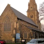
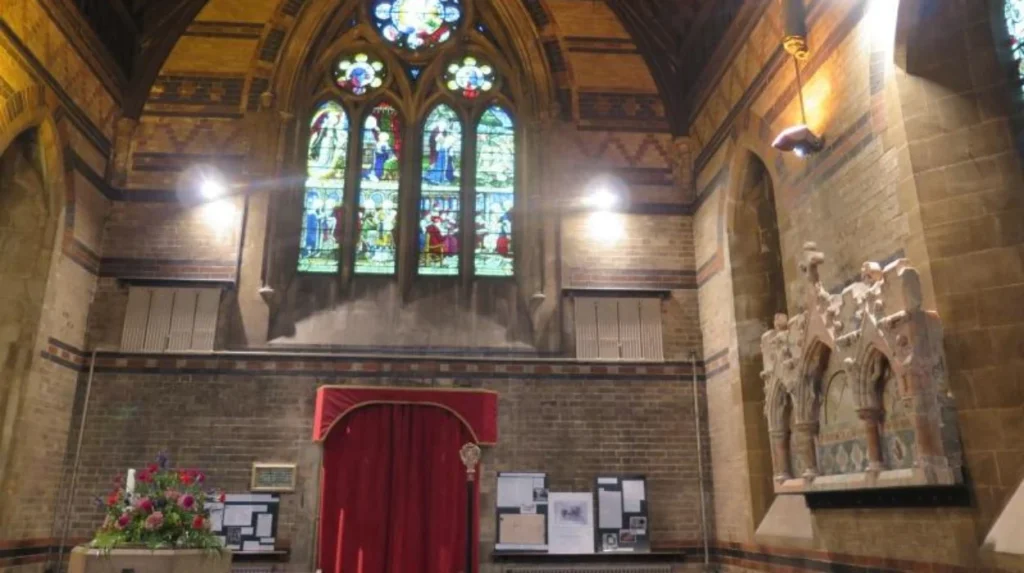
St Margaret’s Church is the historic parish church of Roath, with Norman origins dating to the late eleventh century. Its successive buildings, churchyard and Bute family connections provide important evidence of the district’s religious, architectural and social development.
The history of St Margaret of Antioch Church is closely connected to the origins of the village. The church served the local parish community before the expansion of Cardiff transformed Roath into an urban district.
The original church was established during the Norman period, when religious institutions played an important role in organising rural communities. Parish churches provided places of worship, community gathering and local religious administration.
The original medieval building was demolished in 1869. A replacement church was constructed on the historic site, reflecting the changing needs of a growing population.
Who Designed the Present St Margaret’s Church?
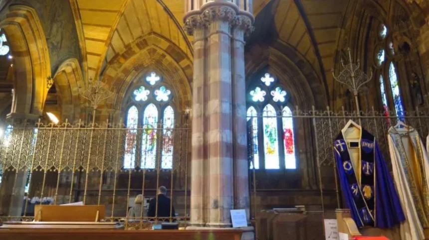
The present Victorian church was designed by architect John Prichard and financed by the third Marquess of Bute. Its construction took place during a period of significant religious and architectural investment in Cardiff.
John Prichard was an important Welsh ecclesiastical architect associated with several church restoration and construction projects across South Wales.
The church also contains the Bute Mausoleum, where nine members of the Bute family are interred. This connection demonstrates the influence of the Bute family on Roath’s religious and architectural heritage.
The church tower received a further historical role when it was dedicated as a war memorial in 1926. This addition connected the historic parish building with the remembrance of military service and local sacrifice.
Why Is St Margaret’s Church Important to Local Heritage?
St Margaret’s provides continuity between medieval Roath and modern Cardiff. Although the original structure disappeared, the church remained on its historic site and continued to serve the surrounding community.
Its location also helps identify the original village centre. Historic maps and local research place cottages, agricultural holdings and the former village green around the church.
The church therefore represents more than a religious building. It is an important geographical reference point for understanding how Roath developed from a small settlement into a substantial urban neighbourhood.
What Was Roath Court and Who Owned the Historic Estate?
Roath Court was a historic manor property associated with the medieval settlement of Roath. Its present building developed from an eighteenth-century house with early nineteenth-century additions, while the Williams family became important landowners during the Victorian period.
Roath Court occupies an important position in the district’s history. The property stands near the junction of Newport Road and Albany Road, close to the location of the original village.
Its origins are associated with an earlier medieval manor house known as Roath Dogfield. The historian Rice Merrick referred to an older fortified property called The Court in his 1578 description of the area.
The present building originated in the eighteenth century and received early nineteenth-century additions. John Wood, a Cardiff banker, is associated with these alterations.
Charles Crofts Williams later became one of the best-known occupants of the property. He was a prominent landowner and served as Mayor of Cardiff.
Roath Court remained associated with the Williams family until the twentieth century. The property was sold in 1952, and its subsequent use as a funeral home preserved its connection with local services.
Cadw lists Roath Court as a Grade II building, recognising its architectural and historical importance.
How Did the Roath Court Estate Influence Local Development?
The Roath Court estate controlled substantial land around the original settlement. During the nineteenth century, parts of the estate became available for residential development as Cardiff expanded.
The surrounding agricultural land gradually gave way to houses, streets and commercial premises. This transformation changed the character of the historic manor landscape.
The estate also influenced the layout of Albany Road and neighbouring streets. Its historic boundaries help explain why different sections of modern Roath developed under separate landowners.
Roath Court therefore represents the transition from a traditional landed estate to a modern urban neighbourhood.
How Did the Industrial Revolution Transform Roath During the Nineteenth Century?
The Industrial Revolution transformed Roath through Cardiff’s expanding port economy, population growth and demand for housing. Agricultural land became residential streets, while roads, shops, schools and religious buildings developed to serve the expanding urban population.
Cardiff experienced major economic changes during the nineteenth century. Coal exports from the South Wales valleys increased the importance of its docks, railways and commercial infrastructure.
The growth of the coal trade attracted workers, merchants, industrialists and professional families. Cardiff’s population increased rapidly, creating pressure on available housing within the historic town.
Roath provided land for residential expansion because it lay beyond the older urban centre. Landowners began converting agricultural estates into building plots.
This process created different types of housing. Terraced houses accommodated working families and employees, while larger villas attracted middle-class residents.
The development of Roath also reflected the wider economic transformation of Cardiff. Employment in the docks, railway services, administration, retail and manufacturing supported the growing residential population.
What Do Historical Population Figures Reveal About Roath?
The historical census figures demonstrate how quickly Roath changed during the nineteenth century.
The figures published in historical research by the Roath Local History Society show that the parish experienced relatively limited population growth during the first half of the nineteenth century.
The dramatic increase between 1851 and 1861 reflects the beginning of large-scale residential development. The number of inhabited houses increased from 63 in 1851 to 524 in 1861.
This change demonstrates that Roath’s transformation was not simply gradual village expansion. It was a major shift towards a densely populated urban environment.
The figures refer to the historic parish rather than the exact boundaries of the present-day neighbourhood.
Which Landowning Families Influenced Roath’s Urbanisation?
Several prominent landowners controlled estates that later became residential districts.
The Tredegar family held extensive land in the parish and influenced some of the earliest urban development near the Cardiff boundary. Their estate was connected to the wider Morgan family holdings in South Wales.
The Bute family also played an important role in Cardiff’s development through its landholdings and commercial interests. The third Marquess of Bute later donated land for Roath Park.
The Richards family owned the Plasnewydd estate. Harriet Richards subsequently married the Mackintosh of Mackintosh, connecting the estate with the Scottish Mackintosh family.
These landowners influenced how residential plots were arranged, leased and developed. Their estates formed the framework for the modern street network.
Why Did Roath Become Part of Cardiff in 1875?
Roath became part of Cardiff in 1875 following the city’s legislative expansion under the Cardiff Improvement Act. This change brought the growing settlement within Cardiff’s municipal administration and accelerated the integration of its roads, housing and public services.
Before incorporation, Roath existed as a separate parish outside the historic municipal boundary of Cardiff.
However, nineteenth-century urban development increasingly connected the settlement with the neighbouring town. Residential streets expanded towards Roath, while roads and commercial routes connected the two communities.
The Cardiff Improvement Act of 1875 formally incorporated Roath into the borough. This administrative change reflected the practical reality of an expanding urban area.
Municipal integration allowed the local authority to extend its responsibilities for roads, drainage, sanitation and other public infrastructure.
The change also influenced the future development of Roath. New streets, houses and businesses became part of a wider urban planning framework.
How Did Municipal Integration Change Daily Life?
The integration of Roath into Cardiff supported the development of more organised urban services. Roads required maintenance, drainage systems needed improvement and expanding neighbourhoods required public facilities.
Housing development also became increasingly regulated through local authority building requirements.
The introduction of improved water supplies and internal sanitation changed residential conditions. Houses increasingly included bathrooms and domestic facilities that had been less common in earlier rural properties.
These improvements reflected broader changes in Victorian public health and urban administration.
The incorporation of Roath therefore marked an important stage in the development of modern Cardiff.
How Did the Mackintosh Estate Shape the Development of Roath?
The Mackintosh Estate was one of the most important residential development projects in Victorian Roath. Its urbanisation began in 1884 and created a planned network of streets, houses, shops, schools and religious buildings around the growing Albany Road commercial district.
The Mackintosh Estate developed from the historic Plasnewydd property. The land belonged to the Richards family before Harriet Richards married the Mackintosh of Mackintosh in 1880.
The estate became an important source of residential building land during Cardiff’s period of rapid population growth.
Development began in 1884, when architect Charles Rigg prepared plans for the proposed street layout and residential buildings.
The estate used a planned street arrangement rather than relying entirely on unregulated construction. Building plots were leased to developers, while estate representatives exercised control over the design and construction process.
This approach helped create the recognisable Victorian street pattern found across parts of Roath today.
Why Was Albany Road Important to the Mackintosh Estate?
Albany Road became the principal east-west route through the Mackintosh Estate.
The road was originally known as Merthyr Road. Its name changed to Albany Road in April 1884, following the death of Prince Leopold, Duke of Albany, Queen Victoria’s youngest son.
The route provided an important connection between the western part of Roath and the historic village near Roath Court.
Initially, the estate intended Albany Road to function mainly as a residential street. However, its central position encouraged commercial development.
Residential properties gradually incorporated shopfronts at ground-floor level. Independent retailers, service providers and public houses established businesses along the route.
By the end of the nineteenth century, Albany Road had become an important commercial centre for the expanding neighbourhood.
How Large Was the Mackintosh Estate by 1900?
The scale of development was substantial. Research by the Roath Local History Society estimates that by 1900 the estate contained approximately:
- 2,750 houses.
- Two schools.
- Three public houses.
- Several places of religious worship.
- Numerous shops and commercial premises.
- A population of approximately 13,000 to 15,000 residents, depending on the historical account and boundary used.
These figures demonstrate how quickly the estate developed from agricultural land into a densely populated residential community.
The street names also preserve the estate’s historical connections. Mackintosh Place, Richards Street, Inverness Place and other local roads reflect the landowners and family associations involved in its development.
The Mackintosh Estate remains one of the clearest examples of planned Victorian suburban expansion in Cardiff.
How Did Roath Park Become One of Cardiff’s Most Important Historic Landmarks?
Roath Park became Cardiff’s first publicly owned public park after landowners donated land for recreational development in 1887. Designed during the Victorian period and opened in 1894, it introduced extensive gardens, a lake, sporting facilities and botanical collections.
Roath Park represents an important chapter in the history of public recreation and urban planning in Cardiff.
Before the park existed, much of its land consisted of wet meadows associated with the Nant Fawr Brook. The landscape was transformed into a formal public recreational space as Cardiff’s population increased.
The third Marquess of Bute, Lord Tredegar and other landowners donated land for the project in 1887. Development continued between 1887 and 1894.
Cardiff borough engineer William Harpur was responsible for laying out the park. William Wallace Pettigrew, appointed Cardiff’s first Parks Superintendent in 1891, played an important role in its planting and horticultural development.
The park officially opened on 20 June 1894. The opening ceremony attracted approximately 10,000 people to Roath Recreation Ground, demonstrating the importance of the new public space to the growing city.
Cadw registered Roath Park as a Grade I historic park and garden in 2022. Its designation recognises its Victorian design, surviving historic features and associations with the Pettigrew family.
What Historical Features Can Visitors Find in Roath Park?
Roath Park contains several features that preserve its Victorian origins and subsequent historical development.
The lake: The large artificial lake forms the central landscape feature. It was created through the modification of the original wetland environment.
The lighthouse: The distinctive clock-tower lighthouse stands within the lake and commemorates Captain Robert Falcon Scott and his Antarctic expedition. Scott’s expedition sailed from the Port of Cardiff in 1910. The memorial structure was installed in 1915 through a private gift from F. C. Bowring.
The Botanical Gardens: These gardens preserve the park’s original horticultural purpose and contain collections of plants and trees.
The Conservatory: The glasshouse provides a setting for botanical displays and reflects the Victorian interest in horticulture and public education.
The Rose Garden: This formal garden contributes to the park’s historic landscape and has an association with the Pettigrew family.
The park also contains historic bridges and other architectural features. Several structures are protected through Cadw’s listed-building system.
How Did Roath Park Support Cardiff’s Growing Population?
Victorian public parks provided recreation, exercise, fresh air and opportunities for social activities.
Roath Park was specifically designed to serve residents of eastern Cardiff. Its facilities included walking routes, sporting areas, botanical gardens and open recreational grounds.
The park also contributed to residential development. Houses were constructed around its boundaries, with their owners benefiting from access to landscaped open space.
This relationship between public parks and residential neighbourhoods became an important feature of Victorian urban planning.
How Did Victorian Housing and Architecture Change Roath?
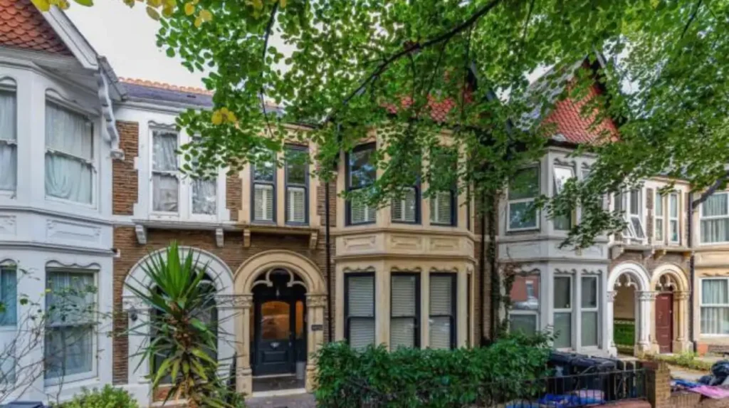
Victorian urban development transformed Roath’s agricultural landscape into residential streets containing terraced houses, villas, churches and commercial buildings. Different property styles reflected household income, changing construction practices and the growing demand for accommodation in Cardiff.
The expansion of Roath created a distinctive architectural landscape. Developers constructed properties to accommodate different sections of Cardiff’s growing population.
Terraced housing became particularly important. These properties generally consisted of two or three storeys, with repeated architectural designs and shared structural walls.
Larger villas were also constructed along selected residential streets. They offered more internal space and often included decorative architectural features.
The difference between these property types reflected the economic structure of Victorian Cardiff. Dockworkers, tradespeople, clerks, merchants and professional families required different types of accommodation.
What Architectural Features Define Historic Roath?
Several architectural characteristics help identify the Victorian development of Roath.
Red and yellow brickwork: Many properties feature contrasting brick colours, creating decorative patterns around windows, doors and building elevations.
Bay windows: Projecting windows increased internal light and provided additional views of the street.
Decorative stonework: Stone lintels, window surrounds and entrance details added architectural character.
Slate roofs: Welsh slate became a common roofing material during the expansion of Victorian housing.
Traditional shopfronts: Commercial streets developed through the conversion of residential ground floors into retail premises.
These features remain visible across Albany Road, Richmond Road, City Road and neighbouring residential streets.
Why Are Roath’s Historic Streets Important?
The street pattern preserves evidence of different landownership arrangements and development periods.
Albany Road reflects the planned expansion of the Mackintosh Estate. City Road developed through earlier and later phases of urban growth, while residential streets around Roath Park demonstrate the relationship between housing and public recreation.
The buildings also provide evidence of changing lifestyles. Larger Victorian houses were divided into smaller accommodation in some locations, while others were converted into commercial or professional premises.
Historic architecture therefore provides a physical record of Roath’s changing social and economic conditions.
How Did Religious and Community Institutions Develop in Roath?
Religious and community institutions expanded as Roath became a densely populated Cardiff suburb. Churches, chapels, schools, public houses and recreational facilities provided essential services, supported social networks and established neighbourhood identities.
The nineteenth-century population increase created demand for community institutions.
St Margaret’s Church continued its historic role, while new religious buildings served expanding residential streets.
St Martin’s Church, situated near the western end of Albany Road, was built in 1899 on land donated by the Mackintosh Estate. Architect Frederick R. Kempson designed the building.
The development of St Martin’s demonstrates how religious infrastructure expanded alongside residential construction.
Other churches and places of worship also emerged across the district, reflecting the religious and social diversity of Cardiff.
What Role Did Schools Play in Roath’s Development?
Schools became increasingly important as residential estates expanded.
The Mackintosh Estate contained two schools by 1900, according to local historical research. These institutions served families living in the newly developed neighbourhood.
The establishment of schools reduced the need for children to travel into the older parts of Cardiff for education.
Educational facilities also contributed to the long-term stability of residential communities. Families required accessible schools, local services and safe routes between their homes and educational institutions.
How Did Public Houses and Local Businesses Support Community Life?
Public houses and independent businesses provided important social and economic services.
The Albany Hotel, established in 1895, represents the commercial development associated with the Victorian residential expansion. Its location near the surrounding streets reflected the growing demand for hospitality and neighbourhood services.
The Roath Park Hotel, associated with 1886, provides another example of the period’s commercial development.
Local shops supplied household goods, food and everyday services. Their concentration along Albany Road helped establish the street as a central shopping destination.
These institutions strengthened the district’s identity and supported the everyday needs of its expanding population.
What Happened to Roath During the Twentieth Century?
During the twentieth century, Roath experienced further residential change, commercial expansion and improvements to public infrastructure. Established Victorian buildings continued to serve new generations, while post-war development introduced additional housing and changed the use of historic properties.
The early twentieth century marked a period of consolidation for Roath.
By this stage, much of the Mackintosh Estate had been developed, and the district had become an established part of Cardiff’s residential structure.
The streets contained shops, schools, religious buildings and public houses. The area no longer depended on agricultural activities and functioned as an urban community.
Cardiff itself received city status in 1905, marking another important milestone in the wider history of the Welsh capital.
Roath subsequently developed alongside the city’s expanding administrative, commercial and cultural institutions.
How Did the First World War and Later Conflicts Influence Roath?
The twentieth century brought significant changes to community life across Cardiff.
Military service, wartime restrictions and remembrance activities affected families throughout the city. Churches and public institutions became important locations for community remembrance.
The Roath Park lighthouse also reflects Cardiff’s maritime and military connections. It commemorates Captain Scott and his Antarctic expedition, which departed from Cardiff in 1910.
The park’s Rose Garden acquired a wartime association through its contribution to the war effort during the Second World War. Its history demonstrates how established public spaces acquired additional community roles during periods of national difficulty.
How Did Post-War Housing Change Roath?
Post-war housing development introduced new residential arrangements within the historic district.
Some older properties were adapted, divided or redeveloped to accommodate changing household requirements.
Timbers Square provides a documented example. The first house-building plans for the square date from 1955. The development occupied land previously associated with the Roath Court estate.
The Roath Court property itself was sold in 1952, following the end of the Williams family’s long association with the building.
These changes demonstrate how twentieth-century housing demand reshaped land that had once formed part of large private estates.
How Has Roath Developed into a Modern Cardiff Neighbourhood?
Modern Roath combines historic residential streets, established commercial areas, educational facilities, religious buildings and public green spaces. Its Victorian foundations remain visible, while changing housing needs and local businesses continue to influence the neighbourhood’s character.
Roath is now an established urban district within Cardiff. Its identity is closely connected to its historical streets, independent businesses, parks and residential communities.
Albany Road remains one of its principal commercial routes. The street contains shops, cafés, restaurants and everyday services that support local residents.
Wellfield Road also functions as an important local shopping destination. Its independent businesses contribute to the commercial character of eastern Cardiff.
Residential properties include Victorian terraces, larger period houses, converted accommodation and more recent developments.
This mixture reflects the different phases of construction that shaped Roath over more than a century.
Why Does Roath’s Historical Architecture Still Matter?
Historic architecture provides evidence of the district’s development and changing population.
Victorian residential streets demonstrate the scale of nineteenth-century urbanisation. Churches preserve the history of religious institutions, while older commercial buildings reveal the expansion of local retail activity.
Roath Court and the historic structures within Roath Park provide additional evidence of the influence of private landowners, civic investment and public recreation.
Conservation and heritage protection help preserve these features for future generations.
Cadw’s Grade I designation for Roath Park and the protection of individual historic buildings demonstrate the importance of maintaining Cardiff’s architectural heritage.
What Is the Importance of Roath’s Parks and Green Spaces Today?
Green spaces remain central to Roath’s residential and recreational identity.
Roath Park provides opportunities for walking, outdoor exercise, horticultural activities and community recreation.
Waterloo Gardens also preserves part of the district’s historic green-space network. Its location near the former Roath Brook connects the modern landscape with the area’s agricultural past.
Roath Recreation Ground provides another important open space. It covers approximately 23 acres and was developed as part of the wider Roath Park project.
These spaces support the original Victorian objective of providing accessible recreation for residents.
They also demonstrate the continuing importance of urban green infrastructure as Cardiff accommodates changing population and housing needs.
Explore More Area Guide
The History of Canton Cardiff: From Medieval Village to Modern Suburb
History of Splott, Cardiff: Industry, Steelworks and Community
Why Is Preserving the History of Roath Important for Cardiff’s Future?
Preserving Roath’s history protects the buildings, landscapes and records that explain Cardiff’s urban development. Historic churches, Victorian streets, public parks and former estates provide cultural continuity and help future generations understand the district’s origins.
Roath’s historical significance extends beyond individual buildings. Its development provides evidence of how landownership, industrial employment, population growth and municipal planning transformed Cardiff.
The original village illustrates the region’s medieval agricultural economy. The Victorian estates demonstrate the relationship between private landowners and urban expansion. Roath Park reflects the growing importance of public recreation and civic investment.
These historical connections remain relevant to modern planning decisions.
The preservation of historic buildings requires attention to architectural character, original materials and the surrounding streetscape. Public parks also require ongoing maintenance to protect historic planting, structures and landscape features.
Local historical organisations contribute to this work by researching archival documents, digitising photographs, recording oral histories and sharing information about buildings and streets.
The Roath Local History Society is particularly valuable for understanding the district’s transformation. Its research includes historic maps, census information, estate development and the changing character of local streets.
Cardiff’s historical archives and heritage records provide additional evidence for future research.
The history of Roath demonstrates that modern neighbourhoods retain important connections to their original landscapes and communities. Protecting those connections ensures that Cardiff’s development remains understandable through its surviving buildings, public spaces and documented history.
How Does Roath Reflect the Wider History of Cardiff?
Roath’s transformation from a small medieval village into an established Cardiff suburb represents one of the most significant examples of nineteenth-century urban expansion in South Wales.
Its early identity developed around St Margaret’s Church, Roath Court, agricultural holdings and the Roath Brook. Industrial growth and population increases subsequently encouraged landowners to convert rural estates into residential streets.
The incorporation of Roath into Cardiff in 1875 formalised its integration into the expanding borough. The Mackintosh Estate, Albany Road and the development of Victorian housing established the district’s modern urban structure.
The opening of Roath Park in 1894 introduced an important public recreational landscape, while churches, schools and commercial premises strengthened community life.
Today, Roath retains these historical connections through its architecture, shopping streets, green spaces and heritage buildings. Its history provides an important understanding of how Cardiff developed from a historic market town into the modern capital of Wales.
How old is Roath in Cardiff?
Roath has medieval origins, with its history extending back to at least the Norman period. St Margaret’s Church dates from the late eleventh century, making it one of the oldest historical landmarks in the district.