The River Rhymney is one of Cardiff’s most important natural waterways, flowing from the South Wales Valleys through Caerphilly and eastern Cardiff before reaching the Severn Estuary. It connects historic industrial communities, residential neighbourhoods, wetlands and coastal landscapes. The river also plays an important role in Cardiff’s drainage system, biodiversity, flood management and outdoor recreation.
- What Is the River Rhymney and Where Is It Located?
- What Is the History of the River Rhymney?
- How Did Industrialisation Change the River Rhymney?
- What Happened to River Pollution During the Nineteenth Century?
- Which Areas of Cardiff Does the River Rhymney Flow Through?
- What Is the Rhymney Trail and Where Can Visitors Walk?
- What Can Visitors See Along the Rhymney Trail?
- Is the Rhymney Trail Suitable for Walking and Cycling?
- Where Can Visitors Start the Rhymney Trail?
- What Wildlife and Natural Habitats Are Found Along the River Rhymney?
- Which Birds Live Near the River Rhymney?
- Why Are Reed Beds and Wetlands Important?
- What Is the Ecological Importance of the Wentlooge Levels?
- How Does the River Rhymney Affect Cardiff’s Flood Risk?
- Why Does the River Rhymney Flood?
- What Is the Role of Flood Defences Along the River Rhymney?
- How Can Residents Check River Rhymney Flood Risk?
- What Is the Water Quality of the River Rhymney?
- What Causes Water Pollution in the River Rhymney?
- Has River Rhymney Water Quality Improved?
- Why Is River Water Quality Important for Wildlife?
- How Does the River Rhymney Connect with Cardiff’s Other Rivers?
- What Is the Difference Between the River Rhymney and River Taff?
- How Is the River Ely Different from the River Rhymney?
- What Is the Future of the River Rhymney in Cardiff?
- How Will Climate Change Affect the River Rhymney?
- Why Is River Restoration Important?
- How Can Local Communities Protect the River Rhymney?
- Why Should Visitors Explore the River Rhymney?
- Why Is the River Rhymney Important to Cardiff?
For residents and visitors, the River Rhymney provides an opportunity to understand the geographical and environmental character of eastern Cardiff. Its surrounding landscape includes the Rhymney Trail, Rumney Hill Gardens, Llanrumney, Rumney and the low-lying Wentlooge Levels.
The river has experienced significant environmental changes. Coal mining, iron production, urban development and industrial pollution affected its water quality during the nineteenth and twentieth centuries. Environmental regulation, improvements to drainage infrastructure and habitat restoration have contributed to improvements in river conditions.
Understanding the River Rhymney involves examining its geographical route, historical development, ecological importance, recreational opportunities and relationship with Cardiff’s flood management.
What Is the River Rhymney and Where Is It Located?
The River Rhymney is a major river in South Wales that flows approximately 59 kilometres from its upland source near Odyn Fach through the Rhymney Valley and eastern Cardiff before entering the Severn Estuary. It forms an important natural boundary and ecological corridor.
The River Rhymney, also known as Afon Rhymni in Welsh, is located in South Wales. Its catchment extends across several communities in Caerphilly County Borough and Cardiff.
The river begins in the uplands north of the town of Rhymney, near Odyn Fach. It follows a generally southward route through the Rhymney Valley before entering the flatter landscape of Cardiff.
Its route passes several important settlements, including:
- New Tredegar.
- Bargoed.
- Ystrad Mynach.
- Llanbradach.
- Caerphilly.
- Bedwas.
- Trethomas.
- Machen.
- Llanrumney.
- Rumney.
These communities developed around the river and its surrounding valley. The waterway historically supported agriculture, industrial activity and local settlements.
The river reaches its lower course in eastern Cardiff, where the landscape changes from an enclosed valley into a broad coastal floodplain.
Its final section passes through the Rumney and Trowbridge area before reaching the Severn Estuary near Lamby. This coastal location connects Cardiff’s inland river environment with the wider estuarine ecosystem.
How Long Is the River Rhymney?
The River Rhymney measures approximately 59 kilometres, equivalent to around 37 miles, according to geographical research published by the University of South Wales. Some local planning documents use an approximate length of 35 miles. These figures reflect differences in measurement and route definition.
The river’s length makes it an important watercourse within the South Wales river network.
Its catchment includes upland landscapes, industrial settlements, agricultural areas and densely populated urban neighbourhoods. These different environments influence the river’s flow, sediment levels, water quality and ecological conditions.
Why Is the River Rhymney Important to Cardiff?
The River Rhymney is important to Cardiff because it provides a natural drainage corridor, supports wildlife habitats and creates recreational green space in the eastern part of the city.
It also connects Cardiff with communities further north, demonstrating how environmental conditions in the South Wales Valleys influence the city’s rivers.
The river is particularly significant for eastern Cardiff because its floodplain forms part of the wider landscape around Rumney, Llanrumney and the Wentlooge Levels.
Its ecological importance extends beyond the river channel. Wetlands, reed beds, floodplain grasslands and nearby green spaces support different forms of wildlife.
What Is the History of the River Rhymney?
The River Rhymney has a long history connected with settlement, agriculture, iron production and coal mining in South Wales. Industrial expansion during the eighteenth and nineteenth centuries transformed its surrounding communities and introduced serious pollution problems.
The river’s history reflects the wider development of the South Wales Valleys.
Before industrialisation, communities around the Rhymney Valley depended heavily on agriculture, local trade and natural resources. The river provided water, supported farming and influenced where settlements developed.
Historical place names also demonstrate the river’s importance to the region. The settlement of Rhymney developed around the iron industry and adopted the name of the nearby watercourse.
According to Rhymney Community Council, the river’s name appears in historical records dating back to 1101, when it was recorded as Remni. Later historical spellings include Rumeya in 1274 and Rompney in 1314.
The changing spelling demonstrates the long historical connection between the river and surrounding communities.
How Did Industrialisation Change the River Rhymney?
Industrialisation transformed the Rhymney Valley through the development of coal mines, ironworks, manufacturing facilities and transport infrastructure.
The Rhymney Ironworks became an important part of the area’s industrial development. The Union Ironworks Company was established in 1803, contributing to the growth of the settlement and the wider valley economy.
Coal extraction and iron production created employment and supported the expansion of nearby towns.
However, industrial growth also introduced significant environmental pressures.
Factories and mines released wastewater, mineral residues, coal dust and other industrial materials into surrounding watercourses. These pollutants affected aquatic habitats and reduced the river’s suitability for domestic and agricultural use.
Research published in the academic journal Rural History by Cambridge University Press documents serious pollution in the River Rhymney during the nineteenth century.
Historical investigations recorded complaints about coal washing, industrial waste and contaminated water. In 1880, residents reported that sediment deposited after the river overflowed its banks damaged surrounding land.
These records demonstrate how industrial pollution affected communities beyond the immediate industrial sites.
What Happened to River Pollution During the Nineteenth Century?
Industrial pollution became a major environmental concern as mining and manufacturing expanded throughout South Wales.
Historical investigations of the River Rhymney identified pollution from coal washing and industrial waste. Local authorities received complaints about contaminated water and the effects of industrial discharge on surrounding agricultural land.
The Cardiff Union Rural Sanitary Authority investigated pollution affecting the Rhymney, Taff and Ely rivers.
Its work included inspections, pressure on industrial businesses and threats of legal action against polluters.
The Rivers Pollution Prevention Act 1876 also formed part of the developing legal framework for controlling industrial water pollution.
These historical developments established an important foundation for modern river protection and environmental regulation.
Which Areas of Cardiff Does the River Rhymney Flow Through?
The River Rhymney enters eastern Cardiff and passes through the Rumney and Llanrumney landscape before reaching the coastal floodplain near Lamby. Its surrounding green spaces connect residential neighbourhoods with wetlands, walking routes and the Severn Estuary.
The Cardiff section of the river differs considerably from its upper course in the South Wales Valleys.
In the upper valley, the river passes through communities shaped by mining, manufacturing and steep-sided landscapes. In Cardiff, it enters a flatter environment with residential development, open spaces and coastal wetlands.
Several Cardiff neighbourhoods and locations have a close relationship with the river.
Rumney
Rumney is an established residential district in eastern Cardiff. It sits close to the lower River Rhymney and forms an important access point for the surrounding river landscape.
The neighbourhood provides access to green spaces and walking routes associated with the Rhymney Trail.
The river corridor offers a contrast to the surrounding residential streets through its open floodplain, vegetation and wildlife habitats.
Rumney also has a historical relationship with the river’s lower reaches and the former coastal landscape.
Llanrumney
Llanrumney is a large residential district in eastern Cardiff. Its proximity to the River Rhymney makes it an important part of the city’s eastern green infrastructure.
The area provides access to walking and cycling routes along the river corridor.
Llanrumney High School and nearby playing fields form recognisable landmarks along sections of the Rhymney Trail.
The surrounding open spaces connect residential development with the river’s floodplain environment.
Trowbridge and Lamby
Trowbridge and the wider Lamby area are associated with the lower River Rhymney and eastern Cardiff’s coastal landscape.
The river approaches the Severn Estuary through low-lying land characterised by wetlands, drainage channels and reclaimed agricultural landscapes.
Lamby is particularly important geographically because it marks the river’s connection with the coastal environment.
The surrounding landscape also contains infrastructure and land uses that influence access, drainage and environmental management.
What Is the Rhymney Trail and Where Can Visitors Walk?
The Rhymney Trail is a walking and cycling route following the River Rhymney corridor through eastern Cardiff. It connects neighbourhood green spaces, wetlands, floodplains and countryside, providing opportunities to explore local history and wildlife.
The Rhymney Trail is one of the important outdoor routes in eastern Cardiff.
It allows residents and visitors to explore the landscape surrounding the river while connecting different neighbourhoods and open spaces.
Outdoor Cardiff provides route information, wildlife guidance and historical resources for people exploring the trail.
The route includes sections around Rumney Hill Gardens, Llanrumney and the wider river corridor.
What Can Visitors See Along the Rhymney Trail?
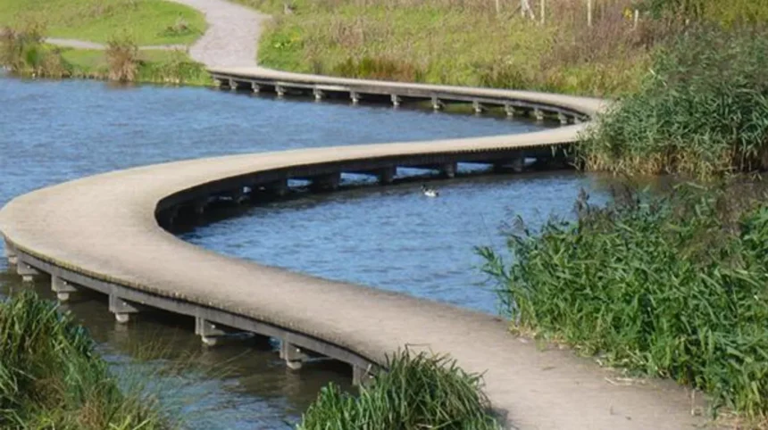
The Rhymney Trail passes through several different landscape environments, including riverside vegetation, reed beds, wildflower meadows and open floodplain areas.
These habitats provide opportunities to observe birds, plants and other wildlife.
Important features include:
- Riverside embankments.
- Reed beds.
- Wildflower meadows.
- Wetland habitats.
- Open playing fields.
- Woodland paths.
- Historic buildings and landscape features.
The lower landscape also connects with the Wentlooge Levels, an area of reclaimed coastal land protected by a sea wall.
The combination of natural and historic features makes the trail relevant to people interested in Cardiff’s environmental and cultural geography.
Is the Rhymney Trail Suitable for Walking and Cycling?
The Rhymney Trail includes sections suitable for both walking and cycling, although some sections contain steep slopes, uneven surfaces and access limitations.
One documented section runs between Rumney Hill Gardens and the Pontprennau underpass. The route passes through open green spaces and follows the river corridor.
Outdoor Cardiff also identifies a circular walking route of approximately 3.6 kilometres around Rumney Hill Gardens.
This circular route provides an option for visitors who want a shorter outdoor activity without completing a longer journey along the river.
Some sections are unsuitable for certain wheelchair users because of steep slopes and footbridge access. Visitors should check individual route conditions before travelling.
Where Can Visitors Start the Rhymney Trail?
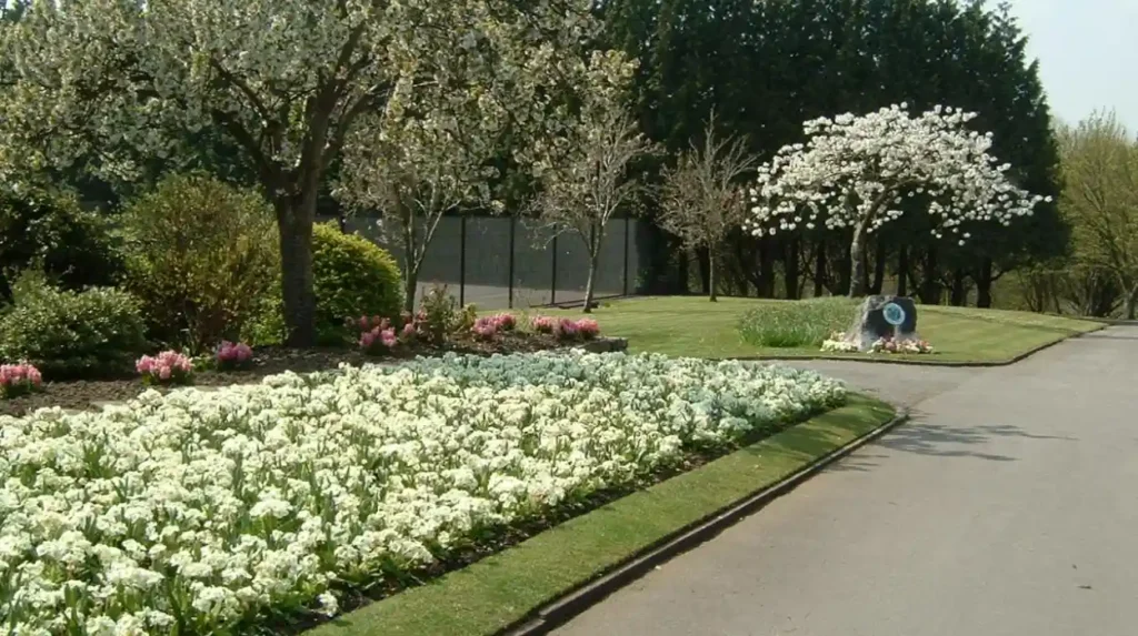
Rumney Hill Gardens provides an accessible starting point for exploring one of the documented sections of the Rhymney Trail.
The gardens are located on Rumney Hill on the eastern side of the River Rhymney.
The park was established during the 1950s to serve the expanding residential community of Llanrumney.
Its facilities include tennis courts, a bowling green, landscaped gardens and woodland paths.
The trail also connects with surrounding neighbourhoods, including Rumney, Llanrumney and areas towards Pontprennau.
Outdoor Cardiff provides route descriptions and downloadable publications covering the trail’s wildlife, history and recreational features.
What Wildlife and Natural Habitats Are Found Along the River Rhymney?
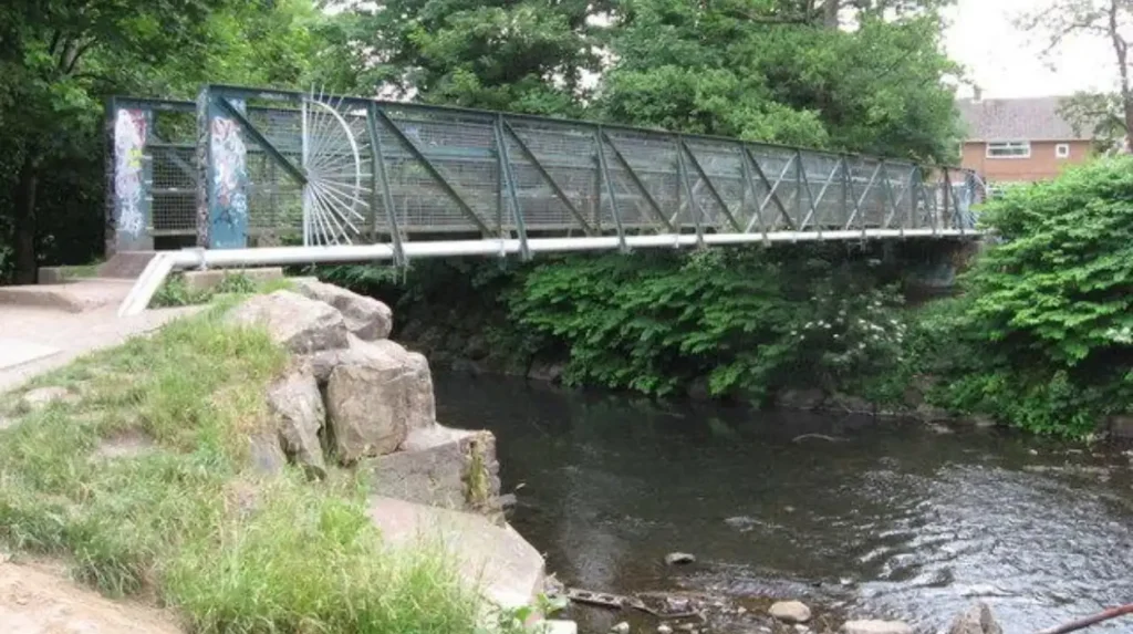
The River Rhymney supports wildlife through its river channel, surrounding wetlands, reed beds, floodplain grasslands and woodland habitats. These environments provide feeding, shelter and breeding opportunities for birds, aquatic organisms, insects and other native wildlife.
The river is an important ecological corridor in eastern Cardiff. An ecological corridor is a connected natural area that allows wildlife to move between habitats.
The River Rhymney’s lower course contains a mixture of wetland and grassland environments. These habitats are particularly important because Cardiff’s urban development has reduced and fragmented many natural landscapes.
The river corridor provides a connection between inland green spaces and the coastal habitats of the Severn Estuary.
Which Birds Live Near the River Rhymney?
The River Rhymney and its surrounding wetlands support different bird species, particularly around reed beds, open water and the Wentlooge Levels.
Birds associated with these environments include:
- Herons, which feed in shallow water and along riverbanks.
- Kingfishers, which hunt small fish near suitable river sections.
- Moorhens, which use vegetated water margins.
- Ducks, which occupy suitable wetland and open-water habitats.
- Wading birds, which feed in muddy coastal and estuarine environments.
The Rhymney Trail’s wildlife information identifies herons and birds associated with the Severn Estuary as notable wildlife around the lower river landscape.
The availability of food, vegetation and sheltered habitats influences where these species occur.
Why Are Reed Beds and Wetlands Important?
Reed beds and wetlands are important because they provide wildlife habitats, support aquatic food chains and help regulate water movement through the landscape.
Reed beds contain dense vegetation that provides nesting and shelter opportunities for birds and other wildlife.
Wetland areas also support insects and aquatic organisms that form part of the food chain.
The floodplain around the River Rhymney provides additional ecological functions. During periods of higher water levels, connected floodplain areas can temporarily store water and reduce pressure on downstream sections.
Wetland vegetation also helps trap sediment and intercept certain pollutants, although it does not replace the need for effective pollution prevention.
What Is the Ecological Importance of the Wentlooge Levels?
The Wentlooge Levels are low-lying coastal lands east of Cardiff that have been reclaimed from the sea and protected by coastal flood defences.
The landscape contains drainage channels known as reens, agricultural land, wetlands and coastal habitats.
These features create important environments for birds and other wildlife.
The relationship between the Wentlooge Levels and the River Rhymney demonstrates how natural waterways interact with human-managed coastal landscapes.
The area also has historical significance because its present-day geography reflects centuries of land reclamation and drainage management.
How Does the River Rhymney Affect Cardiff’s Flood Risk?
The River Rhymney contributes to flood risk in eastern Cardiff because rainfall from its upstream catchment flows towards low-lying urban and coastal areas. River levels, surface water drainage, tidal conditions and flood defences influence local flood exposure.
Flooding is an important environmental and planning consideration along the River Rhymney.
The river receives water from its wider catchment, which includes upland and urban areas across the South Wales Valleys.
Heavy rainfall increases the amount of water entering the river. When the channel cannot contain the incoming flow, water can spread onto surrounding floodplains.
The lower reaches of the river have additional considerations because they are close to the Severn Estuary.
Cardiff’s coastal geography, tidal conditions and low-lying land influence how water moves through eastern parts of the city.
Why Does the River Rhymney Flood?
River flooding occurs when the amount of water entering a river exceeds the capacity of its channel.
Several factors influence flooding along the River Rhymney.
Heavy rainfall: Prolonged or intense rainfall increases runoff from the catchment and raises river levels.
Urban development: Roads, buildings and paved surfaces reduce the amount of rainfall absorbed naturally into the ground.
Catchment geography: Steep valley landscapes can transfer rainfall rapidly into the river system.
Low-lying floodplains: The lower river landscape contains relatively flat land where floodwater can spread beyond the channel.
Tidal conditions: High water levels in the Severn Estuary influence drainage conditions around the river’s lower reaches.
These factors interact. Flood risk depends on rainfall, river conditions, drainage infrastructure and the location of individual properties.
What Is the Role of Flood Defences Along the River Rhymney?
Flood defences are structures and engineered measures designed to reduce the likelihood or consequences of flooding.
They include raised embankments, flood walls, barriers and other water-management infrastructure.
Natural Resources Wales is responsible for managing flood risk from designated main rivers, including the River Rhymney.
Cardiff Council also has responsibilities relating to local flood risk, including surface water and ordinary watercourses.
Flood defences reduce flood exposure but do not eliminate it. Extreme river flows, overtopping, structural failure and blocked drainage systems can still create flooding.
Natural Resources Wales includes flood defence locations and areas benefiting from defences in its Flood Risk Assessment Wales mapping service.
How Can Residents Check River Rhymney Flood Risk?
Residents can check their local flood exposure through the official Natural Resources Wales Flood Risk Assessment Wales map.
The service provides information about:
- River flooding.
- Sea and tidal flooding.
- Surface water flooding.
- Small watercourse flooding.
- Reservoir flooding scenarios.
- Flood defence locations.
The map uses high, medium, low and very low categories for relevant flood risks.
For river flooding, high risk represents an annual probability greater than 1 in 30. Medium risk represents between 1 in 100 and 1 in 30. Low risk represents between 1 in 1,000 and 1 in 100.
These classifications help residents understand the potential exposure of an area.
However, a flood-risk category does not provide a complete assessment of an individual property. Natural Resources Wales explains that its mapping identifies general area risks rather than guaranteeing whether a specific building will flood.
Residents should also distinguish between the Flood Risk Assessment Wales map and the Flood Map for Planning. The latter is the appropriate mapping resource for development-planning assessments.
What Is the Water Quality of the River Rhymney?
The River Rhymney has experienced significant historical pollution from mining, industrial activity, sewage and urban runoff. Environmental improvements have reduced some pressures, but water quality and ecological conditions remain important management priorities.
Water quality determines the condition of a river and its suitability for supporting aquatic life.
The River Rhymney has experienced substantial environmental pressure because its catchment contains industrial settlements, residential development and transport infrastructure.
Coal mining and iron production historically introduced pollutants into the river system.
Modern environmental pressures include urban runoff, wastewater discharges, misconnections and physical changes to the river channel.
Cardiff Council’s environmental assessments have identified water quality as an important issue affecting the city’s major rivers.
A 2021 sustainability appraisal described the Taff and Rhymney rivers and their catchments as being in moderate condition within the assessment it reviewed. This historical assessment should not be treated as a live 2026 water-quality classification.
What Causes Water Pollution in the River Rhymney?
Water pollution occurs when harmful substances enter a watercourse and affect its physical, chemical or biological condition.
The River Rhymney faces several recognised pollution pressures.
Historical industrial pollution: Coal washing, iron production and industrial wastewater introduced contaminants into the river during the industrial period.
Urban runoff: Rainwater flowing across roads, roofs and paved areas carries pollutants into drainage systems and waterways.
Wastewater discharges: Treated wastewater and problems within sewerage infrastructure influence river conditions.
Misconnected drainage: Incorrectly connected household or commercial drainage systems can allow wastewater to enter surface-water networks.
Minewater pollution: Water passing through abandoned mine workings can transport dissolved minerals and other contaminants into nearby watercourses.
These pressures can affect aquatic organisms, sediment quality and the wider river ecosystem.
Has River Rhymney Water Quality Improved?
Environmental regulation, changes in industrial activity and improvements to wastewater infrastructure have contributed to better conditions in many South Wales rivers.
The decline of heavy industrial activity reduced some of the historical pollution sources affecting the River Rhymney.
Improved pollution controls also increased the ability of environmental authorities to investigate and regulate harmful discharges.
However, improvement does not mean that every section of the river has achieved good ecological condition.
The Water Framework Directive provides an important framework for assessing river conditions across Wales and the wider European water environment.
It considers ecological and chemical factors when evaluating water bodies.
Natural Resources Wales publishes water-quality information through its Water Watch Wales service, which provides information about river classifications and environmental monitoring.
Why Is River Water Quality Important for Wildlife?
Water quality directly affects the survival and distribution of aquatic organisms.
Fish require suitable oxygen levels, water temperatures and habitat conditions. Aquatic invertebrates also depend on clean water and appropriate river habitats.
Pollution can reduce biodiversity, damage aquatic food chains and affect the ability of fish to reproduce.
Poor water quality also influences the wider environment because pollutants move through connected rivers, wetlands and estuarine habitats.
Protecting the River Rhymney therefore requires management across its entire catchment rather than focusing exclusively on the Cardiff section.
How Does the River Rhymney Connect with Cardiff’s Other Rivers?
The River Rhymney forms part of Cardiff’s wider river network alongside the River Taff and River Ely. These waterways drain different catchments and connect the city’s inland landscapes with the Severn Estuary.
Cardiff has three major river systems: the River Rhymney, River Taff and River Ely.
Each river has a different geographical route and relationship with the city’s landscape.
The Taff and Ely enter Cardiff Bay, which connects with the Severn Estuary through the Cardiff Bay Barrage.
The Rhymney follows a different route through eastern Cardiff and reaches the Severn Estuary near Lamby.
This distinction is important when understanding Cardiff’s drainage geography and flood-management arrangements.
What Is the Difference Between the River Rhymney and River Taff?
The River Rhymney and River Taff both originate in the South Wales uplands and flow southwards towards Cardiff, but they follow different catchments and reach the coast through different routes.
The River Taff passes through communities including Merthyr Tydfil, Pontypridd and Cardiff city centre.
It flows through central Cardiff before entering Cardiff Bay.
The River Rhymney passes through the eastern South Wales Valleys and reaches Cardiff through Rumney and Llanrumney.
Its lower course retains a more direct connection with the Severn Estuary.
How Is the River Ely Different from the River Rhymney?
The River Ely drains western parts of South Wales and passes through areas including Pontyclun, Talbot Green, Ely and western Cardiff.
It reaches Cardiff Bay rather than flowing directly into the estuary through the eastern coastal landscape.
The River Rhymney serves eastern Cardiff, while the River Ely has a stronger geographical relationship with western Cardiff.
Together with the Taff, these rivers demonstrate how different catchments shape the city’s natural geography.
What Is the Future of the River Rhymney in Cardiff?
The future of the River Rhymney depends on effective pollution control, habitat protection, flood-risk management and responsible urban development. Climate change and population growth increase the importance of maintaining a healthy river and connected floodplain.
The River Rhymney will remain an important environmental feature of eastern Cardiff.
Its future condition depends on decisions made across the wider catchment, including areas outside Cardiff’s administrative boundaries.
Environmental management must address water quality, wildlife habitats, drainage infrastructure and flood exposure together.
How Will Climate Change Affect the River Rhymney?
Climate change is expected to influence river environments through changes in rainfall patterns, temperatures and extreme weather events.
More intense rainfall increases the potential for rapid runoff and river flooding.
Higher temperatures can also affect water quality by increasing water temperatures and changing oxygen conditions.
At the lower end of the River Rhymney, rising sea levels create additional challenges for coastal flood management.
These pressures are particularly relevant to eastern Cardiff because of its low-lying floodplain and connection with the Severn Estuary.
Long-term flood planning therefore needs to consider river flows, tidal conditions and surface-water drainage together.
Why Is River Restoration Important?
River restoration involves improving the natural condition and ecological functioning of a watercourse.
Restoration measures include reconnecting floodplains, improving riverside vegetation, removing unnecessary barriers and creating suitable habitats.
The River Rhymney’s ecological corridor benefits from maintaining connections between riverbanks, wetlands and nearby green spaces.
Restoration also supports natural flood-management processes by improving the ability of surrounding landscapes to store and regulate water.
However, restoration projects require appropriate technical assessments because river engineering, flood protection and biodiversity objectives must work together.
How Can Local Communities Protect the River Rhymney?
Local communities contribute to river protection through responsible behaviour, environmental awareness and participation in conservation activities.
Residents can help by avoiding the disposal of rubbish, oils, chemicals and household waste into drains or waterways.
Reporting pollution incidents and damaged river infrastructure also supports environmental monitoring.
Local residents, schools and community groups can contribute to activities such as litter collection, wildlife monitoring and habitat improvement.
These actions complement the responsibilities of Cardiff Council, Natural Resources Wales and Welsh Water.
The long-term condition of the River Rhymney depends on cooperation between environmental organisations, local authorities, businesses and communities throughout its catchment.
Explore More Area Guide
River Ely Cardiff: History, Wildlife, Flood Defences and Guide
River Taff Cardiff: History, Attractions and Walking Guide
Why Should Visitors Explore the River Rhymney?
The River Rhymney offers visitors an opportunity to discover eastern Cardiff’s natural environment, local history and recreational green spaces. Its walking routes, wetlands, wildlife habitats and connections with nearby neighbourhoods make it an important outdoor destination.
The river provides a different perspective on Cardiff beyond its central attractions.
Visitors interested in nature can explore the surrounding floodplain, observe birds and discover wetland environments.
Walkers and cyclists can use the Rhymney Trail to explore the area’s green spaces and residential surroundings.
People interested in local history can also investigate how the river influenced settlement, agriculture and industrial development throughout South Wales.
Rumney Hill Gardens provides an additional recreational destination with landscaped gardens, woodland paths, tennis courts and a bowling green.
The river’s proximity to established residential communities makes it particularly useful for everyday outdoor recreation.
For tourists, the Rhymney Trail offers an opportunity to explore a less prominent part of Cardiff’s landscape while understanding the city’s relationship with its rivers and coastal environment.
Why Is the River Rhymney Important to Cardiff?
The River Rhymney is an important geographical, historical and environmental feature of Cardiff. Its journey from the South Wales Valleys to the Severn Estuary connects industrial communities, residential neighbourhoods, wetlands and coastal landscapes.
Its history demonstrates the environmental consequences of industrialisation and the importance of modern pollution controls. Its present-day landscape supports wildlife, walking, cycling and outdoor recreation.
The river also contributes to Cardiff’s wider flood-management system. Its catchment, floodplain and relationship with the Severn Estuary make responsible water management essential.
The Rhymney Trail, Rumney Hill Gardens and surrounding green spaces provide opportunities for residents and visitors to experience the river environment.
Protecting the River Rhymney requires continued cooperation between environmental organisations, local authorities and communities. Improvements to water quality, habitat conservation and flood resilience will remain central to maintaining this important natural resource for future generations.
Where is the River Rhymney located?
The River Rhymney is located in South Wales. It flows through the Rhymney Valley, Caerphilly and eastern Cardiff before reaching the Severn Estuary near Lamby.