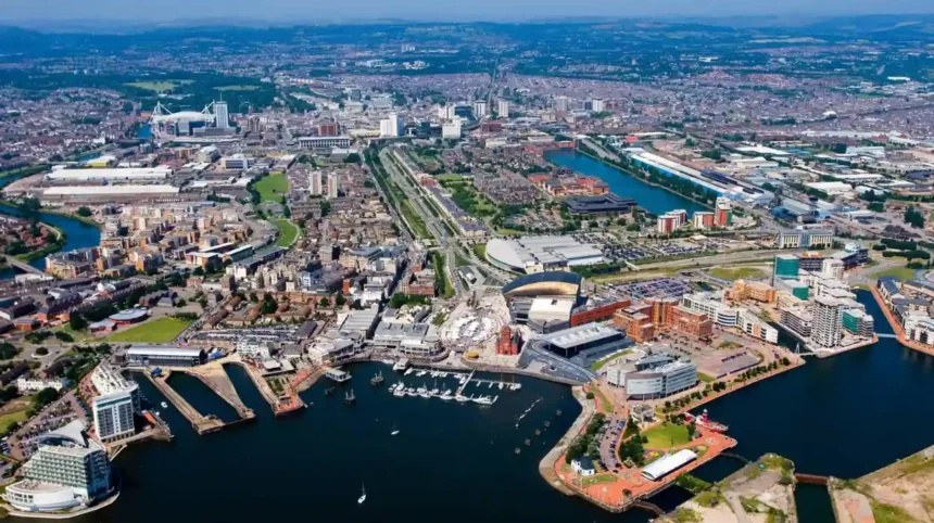
Cardiff flood risk is an important consideration for residents, homeowners, tenants, businesses, property buyers and developers. The Welsh capital faces several sources of flooding, including river flooding, coastal flooding, surface water flooding and drainage-related incidents. Its location beside the Bristol Channel and the River Taff, combined with low-lying urban areas and periods of heavy rainfall, creates different flood risks across the city.
- What does Cardiff flood risk mean?
- Which types of flooding affect Cardiff?
- Why is Cardiff vulnerable to flooding?
- Which areas of Cardiff require attention when assessing flood risk?
- Cardiff Bay and the coastal environment
- River Taff corridor
- River Ely corridor
- River Rhymney corridor
- Low-lying residential and urban locations
- What do Cardiff’s official flood-risk classifications mean?
- How can residents check their Cardiff flood risk by postcode?
- How to use the flood-risk map
- What is the difference between the two Welsh flood maps?
- Why should property buyers check flood history?
- What happened during major historical flooding events affecting Cardiff?
- Storm Dennis in February 2020
- Historical comparison with the 1979 floods
- What did Storm Dennis demonstrate?
- How does Cardiff protect communities from flooding?
- What responsibilities do Cardiff Council and Natural Resources Wales have?
- How do Welsh planning regulations address Cardiff flood risk?
- What is Technical Advice Note 15?
- What is a Flood Consequences Assessment?
- Why do developers need to consider future flood conditions?
- How does climate change affect Cardiff flood risk?
- What should Cardiff residents do to prepare for flooding?
- Check your property’s flood exposure
- Register for flood warnings
- Prepare an emergency flood plan
- Protect the property
- How should residents report flooding in Cardiff?
- What is the future of flood-risk management in Cardiff?
Understanding Cardiff flood risk requires more than identifying properties close to rivers or the coastline. Flooding also affects roads, residential streets, commercial areas, public infrastructure and green spaces. Heavy rainfall can overwhelm drainage systems, while high tides and storm conditions increase pressure on coastal defences.
Natural Resources Wales (NRW) provides national flood-risk information, while Cardiff Council manages important aspects of local flood prevention, drainage and flood-risk planning. These organisations work within the wider Welsh flood and coastal erosion management framework. naturalresources.wales+2
This guide explains the main causes of flooding in Cardiff, the areas and environments requiring attention, historical flood events, official risk classifications, flood protection measures and the practical steps residents can take to understand and manage their exposure.
What does Cardiff flood risk mean?
Cardiff flood risk describes the likelihood and potential consequences of flooding affecting properties, roads, infrastructure and communities across the Welsh capital. It includes flooding from rivers, the sea, surface water, small watercourses and reservoirs, with exposure varying according to location and local conditions.
Flood risk combines two important concepts: the probability of flooding and the consequences if flooding occurs. A location with a high probability of flooding does not automatically experience the greatest damage. Building design, flood depth, water speed, warning times and protective infrastructure also influence the consequences.
Cardiff’s geographical position creates several distinct flood-risk conditions. The city sits near the Severn Estuary and Bristol Channel, while the River Taff runs through its urban centre. The River Ely and River Rhymney also form important parts of the city’s drainage environment.
These waterways collect rainfall from wider catchment areas before carrying water towards the coast. A catchment is the geographical area from which rainfall drains into a particular river or watercourse.
Urban development introduces additional drainage pressures. Roads, pavements, buildings and car parks replace natural ground surfaces with materials that allow less rainwater to soak into the soil. Water therefore moves across the surface more quickly during heavy rainfall.
Cardiff flood risk is consequently influenced by geographical, environmental and infrastructure-related factors. A property beside a river faces different conditions from a property on a hillside or a street where rainwater collects because of inadequate drainage.
Which types of flooding affect Cardiff?
Cardiff faces four principal categories of flood risk: river flooding, coastal flooding, surface water flooding and reservoir flooding. Each category has different causes, warning characteristics and potential consequences for homes, businesses, transport networks and public infrastructure.
Natural Resources Wales identifies rivers, the sea, surface water and small watercourses as the main sources represented in its national flood-risk mapping. Reservoir flood information is also available as a separate worst-case scenario.
River flooding
River flooding occurs when water levels rise beyond the capacity of a river channel. Heavy rainfall across a river catchment increases runoff and raises water levels downstream.
The River Taff, River Ely and River Rhymney are important waterways in Cardiff’s flood-risk environment.
River flooding affects low-lying land beside river channels and connected floodplains. A floodplain is an area of relatively flat land that naturally accommodates excess water when a river overflows.
The River Taff flows through central Cardiff towards Cardiff Bay. Its catchment extends beyond the city, meaning rainfall in upstream communities influences downstream river conditions.
The River Ely forms another significant drainage route through western Cardiff. Its surrounding areas include residential neighbourhoods, transport infrastructure and commercial development.
The River Rhymney enters eastern Cardiff before reaching the Severn Estuary. Its catchment includes communities beyond the Cardiff boundary.
River flooding can develop after prolonged rainfall or intense storms. Water levels rise when the volume entering a river exceeds the channel’s capacity.
Coastal and tidal flooding
Coastal flooding occurs when seawater moves inland during high tides, storm surges or combinations of high water levels and severe weather.
Cardiff’s southern coastline faces the Bristol Channel and the Severn Estuary. These waters experience substantial tidal variations.
A storm surge is an abnormal rise in coastal water levels caused by atmospheric pressure changes and strong winds. When a storm surge coincides with a high astronomical tide, pressure on coastal infrastructure increases.
Cardiff Bay and the surrounding waterfront are important locations within the city’s coastal environment. Coastal flood management therefore forms part of the wider protection strategy for Cardiff.
Tidal flooding differs from ordinary river flooding because coastal water levels influence the movement of water near estuaries and river mouths.
Surface water flooding
Surface water flooding happens when rainwater cannot drain away quickly enough through the ground, street drainage systems or natural watercourses.
This risk affects urban environments because buildings and paved surfaces reduce natural water absorption.
Heavy rainfall can create standing water on roads, pavements, car parks and residential streets. Water also travels downhill and collects in depressions or poorly drained areas.
Surface water flooding is particularly difficult to predict at individual street level because rainfall intensity and local drainage conditions change rapidly.
Reservoir flooding
Reservoir flooding involves the release of stored water following a reservoir failure or other major structural incident.
Natural Resources Wales provides maps showing the areas that could be affected by a large reservoir failure. These maps represent a worst-case scenario rather than the likelihood of an actual incident.
The agency defines a large reservoir for this mapping purpose as one holding more than 10,000 cubic metres of water.
Reservoir flooding is considered extremely unlikely. However, its potential consequences justify emergency planning and public awareness.
Why is Cardiff vulnerable to flooding?
Cardiff’s flood vulnerability results from its coastal location, major river catchments, low-lying land, urban development and exposure to intense rainfall. These factors interact, creating different levels of flood exposure across residential neighbourhoods, commercial districts and transport corridors.
Cardiff occupies a geographical position where inland river systems meet a tidal coastal environment. This creates an interconnected drainage system influenced by rainfall, river levels and coastal conditions.
The River Taff and River Ely transport water towards the Bristol Channel. The River Rhymney provides another major drainage route in eastern Cardiff.
Low-lying coastal geography
Low-lying land near the coast faces additional challenges during high tides and storm conditions.
Water levels in estuarine environments respond to tidal cycles. Strong winds and atmospheric pressure changes increase coastal water levels during storms.
These conditions place pressure on sea walls, embankments, tidal structures and drainage outlets.
Urban development
Cardiff has experienced extensive residential, commercial and transport development. Urban expansion increases the area covered by roofs, roads and other impermeable surfaces.
Impermeable surfaces prevent rainfall from soaking naturally into the ground. This increases surface runoff and places additional demand on drainage infrastructure.
The speed at which rainwater enters drainage systems influences the severity of localised flooding.
River catchment conditions
Cardiff’s rivers receive water from catchments extending beyond the city.
Rainfall in upstream locations affects river levels further downstream. Consequently, flood conditions in Cardiff do not depend exclusively on rainfall recorded within the city itself.
Prolonged rainfall saturates soil and increases the amount of water entering rivers. Saturated ground absorbs less additional rainfall, increasing runoff.
Climate change
Climate change influences long-term flood management through changing rainfall patterns, extreme weather conditions and rising sea levels.
Natural Resources Wales identifies increasing risks associated with extreme rainfall and sea-level rise in its national flood-risk assessments. Its 2025–2026 annual reporting also identifies substantial projected increases in properties exposed to river, coastal and surface water flooding across Wales by 2120. These are national projections, not Cardiff-specific property forecasts.
Which areas of Cardiff require attention when assessing flood risk?
Flood-risk assessment in Cardiff should consider neighbourhoods near the River Taff, River Ely, River Rhymney and coastal areas around Cardiff Bay. Low-lying streets, river corridors and locations with surface-water drainage problems also require individual postcode-level checks.
Flood exposure varies considerably across Cardiff. Proximity to a river or coastline provides an initial indication of potential exposure, but it does not establish the actual risk to an individual property.
Cardiff Bay and the coastal environment
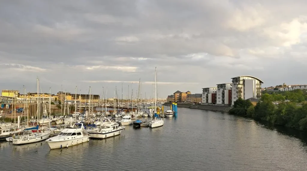
Cardiff Bay occupies a prominent position in the city’s southern waterfront. Its relationship with the Bristol Channel makes coastal and tidal conditions important considerations for flood management.
The Cardiff Bay Barrage is a major piece of infrastructure designed to maintain water levels within the bay. Cardiff Council identifies the barrage as one of the city’s flood-prevention measures.
Coastal risk assessment also considers tidal conditions, storm surges, drainage arrangements and the performance of flood defences.
River Taff corridor
The River Taff passes through central Cardiff before reaching Cardiff Bay. Its floodplain and surrounding urban development form an important part of the city’s river flood-risk environment.
Areas beside the river require consideration of river levels, floodplain characteristics and the location of existing defences.
Upstream rainfall also influences conditions along the Taff. Heavy rainfall in the wider catchment increases the volume of water flowing towards Cardiff.
River Ely corridor
The River Ely drains western parts of the Cardiff region. Its route connects surrounding communities with the coastal environment.
Properties and infrastructure near the river require assessment of river flooding and local surface-water conditions. Drainage problems also require attention where smaller watercourses connect with the main river system.
River Rhymney corridor
The River Rhymney flows through eastern Cardiff towards the Severn Estuary. Its catchment extends beyond the city, creating a connection between rainfall in surrounding communities and downstream water levels.
The river corridor requires attention during periods of prolonged rainfall and high river flows.
Low-lying residential and urban locations
Flooding is not restricted to properties immediately beside major rivers. Residential streets, underpasses, commercial premises and road junctions also experience surface-water problems.
Local depressions collect rainwater when drainage capacity becomes insufficient. Blocked gullies and overloaded drains increase the likelihood of standing water.
Residents should therefore examine individual property addresses rather than relying on general descriptions of neighbourhood flood risk.
What do Cardiff’s official flood-risk classifications mean?
Natural Resources Wales classifies river and surface-water flood probabilities as high, medium, low or very low. These categories describe the annual probability of flooding and help residents understand exposure without guaranteeing that flooding will occur or remain absent.
The Flood Risk Assessment Wales Map provides the main public resource for examining present-day flood exposure.
Natural Resources Wales uses annual exceedance probability to describe the chance of a particular flood event occurring in any given year.
The classifications are as follows:
- High risk: Greater than a 1-in-30 annual probability, equivalent to more than 3.3%.
- Medium risk: Between 1-in-100 and 1-in-30 annual probability, equivalent to 1%–3.3%.
- Low risk: Between 1-in-1,000 and 1-in-100 annual probability, equivalent to 0.1%–1%.
- Very low risk: Less than a 1-in-1,000 annual probability, equivalent to below 0.1%.
These classifications apply to the relevant mapped flood source. A property with low river-flood risk can still experience surface-water flooding.
What does a one-in-100-year flood mean?
A one-in-100-year flood describes an event with a 1% chance of occurring in any particular year.
It does not mean that flooding happens only once every 100 years. Two events with the same annual probability can occur in consecutive years.
Annual probabilities remain relevant throughout a property’s lifetime. A location with a 1% annual flood probability faces a cumulative probability of approximately 26% over 30 years, assuming a constant and independent annual probability.
This distinction helps homeowners understand why apparently infrequent flood events still require long-term preparation.
Why do flood defences influence risk classifications?
Flood-risk classifications account for the effect of existing flood defences where relevant.
A flood defence reduces the likelihood of flooding in the areas it protects. However, it does not eliminate all risk.
Defences can become overwhelmed, overtopped or damaged. Water can also enter through alternative pathways, including drainage systems and nearby watercourses.
Residents should therefore examine both defended and undefended flood information when assessing property exposure.
How can residents check their Cardiff flood risk by postcode?
Cardiff residents can check their flood exposure through the Natural Resources Wales Flood Risk Assessment Wales Map. The online service provides postcode-based information about river, coastal, surface-water and reservoir flooding, alongside relevant flood-defence information.
The official mapping service is an essential starting point for residents, tenants, landlords, property buyers and business owners.
The map includes information about flood sources, flood-defence locations and areas benefiting from protective infrastructure.
How to use the flood-risk map
Residents can follow a straightforward process:
- Open the Natural Resources Wales Flood Risk Assessment Wales Map.
- Enter the Cardiff postcode or property location.
- Select the relevant address or map location.
- Examine the river, sea and surface-water flood layers.
- Review available flood-defence information.
- Examine the reservoir flood information separately.
- Record the results for future property or insurance discussions.
The map provides an overview of flood exposure. It does not replace a professional property-level flood assessment.
What is the difference between the two Welsh flood maps?
Natural Resources Wales provides two important mapping services with different purposes.
Flood Risk Assessment Wales Map
This map focuses on present-day flood risk and considers the effect of existing flood defences. It supports public awareness and household risk assessment.
Flood Map for Planning
This map supports planning decisions and considers future flood-risk conditions, including climate change. Its information helps planning authorities assess development proposals and the potential consequences of flooding.
The Flood Map for Planning also includes recorded flood extents, flood-defence information, reservoir information and coastal erosion information.
The two maps should not be treated as interchangeable. The present-day map is useful for understanding existing exposure, while the planning map supports development and land-use decisions.
Why should property buyers check flood history?
A postcode-level flood-risk assessment helps buyers identify potential issues before completing a purchase.
Property buyers should examine:
- Previous flood incidents affecting the property.
- Ground-floor and basement exposure.
- Distance from rivers and watercourses.
- Existing flood protection.
- Surface-water drainage conditions.
- Insurance availability and excess payments.
- Potential flood-related maintenance costs.
A professional survey provides additional information about building condition and previous water damage.
What happened during major historical flooding events affecting Cardiff?
Historical flooding demonstrates how extreme rainfall and rising river levels affect Cardiff and surrounding communities. Storm Dennis in February 2020 provides a significant example, when the Taff, Ely and Rhymney recorded exceptionally high flows and Cardiff experienced transport and waterfront disruption.
Flood history provides important evidence for understanding the city’s vulnerability.
Storm Dennis in February 2020
Storm Dennis affected Wales between 15 and 17 February 2020. The storm brought exceptionally heavy rainfall after a particularly wet winter.
Cardiff Council reported on 16 February that river levels in the Taff, Ely and Rhymney were receding. The council also confirmed that Michaelston Road remained closed following the event.
The authority reported the highest river flows recorded since Cardiff Bay impoundment. It also identified exceptionally high river levels further upstream on the River Taff.
The event demonstrated the importance of monitoring rainfall and river levels across entire catchments rather than focusing exclusively on conditions within Cardiff.
Historical comparison with the 1979 floods
The February 2020 flooding also prompted comparisons with the major flooding experienced in Wales in 1979.
A report presented to Rhondda Cynon Taf’s Major Incident Recovery Board in February 2020 recorded that Storm Dennis brought more than a month’s rainfall in 48 hours.
The report also documented 86 flood warnings, including two severe flood warnings, during the wider incident response.
These figures relate to the wider emergency response and should not be interpreted as Cardiff-only flood statistics.
What did Storm Dennis demonstrate?
The 2020 event highlighted several important flood-management issues.
First, extreme rainfall increases pressure on rivers across large catchments.
Second, high river flows create additional pressure on riverbanks, floodplains and nearby infrastructure.
Third, flooding affects more than residential buildings. Roads, public transport, waterfront facilities and commercial operations also experience disruption.
Finally, effective flood management requires coordination between local authorities, Natural Resources Wales, emergency services and water companies.
Historical flood events remain important when assessing future development and emergency preparedness.
How does Cardiff protect communities from flooding?
Cardiff uses a combination of engineered flood defences, river management, drainage maintenance, floodplains and sustainable drainage systems to reduce flood exposure. Cardiff Council and Natural Resources Wales coordinate important responsibilities covering local drainage, major rivers, coastal protection and emergency flood management.
Flood prevention requires different measures for different sources of flooding. A coastal defence does not automatically prevent surface-water flooding, while improved street drainage does not prevent a river from overtopping its banks.
Cardiff Bay Barrage
The Cardiff Bay Barrage is one of the city’s most recognisable water-management structures.
The barrage was developed to create a controlled freshwater environment within Cardiff Bay. Its operation also forms part of the city’s wider flood-management arrangements by helping to manage water levels within the bay.
Cardiff Council identifies the barrage as an important flood-prevention measure. It operates alongside other infrastructure and natural flood-management features.
Floodplains and green spaces
Floodplains provide space for excess river water during periods of high flows.
Cardiff uses designated green open spaces that accommodate additional water when river levels rise. These areas reduce pressure on developed locations by providing temporary storage for floodwater.
Natural floodplain management also supports biodiversity and creates additional green space for communities.
Drainage maintenance
Road gullies, culverts and drainage channels help remove rainwater from developed areas.
A gully is an opening that collects water from roads and directs it into drainage infrastructure. A culvert is a structure that carries water beneath roads, buildings or other obstacles.
Blocked gullies and culverts reduce drainage capacity. Cardiff Council undertakes drainage-related maintenance and encourages residents to report problems involving blocked drains and surface-water accumulation.
Sustainable Drainage Systems
Sustainable Drainage Systems (SuDS) manage rainwater by imitating natural drainage processes.
These systems reduce the volume and speed of surface runoff while supporting water quality and environmental benefits.
Common examples include:
- Rain gardens, which collect and absorb runoff from nearby surfaces.
- Permeable paving, which allows water to pass through its surface.
- Swales, which are shallow vegetated channels that transport and temporarily store rainwater.
- Attenuation ponds, which temporarily hold runoff before controlled discharge.
- Green roofs, which retain rainfall within vegetation and growing materials.
Cardiff Council explains that SuDS help maintain water quality and limit the total amount of water leaving a development site.
Since 7 January 2019, new developments with a construction area of 100 square metres or more have generally required sustainable drainage systems. Approval from the local authority acting as the SuDS Approving Body is required before construction begins, subject to the applicable requirements and exemptions.
What responsibilities do Cardiff Council and Natural Resources Wales have?
Cardiff Council and Natural Resources Wales have different but complementary responsibilities for flood management. Cardiff Council leads local flood-risk management for surface runoff and ordinary watercourses, while Natural Resources Wales manages important aspects of main-river and coastal flood risk.
Understanding these responsibilities helps residents report flooding to the correct organisation.
Cardiff Council
Cardiff Council acts as the Lead Local Flood Authority under the Flood and Water Management Act 2010.
Its responsibilities include:
- Managing local flood risk from surface water.
- Managing flood risk from ordinary watercourses.
- Preparing local flood-risk management strategies.
- Investigating qualifying flood incidents.
- Maintaining relevant local drainage infrastructure.
- Managing the approval of sustainable drainage systems.
The council also provides information about highway drainage, flooding reports and ordinary watercourse consent.
Cardiff adopted an updated Local Flood Risk Management Strategy in May 2025. The strategy establishes the council’s approach to managing local flood exposure and coordinating flood-risk actions across the city. cardiff.moderngov.co.uk+1
Natural Resources Wales
Natural Resources Wales is the principal environmental regulator responsible for important national flood and coastal risk management functions.
Its responsibilities include:
- Managing flood risk from designated main rivers.
- Managing coastal flood-risk functions.
- Providing public flood-risk maps.
- Issuing flood warnings and alerts.
- Maintaining relevant flood-risk information.
- Advising on flood-risk planning and environmental protection.
NRW also provides information about flood defences and areas benefiting from those defences.
Dŵr Cymru Welsh Water
Dŵr Cymru Welsh Water manages public sewerage infrastructure across Cardiff.
Sewer flooding occurs when wastewater or combined drainage systems become overwhelmed, blocked or damaged.
Residents experiencing flooding from public sewers should contact Welsh Water rather than assuming that Cardiff Council or Natural Resources Wales manages the problem.
Private drainage systems and water mains have separate reporting and maintenance arrangements.
How do Welsh planning regulations address Cardiff flood risk?
Welsh planning policy requires flood exposure and coastal erosion to be considered when assessing development proposals. Technical Advice Note 15 provides guidance for planning authorities, developers and other organisations on avoiding inappropriate development and improving resilience in areas exposed to flooding.
Planning decisions influence the city’s long-term flood resilience.
New housing, commercial buildings, transport infrastructure and public facilities can change how rainwater moves across the landscape.
Development on floodplains or in areas exposed to surface-water flooding requires careful assessment.
What is Technical Advice Note 15?
Technical Advice Note 15 (TAN 15) is Welsh Government guidance covering development, flooding and coastal erosion.
It supplements the policies contained in Planning Policy Wales and Future Wales.
The guidance uses flood-risk information to support decisions about the location, design and suitability of development.
The revised guidance was published on 1 April 2025 and updated on 20 March 2026.
What is a Flood Consequences Assessment?
A Flood Consequences Assessment (FCA) examines the potential effects of flooding on a proposed development.
It considers whether a development can remain safe during flood conditions and whether it increases flood risk elsewhere.
An FCA can examine:
- Existing and future flood probabilities.
- Flood depth and water velocity.
- Access and escape routes.
- Flood-warning arrangements.
- Effects on neighbouring properties.
- Drainage infrastructure.
- Flood-resilient building design.
The assessment provides technical evidence for planning decisions.
Why do developers need to consider future flood conditions?
A development designed only around present-day flood conditions does not fully address long-term exposure.
Climate change, sea-level rise and changes in rainfall patterns influence the performance of drainage and flood-defence infrastructure.
Planning assessments therefore consider future conditions over the expected lifetime of a development.
The Natural Resources Wales Flood Map for Planning includes information about future flood exposure and the potential effects of climate change.
How does climate change affect Cardiff flood risk?
Climate change increases the importance of long-term flood planning in Cardiff through rising sea levels, changing rainfall patterns and greater pressure on drainage infrastructure. These changes influence river, coastal and surface-water exposure and require continued investment in flood resilience.
Cardiff’s location beside the Bristol Channel makes sea-level rise an important consideration for long-term coastal management.
Increasing rainfall intensity also places additional pressure on rivers, culverts and urban drainage systems.
Rising sea levels
Sea-level rise increases the baseline water level along coastlines and estuaries.
Higher coastal water levels influence tidal flooding and the conditions experienced by coastal defences.
For Cardiff, long-term coastal planning needs to consider the relationship between the Bristol Channel, the Severn Estuary and the city’s waterfront infrastructure.
More intense rainfall
Intense rainfall produces large volumes of runoff over short periods.
Urban drainage networks face additional pressure when rainfall exceeds their capacity.
This increases the importance of sustainable drainage, green infrastructure and routine maintenance.
Long-term national flood projections
Natural Resources Wales’ 2025–2026 annual reporting identifies substantial projected increases in flood exposure across Wales by 2120.
Its projections indicate:
- More than 131,000 properties at risk of flooding from the sea.
- Nearly 131,000 properties at risk from rivers.
- More than 48,000 additional properties at risk from surface water and small streams.
These figures are national projections covering Wales. They do not represent the number of Cardiff properties expected to flood. naturalresourceswales.gov.uk
The figures demonstrate why flood-risk assessments must account for changing environmental conditions rather than relying exclusively on historical flood records.
What should Cardiff residents do to prepare for flooding?
Cardiff residents should understand their property’s flood exposure, register for relevant flood warnings, prepare essential emergency supplies and protect important household belongings. Early preparation improves safety and reduces potential property damage during river, coastal and surface-water flooding.
Household preparedness is an important part of flood resilience.
Residents do not need to live directly beside a river to benefit from flood planning. Heavy rainfall can affect streets and buildings away from major waterways.
Check your property’s flood exposure
Use the Natural Resources Wales flood-risk map to examine the property’s location.
Check all relevant flood sources rather than concentrating exclusively on river flooding.
Homeowners should also investigate previous incidents, insurance conditions and the availability of professional flood assessments.
Register for flood warnings
Natural Resources Wales provides flood warnings and alerts for eligible locations.
Residents should check whether their postcode falls within a warning service area and register for available notifications.
Official flood warnings help households prepare before conditions deteriorate.
Prepare an emergency flood plan
A household flood plan should identify important contacts, emergency supplies and safe evacuation arrangements.
Essential preparations include:
- Keeping important documents in waterproof storage.
- Preparing a torch, batteries and a portable phone charger.
- Storing essential medication safely.
- Keeping emergency contact details accessible.
- Moving valuable possessions away from ground-floor flood exposure.
- Identifying a safe route away from floodwater.
Residents should never walk or drive through floodwater. Water depth and current strength are difficult to judge, and submerged hazards create additional dangers.
Protect the property
Property-level flood protection helps reduce damage when water enters or approaches a building.
Useful measures include suitable door barriers, non-return valves, raised electrical equipment and waterproof storage.
Non-return valves help prevent wastewater from flowing backwards through drainage connections.
Sandbags can provide temporary protection in certain circumstances, but their effectiveness depends on installation, water depth and the flood pathway.
Residents should discuss suitable protection measures with qualified specialists.
Explore More Area Guide
Flood-Prone Areas of Cardiff: High-Risk Neighbourhoods and Safety Guide
Things to Do in Cardiff With Teenagers: Best Activities and Attractions
How should residents report flooding in Cardiff?
Residents should report flooding to the organisation responsible for the affected infrastructure. Cardiff Council handles local surface-water and highway drainage issues, Natural Resources Wales handles relevant river and coastal incidents, and Welsh Water handles public sewer and water-supply problems.
Reporting flooding quickly helps the responsible authority investigate problems and arrange appropriate action.
These reporting routes are published in Cardiff Council’s official flooding guidance.
When reporting an incident, provide the location, approximate time, affected road or property and available photographs where safe.
Residents should also report recurring drainage problems. Repeated flooding at the same location provides useful evidence for local flood investigations and infrastructure maintenance.
What is the future of flood-risk management in Cardiff?
The future of Cardiff flood management depends on maintaining existing defences, improving urban drainage, protecting natural floodplains and incorporating climate projections into planning decisions. Continued investment in resilient infrastructure and public preparedness remains essential for protecting homes, businesses and communities.
Cardiff’s flood-risk management will increasingly combine engineered infrastructure with natural water-management solutions.
The Cardiff Bay Barrage, river floodplains, drainage improvements and sustainable urban development all contribute to the city’s wider approach.
The council’s 2025 Local Flood Risk Management Strategy provides an important framework for coordinating local action.
Future priorities include improving drainage capacity, identifying vulnerable locations, maintaining flood defences and supporting sustainable development.
Residents also have an important role. Checking flood maps, understanding warning systems and preparing emergency plans improve community resilience.
Cardiff flood risk is not identical across the city. Individual properties experience different conditions depending on elevation, drainage, river proximity, coastal exposure and existing protection.
Understanding these differences is essential for making informed decisions about housing, insurance, development and emergency preparedness.
Is Cardiff at risk of flooding?
Yes. Cardiff faces river, coastal, surface-water and reservoir flood risks. Its location near the Bristol Channel and major rivers, including the Taff, Ely and Rhymney, creates different levels of flood exposure across the city.