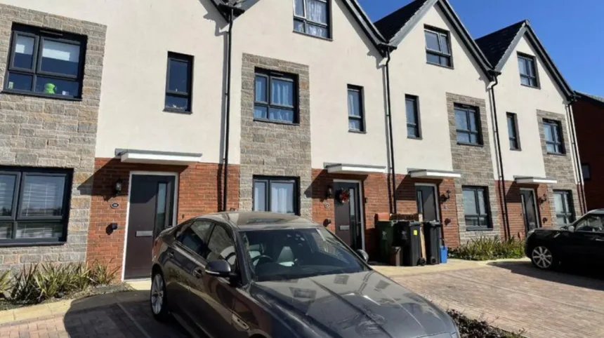
Cardiff is expanding through large-scale housing development, regeneration and new neighbourhood planning. The strongest growth is concentrated in north-west and north-east Cardiff, where strategic sites combine thousands of homes with schools, transport, employment, community facilities and green infrastructure.
- What is driving residential growth across Cardiff?
- Which Cardiff communities are growing the fastest?
- Why is north-west Cardiff one of the fastest-growing residential areas?
- How is Plasdŵr changing Cardiff’s western communities?
- Why is north-east Cardiff experiencing major residential growth?
- How is Pontprennau contributing to Cardiff’s housing expansion?
- Why is Creigiau becoming an important residential growth area?
- What role does the north of M4 Junction 33 play in Cardiff’s residential growth?
- How many new homes does Cardiff need through 2036?
- How does Cardiff’s population growth affect residential communities?
- What infrastructure is required for Cardiff’s fastest-growing communities?
- How is Cardiff balancing new housing with affordable housing?
- What does Cardiff’s housing growth mean for the future?
The city’s growth is part of a longer demographic trend. Census 2021 recorded Cardiff as one of Wales’s fastest-growing local authorities between 2011 and 2021, with population growth of 4.7%. Wales as a whole grew by 1.4% during the same period.
Cardiff’s current planning framework continues this expansion. The Cardiff Replacement Local Development Plan (RLDP) 2021–2036 proposes provision for 26,400 homes, including a core housing requirement of 24,000 dwellings and a 10% flexibility allowance. The plan also identifies 32,300 new jobs during the plan period.
Understanding Cardiff’s fastest-growing residential communities therefore requires more than looking at housebuilding alone. Population growth, planning allocations, infrastructure delivery, schools, transport connections and the scale of individual developments all indicate where residential change is strongest.
What is driving residential growth across Cardiff?
Cardiff’s residential growth is driven by population change, housing demand, strategic planning allocations, employment growth and major development sites. These factors concentrate new homes in planned communities such as north-west Cardiff, north-east Cardiff, Pontprennau, Creigiau and areas around major transport corridors.
Cardiff is Wales’s largest urban authority and a major employment, education and administrative centre. Its population growth creates sustained demand for housing.
The 2021 Census recorded Cardiff among the Welsh local authorities with the highest population growth between 2011 and 2021. Cardiff’s population increased by 4.7%, compared with 1.4% across Wales.
Housing demand is also connected to Cardiff’s economic role. Cardiff Council identifies the city as a major regional employment centre and has planned substantial additional employment and housing capacity through its development plans.
The adopted Cardiff Local Development Plan was approved in January 2016 and established the planning framework for managing land use and development through the plan period.
The replacement plan extends the strategic approach towards 2036. It places significant emphasis on sustainable neighbourhoods, regeneration, transport connections, active travel and infrastructure alongside new housing.
This approach explains why the fastest-growing residential communities are generally large planned developments rather than isolated housing schemes.
Which Cardiff communities are growing the fastest?
The largest planned residential growth is concentrated in north-west Cardiff, north-east Cardiff, Pontprennau, Creigiau and areas connected to major strategic sites. North-west Cardiff has a minimum allocation of 5,000 homes, while north-east Cardiff has around 4,500 homes planned.
Cardiff Council identifies eight strategic sites containing at least 500 dwellings or significant employment uses. These sites form an important part of the city’s planned housing expansion.
The largest residential allocations include:
- North-west Cardiff: minimum 5,000 homes.
- North-east Cardiff: around 4,500 homes.
- North of M4 Junction 33: around 2,000 homes.
- East of Pontprennau Link Road: around 1,300 homes.
- South of Creigiau: around 650 homes.
- Cardiff Central Enterprise Zone and regional transport hub: around 2,000 homes.
- Former Gas Works at Ferry Road: around 500 homes.
These allocations do not represent identical development stages. Some areas have substantial construction activity, while others remain part of longer-term delivery programmes.
Cardiff Council monitors planning applications, construction, completed homes and infrastructure commitments across the strategic sites.
The distinction is important. A planned allocation is not the same as completed housing. Construction rates vary according to planning approvals, infrastructure delivery, market conditions and site constraints.
Why is north-west Cardiff one of the fastest-growing residential areas?
North-west Cardiff is one of the city’s largest residential growth areas, with a minimum strategic allocation of 5,000 homes. The area includes Plasdŵr and surrounding communities, supported by new schools, roads, services, green spaces and neighbourhood infrastructure.
North-west Cardiff represents one of the clearest examples of planned suburban expansion in Wales.
Cardiff Council’s strategic-site monitoring identifies a minimum of 5,000 homes for North-west Cardiff alongside employment and community uses.
A major component is Plasdŵr, a large-scale new community located around areas including Radyr, Fairwater, St Fagans, Creigiau and surrounding parts of western Cardiff.
The Plasdŵr development is planned to deliver around 7,000 homes over the longer development period. The development promoter states that the community is designed around five neighbourhoods and includes apartments, terraced houses, linked homes and detached family properties. Up to 30% of the homes are planned as affordable housing.
The scale makes Plasdŵr one of the most significant residential projects in Cardiff.
Growth is not limited to housing plots. The planning model incorporates schools, roads, public spaces and other facilities.
Ysgol Gynradd Groes-wen Primary School opened in September 2023 to serve parts of north-west Cardiff. Cardiff Council states that the school provides 420 primary places and 96 part-time nursery places.
The school demonstrates how population growth affects public services. New housing generates demand for education, transport, drainage, utilities, parks and community facilities.
How is Plasdŵr changing Cardiff’s western communities?
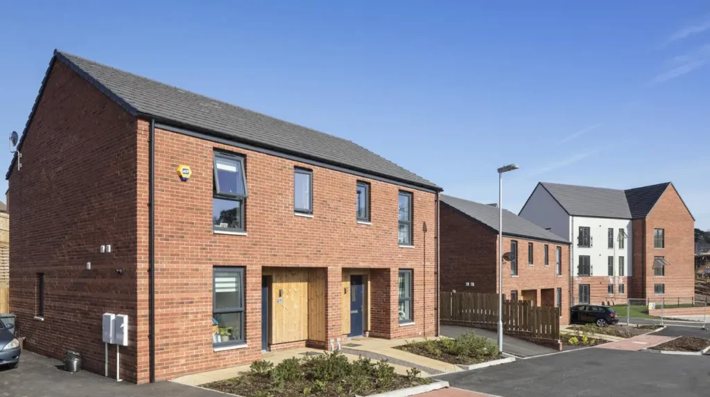
Plasdŵr is changing western Cardiff by creating a large planned residential community between established neighbourhoods and surrounding countryside. Its long-term programme includes around 7,000 homes, multiple neighbourhoods, affordable housing, new schools and supporting transport infrastructure.
Plasdŵr has introduced new residential development across an area previously characterised by a mixture of established communities, agricultural land and open space.
The development is designed as a series of neighbourhoods rather than one uniform housing estate. This structure supports different housing types and household needs.
The planned housing mix includes apartments, terraced properties, linked homes and detached houses. The development promoter states that up to 30% of the homes will be affordable.
Infrastructure is a central part of the development model. Cardiff Council’s strategic-site policy requires major developments to incorporate sustainable transport corridors, schools, community facilities and green spaces.
The scale of Plasdŵr also creates wider implications for established communities. Areas such as Radyr, Morganstown, Fairwater, Creigiau and St Fagans interact with the new development through transport, education and local services.
Cardiff Council records Plasdŵr as a land area subject to planning and land-use controls. Its local land-charge information identifies Plasdŵr within north-west Cardiff.
The development therefore represents both housing growth and spatial restructuring.
Why is north-east Cardiff experiencing major residential growth?
North-east Cardiff is another major residential growth corridor, with around 4,500 homes allocated to the strategic site west of Pontprennau and associated land around Lisvane and north-east Cardiff. The programme combines housing with employment and community infrastructure.
North-east Cardiff has been identified as a strategic growth location within Cardiff’s planning framework.
Cardiff Council lists North-east Cardiff, west of Pontprennau, as a strategic site with around 4,500 homes alongside employment and community uses.
The wider area includes established communities such as Pontprennau and Lisvane. New housing increases the scale and density of residential development around these existing settlements.
North-east Cardiff also benefits from connections towards the M4 and eastern Cardiff. Transport accessibility is therefore an important factor in its residential development pattern.
The planning framework does not treat housing as a standalone land use. Strategic sites are expected to provide infrastructure alongside development.
This includes community facilities, sustainable transport corridors and green infrastructure.
The scale of the allocation means north-east Cardiff is positioned as a major source of future housing capacity rather than a small infill location.
How is Pontprennau contributing to Cardiff’s housing expansion?
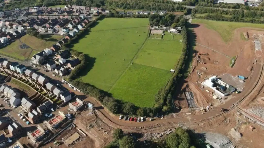
Pontprennau is contributing to Cardiff’s housing expansion through large strategic allocations east and north-east of the established urban area. The East of Pontprennau Link Road site alone is allocated for around 1,300 homes with associated community facilities.
Pontprennau has become an important part of Cardiff’s eastern housing geography.
The strategic planning framework identifies the East of Pontprennau Link Road site for around 1,300 homes. The allocation includes associated community uses.
The location is significant because it connects residential development with Cardiff’s wider eastern transport network.
The development pattern also links with the larger North-east Cardiff allocation.
Together, these sites demonstrate how housing growth is being concentrated around major planned corridors rather than distributed evenly across every Cardiff neighbourhood.
The effect is a gradual expansion of Cardiff’s built-up residential footprint.
Pontprennau also illustrates why infrastructure planning matters. Additional homes increase demand for roads, public transport, schools, walking routes, cycling routes, drainage and community services.
Cardiff Council’s strategic-site monitoring framework specifically tracks infrastructure secured through planning obligations and related projects.
Why is Creigiau becoming an important residential growth area?
Creigiau is becoming an important growth area because Cardiff’s strategic planning framework allocates around 650 homes south of the existing settlement. The development forms part of wider north-west Cardiff growth and increases demand for schools, transport and local services.
South of Creigiau is one of Cardiff’s smaller strategic housing allocations, with around 650 homes planned.
Its importance comes from its relationship with the much larger north-west Cardiff development area.
Creigiau sits close to major development activity around Plasdŵr and Llantrisant Road. New housing therefore contributes to a broader western growth corridor.
The expansion also affects education provision.
Cardiff Council established Ysgol Gynradd Groes-wen Primary School to support parts of north-west Cardiff, including areas around Creigiau, St Fagans, Radyr, Morganstown and Fairwater.
The school provides both Welsh-medium and dual-language educational provision.
This reflects the wider demographic and linguistic characteristics of Cardiff and the Welsh Government’s Cymraeg 2050 objectives.
Creigiau’s growth therefore forms part of a wider community-building process rather than a simple increase in housing numbers.
What role does the north of M4 Junction 33 play in Cardiff’s residential growth?
The strategic site north of M4 Junction 33 is allocated for around 2,000 homes alongside community uses, employment and a Park and Ride facility. Its location connects residential expansion with regional transport and employment infrastructure.
The M4 is a major strategic transport corridor serving south Wales and connecting Cardiff with Newport, Swansea and the wider motorway network.
Cardiff’s planning framework identifies land north of Junction 33 as a strategic development site.
The allocation provides around 2,000 homes, supported by community uses, employment and Park and Ride infrastructure.
This makes the site different from a conventional residential estate.
Its planning role combines housing with employment and transport functions.
The location also extends Cardiff’s urban development towards the north-western edge of the city.
The planned Park and Ride element is particularly relevant to sustainable transport. It provides a mechanism for people to connect into Cardiff without completing every journey by car.
The site demonstrates the relationship between housing supply and regional transport planning.
How many new homes does Cardiff need through 2036?
Cardiff’s Replacement Local Development Plan provides for 26,400 homes between 2021 and 2036. This comprises a 24,000-dwelling core requirement plus a 10% flexibility allowance of 2,400 homes to support delivery and housing choice.
The RLDP provides the principal framework for Cardiff’s future growth towards 2036.
The current evidence base identifies a 24,000-dwelling requirement for the 2021–2036 period. Cardiff Council adds a 10% flexibility allowance, producing total housing provision of 26,400 homes.
The latest housing background technical paper records 5,477 homes completed between 1 April 2021 and 31 March 2025.
It also records 2,336 homes under construction as of 1 April 2025.
A further 16,064 homes had planning consent but had not been implemented and were anticipated to contribute during the plan period. After applying a non-delivery allowance, the anticipated landbank was calculated at 15,187 homes.
These figures show why Cardiff’s growth is a long-term process.
The city is not relying on one development to satisfy housing demand. Multiple strategic sites, regeneration schemes, brownfield projects and smaller residential developments contribute to overall supply.
How does Cardiff’s population growth affect residential communities?
Population growth increases demand for homes, schools, transport, healthcare, retail, recreation and public services. Cardiff’s 4.7% population increase between 2011 and 2021 placed additional pressure on housing supply and reinforced the need for planned residential expansion.
Cardiff’s population growth is an important foundation for its housing strategy.
The 2021 Census showed that Cardiff increased by 4.7% between 2011 and 2021. This was the second-highest percentage increase among Welsh local authorities listed in the Welsh Government’s summary, behind Newport’s 9.5%.
Cardiff also had Wales’s highest population density at 2,572 residents per square kilometre in 2021.
High density creates a specific planning challenge.
The city must accommodate additional residents while protecting existing communities, managing infrastructure capacity and using land efficiently.
Housing type is also relevant.
Census 2021 data showed Cardiff had the lowest proportion of households living in three-bedroom accommodation among Welsh local authorities, at 38.8%. Cardiff also had a comparatively high proportion of households living in one- or two-bedroom accommodation.
This supports the importance of providing a varied housing mix.
What infrastructure is required for Cardiff’s fastest-growing communities?
Fast-growing communities require coordinated infrastructure including roads, public transport, schools, active-travel routes, drainage, utilities, parks and community facilities. Cardiff’s strategic-site planning system links major housing delivery with infrastructure through master planning and planning obligations.
Infrastructure is essential to the success of large residential communities.
Cardiff Council states that strategic sites use a master-planning approach to coordinate sustainable transport corridors, schools, community facilities and green spaces with new housing.
Planning obligations also contribute to infrastructure.
Section 106 agreements are legal agreements connected to planning permissions. They can secure contributions or works required to mitigate the effects of development.
Cardiff’s monitoring system tracks infrastructure agreed through these mechanisms.
Transport infrastructure is particularly important.
Large developments increase the number of daily journeys between homes, workplaces, schools, shops and community facilities.
The planning strategy therefore promotes alternatives to private cars through walking, cycling and public transport infrastructure.
Schools are another direct requirement.
Ysgol Gynradd Groes-wen Primary School demonstrates how new education capacity is incorporated into residential expansion. The school has capacity for 420 primary pupils and 96 part-time nursery places.
Explore More Area Guide
Cardiff Areas That Changed Most Since 2000 | Cardiff
Cardiff’s Richest Heritage Neighbourhoods: History & Landmarks 2026
How is Cardiff balancing new housing with affordable housing?
Affordable housing is an important component of Cardiff’s residential growth strategy. The Replacement LDP identifies affordable housing as part of overall provision, while large developments incorporate affordable homes alongside market housing to support a broader range of household incomes.
Cardiff faces affordability pressures associated with its role as a growing capital city.
Census 2021 recorded Cardiff as having the lowest overall home-ownership rate among Welsh local authorities, at 58.3%. It also had the highest proportion of households renting privately, including rent-free accommodation, at 24.3%.
These figures demonstrate the importance of housing tenure in understanding residential growth.
New communities therefore need different housing types and tenures.
Plasdŵr states that up to 30% of its approximately 7,000 homes will be affordable housing.
The Cardiff RLDP also provides for 6,000 affordable homes within its 26,400-home overall provision.
Affordable housing includes homes provided for households who cannot access suitable accommodation through the open market.
The combination of market and affordable housing supports mixed communities rather than developments designed exclusively for one income group.
What does Cardiff’s housing growth mean for the future?
Cardiff’s residential growth will continue to reshape the city through 2036 as strategic sites deliver new homes and infrastructure. North-west Cardiff, north-east Cardiff, Pontprennau and surrounding growth corridors remain central to the city’s long-term spatial development strategy.
The Replacement LDP provides the strongest indication of Cardiff’s future residential direction.
The plan is designed to shape development through 2036 and establish where new homes, employment, infrastructure and protected areas should be located.
The council’s latest housing evidence identifies 26,400 homes as the required provision for the plan period.
This means Cardiff’s growth is not a short-term housing cycle. It is a long-term planning programme.
North-west Cardiff is particularly significant because of its minimum 5,000-home strategic allocation and the larger Plasdŵr programme.
North-east Cardiff is also central, with around 4,500 homes planned west of Pontprennau and further housing capacity around the eastern growth corridor.
Pontprennau, Creigiau and the area around M4 Junction 33 add further housing capacity.
The future impact extends beyond property numbers.
New communities change school demand, transport patterns, retail requirements, recreational needs and the distribution of population across Cardiff.
The success of these areas therefore depends on coordinated delivery.
Cardiff Council’s strategic-site monitoring system provides a framework for tracking planning approvals, construction, completed homes and infrastructure.
For residents, buyers, renters and businesses, this makes development monitoring an important source of information.
For policymakers, the central challenge is ensuring that housing growth is matched by infrastructure and sustainable transport.
For the wider city, the expansion of these residential communities represents one of the most significant changes in Cardiff’s urban geography during the 2020s and into the 2030s.
Cardiff’s fastest-growing residential communities are therefore concentrated in identifiable strategic corridors rather than spread evenly across the city. North-west Cardiff and Plasdŵr stand out for their scale, while north-east Cardiff and Pontprennau form another major growth cluster. Creigiau and the M4 Junction 33 corridor add further capacity.
The evidence shows that Cardiff’s residential expansion is being shaped by population growth, strategic land allocations, infrastructure planning and long-term housing requirements. With 26,400 homes planned for the 2021–2036 period, the city’s residential geography will continue to evolve through planned neighbourhood development, regeneration and new housing delivery.
Which areas of Cardiff are growing the fastest?
The fastest-growing residential areas include north-west Cardiff, Plasdŵr, north-east Cardiff, Pontprennau and Creigiau. These locations contain major strategic housing allocations and large-scale developments supported by new infrastructure.