Cardiff has a layered heritage shaped by Roman settlement, medieval administration, religious institutions, coal exports, railway expansion, maritime migration, Victorian urbanisation and twentieth-century housing development. Its neighbourhoods preserve these different periods through churches, terraces, parks, docks, industrial buildings, historic streets and conservation areas.
- Why does Cardiff have such a diverse heritage across its neighbourhoods?
- Which Cardiff neighbourhood has the strongest medieval heritage?
- Why is Butetown essential to understanding Cardiff’s industrial heritage?
- How does Canton preserve Cardiff’s older and Victorian heritage?
- What makes Grangetown important in Cardiff’s heritage?
- Why is Roath one of Cardiff’s most distinctive heritage neighbourhoods?
- What heritage does Cathays contribute to Cardiff?
- Which Cardiff neighbourhoods preserve historic parks and designed landscapes?
- How does Cardiff protect its neighbourhood heritage?
- How did the coal industry shape Cardiff’s historic neighbourhoods?
- Why are Cardiff’s historic neighbourhoods important for understanding the city today?
- What are the most heritage-rich Cardiff neighbourhoods to explore?
Cardiff’s heritage is not concentrated around the city centre alone. Llandaff preserves medieval and ecclesiastical history. Butetown records the development of Cardiff Docks and its international maritime communities. Canton reflects medieval origins and Victorian expansion. Grangetown documents industrial growth and migration. Roath contains Victorian housing and historic parkland, while Cathays demonstrates the architectural ambition of Cardiff’s expansion.
Cardiff Council currently identifies 27 conservation areas, around 1,000 listed buildings, approximately 300 locally listed buildings, and 31 scheduled monuments within Cardiff. The city also contains 18 historic parks and gardens included on the Cadw Register of Landscapes, Parks and Gardens of Special Historic Interest.
These designations demonstrate the scale of Cardiff’s built and landscape heritage. They also explain why individual neighbourhoods are important for understanding how the Welsh capital developed.
Why does Cardiff have such a diverse heritage across its neighbourhoods?
Cardiff has diverse neighbourhood heritage because Roman, medieval, industrial, maritime, religious and Victorian development occurred across different parts of the city. Each period left distinctive buildings, streets, landscapes and communities, creating neighbourhood identities that remain visible today.
Cardiff occupies a strategically important position around the rivers Taff, Ely and Rhymney. The Roman military presence began around AD 55–60, when a fort was established near the site of modern Cardiff Castle. The Normans later reused the Roman site and established Cardiff as an administrative centre for the Lordship of Glamorgan.
The medieval settlement developed outward from Cardiff Castle. The town expanded southwards, while defensive banks, ditches and the River Taff shaped its boundaries. Museum Wales records surviving sections of the medieval town wall and explains that the modern street pattern retains traces of earlier development.
The greatest transformation arrived during the nineteenth century. Coal from the South Wales valleys turned Cardiff into a major international export port. The Glamorganshire Canal opened in 1794, a basin connected it to the sea in 1798, West Bute Dock opened in 1839, and the Taff Vale Railway opened in 1841.
Cardiff’s population, housing and infrastructure expanded alongside this industrial economy. Neighbourhoods near the docks developed strong maritime identities, while areas farther from the waterfront filled with Victorian and Edwardian housing.
This explains why Cardiff’s heritage is geographically varied. Different neighbourhoods preserve different stages of the city’s development.
Which Cardiff neighbourhood has the strongest medieval heritage?
Llandaff has one of Cardiff’s strongest medieval heritage identities, centred on Llandaff Cathedral, the historic village, ancient ecclesiastical landscape and surviving architectural character. Its heritage reflects centuries of religious activity and settlement predating Cardiff’s modern industrial expansion.
Llandaff developed around a major ecclesiastical centre. Llandaff Cathedral is the defining heritage landmark. The cathedral site has religious associations extending back many centuries, and the surrounding settlement retains a village character that contrasts with Cardiff’s denser urban districts.
The area’s historic importance is recognised through conservation controls. Cardiff Council lists Llandaff as a conservation area and provides a dedicated appraisal describing its architectural and historic character. Cardiff Road and Insole Court are also separately represented within the city’s conservation framework.
Llandaff’s heritage extends beyond individual buildings. Its historic value comes from the relationship between cathedral, village streets, older properties, open spaces and the River Taff landscape.
The neighbourhood also demonstrates how Cardiff absorbed older settlements as the city expanded. Modern Llandaff remains administratively part of Cardiff while retaining a distinct historic identity.
For heritage visitors, Llandaff provides evidence of Cardiff before the coal-export boom transformed the city. Its importance is therefore primarily ecclesiastical, architectural and settlement-based rather than industrial.
Why is Butetown essential to understanding Cardiff’s industrial heritage?
Butetown is central to Cardiff’s industrial heritage because it developed alongside the docks that exported South Wales coal worldwide. Its historic squares, dockside buildings, transport infrastructure and multicultural communities record Cardiff’s transformation into a major nineteenth-century maritime city.
Butetown is one of Cardiff’s most important maritime heritage neighbourhoods. Its development was closely connected to the expansion of Cardiff Docks and the coal-export economy.
The Bute family played a major role in dock development. West Bute Dock opened in 1839, followed by further dock expansion as Cardiff competed for South Wales coal exports. Roath Dock opened in 1887, and the Queen Alexandra Dock followed in 1907.
The industrial system connected valleys, railways, docks, warehouses and ships. Butetown sat at the centre of this network.
Mount Stuart Square is particularly significant. Cardiff Council identifies Mount Stuart Square as a conservation area within Butetown. The Pierhead is separately protected through conservation controls.
Butetown’s heritage is also social and cultural. Cardiff Docks attracted sailors, workers, merchants and migrants from different parts of the world. This produced a distinctive multicultural community that became an important part of Cardiff’s identity.
Museum Wales collections preserve photographic records documenting changes in Butetown and Cardiff’s docklands. One collection records the neighbourhood and redevelopment of the docklands through a photographic survey carried out in the twentieth century.
The industrial era ended gradually. Cardiff’s coal exports eventually ceased in 1964. The waterfront subsequently experienced major redevelopment, but important historic structures and streets continue to connect modern Cardiff Bay with its industrial past.
How does Canton preserve Cardiff’s older and Victorian heritage?
Canton combines medieval origins with substantial nineteenth-century urban development. Its historic identity comes from an older settlement absorbed into expanding Cardiff, followed by Victorian housing, commercial streets, churches and buildings that document the city’s rapid nineteenth-century growth.
Canton has a particularly useful heritage story because it demonstrates the transition from rural settlement to urban neighbourhood.
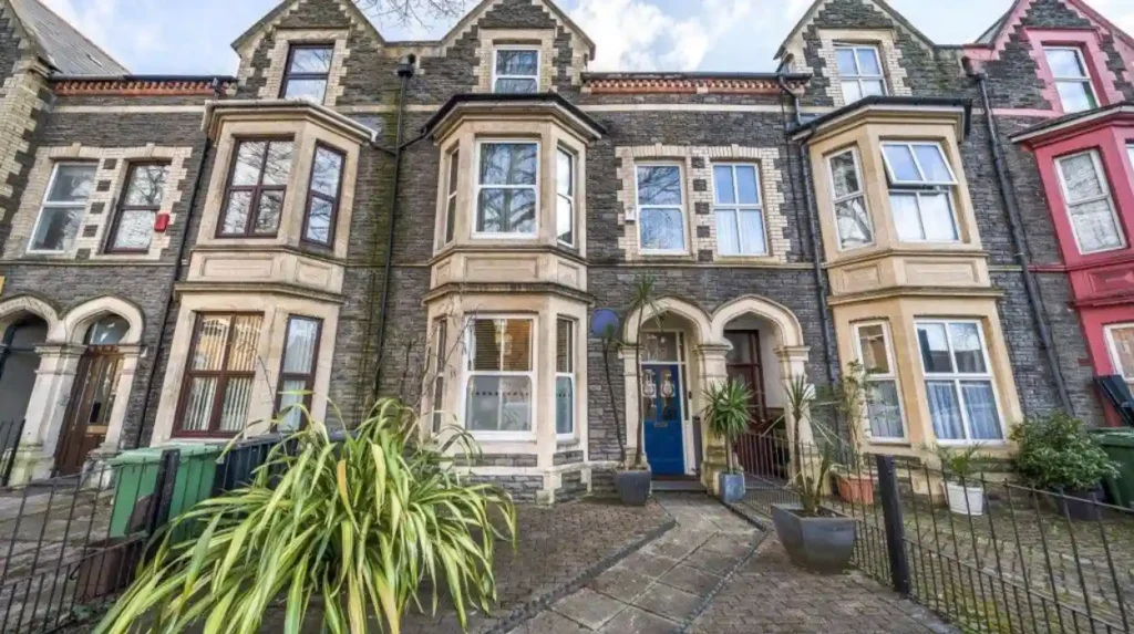
Museum Wales describes Canton as a medieval hamlet that was primarily developed during the late nineteenth century as Cardiff expanded. Much of its domestic architecture was constructed within a relatively short period, producing consistent patterns of building materials and architectural form.
The neighbourhood became increasingly integrated into Cardiff during the period of rapid urban growth. Victorian expansion produced terraces, shops, public buildings and transport connections.
Canton’s historic environment also reflects the wider materials used across Cardiff. Pennant sandstone and brick were common, while Bath Stone appeared in architectural dressings. Other geological materials also occur in individual buildings.
The significance of Canton is therefore not limited to a single landmark. Its heritage is embedded within the streetscape.
Canton also forms part of Cardiff’s contemporary administrative geography. Cardiff Council places Canton within the Cardiff South West planning area alongside areas such as Ely, Caerau and Riverside.
This neighbourhood is particularly important for understanding how nineteenth-century Cardiff grew beyond its medieval core.
What makes Grangetown important in Cardiff’s heritage?
Grangetown is important because its history connects Cardiff’s industrial expansion, railway infrastructure, housing growth and international migration. Its nineteenth-century streets and community institutions demonstrate how workers and migrant families helped build the modern city around the docks and transport networks.
Grangetown developed during Cardiff’s period of rapid industrialisation. Its location south of the central city placed it close to docks, railways, industrial workplaces and the River Taff.
The neighbourhood became a residential area for people working within Cardiff’s expanding economy. Housing growth produced dense terraces and streets characteristic of Victorian and Edwardian Cardiff.
Grangetown’s heritage is also strongly connected to migration. Cardiff’s docks were international workplaces, and communities from different parts of the world settled around the port. Grangetown became one of the areas where this multicultural development became particularly visible.
The neighbourhood therefore provides evidence of both economic and social transformation. Industrial Cardiff required large numbers of workers, and residential districts such as Grangetown supplied the housing and community infrastructure needed for this expansion.
Cardiff Council identifies Grangetown as part of the Cardiff City and South neighbourhood planning area alongside Butetown, City Centre and part of Cathays.
Its heritage remains relevant because modern regeneration and infrastructure projects continue to interact with a built environment shaped by nineteenth-century industrial development.
Why is Roath one of Cardiff’s most distinctive heritage neighbourhoods?
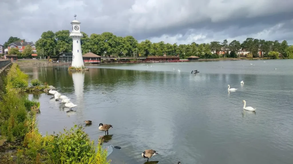
Roath combines Victorian and Edwardian residential architecture with historic parks, gardens and community buildings. Its heritage is especially visible through Roath Park, Roath Park Lake, Roath Mill Gardens and surrounding streets that expanded as Cardiff became a major industrial city.
Roath is one of Cardiff’s strongest examples of planned suburban expansion.
The neighbourhood grew substantially during the nineteenth and early twentieth centuries. Large numbers of homes were constructed as Cardiff’s population increased, producing the terraces and villas that remain characteristic of the district.
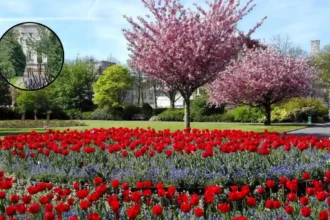
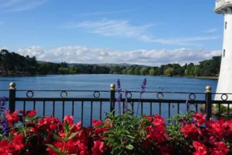
Its heritage is particularly significant because Cardiff Council identifies Roath Park, Roath Mill Gardens, and Roath Park Lake and Gardens within its conservation framework.
Roath Park is more than an urban recreational space. It represents the development of municipal parks as Cardiff expanded. Historic landscapes became important elements of the city’s public infrastructure.
The park also demonstrates the relationship between residential development and open space. Streets of Victorian and Edwardian houses surround a major historic landscape, creating a distinctive urban environment.
The wider Roath area contains numerous buildings associated with Cardiff’s expanding middle-class and working-class communities. Architectural details include bay windows, brick façades, decorative stonework and traditional terraces.
Roath therefore provides a strong example of how Cardiff’s industrial wealth influenced not only docks and factories but also residential neighbourhoods and public landscapes.
What heritage does Cathays contribute to Cardiff?
Cathays preserves the architectural history of Cardiff’s late nineteenth- and early twentieth-century expansion. Its terraces, civic buildings, Cathays Park and surviving historic streets illustrate how Cardiff developed planned residential and institutional districts beyond its medieval urban core.
Cathays became increasingly urban as Cardiff expanded during the Victorian period. The district contains substantial residential architecture alongside major civic and institutional buildings.
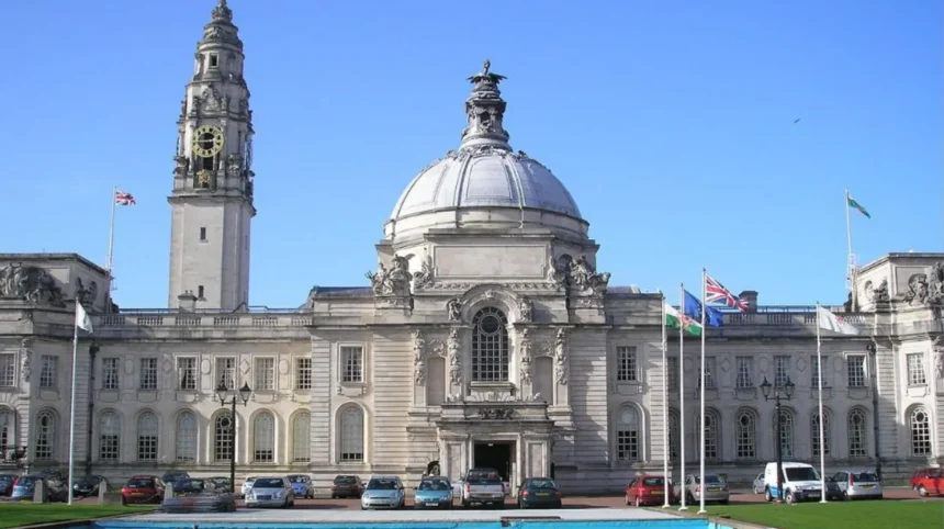
Cathays Park is particularly important. Its development reflected Cardiff’s increasing economic and political status during the late nineteenth and early twentieth centuries.
Cardiff Council includes Cathays Park within its conservation framework and identifies several conservation areas associated with the wider district, including Charles Street, Queen Street and other parts of the city-centre historic environment.
The architecture of Cathays demonstrates the social hierarchy of expanding Cardiff. Large houses, terraces, institutions and civic buildings occupied different parts of the growing district.
The neighbourhood also illustrates Cardiff’s transition from an industrial port into an increasingly important administrative and cultural centre.
The importance of Cathays is therefore architectural as well as historical. Its buildings demonstrate changing expectations around housing, education, civic administration and public space.
Which Cardiff neighbourhoods preserve historic parks and designed landscapes?
Several Cardiff neighbourhoods preserve important historic landscapes, including Roath, Penylan, Rhiwbina, Llandaff and St Fagans. These areas contain registered or conservation-protected parks, gardens and landscapes that add environmental and architectural depth to Cardiff’s heritage.
Historic landscapes form an important part of Cardiff’s heritage because they reveal how the city planned public space and residential environments.
Cardiff Council states that 18 Cardiff parks and gardens feature on the Cadw Register of Landscapes, Parks and Gardens of Special Historic Interest in Wales. Twelve are public parks, demonstrating the importance of municipal landscapes within the city’s heritage framework.
Roath Park is one of the best-known examples. Its landscape is associated with Roath and Penylan and forms part of the city’s protected historic environment.
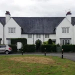
Rhiwbina Garden Village provides another distinctive example. Cardiff Council lists it as a conservation area because of its architectural and historic character.
St Fagans also has an important historic landscape identity. Its conservation area is included among Cardiff’s designated areas, while the wider locality is closely associated with the National Museum of History.
Historic landscapes matter because they preserve relationships between buildings, vegetation, roads, water features and open spaces. These relationships are often impossible to understand by studying individual listed buildings alone.
How does Cardiff protect its neighbourhood heritage?
Cardiff protects neighbourhood heritage through conservation areas, listed buildings, locally listed buildings, scheduled monuments, historic parks and planning controls. These mechanisms recognise architectural and archaeological significance and regulate changes that affect protected historic character.
Cardiff Council currently identifies 27 conservation areas across the city. Conservation areas are designated because of their special architectural or historic interest.
The city also contains around 1,000 listed buildings. Listing recognises special architectural or historic interest within the planning system. Alterations affecting the character of a listed building require Listed Building Consent.
Around 300 locally listed buildings are also recognised for local architectural or historic importance. Local listing provides a separate mechanism for identifying buildings that contribute to Cardiff’s character without having national listed status.
Scheduled monuments provide another level of protection. Cardiff contains 31 scheduled monuments, ranging from prehistoric archaeological remains to twentieth-century military defences. Works affecting scheduled monuments require appropriate consent from Cadw.
These mechanisms create a layered heritage system. A neighbourhood can contain nationally listed buildings, locally important structures, conservation areas, archaeological sites and historic landscapes simultaneously.
Planning controls therefore play an important role in retaining the physical evidence of Cardiff’s development.
How did the coal industry shape Cardiff’s historic neighbourhoods?
The coal industry transformed Cardiff from a relatively small settlement into a major international port. Canals, docks, railways, warehouses, housing and commercial districts expanded together, creating the industrial geography that shaped Butetown, Grangetown, Splott and surrounding neighbourhoods.
Cardiff’s industrial transformation accelerated from the late eighteenth century. The Glamorganshire Canal was completed in 1794, creating a transport connection between Cardiff and the industrial valleys. A basin was completed in 1798 to connect the canal with the sea.
The development of docks strengthened Cardiff’s position as a coal-export centre. West Bute Dock opened in 1839, while the Taff Vale Railway opened two years later.
Railway infrastructure connected Cardiff with the coalfields. Docks provided the facilities needed to load coal onto ships. Housing expanded to accommodate the growing workforce.
By 1862, South Wales coal exports had reached approximately 2 million tonnes annually. Cardiff’s port later handled more than 10 million tonnes in 1913, according to Museum Wales.
The coal economy influenced almost every aspect of urban development. Industrial wealth supported infrastructure, commercial buildings and residential construction, while dock employment encouraged international migration.
The decline of coal changed the city again. Cardiff’s coal exports finally ceased in 1964, ending an industrial era that had dominated the city for generations.
Modern neighbourhoods therefore contain physical evidence of both industrial expansion and post-industrial transformation.
Explore More Area Guide
Cardiff Garden Suburbs: The Story of Rhiwbina
Hidden Communities That Shaped Butetown: Cardiff History 2026
Why are Cardiff’s historic neighbourhoods important for understanding the city today?
Cardiff’s historic neighbourhoods explain how the modern capital developed through successive periods of settlement, religion, industry, migration, transport and urban planning. Their surviving buildings and landscapes provide physical evidence of economic and social changes that continue to shape the city.
Heritage has practical relevance beyond tourism. Historic buildings contribute to neighbourhood identity, architectural character and the understanding of local communities.
The distribution of Cardiff’s protected heritage demonstrates the city’s historical complexity. The Council’s conservation framework includes areas ranging from Llandaff and Mount Stuart Square to Rhiwbina Garden Village, Roath Park and Tredegarville.
Each represents a different phase of urban development.
Llandaff reflects ecclesiastical and medieval history. Butetown reflects maritime industry and migration. Canton records the transition from older settlement to Victorian suburb. Grangetown documents industrial housing and multicultural development. Roath demonstrates suburban growth and municipal landscape planning. Cathays records civic and residential expansion.
The result is a city where heritage exists at neighbourhood scale rather than only around major landmarks.
Understanding these districts also improves interpretation of Cardiff’s contemporary geography. Modern roads, residential areas, parks and commercial centres frequently follow patterns established during earlier periods.
Heritage protection therefore preserves physical evidence while providing a framework for understanding how Cardiff became the capital city of Wales.
What are the most heritage-rich Cardiff neighbourhoods to explore?
The strongest heritage-focused neighbourhoods include Llandaff, Butetown, Canton, Grangetown, Roath and Cathays. Each represents a distinct historical layer, from medieval religion and maritime industry to Victorian housing, migration, civic expansion and historic public landscapes.
For medieval and ecclesiastical heritage, Llandaff is the clearest choice. Its cathedral, historic settlement pattern and conservation area provide a concentrated record of Cardiff’s pre-industrial past.
For industrial and maritime history, Butetown is essential. Mount Stuart Square, the docklands and the Pierhead area demonstrate Cardiff’s transformation into a global coal-export port.
For Victorian neighbourhood development, Canton and Grangetown provide strong evidence. Their terraces, streets and community buildings reflect the rapid population growth associated with industrial Cardiff.
For historic parks and suburban development, Roath stands out. Roath Park and its surrounding residential streets demonstrate how public landscapes were incorporated into an expanding city.
For civic and architectural heritage, Cathays provides a different perspective. Cathays Park and surrounding streets reflect Cardiff’s growing institutional importance during the late nineteenth and early twentieth centuries.
Together, these neighbourhoods provide a chronological framework for understanding Cardiff. They demonstrate that the city’s heritage is not one period or architectural style. It is the accumulated result of Roman settlement, medieval administration, religious institutions, industrialisation, international trade, migration, suburbanisation and modern regeneration.
Cardiff’s neighbourhood heritage remains significant because these historical layers are still embedded in the city’s physical environment. Protected buildings, conservation areas, archaeological sites, parks and surviving streets allow residents and visitors to identify the processes that created modern Cardiff.
Which Cardiff neighbourhood has the richest local heritage?
Llandaff is one of Cardiff’s most historically significant neighbourhoods. Its heritage includes Llandaff Cathedral, medieval settlement features, historic buildings and a long ecclesiastical tradition that predates Cardiff’s industrial expansion.