
Cardiff’s railway history is closely connected to the development of the South Wales coal industry, the growth of its docks and the expansion of the city during the nineteenth and twentieth centuries. Before Cardiff became a modern capital with an extensive commuter railway network, its streets, industrial districts and surrounding valleys contained numerous railway lines, sidings, stations and junctions that have since disappeared.
- What Were Cardiff’s Lost Railways?
- Why Did Cardiff Develop Such an Extensive Railway Network?
- How Did the Taff Vale Railway Transform Cardiff?
- Why Did Competing Railway Companies Build Separate Routes?
- Which Historic Railway Routes in Cardiff Have Disappeared?
- 1. The Cardiff Railway
- 2. The Former Rhymney Railway Route
- 3. The Barry Railway Connections
- 4. Industrial Railway Sidings Around Cardiff Docks
- Which Cardiff Railway Stations Have Been Lost?
- How Did the Glamorganshire Canal and Railway Network Change Cardiff?
- What Happened to the Canal Near Cardiff City Centre?
- How Did the Canal Corridor Become Part of the Modern Road Network?
- What Remains of Cardiff’s Lost Railways Today?
- Former Cardiff Railway Corridor Around Coryton and Heath
- Taffs Well and Walnut Tree Viaduct
- Former Railway Routes Around Tongwynlais
- Why Did Cardiff’s Historic Railway Lines Close?
- How Did the Decline of the Coal Industry Affect Railways?
- How Did Road Transport Replace Railway Infrastructure?
- What Was the Impact of Railway Consolidation?
- How Can People Explore Cardiff’s Lost Railway History Today?
- Visit the Cardiff Bay Area
- Explore Tongwynlais and Taffs Well
- Use Historical Railway Maps and Photographs
- What Is the Historical Importance of Cardiff’s Lost Railways?
- How Did Railways Influence Cardiff’s Urban Development?
- Why Are Former Railway Corridors Important for Heritage Conservation?
- How Do Lost Railways Influence Future Transport Planning?
- What Can Cardiff’s Lost Railways Tell Us About the City’s Future?
These lost railways once transported coal, iron, industrial materials and passengers between Cardiff, the South Wales Valleys, coastal communities and major commercial centres. They belonged to competing railway companies, including the Taff Vale Railway, Rhymney Railway, Barry Railway and Cardiff Railway. Each company helped shape the city’s industrial geography and transport infrastructure.
Today, former railway routes survive in different forms. Some have become public footpaths, roads, housing developments and green corridors. Others remain visible as railway bridges, embankments, tunnels, abandoned cuttings and historic buildings.
Understanding Cardiff’s lost railways reveals how transport shaped the city’s development and explains why certain streets, neighbourhoods and landscapes look the way they do today.
What Were Cardiff’s Lost Railways?
Cardiff’s lost railways were former railway lines, stations, sidings and industrial connections that closed or disappeared during changes to transport and industry. They included routes associated with the Taff Vale, Rhymney, Barry and Cardiff Railway companies, connecting docks, valleys and communities.
The term lost railways describes railway infrastructure that no longer operates in its original form. It includes completely dismantled routes, closed passenger stations, abandoned freight connections and railway corridors converted into other uses.
Cardiff developed an extensive railway network because its docks became an important export centre for Welsh coal. Railway companies constructed routes to connect collieries in the South Wales Valleys with Cardiff’s waterfront and shipping facilities.
The city’s railway network also supported local passenger transport. Workers travelled between residential districts, industrial settlements and employment centres. Railway stations provided access to markets, workplaces and neighbouring towns.
Several railway companies operated competing services and infrastructure. The Taff Vale Railway connected Cardiff with Merthyr Tydfil and the wider Taff Valley. The Rhymney Railway provided connections to the Rhymney Valley and north-eastern coalfields. The Barry Railway developed an alternative route to Barry Docks, while the Cardiff Railway attempted to compete for coal traffic.
As industrial demand changed, railway companies consolidated and passenger and freight services declined on less profitable routes. Railway closures, infrastructure redevelopment and road construction gradually removed many historic railway features.
The surviving remains provide evidence of Cardiff’s industrial and transport history. Historic railway maps, archival photographs and local heritage records help identify routes that no longer appear on modern passenger railway maps.
Why Did Cardiff Develop Such an Extensive Railway Network?
Cardiff developed an extensive railway network because its docks required reliable connections with coalfields, ironworks and industrial settlements across South Wales. Railway companies built competing routes to transport minerals efficiently, support passenger movement and strengthen the city’s position as a major export port.
Cardiff’s railway expansion followed the growth of the South Wales coal industry. During the nineteenth century, coal production increased across the valleys, creating demand for efficient transport to coastal shipping facilities.
Before railways became dominant, the Glamorganshire Canal transported industrial goods between Merthyr Tydfil and Cardiff. The canal opened on 10 February 1794 and extended approximately 25.5 miles, connecting iron-producing communities with Cardiff’s port. The Royal Commission on the Ancient and Historical Monuments of Wales records its importance in the industrial development of the region. Coflein+1
Railways eventually provided greater capacity and operational flexibility for transporting heavy coal traffic.
How Did the Taff Vale Railway Transform Cardiff?
The Taff Vale Railway became one of the most influential railway companies in Cardiff’s development. Its first section opened in 1840, connecting Cardiff with settlements along the Taff Valley. The route subsequently extended towards Merthyr Tydfil and other industrial communities.
The railway transported coal, iron and passengers. It also supported the expansion of Cardiff’s docks by providing a direct connection between inland industrial production and maritime trade.
The Taff Vale Railway established branches and connections serving industrial districts throughout South Wales. Its infrastructure became an important part of the region’s transport system.
Why Did Competing Railway Companies Build Separate Routes?
Competition developed because Cardiff’s coal-export infrastructure generated substantial commercial opportunities.
The Rhymney Railway was incorporated in 1854. It connected industrial communities in the Rhymney Valley with the wider railway network and Cardiff.
The Barry Railway emerged from dissatisfaction with existing dock facilities and railway arrangements. Its development provided coalowners with an alternative export route through Barry Docks.
The Cardiff Railway was established in 1897 after the Bute Docks Company became the Cardiff Railway Company. It opened its principal route in 1909, attempting to provide another connection between the valleys and Cardiff’s docks.
These companies created a dense network of railway infrastructure. The resulting competition contributed to the development of routes, junctions, sidings and stations that later disappeared or changed function.
Which Historic Railway Routes in Cardiff Have Disappeared?
Cardiff’s historic railway network included several routes that have closed, including the Cardiff Railway, former Rhymney Railway connections and industrial branches around the docks. Their remains survive in former trackbeds, walking routes, road corridors, railway structures and redeveloped industrial areas.
The disappearance of Cardiff’s railways did not happen through one closure programme. Different routes closed at different times because of changing industrial requirements, railway consolidation, declining passenger demand and road development.
1. The Cardiff Railway
The Cardiff Railway was established to challenge the dominance of existing railway companies and improve access to Bute Docks. The company developed an approximately 11-mile route connecting Treforest with the Cardiff area.
The railway opened on 15 May 1909. Its route crossed the Glamorganshire Canal and connected with the Rhymney Railway at Heath Junction, north of Cardiff. It also obtained running powers that allowed access to its dock railway.
The company faced operational difficulties because it did not secure the full access to competing railway infrastructure that its promoters originally wanted. The route therefore struggled to achieve its intended commercial position.
Parts of the former Cardiff Railway corridor remain recognisable. The section between Coryton and Heath survives as part of the modern railway network, while other sections have disappeared or changed function.
The Welsh Railways Research Circle documents the company’s development and its relationship with Cardiff’s docks and competing railway companies. wrrc.org.uk+1
2. The Former Rhymney Railway Route
The Rhymney Railway connected Cardiff with industrial communities in the Rhymney Valley. Its infrastructure supported the transportation of coal and other minerals to Cardiff’s docks.
The company was incorporated on 14 July 1854. Its original railway connected Rhymney Iron Works with Hengoed, where it joined another railway network.
The Rhymney Railway also operated passenger services into Cardiff. Historic stations included Cardiff Adam Street and Cardiff Parade, which also appeared in historical records under the name Cardiff Crockherbtown.
These stations formed part of a railway system that served the expanding city before modern railway arrangements developed.
Sections of former Rhymney railway infrastructure have been dismantled. Some former railway corridors survive as walking routes, while others have been absorbed into modern transport infrastructure.
The Welsh Railways Research Circle provides historical information about the company’s incorporation, management and development.
3. The Barry Railway Connections
The Barry Railway developed an alternative transport connection between the South Wales coalfields and Barry Docks. Its expansion affected Cardiff because it provided competing facilities for coalowners and shipping businesses.
The Barry Dock and Railway Bill received Royal Assent on 14 August 1884. The new infrastructure helped establish Barry as an important coal-export centre.
The railway also developed connections with existing railway networks. Barry trains eventually gained access to Cardiff through connections involving Cogan, Grangetown and the city’s western railway infrastructure.
Historic passenger services used Cardiff Riverside and Clarence Road. These stations are particularly important when examining the railway history of Cardiff’s waterfront and southern districts.
The growth of Barry Docks reduced the dependence of some coalowners on Cardiff’s established dock facilities. This competition formed an important part of the changing railway geography of South Wales. wrrc.org.uk+1
4. Industrial Railway Sidings Around Cardiff Docks
Cardiff’s docks contained extensive railway infrastructure designed to move coal between freight trains, storage facilities and ships. These industrial connections included sidings, loading facilities, junctions and short connecting tracks.
Bute East Dock and Bute West Dock were important parts of Cardiff’s maritime economy. Railway connections allowed coal wagons to reach dockside loading facilities.
The decline of coal exports and changes to industrial transport reduced the need for many of these sidings. Redevelopment subsequently transformed large areas of former dockland.
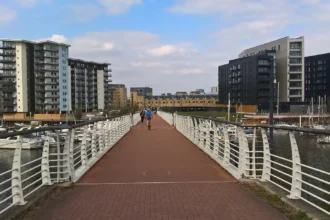
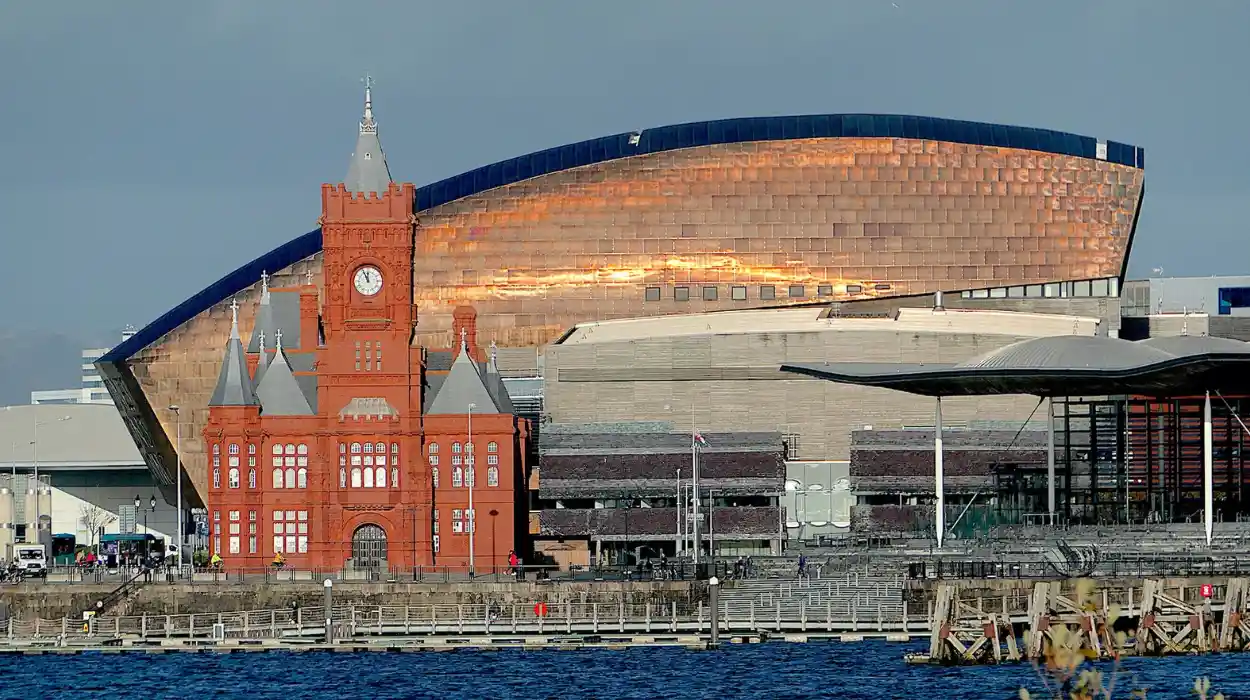
Cardiff Bay now contains commercial, residential, cultural and leisure developments across parts of this former industrial landscape. The disappearance of the original dock railways represents a major change in the city’s southern transport geography.

Which Cardiff Railway Stations Have Been Lost?
Cardiff once contained several railway stations that disappeared through closures, rebuilding or consolidation. Historic examples include Cardiff Adam Street, Cardiff Parade, Cardiff Riverside and Clarence Road, each associated with different railway companies and passenger services.
Railway stations were important centres of local transport during Cardiff’s industrial expansion. Their locations reflected the city’s developing residential districts, commercial streets and dockside employment areas.
Some stations closed because passenger services changed. Others became redundant when railway companies reorganised their operations or concentrated services at larger stations.
Cardiff Adam Street
Cardiff Adam Street was associated with the Rhymney Railway. Historical railway records identify it as an early station serving the city.
Its existence demonstrates that Cardiff’s passenger railway network was not always concentrated around the present-day Cardiff Central and Cardiff Queen Street stations.
The station belongs to an earlier period of railway development when competing companies operated separate facilities within the city.
Cardiff Parade
Cardiff Parade was another historic Rhymney Railway station. Railway records also associate it with the earlier name Cardiff Crockherbtown.
The station was used by Cardiff Railway trains from 1 March 1911. Historical railway documentation records the station’s changing names and company associations.
This station is particularly relevant to Cardiff’s urban history because it demonstrates how railway facilities operated close to the developing city centre.
Its history also reflects the complicated arrangements between railway companies that shared lines, stations and running rights.
Cardiff Riverside
Cardiff Riverside served passenger services associated with the Barry Railway and Taff Vale Railway.
It was connected with railway operations serving destinations such as Barry and Penarth. Historical records indicate that Riverside eventually became incorporated into the wider Cardiff General station arrangements.
The station’s history illustrates the gradual consolidation of passenger facilities around Cardiff’s principal railway station.
Cardiff Clarence Road
Clarence Road was another historic Cardiff passenger station associated with railway services serving the southern part of the city.
It was used by Barry Railway passenger services and formed part of the wider network connecting Cardiff with coastal destinations.
The station disappeared as railway operations changed and passenger facilities were reorganised.
Historic railway timetables and station records provide useful evidence of its former position within Cardiff’s transport network.
How Did the Glamorganshire Canal and Railway Network Change Cardiff?
The Glamorganshire Canal and railway network transformed Cardiff by connecting industrial communities with the port. As canals declined and railway transport expanded, former transport corridors were altered, abandoned or converted into roads and other urban infrastructure.
The Glamorganshire Canal played a major role in Cardiff’s early industrial development.
Opened in 1794, it connected Merthyr Tydfil with Cardiff and provided an important transportation route for iron and other industrial goods.
The canal became increasingly congested as industrial production expanded. Railways subsequently offered an alternative method of moving larger quantities of coal and other materials.
What Happened to the Canal Near Cardiff City Centre?
The canal originally passed through central Cardiff before reaching its southern waterfront connections.
Its route crossed areas around Mill Lane and the developing railway infrastructure. Historical photographs show how dramatically the city centre changed during the twentieth century.
The canal became disused and sections were filled in during the 1950s. The former waterway disappeared beneath later urban development.
History Points, working with Cardiff Libraries’ historical material, documents the former canal location at Mill Lane and its relationship with the railway and surrounding streets.
How Did the Canal Corridor Become Part of the Modern Road Network?
The canal and railway corridors influenced later road development because they had already established transport routes through the landscape.
The Glamorganshire Canal closed in sections. The Pontypridd-to-Cardiff section closed in 1942, while the Cardiff sea pound closed in 1951.
In the northern part of the Cardiff region, the former Cardiff Railway and canal corridor helped shape the route of the A470.
The road became an important connection between Cardiff and the South Wales Valleys. Its construction changed the appearance of areas that once contained railway tracks, canal infrastructure and industrial buildings.
What Remains of Cardiff’s Lost Railways Today?
Remains of Cardiff’s lost railways include former trackbeds, disused cuttings, historic railway structures, converted footpaths and altered transport corridors. These features provide physical evidence of routes that once carried industrial freight and passengers across Cardiff and neighbouring communities.
The disappearance of railway services did not remove every part of the infrastructure. Former track alignments frequently remained useful for walking routes, road construction and urban development.
Several locations around Cardiff and neighbouring areas retain identifiable railway features.
Former Cardiff Railway Corridor Around Coryton and Heath
The Cardiff Railway route between Coryton and Heath remains part of the modern railway network.
Other sections of its historic alignment have changed considerably. Former trackbeds, bridges and cuttings help explain the route’s original relationship with Cardiff’s surrounding landscape.
The area around Tongwynlais provides an example of how former industrial transport corridors have been reused.
Taffs Well and Walnut Tree Viaduct
Taffs Well provides an important example of the railway engineering that once connected Cardiff with the valleys.
The area contained several transport routes, including the Taff Vale Railway, Rhymney Railway connections, Cardiff Railway and Glamorganshire Canal.
The Walnut Tree Viaduct was constructed in 1901 for the Barry Railway connection. Designed by Sir James Szlumper, it measured approximately 1,548 feet in length and stood around 120 feet high.
The structure consisted of seven steel lattice-girder spans supported by brick piers. It dominated the landscape for almost 70 years before its demolition in 1969. Two of its pillars survived.
The former railway landscape changed substantially as the A470 developed along the valley corridor.
This location demonstrates the scale of engineering investment associated with South Wales’s historic railway network.
Former Railway Routes Around Tongwynlais
Tongwynlais contains important evidence of the relationship between the Cardiff Railway and Glamorganshire Canal.
The Cardiff Railway crossed the canal in the area and provided an alternative route towards Cardiff’s docks.
The former Tongwynlais station served the local community. Its location was south of the canal bridge, with access from Iron Bridge Road.
The railway corridor eventually became part of a wider landscape shaped by road construction and urban change.
History Points documents the former railway alignment and its relationship with the canal.

Why Did Cardiff’s Historic Railway Lines Close?
Cardiff’s historic railway lines closed because industrial freight patterns changed, coal production declined, road transport expanded and railway companies reorganised their services. Passenger demand also shifted, making some stations and branch lines less commercially sustainable.
The decline of Cardiff’s historic railway network happened over several decades. The changing economy of South Wales affected the demand for freight transport, particularly routes serving coalfields and industrial facilities.
How Did the Decline of the Coal Industry Affect Railways?
Coal was one of the main commodities transported through Cardiff’s railway network. The docks depended on railway connections to move coal from inland mining communities to ships.
As coal production declined, railway companies lost an important source of freight revenue. Industrial closures also reduced demand for sidings, freight yards and dedicated mineral routes.
The development of alternative energy sources further changed the demand for Welsh coal. Industrial customers increasingly relied on different fuels and transportation arrangements.
These economic changes weakened the commercial importance of several historic railway routes.
How Did Road Transport Replace Railway Infrastructure?
Road transport became increasingly important during the twentieth century. Lorries offered businesses more direct freight connections, while private cars changed passenger travel patterns.
Government investment in road infrastructure also transformed the transport geography of Cardiff and surrounding communities.
The A470 is a particularly important example. Its development through parts of the former canal and railway corridor around Taffs Well changed the landscape of the Taff Valley.
Road construction, housing development and commercial redevelopment subsequently occupied former railway land in several locations.
What Was the Impact of Railway Consolidation?
The Railways Act 1921 reorganised Britain’s railway industry into four major railway groups. The Great Western Railway absorbed several important South Wales railway companies.
Nationalisation followed in 1948, when Britain’s mainline railway network came under public ownership.
These changes altered railway management and investment arrangements. Subsequent railway restructuring and the closures associated with the Beeching era accelerated the decline of less-used passenger routes.
However, not every Cardiff railway closure resulted directly from the Beeching cuts. Industrial changes, earlier railway consolidation and local operating decisions also contributed.
The closure of the Vale of Glamorgan Railway to regular passenger services on 15 June 1964 provides an example of the wider decline affecting South Wales railway routes. Parts of the route continued carrying freight after passenger services ended.
How Can People Explore Cardiff’s Lost Railway History Today?
People can explore Cardiff’s lost railway history through historic walking routes, surviving railway corridors, local museums, archival photographs and heritage records. Locations around Tongwynlais, Taffs Well, Cardiff Bay and the city centre provide useful starting points.
Exploring former railway locations provides an opportunity to understand how Cardiff developed as an industrial and transport centre.
Many historic routes no longer contain railway tracks. Visitors can nevertheless identify their former alignments through surviving structures, street patterns and heritage information.
Visit the Cardiff Bay Area
Cardiff Bay contains important evidence of the city’s former dockland economy.
The waterfront was once dominated by industrial buildings, coal-handling facilities, railway sidings and shipping infrastructure.
Modern developments have transformed the area, but its historical significance remains visible through heritage buildings and dockside features.
Visitors can explore the waterfront and learn about the relationship between Cardiff’s docks, railway companies and the coal-export industry.
Explore Tongwynlais and Taffs Well
Tongwynlais and Taffs Well provide opportunities to examine the former railway and canal corridors north of Cardiff.
The surrounding landscape contains evidence of historic railway engineering, including altered cuttings, former track alignments and surviving infrastructure remains.
The area also demonstrates how the A470 transformed the original transport landscape.
Visitors should use established public paths and avoid entering abandoned railway cuttings, railway property or restricted industrial land.
Use Historical Railway Maps and Photographs
Historical maps provide some of the most useful evidence for identifying Cardiff’s lost railways.
They reveal former stations, railway junctions, freight sidings and industrial connections that are absent from modern transport maps.
The following organisations provide useful historical research resources:
- Glamorgan Archives: Historical documents, photographs, maps and records relating to Cardiff and Glamorgan.
- Cardiff Libraries: Local history collections and historical photographs of Cardiff’s streets, canals and industrial areas.
- Royal Commission on the Ancient and Historical Monuments of Wales: The Coflein database provides archaeological and historic site information.
- Welsh Railways Research Circle: Railway company histories, historical records and research covering Cardiff and South Wales.
- History Points: Local heritage information about historic transport infrastructure and former railway locations.
These resources help researchers compare historical railway alignments with present-day streets and landscapes.
Explore More Area Guide
The History of Ely, Cardiff: From Village to Suburb
The History of Llandaff Cardiff: Cathedral, Heritage and Medieval Past
What Is the Historical Importance of Cardiff’s Lost Railways?
Cardiff’s lost railways are important because they explain the city’s industrial expansion, dock development, population growth and changing transport requirements. Their remains also contribute to local heritage research, urban planning and understanding the relationship between Cardiff and the South Wales Valleys.
The city’s railway history provides important evidence of the economic changes that shaped modern Cardiff.
How Did Railways Influence Cardiff’s Urban Development?
Railways influenced the location of industrial facilities, residential districts and commercial developments.
Workers settled near railway connections because these routes provided access to employment in docks, factories and surrounding industrial communities.
Railway stations also encouraged commercial activity around their entrances and connecting streets.
As the network expanded, railway infrastructure influenced the development of Cardiff’s southern and northern districts.
The disappearance of some stations and railway corridors subsequently created opportunities for alternative urban development.
Why Are Former Railway Corridors Important for Heritage Conservation?
Former railway corridors contain valuable historical evidence. Their bridges, embankments, tunnels and cuttings demonstrate the engineering methods used during the nineteenth and twentieth centuries.
Preserving these features helps communities understand the city’s industrial identity.
Historic Environment Records also document archaeological and historic assets that do not necessarily receive formal statutory designation.
The South Wales Metro heritage documentation, for example, identifies former Rhymney and Cardiff railway alignments around Taffs Well as historic environment assets. It records the former Rhymney railway’s use as a public footpath and the abandoned Cardiff Railway cutting.
How Do Lost Railways Influence Future Transport Planning?
Former railway corridors remain relevant to modern transport planning because they demonstrate the value of established transport connections.
Some surviving railway routes continue carrying passengers, while former trackbeds provide opportunities for walking, cycling and green infrastructure.
The South Wales Metro programme also demonstrates the continuing importance of railway investment across Cardiff and the surrounding valleys.
Understanding historic railway routes helps planners identify heritage constraints, established transport corridors and opportunities for sustainable connections.
Cardiff’s transport future therefore remains connected to its railway past.
What Can Cardiff’s Lost Railways Tell Us About the City’s Future?
Cardiff’s lost railways demonstrate how transport infrastructure changes alongside economic and population growth. Their surviving corridors, historic structures and former station locations provide valuable evidence for heritage conservation, sustainable travel and future urban development.
The history of Cardiff’s railway network is not simply a record of closures. It documents the relationship between industrial development, transport investment and changing community needs.
The city’s former railway routes explain why Cardiff became an important commercial centre during the nineteenth century. They also reveal how the decline of coal exports and the growth of road transport transformed the surrounding landscape.
Today, former railway corridors have different functions. Some support active passenger services, others provide walking connections, while several have disappeared beneath roads and modern developments.
Historical railway research remains important for identifying these changes accurately. Archival photographs, railway timetables, engineering records and historic maps allow researchers to reconstruct the city’s former transport network.
Cardiff’s lost railways are therefore an important part of Welsh industrial heritage. Their history connects the modern capital with the docks, mining communities, ironworks and transport companies that shaped its development.
What were Cardiff’s lost railways?
Cardiff’s lost railways were historic railway lines, stations and freight connections that closed or disappeared as the city’s transport network changed. They included routes operated by the Taff Vale Railway, Rhymney Railway, Barry Railway and Cardiff Railway.