Riverside is a residential neighbourhood on the western side of central Cardiff, positioned beside the River Taff and close to Canton, Pontcanna, Grangetown and Cardiff city centre. The area combines Victorian and Edwardian housing, local shops, community facilities, green space and strong walking, cycling and bus connections.
- What is Riverside Cardiff like as a place to live?
- How did Riverside Cardiff develop historically?
- What types of homes are available in Riverside Cardiff?
- Is Riverside Cardiff close to Cardiff city centre?
- How easy is public transport from Riverside Cardiff?
- Is Riverside Cardiff suitable for walking and cycling?
- What shops and everyday amenities are available in Riverside Cardiff?
- What are the schools and education options near Riverside Cardiff?
- What healthcare services are available near Riverside Cardiff?
- What green spaces and outdoor areas are near Riverside Cardiff?
- How does parking work in Riverside Cardiff?
- What is Riverside Cardiff’s relationship with neighbouring areas?
- What should people check before moving to Riverside Cardiff?
- What is the future relevance of living in Riverside Cardiff?
- Is Riverside Cardiff a practical neighbourhood for everyday life?
The neighbourhood forms part of the Riverside electoral ward in Cardiff. The Office for National Statistics lists Riverside among Cardiff’s electoral wards, while the wider city is administered by Cardiff Council as a unitary authority.
Riverside is particularly associated with Lower Cathedral Road, Cathedral Road, Conway Road, Cowbridge Road East, Despenser Street, Fitzhamon Embankment and the River Taff corridor. Its location gives residents relatively direct access to the city centre while retaining a distinct residential character.
What is Riverside Cardiff like as a place to live?
Riverside Cardiff is a centrally located residential neighbourhood with traditional housing, local shops, community facilities, riverside routes and convenient access to Cardiff city centre. Its character combines established streets with active travel connections and nearby green spaces.
Riverside sits immediately west of central Cardiff. The River Taff forms an important geographical feature along the eastern side of the neighbourhood. The river corridor connects the area with Cardiff city centre, Pontcanna and further north towards Llandaff.
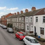
The neighbourhood is predominantly urban and residential. Housing includes traditional terraced properties, larger period houses and converted homes. The architectural character changes between streets, particularly around Cathedral Road and the more compact residential streets closer to Cowbridge Road East.
Riverside also benefits from its relationship with neighbouring districts. Canton provides additional shops, restaurants and everyday services. Pontcanna provides further cafés, green spaces and residential streets. The city centre provides major retail, employment, cultural and transport facilities.
Cardiff Council identifies Riverside as one of the inner-city areas receiving priority under its city parking plan because of parking pressure.
This location therefore creates a neighbourhood where daily life can involve short journeys. Walking, cycling, buses and cars all form part of the local transport network.
How did Riverside Cardiff develop historically?
Riverside developed as Cardiff expanded westward during the industrial and urban growth of the nineteenth and early twentieth centuries. Its built environment reflects this expansion through traditional terraces, larger Victorian properties, established roads and development around the River Taff.
Cardiff experienced rapid population and industrial growth during the nineteenth century as coal exports, docks, railways and associated industries expanded. Residential development followed employment growth across the city.
Riverside’s location beside the River Taff placed it close to important transport and industrial routes. Cardiff’s western districts expanded as the urban area grew beyond the historic centre.
The surviving housing stock provides evidence of this period of development. Traditional terraces remain an important part of the neighbourhood’s built character, while larger houses appear along roads such as Cathedral Road.
Cathedral Road is particularly significant from a conservation perspective. Cardiff Council identifies Cathedral Road Conservation Area within the Riverside ward. The council also identifies the Conway Road Conservation Area within Riverside.
A conservation area is a designated area where planning controls protect architectural and historic character. Cardiff currently has 27 conservation areas across the city.
These designations affect property alterations. Owners need to check whether additional planning controls apply before making changes to buildings, windows, trees or other features.
The area’s historical development remains visible through building form rather than through a single landmark. Terraced streets, period façades, traditional boundary treatments and established road layouts contribute to Riverside’s identity.
What types of homes are available in Riverside Cardiff?
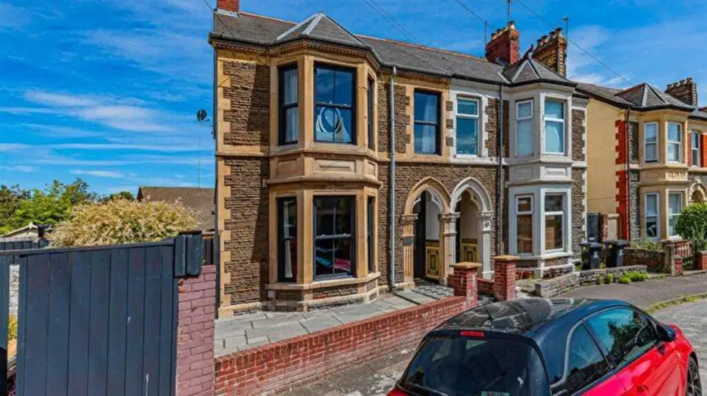
Riverside housing includes Victorian and Edwardian terraces, larger period houses, converted properties, flats and modern residential units. Housing type varies by street, with traditional terraces particularly important across the established residential parts of the neighbourhood.
Traditional terraced houses are a defining feature of many Riverside streets. These properties were typically constructed as part of Cardiff’s nineteenth- and early twentieth-century urban expansion.
Period terraces often contain two or more floors, front reception rooms, rear kitchens or extensions and small outdoor spaces. Internal layouts vary because many properties have been altered over time.
Larger period properties are particularly associated with roads such as Cathedral Road. Some historic buildings have been converted into flats, professional premises or other uses.
Flats provide another part of the local housing market. Conversions of larger houses create apartments within established buildings, while newer developments provide more contemporary accommodation.
Property searches should therefore consider the specific street rather than treating Riverside housing as one uniform category.
Prospective buyers and renters also need to check planning restrictions. Properties within conservation areas can face additional controls over alterations. Cardiff Council provides planning information and allows searches by postcode, address, keyword, application reference, date and ward.
Property purchasers should also consider local land charges. Cardiff Council states that these can include planning permissions, highway agreements, conservation areas, tree preservation orders, listed buildings and environmental health notices.
The practical implication is clear: housing research in Riverside requires both property-level inspection and neighbourhood-level research.
Is Riverside Cardiff close to Cardiff city centre?
Riverside Cardiff is close to Cardiff city centre, making central retail, employment, education, entertainment and transport facilities accessible from the neighbourhood. The River Taff corridor and surrounding road network provide several routes between Riverside and central Cardiff.
Riverside’s proximity to the city centre is one of its defining geographical characteristics.
Cardiff Central is the city’s principal railway station and an important transport interchange. Transport for Wales states that Cardiff Central has seven platforms, including platforms 0, 1, 2, 3a/b, 4a/b, 6 and 7. A further two platforms are planned as part of station redevelopment.
Transport for Wales also states that the walk from Cardiff Central to Cardiff city centre via St Mary Street takes approximately five minutes.
For Riverside residents, the city centre therefore functions as an extension of the neighbourhood’s everyday service network.
Central Cardiff contains major shopping streets, offices, universities, cultural venues, restaurants, public services and transport connections. Riverside residents can combine local services with access to the wider city without depending entirely on long-distance travel.
The exact journey time varies according to the starting street, destination, walking speed, traffic and transport service.
How easy is public transport from Riverside Cardiff?
Public transport from Riverside Cardiff is supported by local bus services, nearby railway stations and connections into central Cardiff. Cardiff Council directs residents to Traveline Cymru for current bus and rail information because routes and timetables change.
Buses are particularly important for Riverside because the neighbourhood sits within Cardiff’s established inner-city transport network.
Cardiff Council states that Traveline Cymru provides comprehensive public transport information covering buses and trains across Cardiff. The council also provides information about Cardiff Bus services.
Cardiff Central provides the principal rail connection. It serves destinations including Swansea, Manchester, Liverpool, Chester and Bangor, according to Transport for Wales.
Residents can therefore combine local bus travel with rail connections for longer journeys.
Transport accessibility is also relevant for residents with mobility requirements. Cardiff Council notes that buses, trains and some taxis have accessibility facilities designed for wheelchair users.
Because routes and timetables change, residents should check current information before planning a journey.
Is Riverside Cardiff suitable for walking and cycling?
Riverside Cardiff is well positioned for walking and cycling because it sits beside the River Taff and close to central Cardiff. Cardiff’s active travel network connects Riverside with the city centre, Ely and Caerau through Cycleway 5.
The River Taff corridor is an important active-travel feature. Walking and cycling routes connect Riverside with surrounding neighbourhoods and central Cardiff.
Cardiff Council’s cycleway programme identifies Cycleway 5 as the route connecting the city centre with Riverside, Ely and Caerau.
Cardiff’s wider active travel programme is designed to improve walking and cycling connections between residential communities and major destinations.
The council’s Local Transport Plan includes walking and cycling infrastructure, bus network improvements, junction improvements, 20mph limits and road safety schemes.
Walking is also practical for accessing local shops and nearby neighbourhoods. The relatively compact urban form reduces the need for a car for some short journeys.
Cycling provides another option for commuting towards central Cardiff and travelling along the Taff corridor.
The exact quality of a journey depends on the street, crossing point, traffic conditions and destination. Residents should therefore assess their normal route rather than relying solely on neighbourhood-level descriptions.

What shops and everyday amenities are available in Riverside Cardiff?
Riverside provides everyday neighbourhood services while nearby Canton, Pontcanna and central Cardiff expand the range of shopping, dining and professional services. Residents can combine local convenience shops with larger commercial areas within short journeys.
Riverside has a local commercial network centred around roads serving the residential population. Cowbridge Road East is particularly important for everyday services and connections with neighbouring Canton.
Nearby districts add further options. Canton has a substantial high-street environment, while Pontcanna contains independent cafés, food businesses and other services.
Central Cardiff provides the largest concentration of retail and commercial facilities.
This layered service structure is important for residents. Everyday purchases can be made locally, while less frequent shopping and specialist services are available elsewhere in the city.
The neighbourhood also benefits from Cardiff’s public service infrastructure. Council services include waste collection, street cleaning, roads, parking, planning, housing and community development.
Residents moving into Riverside should check the exact service arrangements for their property, including waste collection days, parking restrictions and council services.
What are the schools and education options near Riverside Cardiff?
Families living in Riverside can access Cardiff’s wider education network, including maintained schools, nurseries, secondary schools and specialist provision. School admission depends on individual school policies, available places, catchment areas and Cardiff Council application procedures.
Cardiff Council provides an online school service covering school locations, catchment areas, numbers on roll and contact details. It also manages applications for nursery, primary and secondary school places.
Catchment areas are important because living in Riverside does not automatically guarantee admission to a particular school.
Families should check the current catchment boundary for their address before making housing decisions based on school access.
Cardiff’s education system includes maintained primary and secondary schools, special schools and other educational services. The city’s Healthy Schools Cardiff Network operates across maintained schools and includes nurseries, primary schools, secondary schools and special schools.
Education planning should therefore consider school stage, admissions criteria, travel distance and available places.
Families also have access to wider childcare and early-years services through Cardiff Council’s education and learning provision.
What healthcare services are available near Riverside Cardiff?
Riverside residents use the wider Cardiff and Vale healthcare network for GPs, pharmacies, dentists, opticians, hospitals and specialist treatment. Exact services depend on registration eligibility, provider availability and the individual healthcare requirement.
Cardiff Council directs residents to NHS Wales services to locate GPs, pharmacies, opticians, dentists and hospitals.
The wider Cardiff and Vale University Health Board provides healthcare services across South and Mid Wales.
Residents should register with a local GP practice after moving if they require ongoing primary healthcare. Dental and pharmacy arrangements should also be checked separately because registration and appointment availability vary between providers.
Riverside’s central location provides access to a broad urban healthcare network rather than requiring residents to rely solely on facilities inside the neighbourhood.
For urgent or specialist healthcare, residents should use the appropriate NHS Wales service according to the nature of the requirement.
What green spaces and outdoor areas are near Riverside Cardiff?
Riverside’s main outdoor advantage is its position beside the River Taff, with nearby parks and open spaces extending recreational options into Canton, Pontcanna and other parts of western Cardiff. Walking and cycling routes strengthen access to these areas.
The River Taff is central to Riverside’s geography. Its corridor provides routes for walking and cycling and links several Cardiff neighbourhoods.
Residents also have access to nearby parks and recreational spaces in western Cardiff. Pontcanna Fields and neighbouring green areas provide larger open spaces within the wider local area.
Cardiff Council states that parks and green spaces cover around 10% of the city.
Outdoor access therefore extends beyond formal parks. River corridors, cycle routes, footpaths, recreation grounds and neighbourhood green spaces all contribute to everyday outdoor activity.
The proximity of the River Taff also gives Riverside a direct relationship with one of Cardiff’s major natural corridors.
People choosing a property should inspect its exact distance from the river and nearby parks because accessibility varies considerably between streets.
How does parking work in Riverside Cardiff?
Parking is an important consideration in Riverside because Cardiff Council identifies the neighbourhood as a priority inner-city area for parking management. Permit rules, controlled areas, waiting restrictions and parking bays vary by street.
Cardiff Council’s city parking plan identifies Riverside among the inner-city areas prioritised because of limited parking.
The council has also established a Riverside South parking zone covering streets including Beauchamp Street, Clare Street, Fitzhamon Embankment, Lower Cathedral Road, Plantagenet Street and Wyndham Street. The listed zone operates between 8am and 10pm every day, with some restrictions applying throughout the day.
Parking therefore needs to be investigated at street level.
Residents should check whether a property has private parking, whether a resident permit is available and what restrictions apply to visitors.
Households with multiple cars need particular attention to parking arrangements because traditional terraces often have limited off-street parking.
Parking conditions can also influence the practicality of commuting by car. Cardiff Council’s wider transport strategy prioritises public transport, walking and cycling alongside road improvements.
What is Riverside Cardiff’s relationship with neighbouring areas?
Riverside connects directly with Canton, Pontcanna, Grangetown, Cardiff city centre and other western Cardiff neighbourhoods. These neighbouring areas expand access to shops, parks, restaurants, schools, employment locations, cultural venues and transport services.
Canton lies west and southwest of Riverside and provides a major local commercial centre.
Pontcanna lies to the northwest and is closely connected through residential streets and the River Taff corridor.
Cardiff city centre lies east of Riverside and provides the city’s principal commercial, cultural and transport facilities.
Grangetown lies south and southeast of the central Cardiff area, creating another nearby residential and commercial district.
These boundaries are useful for understanding daily life because residents frequently use facilities outside Riverside itself.
The neighbourhood should therefore be understood as part of Cardiff’s wider western urban area rather than as an isolated settlement.
This interconnected structure also supports active travel. Cardiff’s cycleway plans specifically connect Riverside with central Cardiff, Ely and Caerau through Cycleway 5.
What should people check before moving to Riverside Cardiff?
People considering Riverside should assess the exact street, property condition, parking arrangements, conservation controls, transport links, school catchment, local services and flood-related information before moving. Neighbourhood characteristics vary significantly between individual streets and property locations.
Property condition is important in older housing. Buyers should inspect roofs, windows, damp protection, insulation, electrical systems, plumbing and previous alterations.
Planning history is another important consideration. Cardiff Council allows planning applications to be searched using an address, postcode, keyword, date, application reference or ward.
Conservation status should also be checked for relevant properties. Cathedral Road and Conway Road have designated conservation areas within Riverside.
Parking should be checked before signing a tenancy or purchasing a property. Riverside contains controlled parking areas, including Riverside South.
Flood and river-related information is also relevant because Riverside sits beside the River Taff. Property-level environmental and flood information should be checked through current official datasets and searches.
School catchments should be confirmed directly through Cardiff Council rather than inferred from proximity.
Transport should be assessed using the actual daily destination. A property that is convenient for Cardiff city centre can have different transport advantages from one closer to Canton or the northern part of Riverside.
Explore More Area Guide
Living in Splott Cardiff: Housing, Transport and Local Services
Living in Grangetown Cardiff: Housing, Transport & Amenities
What is the future relevance of living in Riverside Cardiff?
Riverside’s future relevance is linked to Cardiff’s continuing investment in transport, active travel, neighbourhood renewal, housing, public spaces and city-centre connections. Existing infrastructure and planning policies will continue shaping how residents move and use the area.
Cardiff Council’s Local Transport Plan includes investment in walking, cycling, buses, junctions, road safety and 20mph measures.
The council also operates neighbourhood regeneration programmes covering housing, streets, public spaces and local services. These programmes use local priorities to identify improvements and manage neighbourhood change.
Active travel remains an important part of Cardiff’s longer-term transport strategy. Cycleway 5 specifically links the city centre with Riverside, Ely and Caerau.
The city’s planning framework also places emphasis on liveable neighbourhoods. Cardiff Council’s Liveable Design Guide identifies quality of life, identity, public and green spaces, transport and sustainability as key considerations for new development.
For Riverside, the combination of an established housing stock and proximity to central Cardiff creates a strong connection with wider city planning.
Future changes should be assessed through official planning applications, transport updates, parking consultations and regeneration information rather than assumptions about proposed schemes.
Is Riverside Cardiff a practical neighbourhood for everyday life?
Riverside Cardiff offers a central residential location, traditional housing, local services, riverside access and connections to Cardiff city centre. Its main practical considerations include parking pressure, property condition, conservation controls and the exact location of schools and services.
Riverside’s strongest geographical feature is its position. Residents are close to central Cardiff while remaining within an established residential neighbourhood.
The housing stock provides several property formats, including terraces, period houses, conversions and flats. This creates variation between streets and individual properties.
Transport options include walking, cycling, buses and rail connections through nearby Cardiff Central. Cardiff Council’s active travel programme specifically includes Riverside within its planned cycleway network.
Everyday services are supported by Riverside itself and neighbouring Canton, Pontcanna and central Cardiff.
The neighbourhood’s historic character is protected in designated areas such as Cathedral Road and Conway Road, creating additional planning considerations for some properties.
Parking requires particular attention because Riverside is included among Cardiff’s inner-city parking priorities.
For people researching a move, the most reliable approach is to assess the specific property, street and daily travel pattern. Riverside’s character changes across its boundaries, while Cardiff’s broader transport, planning and regeneration programmes continue to influence the neighbourhood.
What is Riverside Cardiff like to live in?
Riverside Cardiff is an established residential neighbourhood beside the River Taff. It offers traditional housing, local shops, community facilities, walking and cycling routes, and convenient access to Cardiff city centre.