Suburban housing sprawl in Cardiff refers to the outward expansion of the city boundary into greenfield land. This process involves the construction of low-density residential developments, primarily on the northern and eastern fringes, to accommodate a growing capital population.
- How has the history of Cardiff shaped its modern suburban sprawl?
- What are the primary drivers of suburban housing sprawl in Cardiff?
- What is the role of the Local Development Plan in Cardiff expansion?
- How does suburban sprawl affect the environment in Cardiff?
- What are the social and economic implications of sprawl for Cardiff residents?
- How does the South Wales Metro project relate to Cardiff housing sprawl?
- What are the future trends for suburban development in Cardiff?
- How does Cardiff compare to other UK cities regarding housing sprawl?
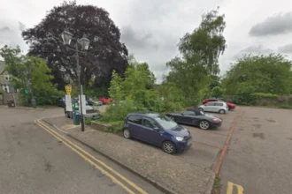
Cardiff functions as the capital city of Wales and serves as the primary economic engine of the region. The city underwent significant industrial growth in the nineteenth century, centered on coal exports through the Cardiff Docks. Modern expansion differs from industrial growth as it focuses on car-dependent residential estates. This shift occurs because land values in the city center remain high, forcing developers to seek larger plots on the periphery. The Cardiff Local Development Plan (LDP) 2006 to 2026 identifies specific strategic sites for this growth. These sites include land north of the M4 motorway and areas adjacent to Pontprennau and St Mellons. Suburbanization changes the land use from agricultural or semi-rural to permanent urban infrastructure.
The physical footprint of Cardiff has doubled since the mid-twentieth century. This expansion is characterized by the conversion of the “Green Wedge” into housing assets. National planning policy in Wales, specifically Planning Policy Wales (PPW), attempts to balance housing demand with environmental preservation. However, the requirement to maintain a five-year land supply for housing often necessitates the release of rural land. Suburban sprawl creates a distinct urban morphology where residential zones are separated from commercial hubs. This separation increases the average distance residents travel for work and services. The resulting landscape features a network of cul-de-sacs and arterial roads that connect the suburbs to the city center.
How has the history of Cardiff shaped its modern suburban sprawl?
The history of Cardiff shaped modern sprawl through the transition from a compact maritime port to a sprawling administrative capital. Post-war housing shortages and the decline of heavy industry prompted local authorities to develop peripheral estates to relocate residents.
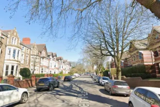
In the early 1900s, Cardiff was the most significant coal port in the world. The population was concentrated in high-density terraced housing in areas like Butetown, Roath, and Canton. Following the Second World War, the city council addressed overcrowding by building large social housing estates on the outskirts. Examples include Llanrumney, Ely, and Caerau. These developments marked the first major wave of planned suburban expansion away from the industrial core. The introduction of the M4 motorway in the 1970s and 1980s further incentivized northern growth. Developers recognized the value of proximity to major transport links, leading to the creation of private commuter suburbs like Thornhill and Lisvane.
The local government reorganization in 1996 established Cardiff as a unitary authority. This status gave the city more control over its planning destiny but also created pressure to perform as a regional hub. Economic diversification into finance, media, and government services attracted a larger workforce. Between 2001 and 2011, Cardiff experienced the fastest population growth of any UK core city. This demographic surge outpaced the existing housing stock. Consequently, the city expanded into the “Northern Fringe,” which was previously protected rural land. The historical reliance on peripheral development set a precedent for the current Local Development Plan, which continues to designate outlying areas for large-scale residential projects.
What are the primary drivers of suburban housing sprawl in Cardiff?
The primary drivers of suburban housing sprawl in Cardiff include rapid population growth, a shortage of affordable urban brownfield sites, and high demand for family homes. Economic investment in the Cardiff Capital Region also incentivizes peripheral residential development projects.
Cardiff remains the fastest-growing area in Wales, with the population projected to exceed 400,000 by 2035. This growth creates a continuous requirement for new dwelling units. While brownfield sites exist within the city, such as the former docklands in Cardiff Bay, these areas are often restricted to high-density apartments. Many households prefer detached or semi-detached houses with private gardens, which are easier to construct on undeveloped greenfield sites. Landowners on the edge of the city can achieve significantly higher returns by selling to developers than by maintaining agricultural use. This economic incentive drives the conversion of the rural-urban fringe into residential estates.
The Cardiff Capital Region City Deal represents a £1.2 billion investment in local infrastructure. This investment improves connectivity between the city and its surrounding valleys, making the outskirts more attractive for commuters. High property prices in the city center drive first-time buyers toward the suburbs where they can find more space for lower costs. Furthermore, the Welsh Government sets ambitious targets for housing delivery to combat homelessness and rising rents. Local authorities must meet these targets to comply with national legislation. The availability of large tracts of land under single ownership simplifies the planning process for developers. This ease of execution makes suburban sprawl the most common solution for meeting housing quotas.
What is the role of the Local Development Plan in Cardiff expansion?

The Local Development Plan (LDP) acts as the legal framework for Cardiff expansion by designating specific areas for residential and commercial growth. It balances the need for 41,000 new homes with the protection of essential environmental and historical assets.
The current LDP was adopted in 2016 and covers the period until 2026. It identifies eight strategic sites across the city that are essential for meeting growth targets. These sites include Strategic Site C (North West Cardiff), which is designed to provide up to 5,000 homes. Another major area is Strategic Site G (East of Pontprennau), which accommodates approximately 4,500 dwellings. The LDP ensures that developers provide necessary infrastructure, such as schools and healthcare facilities, alongside housing. This “master-planning” approach aims to prevent disorganized sprawl by creating cohesive new communities. However, the plan has faced criticism for the loss of greenbelt land between Cardiff and neighboring Rhondda Cynon Taf.
Legislative requirements force the LDP to undergo regular reviews to ensure it remains relevant to changing economic conditions. The Replacement Local Development Plan (RLDP) is currently in development to extend the planning horizon to 2036. This new plan must account for updated population projections and environmental regulations, such as the Well-being of Future Generations (Wales) Act 2015. The RLDP focuses on “transit-oriented development,” which seeks to align housing growth with public transport corridors like the South Wales Metro. By concentrating sprawl around transport hubs, the plan attempts to reduce the environmental footprint of new suburbs. The LDP serves as the primary document used by the planning committee to approve or reject new housing applications.
How does suburban sprawl affect the environment in Cardiff?
Suburban sprawl affects the environment in Cardiff by reducing biodiversity, increasing carbon emissions from transport, and altering natural drainage systems. The loss of greenfield land destroys habitats for local species and diminishes the city’s natural carbon sequestration capacity.
The conversion of fields and woodlands into paved surfaces creates “impermeable layers” that prevent rainwater from soaking into the ground. This increases the risk of surface water flooding in lower-lying areas of the city. As housing estates replace natural vegetation, local wildlife populations, such as bats, badgers, and various bird species, lose their foraging and nesting grounds. The removal of hedgerows, which act as vital ecological corridors, isolates remaining pockets of nature. Additionally, suburban residents are more likely to rely on private vehicles for daily commutes. This reliance leads to higher levels of nitrogen dioxide and particulate matter in the atmosphere, particularly along the A48 and M4 corridors.
Sprawl also contributes to the “urban heat island” effect, where built-up areas retain more heat than rural landscapes. While Cardiff is not as densely built as London, the replacement of grass with tarmac in the suburbs raises local temperatures. The Welsh Government has declared a climate emergency, which places more scrutiny on the environmental costs of greenfield development. To mitigate these impacts, developers are now required to demonstrate “biodiversity net gain” in their projects. This involves creating new habitats, such as ponds or wildflower meadows, within the housing estates. Despite these efforts, the fundamental transition from natural land to suburban infrastructure represents a permanent ecological shift for the Cardiff region.
What are the social and economic implications of sprawl for Cardiff residents?
The social and economic implications of sprawl for Cardiff residents include increased commuting costs, potential social isolation, and pressure on local services. While sprawl provides new housing stock, it can lead to the decline of traditional community centers.
Residents in new suburban developments often face long travel times to reach employment hubs in the city center or Cardiff Bay. This “commuter culture” reduces the amount of time individuals spend within their local community, weakening social ties. Because these areas are designed primarily for housing, they often lack the “third spaces” found in older neighborhoods, such as pubs, community halls, and small shops. This lack of infrastructure can lead to social isolation, particularly for the elderly or those without access to a car. Economically, the cost of maintaining a vehicle and paying for fuel places a financial burden on suburban households.
On a macro level, suburban sprawl necessitates significant public investment in new roads, sewers, and electricity grids. These costs are often partially covered by developers through Section 106 agreements, but the long-term maintenance falls on the local authority. The influx of residents into new suburbs puts immediate pressure on existing schools and GP surgeries in nearby established areas. If the rate of housing construction exceeds the rate of infrastructure delivery, the quality of life for both new and old residents may decline. Conversely, sprawl supports the local construction industry and provides modern, energy-efficient homes that are not available in the older urban core. This availability helps stabilize the local housing market by increasing total supply.
How does the South Wales Metro project relate to Cardiff housing sprawl?
The South Wales Metro project relates to Cardiff housing sprawl by providing a high-capacity rail and bus network designed to support peripheral growth. It aims to transform car-dependent suburbs into sustainable, connected neighborhoods through improved public transport links.
The South Wales Metro is a multi-modal transport integration project led by Transport for Wales (TfW). It involves the electrification of the Core Valley Lines and the introduction of new tram-trains. This infrastructure is vital for the success of Cardiff’s northern and western housing developments. By placing new housing estates near Metro stations, planners hope to encourage residents to use trains instead of cars. This concept, known as “Transit Oriented Development” (TOD), is a key strategy for managing the negative effects of sprawl. For example, the development of the Plasdŵr site in North West Cardiff is designed to integrate with future Metro extensions.
The Metro also facilitates the “Cardiff Capital Region” concept, which views Cardiff and the surrounding 10 local authorities as a single economic entity. If the Metro provides fast, reliable transport, housing demand can be spread across a wider area, potentially reducing the pressure for sprawl within Cardiff’s immediate greenbelt. However, if the Metro delivery lags behind housing construction, the new suburbs will remain car-oriented for decades. The project represents the most significant investment in Welsh transport infrastructure in a generation. Its primary goal is to ensure that the physical expansion of the city does not lead to total gridlock on the existing road network.
What are the future trends for suburban development in Cardiff?
Future trends for suburban development in Cardiff include the adoption of “15-minute city” principles, increased density in new estates, and a focus on low-carbon construction. Planners are shifting toward models that prioritize pedestrian movement and local service accessibility.
The “15-minute city” concept aims to ensure that all residents can access essential services within a short walk or cycle from their homes. In Cardiff, this means future suburban designs will include integrated commercial zones, co-working spaces, and healthcare hubs. This reduces the need for the traditional “sprawl” model where the suburb is purely a dormitory for the city center. Additionally, there is a trend toward “infilling” and higher density. Rather than building only detached houses, developers are being encouraged to include townhouses and low-rise apartments to maximize land use efficiency. This approach preserves more green space while meeting housing targets.
Environmental regulations will also dictate the future of Cardiff’s suburbs. All new homes in Wales must move toward being “carbon neutral” in their operation. This involves the installation of air-source heat pumps, solar panels, and high-performance insulation. The Welsh Government is also exploring “Green Belts” as a more permanent alternative to “Green Wedges” to provide stronger legal protection against sprawl in certain directions. As the city approaches its natural geographic limits—constrained by the sea to the south and the hills to the north—future growth may require even more radical approaches to urban planning. The focus will likely shift from outward expansion to the regeneration of existing suburban centers to accommodate more residents.
How does Cardiff compare to other UK cities regarding housing sprawl?
Cardiff compares to other UK cities by having one of the highest rates of population-driven expansion relative to its size. Unlike land-locked cities like Birmingham, Cardiff’s growth is restricted by the Bristol Channel and the South Wales Valleys.
Compared to English core cities like Manchester or Leeds, Cardiff has a smaller total land area, which makes its sprawl more visible. The city’s expansion has been concentrated into a few massive strategic sites, whereas other cities often see more fragmented growth. Cardiff’s planning policy is governed by the Senedd (Welsh Parliament), which allows for distinct regulations compared to the English planning system. For instance, the “Well-being of Future Generations Act” is a uniquely Welsh piece of legislation that requires planners to consider the long-term impact of sprawl on future residents. This results in a higher emphasis on sustainability and active travel than might be seen in some English developments.
In terms of housing density, Cardiff’s new suburbs are similar to those in Bristol or Southampton. These cities all face the challenge of balancing historic maritime identities with modern residential needs. However, Cardiff’s role as a national capital gives it a unique pressure to provide high-quality “gateway” developments. The city’s sprawl is also influenced by its relationship with the Valleys.
While many UK cities see sprawl merge into neighboring towns, Cardiff still maintains distinct, though narrowing, gaps between its northern suburbs and the towns of Caerphilly and Pontypridd. This geographic containment makes the management of the rural-urban fringe a top priority for local policymakers.
Is there a housing crisis in Cardiff?
Cardiff faces a significant housing crisis characterized by high demand and insufficient supply. Rising property prices and long social housing waiting lists have forced the city to prioritize large-scale suburban expansion to provide affordable homes for a rapidly growing population.
What is the most deprived area in Cardiff?
Trowbridge and parts of Ely are frequently identified as the most deprived areas in Cardiff according to the Welsh Index of Multiple Deprivation. These neighborhoods face challenges regarding employment, health, and access to services compared to the affluent northern suburbs.
What is the poorest town in Wales?
Jaywick is often cited in UK contexts, but within Wales, Rhyl and certain communities in the South Wales Valleys like Blaenau Gwent report the highest poverty levels. These areas struggle with the long-term economic effects of industrial decline.
What are the disadvantages of living in Wales?
Disadvantages of living in Wales include lower average salaries compared to southeast England and geographic isolation in rural regions. Some residents also cite higher rainfall and limited public transport infrastructure in areas outside the major southern coastal hubs.
What language is spoken in Cardiff?
English is the primary language spoken by the majority of Cardiff residents. However, Welsh is widely spoken and visible on all public signage, with a growing number of bilingual schools and households contributing to the city’s diverse linguistic landscape.