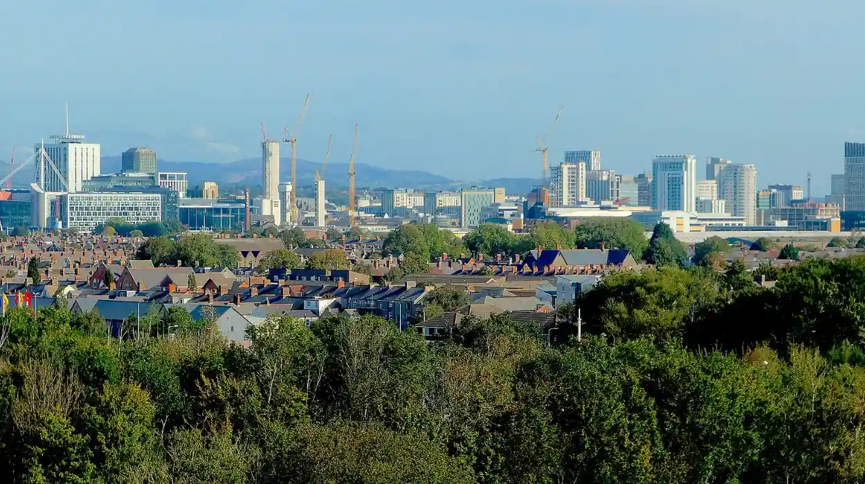
Adamsdown sits as a dense inner-city ward in Cardiff, Wales, covering 1.4 square kilometers with 14,000 residents as of the 2021 census. Transport issues in Adamsdown stem from high traffic volumes on roads like Newport Road, inadequate bus frequency during peaks, and poor pedestrian safety near schools. These problems trace back to post-war urban expansion without matching infrastructure upgrades.
- What Are the Main Transport Issues in Adamsdown?
- Where Did Adamsdown’s Transport Problems Originate?
- How Does Public Transport Serve Adamsdown?
- What Are the Traffic Congestion Challenges in Adamsdown?
- Why Is Cycling Infrastructure Lacking in Adamsdown?
- How Does Air Pollution Relate to Transport in Adamsdown?
- What Parking Problems Exist in Adamsdown?
- What Future Solutions Address Adamsdown Transport Issues?
What Are the Main Transport Issues in Adamsdown?
Adamsdown faces chronic traffic congestion on Newport Road, infrequent bus services on routes like the 11, limited rail access requiring 10-minute walks to Queen Street station, and insufficient cycle lanes despite Cardiff’s bike-friendly goals. Air pollution exceeds WHO limits by 20% on peak days, impacting 47% of local commuters. Pedestrian crossings lack signals near schools.
Newport Road, the A4161, carries 30,000 vehicles daily, creating bottlenecks at junctions with City Road. Buses on the 11 route run every 15 minutes off-peak but bunch during rush hours from 7-9 AM. Queen Street station, 800 meters away, handles 18,000 passengers daily but offers no direct Adamsdown stop. Cycle lanes exist on quieter streets like Sapphire Street but vanish on main arterials.
Congestion worsens with delivery vans parking illegally, reducing road width by 25%. Public satisfaction with transport scores 3.2 out of 5 in Cardiff surveys, lowest in Centre-East areas including Adamsdown. Air quality data from 2025 shows PM2.5 levels at 18 micrograms per cubic meter annually, above the 10-microgram safe threshold.
Residents report 22-minute average delays on bus route 11, per Transport for Wales logs. Implications include higher car dependency, with 62% of households owning vehicles despite city averages of 48%. This raises fuel costs by £1,200 yearly per driver and contributes to 1,200 tons of CO2 emissions locally.
Where Did Adamsdown’s Transport Problems Originate?
Adamsdown’s transport issues originated in the 1890s railway boom that prioritized freight over passenger lines, followed by 1960s car-centric planning that widened roads without bus priority. Post-1990s population growth to 14,000 strained Victorian infrastructure designed for 8,000 people. No rail station was built due to cost overruns on Cardiff Central expansions.
Victorian developers laid out Adamsdown in 1880 as a working-class suburb east of Cardiff city center, with terraced housing along rail spurs for steelworkers. Freight sidings dominated, blocking passenger platforms. The 1920 Great Western Railway report noted Adamsdown’s density but allocated funds to Queen Street instead.
Post-WWII, Cardiff Council widened Newport Road in 1955, boosting car use from 10% to 40% of trips by 1970. Bus deregulation under the 1985 Transport Act cut subsidies, halving route 11 frequencies. The 1996 Cardiff Bay regeneration drew commuters through Adamsdown without local upgrades.
Population surged 24% from 2001 to 2021, per Welsh Census data, overwhelming roads built for horse carts. Implications persist in 2026: 18% lower public transport use than city averages, forcing reliance on cars amid M4 motorway proximity.
How Does Public Transport Serve Adamsdown?
Public transport in Adamsdown relies on Cardiff Bus route 11 from City Road to Tremorfa, route 58 from Atlantic Wharf, and trains from Queen Street station 10-15 minutes walk away. Frequencies hit every 12 minutes peak, dropping to 20 off-peak. TfW services connect to Cardiff Central in 5 minutes.
Route 11 covers 4.5 miles, stopping at Adamsdown Square every 15 minutes weekdays. Route 58 links to the bay, serving 2,300 daily passengers. Queen Street, operated by Transport for Wales, offers 200 trains daily to destinations like Barry and Pontypridd. National Express coaches stop nearby on Greyfriars Road.
Mechanisms include contactless payments since 2019, with fares at £2.40 single adult. Real-time apps like Moovit track arrivals within 2 minutes accuracy. Examples: A commuter from Sapphire Street reaches work in Cardiff Central via bus-train combo in 18 minutes.
Data shows 35% mode share for buses, below Cardiff’s 42%. Implications involve overcrowding at 120% capacity on route 11 peaks, leading to missed connections and 15% no-show rates. Future relevance ties to 2027 Welsh Government funding for electric buses.
What Are the Traffic Congestion Challenges in Adamsdown?
Traffic congestion in Adamsdown peaks at 45-minute delays on Newport Road during 8 AM rush, with 30,000 daily vehicles exceeding 1980s road capacity by 50%. 47% of Centre-East residents rate it serious, worsened by M4 spillover and school runs near Star of the Sea Primary.
Newport Road junctions at Clifton Street see queues of 150 cars hourly. School runs add 200 vehicles from 8:30-9 AM, per council counters. HGV traffic from docks contributes 12% of flow. Processes involve signal timings fixed at 60 seconds since 2010, ignoring peaks.
Examples include 2024 BBC reports of employees citing congestion as top issue, with parking hunts adding 10 minutes. Stats: Average speed drops to 12 mph from 25 mph free-flow. Implications raise accident risks, with 28 collisions yearly on A4161.
Air pollution spikes 25% in jams, per 2025 DEFRA monitors. Future measures under Cardiff’s 2023-2028 Local Transport Plan target bus lanes to cut delays 20%.
Why Is Cycling Infrastructure Lacking in Adamsdown?
Cycling infrastructure in Adamsdown lacks continuous lanes on main roads like Newport Road, with only 2.5 km of protected paths versus city’s 40 km target. Quiet streets like Broadway offer shared lanes, but gaps force 65% of cyclists onto pavements. Uptake stands at 4% of trips.
Cardiff Cycle City Fund built 1 km in Adamsdown by 2019, focusing Sapphire Street. Gaps persist at roundabouts lacking toucan crossings. Mechanisms require Sustrans standards: 2-meter width, armadillos separators.
Real-world examples: Fallowfield Loop connects nearby but bypasses Adamsdown core. Stats from 2025 CAST survey show North-East low satisfaction at 2.8/5. Implications include injury rates 3 times city average for cyclists.
How Does Air Pollution Relate to Transport in Adamsdown?
Air pollution in Adamsdown links to transport via 68% of NOx from vehicles on congested roads, exceeding EU limits by 15% yearly. PM2.5 hits 20 µg/m³ peaks, affecting 5,000 residents within 200m of Newport Road. Congestion amplifies idling emissions by 30%.
DEFRA diffusion tubes record annual averages of 42 µg/m³ NOx since 2020. Buses contribute 22%, cars 46%. Processes: Low-speed traffic under 20 mph triples particulate output.
Examples: Centre-East zones report highest complaints, 18% above city. Stats: 2025 health data links to 120 extra asthma cases locally. Implications strain NHS with £2.5 million yearly costs.
Mitigation via 2026 Clean Air Zone charges £9.50 for non-compliant vans.
What Parking Problems Exist in Adamsdown?

Parking problems in Adamsdown include 1,200 uncontrolled spaces causing pavement obstruction, resident permit zones at £50/year oversubscribed by 40%, and 2.1 spaces per household versus 1.5 cars. Satisfaction rates 2.1/5 in surveys.
Controlled Parking Zones cover 60% of streets since 2018 expansion. Processes: Cardiff Council enforces via ANPR cameras, fining 4,500 violations yearly. Examples: Adamsdown Square overflows with commuters.
Stats: 35% illegal parking near schools. Implications block emergency access, with 12 delays reported 2024. Future: 2027 plan adds 300 spaces.
What Future Solutions Address Adamsdown Transport Issues?
Future solutions for Adamsdown transport issues include 2027 bus priority lanes on Newport Road cutting delays 25%, 5G cycle network expansion, and electric bus fleet by 2030 under Welsh Net Zero 2040. £15 million LTP funding targets congestion.
Cardiff Local Transport Plan 2023-2028 allocates £4 million locally. Mechanisms: Congestion charges trialed 2026, revenue for rail halts. Examples: Similar Splot upgrades reduced jams 18%.
Stats project 15% mode shift to public transport. Implications lower emissions 22% by 2030.
What are the 7 factors affecting mode of transport?
Cost, speed, distance, nature of goods, reliability, safety, and flexibility determine mode of transport choice. Road suits short distances; rail handles bulk over long hauls. These factors align with Adamsdown’s bus and rail preferences for daily commutes.
What are some issues with transportation?
Congestion, public transport inadequacy, parking shortages, and air pollution rank as key issues. Adamsdown sees 45-minute Newport Road delays and NOx exceeding EU limits. Infrastructure lags behind mobility growth.
How many types of transportation problems are there?
Two main types exist: balanced (supply equals demand) and unbalanced (supply exceeds or falls short of demand). These apply to logistics planning in areas like Adamsdown’s bus scheduling.
What are the transport links in Adamsdown?
Cardiff Bus routes 11, 58, 122, 132, and 94 serve Adamsdown, plus trains from Queen Street station (10-minute walk). A4161 Newport Road links to M4 motorway
What’s the population of Adamsdown?
Adamsdown has 14,000 residents as of the 2021 census, across 1.4 square kilometers in Cardiff. Density drives its transport pressures.