Rumney is an eastern Cardiff community with a strong residential character, established green spaces, riverside landscapes, historic buildings and connections to Cardiff’s wider active-travel network. Walking around Rumney provides access to neighbourhood streets, Rumney Hill Gardens, the River Rhymney corridor and routes towards Llanrumney, Trowbridge and St Mellons.
- What makes Rumney suitable for walking?
- Where can you walk in Rumney?
- How does Rumney Hill Gardens fit into a walking route?
- Can you walk from Rumney towards the River Rhymney?
- How can you connect a Rumney walk with Llanrumney and Trowbridge?
- What historical features can you see while walking around Rumney?
- What type of walking route is best for different visitors?
- How accessible is walking around Rumney?
- What should you check before walking around Rumney?
- How does Cardiff’s active-travel strategy affect walking in Rumney?
- Why does walking around Rumney matter for Cardiff?
Cardiff Council records approximately 200 kilometres of public rights of way and bridleways across Cardiff. Public rights of way include legally recognised footpaths and bridleways, while other walking opportunities include parks, permissive paths, green lanes, cycle tracks and common land.
Rumney is also relevant to Cardiff’s long-term active-travel programme. Cardiff Council’s Active Travel Network Map includes Rumney and identifies existing and future routes for walking, wheeling and cycling. Cycleway 2 is planned to connect Cardiff city centre with Adamsdown, Newport Road retail areas, Rumney, Llanrumney and St Mellons Business Park.
Walking around Rumney therefore covers more than a single trail. It involves a network of residential roads, parks, riverside paths, local destinations and connections between neighbouring communities.
What makes Rumney suitable for walking?
Rumney combines residential streets, public green spaces, riverside landscapes, local facilities and established pedestrian connections. Its position in eastern Cardiff provides walking links towards Llanrumney, Trowbridge, St Mellons, the River Rhymney corridor and wider Cardiff active-travel routes.
The structure of Rumney supports different types of walking. Short local walks can focus on streets, shops, community facilities and parks. Longer walks can follow routes towards the River Rhymney and neighbouring Cardiff communities.
The River Rhymney is particularly important to the area’s landscape. Cardiff Council identifies the river as the western boundary of Rumney in its flood-risk planning documents. The council also records flood defences along the River Rhymney that are managed by Natural Resources Wales.
Rumney is also part of a larger urban area. Cardiff had approximately 362,300 residents in 2021, representing a 4.7% increase from around 346,100 in 2011. The Office for National Statistics recorded Cardiff as the most densely populated of Wales’s 22 local authority areas in 2021.
This wider population context makes accessible walking infrastructure important. Walking connects residential areas with parks, education, retail, community facilities and transport services without requiring a car for every short journey.
Cardiff Council’s active-travel planning specifically considers connections to education, retail, leisure, health services, community centres, places of worship and transport interchanges.
Where can you walk in Rumney?
Key walking areas in Rumney include Rumney Hill Gardens, residential streets around the village centre, routes towards the River Rhymney, and connections with Llanrumney, Trowbridge and neighbouring eastern Cardiff communities through the wider pedestrian network.
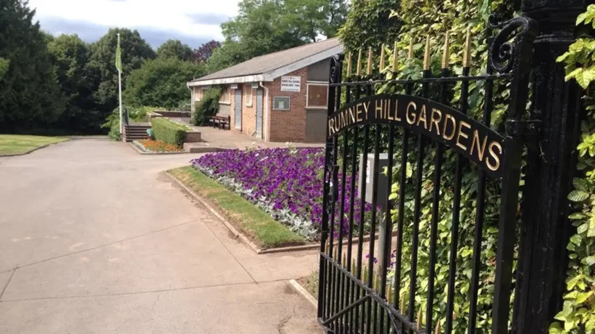
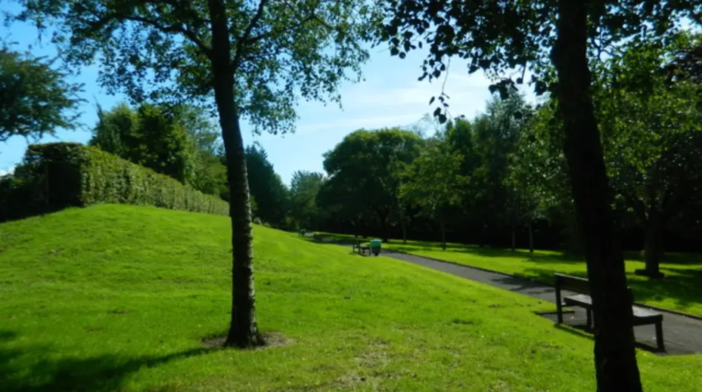
Rumney Hill Gardens is one of the most significant green spaces for local walking. The park contains paths, wooded areas and recreational facilities. Its location provides a transition between the built-up neighbourhood and the landscape around the River Rhymney.
The park has an unusual history. History Points records that the site was consecrated as Rumney Cemetery in April 1937, but it was never used for burials. The land later became allotments during the Second World War before being converted into a public park.
The park was subsequently developed with a bowling green, tennis courts, paths and flowerbeds. History Points records that residents used allotments on the site until 1953, when the land was converted into a park.
Today, Rumney Hill Gardens provides a useful starting point for a local walk. Its wooded areas create a different walking environment from the surrounding residential streets.
The wider Rumney area also connects towards the River Rhymney flood plain. History Points identifies the route beyond Rumney Hill Gardens as part of the Rhymney Trail riverside route for walking and cycling.
Walking routes in Rumney should therefore be considered as a connected network rather than a single circular path. Route choice depends on the desired distance, surface, destination and weather conditions.
How does Rumney Hill Gardens fit into a walking route?
Rumney Hill Gardens provides a green-space section for local walks, with wooded areas, recreational facilities and paths leading towards the River Rhymney flood plain. The park also connects present-day recreation with the site’s former cemetery and allotment history.
Rumney Hill Gardens occupies an important position in the local walking landscape. The park is close to residential areas, making it accessible for everyday walking rather than only recreational visits.
The site also demonstrates how land use in Rumney has changed over time. Its history includes religious consecration, proposed cemetery use, wartime allotments and later public recreation.
The park’s woodland provides shade and a distinct landscape character. Open recreational areas provide additional space for walking and local activity. The paths make the site useful for short walks, while the connection towards the Rhymney flood plain supports longer routes.
Cardiff Council maintains a wider system of parks and green spaces across the city. Its parks service provides information about local parks, play areas, grass cutting, trees and reporting problems in green spaces.
In 2024, Cardiff Council replaced conifers at Rumney Hill Gardens with 18 new trees, including cherry and acer, primarily around the sports facilities. History Points records the tree planting as part of improvements to the site’s treescape.
For walkers, this means the park combines established woodland with newer planting. The landscape also changes according to the season, with tree cover, grass and flowering vegetation creating different conditions throughout the year.
The park is best treated as one component of a wider Rumney walking itinerary. A short visit can focus on the internal paths. A longer walk can continue towards the river corridor.
Can you walk from Rumney towards the River Rhymney?
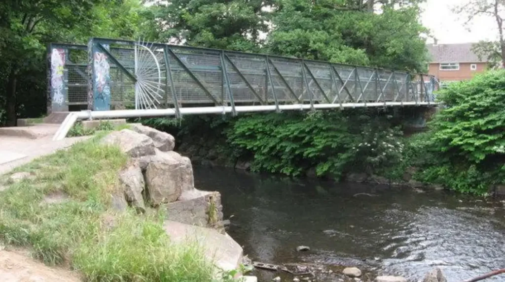
Yes. Rumney connects with the River Rhymney landscape through paths and routes around Rumney Hill Gardens and the flood plain. The riverside corridor provides a longer walking environment beyond residential streets and links into Cardiff’s wider walking and cycling network.
The River Rhymney is a major geographical feature of eastern Cardiff. It separates parts of the urban landscape from the open flood plain and provides a natural corridor through the built-up eastern side of the city.
Rumney’s relationship with the river is also relevant to walking conditions. Cardiff’s Flood Risk Management Plan identifies the western side of Rumney as bounded by the River Rhymney and notes the presence of flood defences.
Floodplain environments require more attention to weather and surface conditions than ordinary pavements. Heavy rainfall can affect ground conditions, drainage and path usability. Walkers should check local conditions before using riverside routes after prolonged rain.
The Rhymney Trail adds a wider recreational dimension. History Points identifies the route through the Rumney Hill Gardens area as part of the riverside walking and cycling corridor.
Riverside walking also changes the visual character of a Rumney route. Residential buildings become less dominant as the path approaches open land and the river environment.
The route is therefore useful for people looking for a longer walk rather than a short neighbourhood stroll. It also creates a connection between Rumney’s green spaces and Cardiff’s wider network of active-travel and recreational routes.
How can you connect a Rumney walk with Llanrumney and Trowbridge?
Rumney connects with nearby communities through Cardiff’s road, pedestrian and active-travel network. Walking routes towards Llanrumney and Trowbridge extend the local walking area and create links between residential neighbourhoods, schools, community facilities, retail areas and transport corridors.
Llanrumney lies immediately to the north and northeast of Rumney, while Trowbridge is another neighbouring eastern Cardiff community. These areas form part of a continuous urban landscape rather than isolated settlements.
Cardiff Council’s active-travel planning recognises the importance of these connections. Cycleway 2 is planned to connect the city centre with Adamsdown, Newport Road retail parks, Rumney, Llanrumney and St Mellons Business Park.
The Cycleway programme is part of Cardiff’s wider effort to improve walking and cycling connections. Cardiff Council states that the proposed cycleways are designed to support people of different ages and abilities and provide continuous, intuitive routes between communities and major destinations.
Walking routes do not always follow the same infrastructure as cycle routes. A cycleway proposal therefore does not automatically mean every section is a dedicated pedestrian path. The exact route design, crossings, footway arrangements and construction phases depend on individual schemes.
The Active Travel Network Map provides a more precise way to understand planned connections. Cardiff Council describes the map as a long-term planning tool covering existing and future routes for walking, wheeling and cycling.
The map also distinguishes active-travel routes from purely recreational paths. Routes shown as active travel must support everyday journeys such as trips to work or school, while leisure-only walking routes do not qualify under the same definition.
This distinction is important when planning a walk. A riverside recreational route and an everyday pedestrian connection serve different purposes, even when they intersect.
What historical features can you see while walking around Rumney?
Rumney’s walking landscape includes historic sites and buildings alongside modern housing and transport infrastructure. Rompney Castle is protected through planning controls, while Rumney Hill Gardens records earlier cemetery, allotment and recreational uses within the area’s changing local history.
Walking around Rumney provides opportunities to observe the area’s transition from a historic settlement into an established Cardiff suburb.
One important heritage reference is Rompney Castle, identified by Cardiff Council within its conservation and planning information. In September 2023, Cardiff Council confirmed an Article 4 direction affecting Rompney Castle in Rumney. The direction removed certain permitted development rights, including rights relating to demolition or painting.
An Article 4 direction is a planning control that removes specified permitted development rights from a property or area. It does not automatically prohibit all change. Instead, it requires certain works to receive planning permission where they would otherwise qualify as permitted development.
Cadw explains that historic buildings and structures can receive statutory protection through listing under the Historic Environment (Wales) Act 2023. Listed buildings are recorded in the national historic-assets system and changes to listed buildings are managed through listed building consent.
Rumney’s heritage is therefore not limited to major monuments. Historic character also survives through older buildings, established street patterns, landscape features and sites with changing community uses.
Rumney Hill Gardens offers a particularly clear example. The site’s history moved from a proposed cemetery in 1937 to wartime allotments and then to a public recreation ground.
This history can be incorporated into a walking itinerary without treating the area as a conventional heritage attraction. The value comes from understanding how land uses changed as Cardiff expanded.
The wider Cardiff landscape contains numerous protected buildings, archaeological remains and historic open spaces. Cardiff Council states that the city has 27 conservation areas, while 18 Cardiff parks and gardens feature on the Cadw Register of Landscapes, Parks and Gardens of Special Historic Interest in Wales.
Rumney’s heritage should therefore be viewed within Cardiff’s wider historic landscape rather than as an isolated collection of buildings.
What type of walking route is best for different visitors?
Short neighbourhood walks suit everyday errands and local exploration, while park-and-riverside walks provide longer recreational routes. Heritage-focused walks work well around historic sites, and active-travel routes suit people walking between homes, schools, shops, transport links and other daily destinations.
A short Rumney walk can concentrate on local streets and Rumney Hill Gardens. This format requires less preparation and works well for everyday exercise or a brief outdoor break.
A medium-length walk can combine residential streets with the park and river corridor. This creates greater variation in scenery and provides a stronger connection between Rumney’s built and natural environments.
A longer walk can continue beyond Rumney towards Llanrumney or Trowbridge. The distance depends on the starting point and selected roads or paths. The official Cardiff rights-of-way information should be checked before relying on a specific public footpath.
A public right of way is a route where the public has a legal right to pass and repass. Cardiff Council states that footpaths provide rights for walkers, while bridleways provide rights for walkers, horse riders and cyclists, with cyclists required to give way to other users.
Not every visible path is a public right of way. Cardiff Council specifically warns that some paths shown on Ordnance Survey maps do not have public-right-of-way status. The council’s Definitive Map is the legal record used to establish public rights of way.
This distinction matters when planning longer walks. A visible track, private access road or permissive path does not necessarily have the same legal status as a recorded public footpath.
Walkers should also consider route surfaces. Pavements provide predictable surfaces for everyday journeys. Park paths can include grass, compacted earth or uneven sections. Riverside routes can become wetter after rainfall.
The correct route therefore depends on purpose. Everyday walking prioritises directness and accessibility. Recreational walking prioritises green space and landscape. Heritage walking prioritises historic locations and interpretation.
Explore more Area Guide
Best Fish and Chips in Rumney: Cardiff Guide 2026
Historic Pubs in Llandaff: Heritage and Architecture in Llandaff, Cardiff 2026
How accessible is walking around Rumney?
Accessibility varies between routes because Rumney contains pavements, park paths, riverside sections and public rights of way with different surfaces and physical characteristics. Cardiff’s active-travel planning specifically considers walking, wheeling, accessibility, path quality, crossings and connections.
Cardiff Council’s Active Travel Network Map uses route-quality assessments when identifying existing active-travel infrastructure. Routes are assessed against Welsh Government Active Travel Design Guidance. Routes scoring above 70% are displayed as suitable existing routes, while lower-scoring routes can carry information about problems affecting their quality.
The council identifies several factors that can affect route quality. These include high vehicle flows, narrow path widths and missing dropped kerbs.
This approach is important for walking and wheeling. A route that works for a confident pedestrian does not automatically provide the same experience for wheelchair users, people with mobility limitations or people using pushchairs.
Cardiff’s Rights of Way Improvement Plan also places emphasis on people who do not regularly participate in outdoor recreation and users who are blind, partially sighted or have mobility difficulties.
Walkers should therefore distinguish between route length and route accessibility. A short path with a smooth surface and dropped kerbs can be more suitable for accessible travel than a longer scenic route with uneven ground.
Weather also affects accessibility. Grass and unsealed surfaces become more difficult after sustained rainfall. Riverside areas require additional attention because they are located within a floodplain environment.
For visitors unfamiliar with Rumney, Cardiff Council’s walking and cycling information provides maps and active-travel resources for planning journeys across the city.
What should you check before walking around Rumney?
Before walking around Rumney, check the official route status, weather, path conditions, roadworks and destination information. Use Cardiff Council’s rights-of-way and active-travel maps for route planning, particularly when a walk includes riverside paths or unfamiliar public footpaths.
The first check should be route legality. Cardiff Council’s Definitive Map provides the legal record of public rights of way. Its online version helps users understand the general location of routes, while the definitive document remains the formal legal record.
The second check should be path condition. Cardiff Council accepts reports about problems including damaged signposts, overgrown vegetation, obstructions, tree issues and dangerous animals on public rights of way.
Roadworks also affect walking routes. Cardiff Council publishes current highway improvement information, including resurfacing works. In July 2026, resurfacing work was recorded on Southern Way in the Penylan and Rumney area.
The third consideration is weather. Riverside and floodplain routes require particular attention after heavy rainfall. The Cardiff Flood Risk Management Plan identifies the River Rhymney boundary and flood-defence infrastructure around Rumney.
The fourth consideration is daylight. Residential streets have conventional urban lighting, while parks and riverside paths can have different lighting conditions. Walkers planning longer routes should account for sunset and route familiarity.
The fifth consideration is route purpose. People walking for an everyday journey should prioritise direct active-travel routes. People walking for recreation should select parks and riverside sections where conditions are suitable.
These checks make walking more predictable and reduce reliance on assumptions about paths that are visible but do not necessarily have public access.
How does Cardiff’s active-travel strategy affect walking in Rumney?
Cardiff’s active-travel strategy places Rumney within a long-term programme connecting eastern communities with Cardiff city centre and major destinations. The Active Travel Network Map covers existing and future routes for walking, wheeling and cycling across the city.
The Active Travel (Wales) Act 2013 established duties for Welsh local authorities to improve active-travel opportunities. Cardiff Council states that its Active Travel Network Map is designed around walking, wheeling and cycling routes that support everyday journeys.
Cardiff’s current network planning has a long-term horizon. The council describes the Active Travel Network Map as a 15-year plan for improving routes. It also states that the approved map from December 2022 is being updated and that the updated version is due for submission to the Welsh Government on 1 December 2026.
Rumney has a dedicated ward map within this planning framework. Cardiff Council lists Rumney among the Cardiff wards for which Active Travel Network Maps are available.
Cycleway 2 is particularly relevant because its proposed alignment connects Cardiff city centre with Adamsdown, Newport Road retail parks, Rumney, Llanrumney and St Mellons Business Park.
This programme gives Rumney a strategic position in eastern Cardiff’s transport network. Walking infrastructure is not only a recreational issue. It supports access to employment, education, retail, health, leisure and transport.
The long-term approach also reflects Cardiff’s wider population growth. The city’s population increased by approximately 16,200 between the 2011 and 2021 censuses.
As Cardiff grows, connections between residential communities and major destinations become increasingly important. Rumney’s location along the eastern transport corridor makes pedestrian connectivity part of the city’s wider planning strategy.
Why does walking around Rumney matter for Cardiff?
Walking around Rumney connects everyday urban mobility with parks, riverside landscapes, heritage and neighbouring communities. The area’s walking network supports local journeys while linking Rumney to Cardiff’s wider active-travel strategy, public-rights-of-way system and green-space network.
Rumney demonstrates how walking functions within a modern urban community. A walking route can simultaneously provide transport, recreation, access to green space and exposure to local history.
Rumney Hill Gardens illustrates this combination particularly well. The site is a public park, a recreational space and a location with documented historical changes from proposed cemetery use to wartime allotments and public gardens.
The River Rhymney provides another important layer. The river corridor creates a natural landscape within an urban setting and connects local walking opportunities with a wider riverside route.
Public rights of way provide the legal framework for many walking connections. Cardiff Council manages approximately 200 kilometres of public rights of way and bridleways, supported by other access routes including permissive paths, green lanes, cycle tracks, parks and common land.
Active-travel planning adds another layer by focusing on everyday journeys. The objective is not simply to create recreational trails. It is to make walking and cycling practical alternatives for trips to schools, workplaces, shops, health facilities and transport interchanges.
For Rumney, this means walking has both local and strategic importance. Local routes serve residents. Riverside routes provide recreation. Connections towards Llanrumney and Trowbridge support neighbourhood mobility. Future active-travel improvements connect eastern Cardiff more effectively with the city centre and St Mellons.
Walking around Rumney is therefore best understood as an interconnected urban experience. The area combines residential Cardiff, green infrastructure, the River Rhymney, historic land uses and evolving transport planning.
For visitors, the most useful approach is to combine a green-space section with local streets and, where conditions permit, a riverside route. For residents, the same network provides practical links for everyday journeys. Official Cardiff Council maps should be used to confirm public rights of way, active-travel routes, road conditions and planned infrastructure before setting out.
Rumney’s walking environment will continue to form part of Cardiff’s wider movement network as the city develops its long-term active-travel programme. The combination of existing parks, established rights of way and planned connections gives walking a lasting role in the area’s geography and daily life.
Is Rumney Cardiff good for walking?
Yes. Rumney offers residential walking routes, Rumney Hill Gardens, riverside paths near the River Rhymney and connections towards Llanrumney, Trowbridge and other eastern Cardiff communities.