The Office for National Statistics collects baseline counts every decade through the official United Kingdom Census. Local government administrative databases track these counts to evaluate housing demands, healthcare allocation, and transportation planning across South Wales. The official figure represents the fixed resident population within the designated municipal boundaries of the Rumney electoral ward in east Cardiff.
- How has the population of Rumney changed historically?
- What is the age distribution within the Rumney demographic profile?
- How does ethnic diversity manifest in the Rumney community?
- What are the primary socioeconomic conditions affecting the population of Rumney?
- How does household composition shape local housing demand in Rumney?
- What religious beliefs are held by residents living in Rumney?
- What health and educational metrics characterize the Rumney population?
- How do geographic boundaries define the population density of Rumney?
- What electoral and administrative governance structures oversee Rumney residents?
- What future demographic projections are anticipated for Rumney?
The population of the broader area varies depending on whether administrative ward boundaries or local postal sector definitions are evaluated. The electoral ward covers a specific geographic zone bordered by Llanrumney to the northwest, Trowbridge to the east, and the River Rhymney to the west. Adjacent residential developments alter overall local urban density, but official government statistical outputs isolate the ward footprint for consistent tracking across multi-year intervals.
Demographic monitoring in Wales relies on the Welsh Government and the Office for National Statistics to process census entries into localized ward profiles. These statistical summaries calculate gender ratios, householder totals, and residential density metrics across the administrative territory. The official population baseline remains critical for funding models applied across the Cardiff principal area.
How has the population of Rumney changed historically?
The population of Rumney transformed from a small rural village of several hundred residents into a bustling suburban community exceeding 9,000 residents following the Cardiff Extension Act 1937. Major mid-century municipal housing projects drove this rapid demographic transition.
Historic population records confirm that Rumney existed as an agricultural community within Monmouthshire prior to its boundary incorporation into the county borough of Cardiff. The expansion of industrial transport networks along the Severn Estuary initiated steady inbound migration during the late nineteenth and early twentieth centuries.
The primary demographic growth period occurred during the post-World War II era. Municipal council initiatives established mass housing developments to accommodate Cardiff’s growing industrial workforce. Farm holdings gave way to suburban residential housing estates, which permanently elevated local resident totals.
The historical population trajectory reflects broader demographic expansion across the capital city of Wales. Residential stability followed the initial post-war construction surge, keeping total census totals consistent over recent decades.
- 1930s boundary changes: Incorporation into Cardiff County Borough.
- Post-war construction: Transition from rural farms to suburban housing.
- Late 20th century: Stabilization of local census figures.
- Modern decade: Infill development and regeneration driving localized growth.
What is the age distribution within the Rumney demographic profile?
The age distribution in Rumney displays a balanced multi-generational demographic structure characterized by strong working-age cohorts, established families, and a expanding proportion of retired older residents. This structural balance underpins steady local demand for schools and elder care services.
The population profile indicates that children and young adults under 18 years old comprise roughly one-fifth of total residents. The working-age population aged 18 to 64 years forms the largest structural group, making up more than 55 percent of usual residents. Pensioners and seniors aged 65 and over constitute the remaining proportion of the local population.
This distribution generates specific public service demands within the community. Family-dense neighborhoods require consistent primary and secondary school capacity, whereas the growing elderly segment relies heavily on local medical practices and community social care systems.
Changes in median age inside Rumney mirror broader trends recorded across Cardiff and Wales. While central Cardiff retains a lower median age due to high university student populations, suburban wards like Rumney maintain higher median ages that align closely with traditional family-residential environments.
- Youth cohort: High demand for local education facilities.
- Working-age cohort: Commuter movement toward central Cardiff commercial hubs.
- Retirement cohort: Elevated reliance on primary health infrastructure.

How does ethnic diversity manifest in the Rumney community?
The ethnic composition of Rumney features a prominent majority White British background alongside growing minority ethnic communities that reflect the broader multicultural development of Cardiff. Diversity figures have steadily expanded in recent decennial censuses.
Decennial census evaluations demonstrate that over 85 percent of Rumney residents identify within the White ethnic category, encompassing Welsh, English, Scottish, and Northern Irish identities. The remaining proportion includes Asian, Black, Mixed, and other minority ethnic backgrounds.
Cardiff has a centuries-long history of international trade and migration, which has gradually diffused from maritime districts like Butetown outward into suburban areas like Rumney. Overseas migration and internal mobility across the United Kingdom contribute to this gradual diversification.
The linguistic landscape mirrors these ethnic patterns. English serves as the primary spoken language across households, while the proportion of Welsh speakers has risen in step with capital-wide educational programs and national Welsh-language targets.
- White British: Dominant demographic heritage group.
- Asian Welsh / British: Growing business and residential presence.
- Mixed Heritage: Fast-growing youth demographic segment.
- Black Welsh / British: Established community presence across east Cardiff.
What are the primary socioeconomic conditions affecting the population of Rumney?
Socioeconomic indicators in Rumney reveal a predominantly working-class and lower-middle-class residential profile marked by mixed employment levels, varied income distributions, and diverse housing tenure patterns. Local conditions reflect typical suburban economic profiles in South Wales.
The Welsh Index of Multiple Deprivation evaluates localized economic health across income, employment, health, education, and housing domains. Portions of Rumney rank within moderate deprivation percentiles compared to national benchmarks, showing higher economic challenges than affluent northern Cardiff wards but lower deprivation than adjacent urban areas.
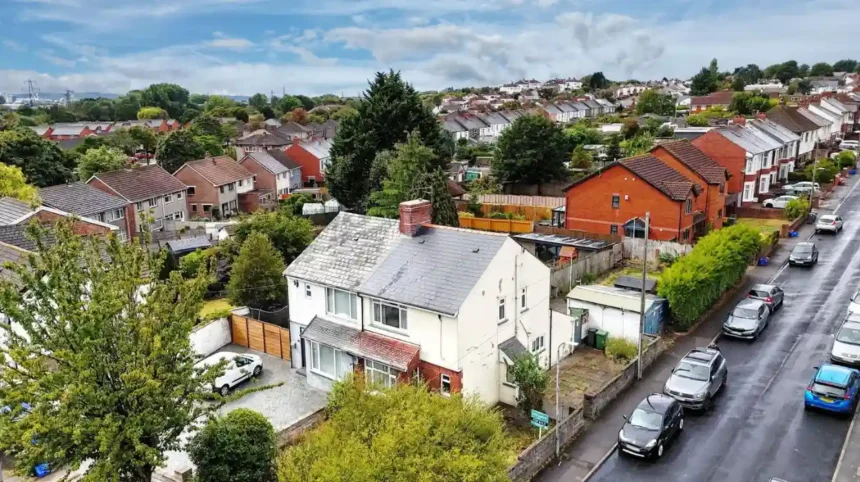
Housing stock consists mainly of mid-century semi-detached houses, terraced dwellings, and public social housing developments. The ratio between owner-occupied homes and social rented properties directly influences local wealth retention and household disposable income.
Employment patterns reflect strong representation in construction, retail, healthcare, logistics, and public administration. A smaller proportion of residents hold corporate managerial roles compared to national averages, prioritizing local access to vocational training and entry-level employment pipelines.
- Employment fields: Construction, health care, retail trade, transportation.
- Deprivation ranking: Mid-tier performance on Welsh Index metrics.
- Property types: High density of terraced homes and semi-detached builds.
How does household composition shape local housing demand in Rumney?
Household structures in Rumney feature a high concentration of nuclear families, lone-parent households, and single-person senior residences, driving consistent demand for two- and three-bedroom housing stock. These arrangements dictate property development strategies throughout the area.
Census records show that multi-person family households make up the majority of residential addresses in Rumney. Lone-parent families represent a notable subset, creating specific demands for affordable housing options, childcare services, and localized support networks.
Single-person households are heavily represented among elderly residents aging in place. This dynamic creates dual pressure on the housing market: young families require expanding living spaces, while older residents require accessible dwellings suited for single occupants.
The local residential footprint reflects low levels of multi-occupancy student housing compared to central Cardiff wards. Consequently, housing turnover remains lower, promoting long-term community residency over transient population shifts.
- Family units: Primary consumers of three-bedroom residential properties.
- Single elderly households: Primary users of local health and community services.
- Lone-parent families: Major demographic segment utilizing localized public support.
Explore more Area Guide
Cardiff’s Hidden Chapels: Nonconformist Architectural and Cultural History Guide to Wales
Temples Around Cardiff: A Complete Guide to Sacred Spaces and Heritage
What religious beliefs are held by residents living in Rumney?
Religious identification in Rumney is primarily divided between Christianity and non-religious belief systems, with smaller numbers of Muslim, Hindu, and other faith populations. Modern census trends reflect a growing secular shift across all age groups.
Historical development embedded Christian denominations deeply within the community, visible in local Anglican and Roman Catholic churches like St. Augustine’s. However, census returns document a steady decline in active Christian identification over recent decades, matching patterns observed across Wales.
The proportion of residents selecting “No Religion” in census questionnaires has grown significantly. Younger cohorts drive this trend toward secularism, whereas older residents maintain higher rates of traditional religious affiliation.
Non-Christian faith groups constitute a modest percentage of the local population. Nearby places of worship in central and eastern Cardiff serve these communities, supporting cultural and religious practices across the region.
- No Religion: Fastest-growing group in decennial surveys.
- Christianity: Historically dominant belief system; retains strong presence among seniors.
- Islam: Minority faith group with steady local representation.
- Other World Religions: Small, diverse groups contributing to local multiculturalism.
What health and educational metrics characterize the Rumney population?
Health and educational outcomes in Rumney indicate moderate attainment levels alongside specific health challenges linked to industrial heritage and socioeconomic factors. Public health data highlights continuous demand for local medical interventions.
The Welsh Index of Multiple Deprivation tracks key community health indicators, including chronic conditions, limiting long-term illnesses, and mental health diagnoses. Rumney records higher rates of long-term health problems than national averages, driving higher utilization of local NHS primary care services.
Educational attainment metrics show a balanced distribution between academic qualifications and vocational skills. Secondary education centered around facilities like Eastern High School provides foundational pathways for young residents transitioning into higher education or regional trades.
Adult qualification levels show that a higher percentage of residents hold Level 2 and Level 3 vocational certifications compared to postgraduate academic degrees. Local policies focus on improving youth skill retention and boosting higher education admission rates across east Cardiff.
- Chronic illnesses: Above-average reporting of long-term mobility issues.
- Vocational qualifications: Strong technical skill base within the active workforce.
- Educational facilities: Centralized secondary campuses serving adjacent eastern wards.
How do geographic boundaries define the population density of Rumney?
Geographic boundaries isolate Rumney as a distinct physical ward, establishing an overall urban population density of approximately 3,000 to 4,000 people per square kilometer. Natural and infrastructure barriers bound this land footprint.
The electoral ward encompasses a fixed land area bounded by the River Rhymney to the west, which historically separated Monmouthshire from Glamorgan. To the south, major commercial transport routes like the A48 Newport Road create a functional division between residential zones and industrial parks.
Population density remains concentrated in planned residential estates, while green infrastructure like Rumney Recreation Ground and the Rhymney River Trail preserve public open space. These land features prevent over-densification compared to inner-city Cardiff wards.
The spatial layout limits rapid geographic expansion. Future population growth depends primarily on urban infill projects, brownfield redevelopment, and adaptive reuse of existing commercial sites rather than greenfield construction.
- Land area: Fixed administrative ward boundaries.
- Natural barriers: River Rhymney corridor restricting westward expansion.
- Density metrics: Moderate suburban density compared to high-density urban centers.
What electoral and administrative governance structures oversee Rumney residents?
The population of Rumney is governed by Cardiff Council locally, represented by elected ward councillors, and falls within the Cardiff East UK parliamentary constituency. These political structures direct local municipal spending and representation.
Local municipal governance relies on three elected local councillors who represent the Rumney ward within the County Council of the City and County of Cardiff. Council decisions govern primary services including waste collection, local road maintenance, planning permissions, and primary education delivery.
At the national level, boundary revisions integrated Rumney into the newly formed Cardiff East UK parliamentary constituency. Devolved matters fall under the jurisdiction of the Senedd Cymru (Welsh Parliament), where residents are represented within the Cardiff South and Penarth Senedd constituency.
Political engagement reflects traditional working-class voter demographics, consistently shaping parliamentary and local council election outcomes across the eastern sector of the capital.
- Cardiff Council: Direct administrative authority for local services.
- UK Parliament: Represented within the Cardiff East constituency.
- Senedd Cymru: Governs devolved Welsh healthcare, education, and transport policy.

What future demographic projections are anticipated for Rumney?
Future demographic projections anticipate stable, slow population growth for Rumney driven by limited land availability, modest housing infill projects, and steady long-term residency patterns. The area’s demographic profile will likely mirror broader regional aging trends.
Projections prepared by Cardiff Council indicate that major urban population growth will concentrate in peripheral strategic housing allocations elsewhere in the county. Because Rumney is a mature suburban ward, its total population will remain structurally stable rather than experiencing sudden surges.
The median age of local residents is expected to rise slowly, increasing the proportion of retirees relative to active workers. Public policy will need to adapt to support an aging demographic by enhancing local healthcare accessibility, public transport connections, and community care services.
Redevelopment of disused commercial and industrial sites along Newport Road may introduce new apartment developments, attracting younger commuters seeking affordable housing outside central Cardiff.
What is the official total population of Rumney?
The official usual resident population of the Rumney electoral ward in Cardiff stands at approximately 9,100 people, according to Office for National Statistics (ONS) census figures.