Grangetown is a low-lying Cardiff district beside the River Taff, Cardiff Bay and the Bristol Channel. Its flood risk is assessed through Natural Resources Wales’ Flood Map for Planning, which separates risk from rivers, the sea, and surface water. The current mapping shows that flood risk varies across Grangetown rather than assigning the whole district to one single zone.
- What flood zone covers Grangetown in Cardiff?
- Why does Grangetown have significant flood risk?
- What does Flood Zone 3 mean in Grangetown?
- Is all of Grangetown in Flood Zone 3?
- What are Flood Zones 1, 2 and 3 in Wales?
- How has flood-zone mapping in Wales changed?
- What is a TAN 15 Defended Zone in Grangetown?
- Does the River Taff affect Grangetown’s flood zone?
- Does Cardiff Bay and the sea affect Grangetown’s flood risk?
- How does surface-water flooding affect Grangetown?
- What does Grangetown flood risk mean for property buyers?
- What does flood zoning mean for planning applications in Grangetown?
- How should residents check the flood zone for a Grangetown address?
- Why should old Grangetown flood-zone information be treated carefully?
- What is the overall flood-risk picture for Grangetown?
What flood zone covers Grangetown in Cardiff?
Grangetown does not have one single flood-zone classification across the whole area. Current Natural Resources Wales mapping places different locations in Flood Zones 1, 2 and 3, depending on the flooding source, exact site and mapped flood extent. Some locations also sit within TAN 15 Defended Zones.
The most important point is that Flood Zone 3 occurs in parts of Grangetown, particularly where river, tidal and low-lying flood-risk areas extend across individual sites. Current planning evidence also identifies locations in Grangetown within Flood Zone 2.
A recent Flood Consequences Assessment for 39 Coedcae Street, Grangetown states that the site is within a TAN 15 Defended Zone. The assessment examined both fluvial flooding from rivers and tidal flooding and considered climate-change allowances.
Another Cardiff planning assessment covering the Wholesale Fruit Market on Bessemer Road identifies the site as being within Flood Zone 2 for river flooding. The same assessment identifies predominantly Flood Zone 1 conditions for surface water, with localised areas of Flood Zones 2 and 3.
This demonstrates why a postcode-level or neighbourhood-level answer is insufficient for property decisions. The flood classification can change between streets and individual development sites.
Natural Resources Wales describes the Flood Map for Planning as a screening tool. It is used by planning authorities to identify locations where further flood assessment is required. It also informs site-specific Flood Consequences Assessments.
Why does Grangetown have significant flood risk?
Grangetown has flood risk because it occupies a low-lying part of southern Cardiff close to the River Taff, Cardiff Bay and tidal waters. Its flood assessment therefore considers river flooding, sea flooding and surface-water flooding as separate sources with different mapped extents.
Grangetown sits within Cardiff’s southern urban area, close to the River Taff and Cardiff Bay. The relationship between the district and these water environments is central to its flood-risk profile.
The River Taff is a major river flowing through Cardiff before reaching Cardiff Bay. River flooding is also known as fluvial flooding. It occurs when river water exceeds the capacity of the river channel or associated flood system.
Tidal flooding is another important consideration. Cardiff Bay connects to the wider Severn Estuary system, where tidal levels influence flood conditions.
The Flood Map for Planning therefore separates river and sea sources in its detailed view. Its basic view can merge river and sea flood-risk information, while the detailed view allows the individual sources to be examined separately.
Surface-water flooding forms another category. This occurs when intense rainfall exceeds the capacity of drainage systems, roads, land surfaces and watercourses.
This distinction matters because a property can have low river risk but still have surface-water exposure. Conversely, a property can be inside a river flood zone while having a different classification for surface-water flooding.
Cardiff Council’s flood management information covers flood risk management, local flood risk, highway drainage, ordinary watercourses and sustainable drainage systems.
What does Flood Zone 3 mean in Grangetown?
Flood Zone 3 represents the highest mapped planning flood-risk category for rivers, the sea and surface water. It includes areas with a 1% or greater annual river-flood probability, a 0.5% or greater annual sea-flood probability, or a 1% or greater annual surface-water probability.
Natural Resources Wales defines Flood Zone 3 using different probability thresholds for different sources.
For rivers, Flood Zone 3 covers areas with a 1% or greater annual probability, equivalent to a 1-in-100 annual probability, including the relevant climate-change allowance.
For the sea, Flood Zone 3 covers areas with a 0.5% or greater annual probability, equivalent to a 1-in-200 annual probability, including the relevant climate-change allowance.
For surface water and small watercourses, Flood Zone 3 covers areas with a 1% or greater annual probability.
These figures describe annual probability. A 1-in-100 annual probability does not mean flooding occurs once every 100 years. It describes the statistical probability assigned to an event in any individual year.
Flood Zone 3 also does not mean that every property inside the boundary floods during every major rainfall or tidal event. The mapping represents modelled flood extent and probability.
Flood defences also affect how flood risk is interpreted. The standard Flood Map for Planning flood zones show undefended risk, while TAN 15 Defended Zones identify areas benefiting from qualifying flood defences.
This distinction is particularly important in Grangetown because parts of the area benefit from flood-management infrastructure.
Is all of Grangetown in Flood Zone 3?
No. Grangetown is not uniformly classified as Flood Zone 3. Current planning evidence identifies locations in Flood Zones 2 and 3, while other locations have Flood Zone 1 or different classifications depending on the flooding source and exact site boundary.
A neighbourhood boundary does not determine a property’s flood zone.
Flood maps operate spatially. Their boundaries follow modelled flood extents rather than ward or community boundaries.
The Bessemer Road assessment provides a clear example. It identifies river Flood Zone 2 at the assessed site, while its surface-water assessment identifies predominantly Flood Zone 1 with some localised Flood Zones 2 and 3.
Other Grangetown locations have been identified as Flood Zone 3 in current property and planning records. Recent planning information for 9 Redlaver Street, Grangetown identifies Flood Zone 3 for rivers and the sea.
A separate current planning record for CF11 6NG in Grangetown also identifies Flood Zone 3 for rivers and the sea.
These examples demonstrate the importance of checking the exact property rather than applying one classification to the entire district.
What are Flood Zones 1, 2 and 3 in Wales?
Flood Zones 1, 2 and 3 represent different levels of mapped flood probability in Wales, with Flood Zone 1 representing lower mapped risk and Flood Zone 3 representing the highest mapped planning risk for the relevant flooding source.
Flood Zone 1 represents land outside the higher-probability areas shown in Flood Zones 2 and 3 for the relevant mapped source.
Flood Zone 2 covers intermediate flood probability. For rivers, it represents an annual probability below 1% but at least 0.1%, equivalent to a range between 1-in-100 and 1-in-1,000 annual probability.
For sea flooding, Flood Zone 2 represents an annual probability below 0.5% but at least 0.1%, equivalent to a range between 1-in-200 and 1-in-1,000 annual probability.
Flood Zone 3 represents the higher-probability category.
The Welsh system also considers climate change. Current Flood Map for Planning information incorporates climate-change effects into mapped flood extents.
This makes the current Welsh mapping different from older flood-risk information that residents or property listings can still reference.
How has flood-zone mapping in Wales changed?
Wales replaced the older Development Advice Map approach with the Flood Map for Planning framework, supported by revised Technical Advice Note 15. The current framework considers present and future flood risk from rivers, the sea and surface water when planning development.
The history of flood planning in Wales is important when interpreting older Grangetown documents.
The earlier TAN 15, published in 2004, worked with the Development Advice Map. In 2021, Welsh Government introduced a revised framework and Flood Map for Planning, but implementation was suspended during a review.
The current revised Technical Advice Note 15, commonly called TAN 15, was published in 2025. It uses a risk-based approach that considers both the likelihood of flooding and the vulnerability of proposed development.
Older Cardiff planning documents can therefore contain terminology that does not directly match the current mapping.
For example, Cardiff planning records have historically referred to Flood Zone C1 under the former Development Advice Map system. A Cardiff planning committee document identified a Grangetown-related site as being in Flood Zone C1 and described it as an area served by significant infrastructure, including flood defences.
That historical C1 classification should not be treated as a direct replacement for the current Flood Map for Planning classification.
Current property and development decisions should use the latest applicable NRW mapping and current TAN 15 requirements.
What is a TAN 15 Defended Zone in Grangetown?
A TAN 15 Defended Zone identifies land benefiting from qualifying flood defences that provide a specified standard of protection. It does not remove flood risk and does not automatically make development suitable because breach, climate-change and site-specific consequences still require assessment.
Natural Resources Wales defines TAN 15 Defended Zones using flood-defence standards.
For river defences, the minimum present-day standard used for the defended-zone mapping is based on a 1-in-100 annual event probability.
For sea defences, the minimum present-day standard is based on a 1-in-200 annual event probability.
Newer flood defences constructed from 2016 onwards also have requirements relating to climate change and design freeboard for inclusion within the TAN 15 Defended Zone mapping.
The term “defended” therefore describes the presence and assessed standard of flood protection. It does not mean “no flood risk”.
Natural Resources Wales states that defended zones should not automatically be considered suitable for development. Flood consequences, including breach scenarios, must be demonstrated through the appropriate assessment.
This is directly relevant to Grangetown because recent Flood Consequences Assessments identify individual sites within TAN 15 Defended Zones.
The Coedcae Street assessment, for example, considers defended conditions, climate-change scenarios and tidal and fluvial events.
Does the River Taff affect Grangetown’s flood zone?
Yes. The River Taff is an important source considered in Grangetown flood-risk assessments. Current planning assessments examine fluvial flood risk separately from tidal and surface-water risk, and individual Grangetown sites have mapped river Flood Zones 2 and 3.
Fluvial flooding describes flooding from a river.
The River Taff flows through Cardiff before entering Cardiff Bay. Its floodplain forms part of the wider flood-risk assessment for southern Cardiff.
The current NRW Flood Map for Planning identifies river flood zones separately in its detailed view. This enables planners to distinguish fluvial risk from tidal risk.
The Wholesale Fruit Market assessment on Bessemer Road provides a current Cardiff example. It identifies the assessed location within Flood Zone 2 for river flooding and assesses the site’s fluvial risk in greater detail.
The Coedcae Street Flood Consequences Assessment also evaluates a 1-in-100-year fluvial event with climate-change allowances.
These assessments show that river flood risk in Grangetown requires site-specific examination rather than a single neighbourhood-wide assumption.
Does Cardiff Bay and the sea affect Grangetown’s flood risk?
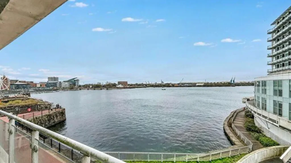
Yes. Cardiff Bay and the wider tidal environment form an important part of Grangetown’s flood-risk assessment. The current Flood Map for Planning separately models sea flooding, while planning assessments examine tidal events alongside river flooding and climate-change allowances.
Sea flooding differs from river flooding because tidal levels influence the extent and depth of inundation.
Grangetown’s position beside Cardiff Bay places tidal risk within the wider flood-planning framework.
The current Flood Map for Planning has a dedicated sea-flood layer. Cardiff Council’s Strategic Flood Consequences Assessment includes separate mapping for sea flood zones and TAN 15 Defended Zones.
A site can therefore have a different classification for river flooding and sea flooding.
The Coedcae Street assessment illustrates this distinction. It examined both fluvial and tidal scenarios and found different outcomes under the assessed modelling conditions.
This is why a property report that only states “Flood Zone 3” does not provide the full technical picture. The underlying source of flooding also matters.
How does surface-water flooding affect Grangetown?
Surface-water flooding is assessed separately from river and sea flooding. It occurs when rainfall exceeds drainage or infiltration capacity, and current Welsh flood mapping identifies separate surface-water and small-watercourse Flood Zones that can differ from a property’s river or sea classification.
Surface-water flooding is particularly relevant to built-up urban areas.
Rainfall can collect on roads, paved areas, gardens and other surfaces when drainage capacity is exceeded.
Natural Resources Wales maps surface-water and small-watercourse risk as a separate category within the Flood Map for Planning.
The Bessemer Road assessment demonstrates how this works in practice. The site is predominantly within Flood Zone 1 for surface water, but localised areas of Flood Zones 2 and 3 are identified.
This shows why a property can have several different flood-risk classifications depending on the source being assessed.
Drainage design is also relevant to new development and redevelopment. Cardiff Council provides information on highway drainage and Sustainable Drainage Systems, known as SuDS. SuDS are designed to manage rainfall through measures that imitate natural drainage processes.
What does Grangetown flood risk mean for property buyers?
For property buyers, Grangetown flood risk should be checked against the exact address rather than the district name. Buyers should review current NRW mapping, property searches, flood history, insurance information and relevant planning assessments before treating a flood-zone classification as conclusive.
A flood zone is an important property-search factor.
It is not, by itself, a complete assessment of an individual building.
The first step is checking the exact location on the current Flood Map for Planning. The map identifies flood risk by source and provides information for planning screening.
The second step is checking the property’s legal and environmental searches.
A conveyancing search can identify relevant flood-risk information and historic flooding records.
The third step is checking insurance arrangements. Flood-zone information can be relevant to insurance availability, premiums and policy terms.
The fourth step is examining any planning history for extensions, conversions or new development. A Flood Consequences Assessment can contain more detailed information than a general online flood map.
The exact building position also matters. Flood boundaries can cross individual sites, roads or parcels of land.
A property near a mapped boundary requires particularly careful address-level checking.
What does flood zoning mean for planning applications in Grangetown?
Flood zoning directly affects planning assessment in Grangetown because Welsh planning policy uses flood probability, development vulnerability and flood consequences when assessing proposals. Higher flood risk and more vulnerable uses face stronger planning requirements under current TAN 15.
TAN 15 is planning guidance issued by the Welsh Government.
The 2025 version uses a risk-based approach. It considers the likelihood of flooding alongside the vulnerability of the proposed development.
Highly vulnerable development receives particular scrutiny in high-risk locations.
Welsh Government states that the current TAN does not support new highly vulnerable development in areas of highest flood risk, identified as Flood Zone 3, subject to the policy framework and specific circumstances set out in the guidance.
Planning applications can therefore require technical flood assessment.
A Flood Consequences Assessment, or FCA, examines the effects of flooding on a proposed development. It can assess flood depth, velocity, access, evacuation, mitigation and the impact of the development on flood risk.
Cardiff Council and Natural Resources Wales have defined roles within this planning process. Cardiff Council acts as the local planning authority, while NRW provides technical flood-risk information and advice within its statutory responsibilities.
How should residents check the flood zone for a Grangetown address?
Residents should use the latest Natural Resources Wales Flood Map for Planning, search the exact property location, check river, sea and surface-water layers separately, and review any relevant planning or Flood Consequences Assessment documents for the site.
The most reliable starting point is the Natural Resources Wales Flood Map for Planning.
Its detailed view separates flooding from rivers, the sea, and surface water and small watercourses.
Residents should record the exact mapped position rather than relying only on a postcode.
This is important because one postcode can contain multiple properties with different relationships to a flood boundary.
For development proposals, the appropriate assessment should use the latest climate-change projection figures and current flood mapping. Welsh Government guidance states that technical flood-risk and Flood Map for Planning matters should be directed to Natural Resources Wales, while site-specific planning questions should be directed to the relevant local planning authority.
Cardiff Council also publishes flood-risk management information covering the city and its communities.
The Cardiff Strategic Flood Consequences Assessment provides further technical evidence for planning work. Cardiff Council’s current Local Development Plan examination library includes separate mapping for rivers, sea flooding, surface water, historic flooding and other flood-risk categories.
Explore More Area Guide
Cardiff Health Board: Cardiff and Vale University Health Board
Which Police Neighbourhood Covers Splott? South Wales Police
Why should old Grangetown flood-zone information be treated carefully?
Older Grangetown documents can use the former Development Advice Map and classifications such as C1, while current planning work uses the Flood Map for Planning and revised TAN 15. Comparing old and current maps requires attention to the mapping system, publication date, flood source and climate-change assumptions.
Flood mapping is not static.
Natural Resources Wales updates flood-risk information as modelling and evidence develop.
The 2021 Welsh Government statement explained that the Flood Map for Planning incorporated climate-change projections and was designed to account for future flood-risk changes.
The revised TAN 15 published in 2025 is now the relevant planning framework for new development subject to its transitional arrangements.
Consequently, an old property listing that describes a Grangetown property as “C1” does not automatically provide the current classification.
Similarly, an old planning application can contain flood information based on modelling that differs from current NRW data.
For a current property purchase or planning application, the latest official mapping and applicable planning guidance should take priority.
What is the overall flood-risk picture for Grangetown?
The overall picture is mixed rather than uniform: parts of Grangetown fall within higher river or sea flood zones, other locations fall within lower mapped zones, and some sites benefit from mapped flood defences. Exact flood risk depends on location, flood source, defence conditions and climate-change modelling.
The answer to “Which flood zone covers Grangetown?” is therefore not simply Flood Zone 3.
Flood Zone 3 is present in parts of the area.
Flood Zone 2 is also documented at Grangetown sites.
Flood Zone 1 applies to some mapped areas for particular flood sources.
TAN 15 Defended Zones also cover some locations where qualifying flood defences provide a defined standard of protection.
Current evidence from Cardiff planning work reinforces this site-specific approach. The Strategic Flood Consequences Assessment contains separate mapping for river, sea, surface-water and historic-flooding information.
The distinction between undefended flood zones and defended zones is particularly important. A defended location remains subject to residual flood risk, including potential defence failure or breach scenarios.
For residents, buyers and developers, the most accurate answer therefore comes from the exact address and current NRW mapping.
Grangetown’s proximity to the River Taff and Cardiff Bay makes flood-risk information an important part of property, planning and development decisions.
The current official framework is the Natural Resources Wales Flood Map for Planning, used alongside Welsh Government’s Technical Advice Note 15 and Cardiff Council’s local flood-risk and planning evidence.
What flood zone is Grangetown in?
Grangetown is covered by more than one flood zone. Parts of the Cardiff district fall within Flood Zones 2 and 3, while other locations have lower mapped flood risk. The exact classification depends on the property’s location and flooding source.