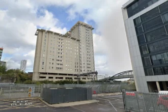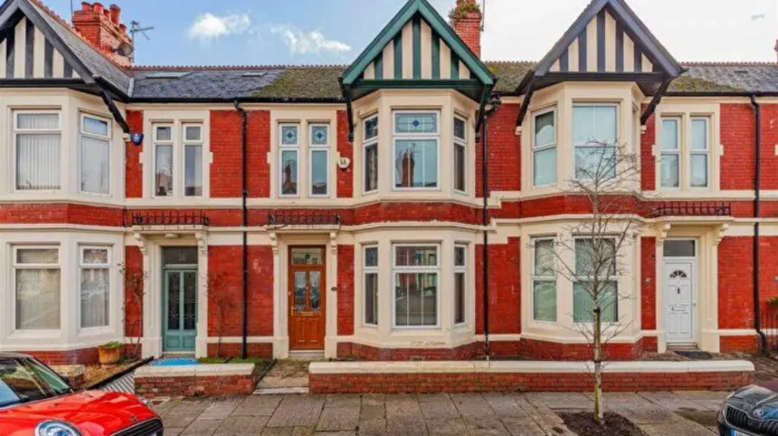
Adamsdown is one of Cardiff’s oldest inner-city districts. Its history connects medieval landholding, Cardiff Castle, farming, Victorian urban expansion, Irish migration, railways, docks, industry, housing, healthcare, religion and community development. The district sits immediately east of Cardiff city centre and retains a street pattern shaped by more than two centuries of urban change.
- Why is Adamsdown called Adamsdown?
- What was Adamsdown like before Cardiff expanded?
- How did Victorian development transform Adamsdown?
- Why are Adamsdown’s street names unusual?
- How did railways and industry shape Adamsdown?
- What role did healthcare and public institutions play in Adamsdown?
- Which historic buildings still explain Adamsdown’s past?
- How did Newtown become part of the Adamsdown story?
- How has Adamsdown changed during the twentieth and twenty-first centuries?
- What does Adamsdown’s history tell us about Cardiff?
The story behind Adamsdown begins with a landscape that was once open countryside outside Cardiff’s medieval eastern boundary. Documentary evidence shows that the place-name existed centuries before the modern residential district developed. The Royal Commission on the Ancient and Historical Monuments of Wales records forms including Adams Downe Farm from 1665 and Adams Down Farm from 1792, demonstrating the long continuity of the name.
The modern neighbourhood emerged during Cardiff’s rapid expansion in the nineteenth century. Farming land gave way to streets, schools, churches, public institutions, industrial premises and working-class housing. Newtown, later incorporated into the wider Adamsdown area, became particularly important because of its Irish population and its connection with Cardiff’s expanding docks.
Adamsdown therefore represents more than a residential district. Its physical landscape records Cardiff’s transformation from a comparatively small market and port town into a major industrial and commercial city.
Why is Adamsdown called Adamsdown?
Adamsdown takes its name from an older parcel of land called Adam’s Down or Adams Downe, with the name recorded for centuries; local historical research connects Adam with Adam Kyngot, a medieval Cardiff Castle porter, while official Welsh place-name evidence confirms the historic name forms.
The precise origin of the personal name remains an important part of Adamsdown’s history. A long-standing explanation identifies Adam Kyngot, a fourteenth-century porter or gatekeeper associated with Cardiff Castle. Historical accounts state that land beyond Cardiff’s eastern gate became associated with Adam and the surrounding “down” or open upland.
The explanation is not simply a modern local tradition. The historic place-name record provides much stronger evidence for the antiquity of the name itself. The Royal Commission on the Ancient and Historical Monuments of Wales records Adams Downe Farm in 1665 and again in 1702, followed by Adams Down Farm in 1792 and Adamsdown Farm in 1824.
The evidence establishes that Adamsdown was already an established geographical name long before Victorian street development.
The second part of the name, “down”, describes open or relatively elevated uncultivated land. The historical landscape differed significantly from today’s dense streets and terraces. Adamsdown was associated with fields, farms and open ground on the eastern side of Cardiff.
The modern spelling gradually became standard as the farm and estate became incorporated into Cardiff’s expanding urban geography. Historical maps and estate records preserve several forms, including Adams Downe and Adams Down.
The Welsh place-name question also requires care. A Welsh form, Waunadda, has appeared in modern usage, but the Welsh Language Commissioner’s place-names advice did not recommend it as an established historical form. The relevant boundary review stated that Adamsdown should retain the single name Adamsdown because the name refers to a specific personal name and the evidence for a long-established Welsh form was insufficient.
The name therefore provides a direct link between present-day Cardiff and an older rural landscape.
What was Adamsdown like before Cardiff expanded?
Before nineteenth-century urbanisation, Adamsdown was predominantly rural land outside Cardiff’s historic eastern boundary, containing farms, fields and open ground; the 1824 Bute Estate plan shows a large Adamsdown estate, while Adamsdown Farm covered approximately 270 acres.
Medieval Adamsdown stood outside the eastern walls of Cardiff. The district belonged within the wider landholding system controlled by the Lords of Glamorgan, the medieval territorial lords who exercised authority over large parts of Glamorgan.
Cardiff itself was considerably smaller than the modern capital. The town developed around Cardiff Castle, the River Taff and its defensive walls. Land beyond those walls retained a rural character.
Adamsdown was part of this outer landscape. The area included agricultural land and separate properties that later became important reference points for the developing district.
The Bute Estate became particularly significant. The Marquesses of Bute controlled extensive land around Cardiff and played a major role in the city’s nineteenth-century development. Estate ownership influenced the release of land for housing, industry, roads and other urban uses.
A Bute Estate plan from 1824 provides an important snapshot of Adamsdown before intensive development. Research by the Roath Local History Society records the Adamsdown estate extending across a substantial area, with land reaching toward the Bristol Channel and incorporating areas that later became associated with industrial Cardiff.
The same historical research records Adamsdown Farm as approximately 270½ acres, including about 21 acres on Splott Moors. The farm represented a very different land use from the dense residential streets visible today.
Adamsdown House formed another important part of the landscape. By the nineteenth century, Adamsdown House and Adamsdown Farm were separate tenancies. Adamsdown House stood close to the later Adamsdown Square and included grounds, barns and other outbuildings.
The house was subsequently used as a ladies’ boarding school operated by Martha Vaughan. It was demolished around 1875, making way for the urban landscape that developed around Adamsdown Square.
This transition from farm and country house to streets and public buildings marks one of the defining changes in Adamsdown’s history.
How did Victorian development transform Adamsdown?
Victorian development transformed Adamsdown from farmland into a densely occupied urban district through housing, transport, schools, churches, healthcare institutions and industry; major expansion accelerated from the 1850s and 1870s as Cardiff’s population and dock economy grew.
Cardiff’s nineteenth-century growth created intense demand for land close to employment. The development of docks, railways, warehouses, factories and commercial premises changed the economic geography of the eastern side of the city.
Adamsdown was well positioned for this transformation. It stood close to Cardiff’s expanding commercial centre, the railway network and the docks. The area’s agricultural land therefore acquired increasing development value.
One of the earliest major urban developments was Newtown, which became associated with Adamsdown. Residential construction expanded from the mid-nineteenth century. The Roath Local History Society records housing development in the area from the 1850s and identifies Newtown as one of the first parts of the wider district to undergo substantial urbanisation.
The population included many Irish immigrants. Cardiff’s expanding docks required large numbers of workers, and Irish migration became an important part of Newtown’s social history. The area acquired the nickname “Little Ireland” because of its predominantly Irish community.
The Vulcan Hotel, built at 10 Adam Street in 1853, provides a surviving physical connection with this period. Amgueddfa Cymru records that the building originally stood in Newtown and documents its association with the predominantly Irish community that lived there.
Residential expansion continued during the 1870s and 1880s. The area developed terraces and planned streets for workers employed in Cardiff’s railways, docks, workshops and industrial businesses.
The Bute Estate played an important role in laying out housing streets. The estate could release land through leases, allowing construction while retaining ownership of the underlying property. This system influenced the form and density of Cardiff’s Victorian suburbs.
Adamsdown’s built environment therefore developed as part of a wider economic system. Industrial employment generated population growth. Population growth generated demand for houses. New houses required roads, schools, churches, shops and public services.
Why are Adamsdown’s street names unusual?
Adamsdown contains distinctive groups of street names linked to astronomy, metals, precious stones and historic families, reflecting deliberate Victorian and later naming patterns; examples include Star Street, Planet Street, Constellation Street, Gold Street, Copper Street, Topaz Street and Diamond Street.
The street names form an important part of Adamsdown’s identity. They also provide evidence of planned urban development rather than organic medieval growth.
Several streets use astronomical terminology. Star Street, Planet Street, Constellation Street and Eclipse Street belong to a recognisable naming pattern. These names appeared as new residential areas were laid out.
Other streets refer to metals and industrial materials. Gold Street, Copper Street, Tin Street and Zinc Street provide examples. Precious-stone names include Topaz Street, Pearl Street, Agate Street and Sapphire Street.
These groups reflect the Victorian practice of creating coordinated street-name themes within new housing districts.
The naming patterns also connect Adamsdown with the industrial character of nineteenth-century Cardiff. Metals were central to the city’s economic identity. Cardiff’s docks exported coal and handled industrial materials on a large scale. The surrounding districts housed workers connected to this expanding economy.
The street network also records the social geography of the district. The construction of terraces created compact residential blocks between employment centres and transport routes.
The development was not uniform. Different sections were built at different times and under different landholding arrangements. Some streets were associated with the Bute Estate, while other areas developed around industrial enterprises and railway infrastructure.
Adamsdown Square became one of the district’s notable planned spaces. The square occupied the former site of Adamsdown House. Historical research records the approval of house plans around the square from 1877, while Adamsdown School was constructed nearby in the late nineteenth century.
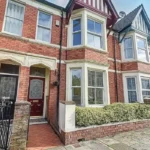
The resulting landscape combined terraced housing with schools, churches, public gardens and commercial premises.
How did railways and industry shape Adamsdown?
Railways and industry reshaped Adamsdown by connecting residential streets with Cardiff’s docks, workshops and factories, creating employment for local residents and encouraging dense worker housing; the nearby East Moors industrial district became one of Cardiff’s major nineteenth- and twentieth-century industrial areas.
Transport infrastructure was central to Adamsdown’s development. Railways created physical boundaries while also connecting workers with employment.
The district stood close to railway lines serving Cardiff and the docks. The railway environment included sidings, bridges and industrial infrastructure. The historic Black Bridge became a recognisable local feature connecting parts of the neighbourhood across the railway.
The East Moors industrial area was also closely connected with the broader Adamsdown estate. The Roath Local History Society records that Bute East Dock was completed in 1859, after which land east and southeast of the dock became highly suitable for industrial development.
A major industrial milestone came in 1891, when the Dowlais Iron Company began operating at East Moors. Steel production followed in 1896. The company later became part of Guest, Keen & Nettlefolds, one of Britain’s major industrial enterprises.
Industrial expansion generated demand for worker accommodation. Companies and private developers built housing near factories, railways and docks.
The industrial relationship between Adamsdown and East Moors also explains why some historical descriptions treat the wider estate as much larger than the present-day neighbourhood. Modern administrative boundaries do not always match historical landownership.
Industrial decline eventually changed the area again. Steel production at East Moors continued through multiple phases of ownership and nationalisation before final production ceased on 28 April 1978, according to the Roath Local History Society’s historical account.
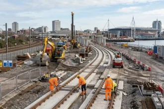
The decline of heavy industry reduced the economic role of the surrounding industrial landscape. Former industrial land subsequently underwent clearance and redevelopment.
Adamsdown therefore reflects both phases of industrial Cardiff: rapid nineteenth-century expansion and twentieth-century industrial contraction.
What role did healthcare and public institutions play in Adamsdown?
Healthcare and public institutions became major features of Adamsdown during the nineteenth century, including a prison, cemetery and infirmary; the South Wales and Monmouthshire Infirmary opened in the 1880s and later became Cardiff Royal Infirmary, serving the city until its closure in 1999.
Public institutions expanded alongside population growth. The arrival of a large urban population created demand for healthcare, sanitation, education, policing and other civic services.
A new prison opened in Adamsdown in 1832. The facility formed part of the wider expansion of public infrastructure beyond Cardiff’s older central core.
A cemetery followed in 1848. The Marquess of Bute provided approximately two acres of land for the cemetery. Its creation reflected the growing pressure on Cardiff’s older burial grounds as the population increased.
The cemetery quickly became connected with the city’s public-health problems. A cholera outbreak affected Cardiff in 1849, and the cemetery became overcrowded within a short period. Historical accounts record its later transformation into a public park.
Today, Cemetery Park preserves part of this historical landscape. Surviving headstones provide physical evidence of the site’s former function.
Healthcare became another defining feature. The South Wales and Monmouthshire Infirmary opened in the 1880s. Historical sources record its construction cost at approximately £23,000. In 1923, it became known as Cardiff Royal Infirmary.
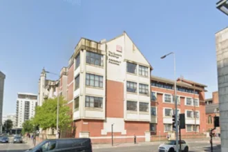
The infirmary remained an important healthcare institution for generations. It finally closed in 1999 after more than a century of medical service.
The institution’s history illustrates how Adamsdown became integrated into Cardiff’s civic infrastructure. The district was no longer an outer rural settlement. It had become part of the city’s core urban system.
Schools also appeared as residential development accelerated. Adamsdown School was built beside Adamsdown Square in the late nineteenth century. The school was later demolished, but the square remains a physical reminder of the Victorian neighbourhood plan.
Which historic buildings still explain Adamsdown’s past?
Historic buildings in and around Adamsdown preserve evidence of Victorian Cardiff, particularly St German’s Church, the former St James the Great, the Vulcan Hotel and surviving terraces; these buildings connect religious, residential, industrial and immigrant histories within the modern neighbourhood.
Religious buildings form an important part of Adamsdown’s architectural history.
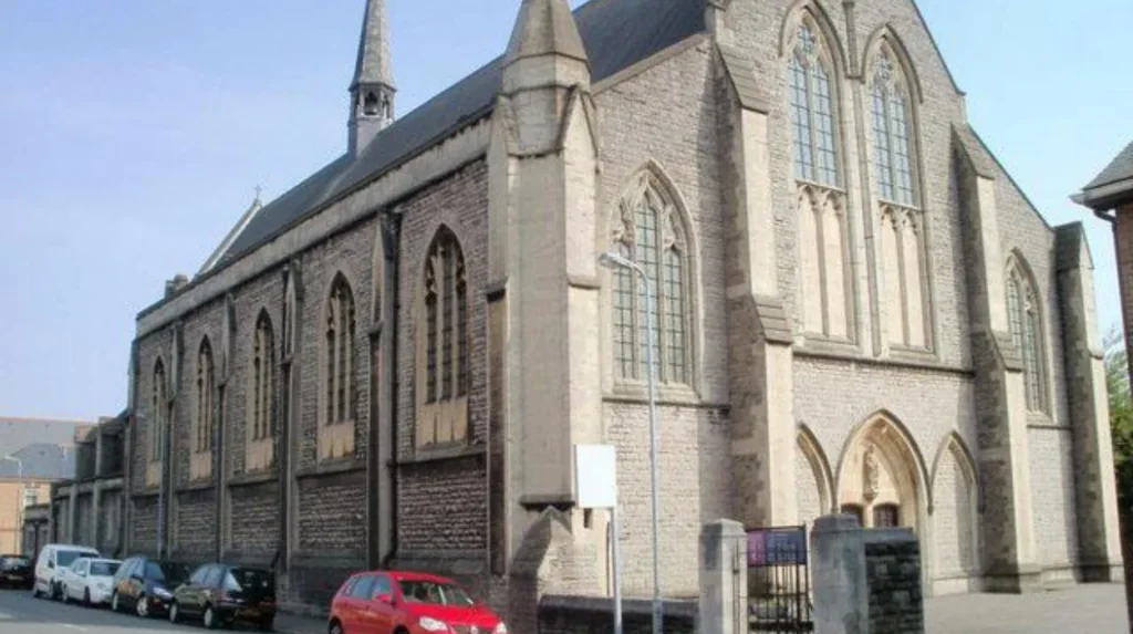
St German’s Church on Star Street was designed by Bodley and Garner and constructed between 1881 and 1884. It is dedicated to St Germanus of Auxerre and is a Grade I listed building.
The church replaced earlier places of worship. A local church community had already developed in the district during the nineteenth century, reflecting population growth and the need for new parish facilities.
The architecture represents the Gothic Revival movement that influenced many Victorian religious buildings. Its scale reflects the size and aspirations of the expanding urban community.
St James the Great on Newport Road provides another important architectural record. Designed by E. M. Bruce Vaughan, the church was built between 1890 and 1894. It became a Grade II listed building in 1975.
The church closed in 2006 after 112 years of Anglican worship. Later conversion work created residential accommodation while retaining architectural features such as arches, columns and stained glass.
The Vulcan Hotel has a different significance. Built in 1853, it represents the social infrastructure of Newtown and the district’s Irish working-class population. Its original location was 10 Adam Street. Amgueddfa Cymru reconstructed the building at St Fagans National Museum of History using original materials.
Historic public houses, terraces and institutional buildings collectively show how the neighbourhood functioned. They were not isolated architectural objects. They formed part of the everyday infrastructure of a densely populated Victorian district.
Cardiff Council continues to identify and protect historic buildings through its conservation and heritage framework. The council states that important buildings, archaeological remains and open spaces receive protection to preserve Cardiff’s special character.
How did Newtown become part of the Adamsdown story?
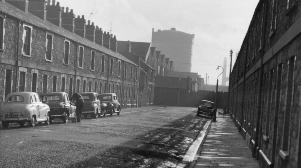
Newtown became an important section of the wider Adamsdown story during nineteenth-century urbanisation, developing as a densely populated working-class district with a strong Irish presence; its streets, pubs, housing and industrial connections reflected Cardiff’s expanding docks economy.
Newtown developed rapidly as Cardiff’s population increased. Its location close to employment centres made it attractive to workers and migrants.
The Irish presence became particularly important. Amgueddfa Cymru records that the community living in Newtown was predominantly Irish and that many residents came to Cardiff during and after the Irish Famine.
The docks provided employment opportunities. Cardiff’s port economy expanded dramatically during the nineteenth century, creating demand for labour in cargo handling, transport, ship-related services and industrial production.
Newtown’s social environment reflected this employment structure. Small houses, public houses and closely packed streets provided accommodation and services within walking distance of workplaces.
The district contained only a limited number of streets but a substantial number of public houses. The St Fagans First World War Trail records that Newtown had seven streets and nine pubs, illustrating the density of its social infrastructure.
The area later underwent substantial redevelopment. Much of historic Newtown disappeared during twentieth-century clearance, leaving only selected street names and surviving structures as reminders of the earlier neighbourhood.
The history of Newtown therefore forms an essential part of understanding Adamsdown. The modern boundaries of the district do not fully communicate the complexity of earlier communities.
Explore More Area Guide
How Pontcanna Got Its Name: Cardiff History
History of Ely: From Roman Roots to Cardiff Community
How has Adamsdown changed during the twentieth and twenty-first centuries?
Twentieth-century Adamsdown experienced industrial decline, housing clearance, institutional change and redevelopment, while the district retained its dense residential character; twenty-first-century planning now focuses on heritage protection, active travel, public space, housing and sustainable connections.
The twentieth century brought major changes to Cardiff’s industrial economy. Heavy industry around the East Moors declined, while older housing areas experienced clearance and redevelopment.
Newtown was extensively demolished during the 1960s. The Roath Local History Society records that only Adam Street and Tyndall Street survived from the original Newtown street network.
The closure of Cardiff Royal Infirmary in 1999 marked another major institutional transition. A building that had served the city for more than a century ceased its original healthcare function.
Historic religious buildings also changed use. St James the Great closed in 2006 and was subsequently converted into residential accommodation.
At the same time, historic preservation became more prominent. Cardiff Council’s heritage policies protect significant buildings and other historic assets. The council’s current conservation framework includes listed buildings, archaeological remains, conservation areas and local heritage initiatives.
Transport planning is another current influence. Cardiff Council’s Cycleway 2 proposals connect the city centre with Adamsdown, Newport Road, Rumney, Llanrumney and St Mellons Business Park. The route forms part of Cardiff’s wider active-travel network.
Cardiff Council also identifies Adamsdown as one of the inner-city areas prioritised within its long-term parking management programme. The council’s city parking plan places Adamsdown alongside Cathays, Plasnewydd, Riverside and Grangetown for phased implementation.
These policies demonstrate that Adamsdown remains part of Cardiff’s strategic urban planning rather than simply functioning as a historic district.
What does Adamsdown’s history tell us about Cardiff?
Adamsdown’s history records Cardiff’s transformation from rural land beyond medieval walls into a dense industrial-era neighbourhood, linking medieval landholding, Victorian housing, Irish migration, railways, docks, healthcare, religion and modern regeneration within one clearly identifiable urban landscape.
The story behind Adamsdown is fundamentally a story of urban transformation.
The name survived from a historic rural landscape. Documentary evidence preserves forms such as Adams Downe Farm from the seventeenth century. By the nineteenth century, the land was being absorbed into an expanding city.
The transition accelerated as Cardiff’s docks and industrial economy expanded. Workers needed housing close to employment. Developers converted farmland into streets and terraces.
Newtown added an important migration history. Irish residents became a major part of the local population, creating a community remembered through historic buildings such as the Vulcan Hotel.
Religious buildings such as St German’s Church and St James the Great demonstrate the institutional growth required by the expanding population. Healthcare facilities such as Cardiff Royal Infirmary demonstrate the development of modern civic services.
Industrial sites and railways reveal the economic foundations of the neighbourhood. East Moors became a major industrial centre, while nearby residential streets housed workers connected with Cardiff’s expanding economy.
The twentieth century brought decline and redevelopment. Industrial closures changed employment patterns. Housing clearance altered the physical structure of Newtown. Former institutional buildings acquired new uses.
The twenty-first century has introduced another phase. Heritage protection, active travel, public-space improvements and urban planning now influence how Adamsdown develops. Cardiff Council’s regeneration work includes improvements to pavements, street environments, parks and community spaces across the city.
Adamsdown’s historical importance therefore rests on its continuity and transformation. The district retains a name rooted in medieval and early modern landholding while its streets largely reflect Victorian Cardiff.
Its history connects Cardiff Castle with the Bute Estate, farmland with terraced housing, Irish migration with the docks, railways with industrial employment, churches with urban population growth, and former institutions with modern redevelopment.
That combination makes Adamsdown an important case study in Cardiff’s wider urban history. Understanding the district explains how the Welsh capital expanded beyond its medieval walls and developed the dense inner-city landscape visible today.
The strongest evidence for Adamsdown’s history comes from the Royal Commission on the Ancient and Historical Monuments of Wales Historic Place Names of Wales, which records historical forms of Adams Down and Adams Downe Farm from the seventeenth century onward.
The Roath Local History Society provides detailed historical research on the Adamsdown estate, Adamsdown House, Adamsdown Farm, Newtown, industrial development, housing and street formation.
Amgueddfa Cymru – Museum Wales provides evidence concerning the Vulcan Hotel, Newtown and the Irish community associated with nineteenth-century Cardiff.
Cardiff Council provides current information on heritage protection, transport planning, active travel and regeneration relevant to Adamsdown’s continuing development.
What is Adamsdown famous for?
Adamsdown is known for its long history, Victorian terraced housing, historic churches, Newtown heritage, Irish community history, Cardiff Royal Infirmary and its connection with Cardiff’s industrial expansion.