Roath is a prominent inner-city suburb located in the northeastern quadrant of Cardiff, the capital city of Wales. Understanding the geographical distances and logistical connections between Roath, Cardiff City Centre, and Cardiff International Airport is essential for effective urban transit planning. This comprehensive guide details the precise distances, transport options, historical developments, and infrastructural frameworks governing these critical routes.
- How far is Roath from Cardiff City Centre?
- What is the distance from Roath to Cardiff Airport?
- How can you travel between Roath and Cardiff City Centre?
- What are the transport options from Roath to Cardiff Airport?
- How do traffic patterns impact these travel times?
- What historical and geographical factors define these routes?
- How will future urban planning change these distances and times?
How far is Roath from Cardiff City Centre?
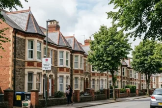
Roath is exactly 1.5 miles (2.4 kilometers) northeast of Cardiff City Centre when measuring from the central business district to Roath broadway. Commuters complete this journey in 6 minutes by taxi, 10 minutes by bus, or 29 minutes by foot.
Geographical Alignment and Spatial Boundaries
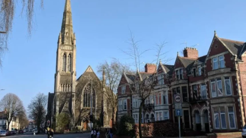
Roath borders the city centre along its southwestern boundary, separated primarily by the railway line running through Cardiff Queen Street station. The suburb spans outward toward the north and east, transitioning into neighboring districts such as Cathays, Penylan, and Splott. The direct linear distance between the centroid of Roath and Cardiff Central Station is 1.8 miles (2.9 kilometers). The primary arterial road connecting these two locations is the A4161, which is also known locally as Newport Road.
Historical Context and Urban Expansion
The physical distance between Roath and Cardiff City Centre became integrated through nineteenth-century industrialization. Historically, Roath was an independent rural parish dominated by agricultural land and manorial estates owned by the Marquesses of Bute. The expansion of the Cardiff Docks during the Industrial Revolution created an immediate demand for high-density housing. Consequently, the terraced housing networks along city streets filled the open geographic gap between the historic town core and Roath by 1900.
What is the distance from Roath to Cardiff Airport?
The road distance from Roath to Cardiff International Airport is 14 miles (22.5 kilometers) traveling southwest via the A4232 link road. Direct vehicular transport requires approximately 26 minutes, while multi-modal public rail and bus transfers require 57 to 70 minutes.
Airport Infrastructure and Regional Location
Cardiff International Airport operates near the village of Rhoose within the Vale of Glamorgan, positioned west of the city boundaries. The facility serves as the primary international gateway for South Wales. Because Roath sits on the northeast side of Cardiff and the airport sits far to the southwest of the city, travelers must navigate across the entire metropolitan expanse. The total linear distance across the sky measures 12.7 miles (20.4 kilometers).
Transit Corridor Geographics
Vehicular travel from Roath to the airport uses major regional trunk roads. Drivers transition from Roath to the A4232 peripheral distributor road via the central road network or via the M4 motorway at Junction 33. The southern route utilizes the A4232, which funnels traffic past Cardiff Bay before merging onto the A4050 and A4226 roads toward Rhoose. Traffic volumes on these specific roads fluctuate during morning and evening rush hours, which affects overall travel times.
How can you travel between Roath and Cardiff City Centre?
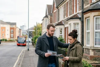
Travelers move between Roath and Cardiff City Centre using four primary transit methods: municipal buses, commuter trains, private motor vehicles, and active travel corridors. Selection depends entirely on time constraints, budgetary preferences, physical capabilities, and specific departure coordinates within the suburb.
Municipal Bus Networks
Cardiff Bus operates frequent scheduled services through Roath to the city centre. The primary routes serving this corridor include the 52 bus, 57 bus, and 58 bus services, alongside the C1 bus route. Buses depart from key stops along Albany Road and Wellfield Road at intervals of five minutes during peak operational hours. The vehicles travel down City Road or Richmond Road, terminating at the newly constructed Cardiff Bus Interchange or Churchill Way. The standard transit duration is 10 to 15 minutes.
Commuter Rail Framework
While Roath does not contain a railway station carrying its own name, residents utilize nearby stations on the Rhymney Line and the Coryton Line. Cardiff Queen Street station serves as the primary gateway on the edge of the suburb, located less than 0.5 miles from southern Roath. Passengers in northern Roath utilize Heath Low Level station or Heath High Level station. The train journey from Heath Low Level to Cardiff Central station requires exactly 8 minutes, with trains operating every 15 minutes.
Active Travel and Pedestrian Infrastructure
Cardiff Council actively promotes walking and cycling through dedicated infrastructure projects. The pedestrian walk from Roath Recreation Ground to the city centre covers 1.5 miles and follows flat terrain through local parks. Cyclists utilize the Nextbike cycle-hire scheme and dedicated cycleways. The route along the Roath Court intersection and onto the Richmond Road cycle lane allows cyclists to reach the city center within 7 to 9 minutes.
What are the transport options from Roath to Cardiff Airport?
Commuters travel from Roath to Cardiff International Airport using private vehicles, registered taxi firms, or integrated public transport systems. Public transit requires a combination of rail travel from local stations to Rhoose station, supplemented by a dedicated shuttle bus connection.
Private Vehicle and Taxi Travel
The most direct method to reach the airport from Roath is via motor vehicle. Taxis charge standard fares ranging from £30 to £40 for this single journey, depending on the time of day. The drive follows the A4232 road down to the Culverhouse Cross roundabout, then continues along the A4050 road past Barry, and concludes on the A4226 road leading to the airport terminal building. Free drop-off zones operate at the terminal for stays under 5 minutes.
Integrated Rail and Shuttle Transport
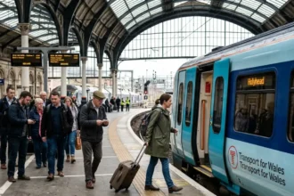
Transport for Wales operates hourly train services from Cardiff Central and Cardiff Queen Street stations directly to Rhoose Cardiff International Airport station. Travelers from Roath catch a southbound train at Cardiff Queen Street, changing at Cardiff Central if required. The rail journey takes 30 minutes to arrive at Rhoose station. From the station platform, passengers board the 905 shuttle bus, which runs a 10-minute connection directly to the airport departures hall.
Express Bus Links
The T9 Cardiff Airport Express bus service historically provided a direct link from the city centre to the airport terminal. Current bus travel requires using local regional bus routes, such as the 304 bus service operated by Adventure Travel. Passengers catch a bus from the city centre to Barry or Rhoose, which takes roughly 1 hour and 10 minutes to complete. This option represents the lowest financial cost but carries the longest overall transit duration.
How do traffic patterns impact these travel times?
Traffic patterns alter travel durations considerably during peak morning hours from 07:30 to 09:00 and evening hours from 16:30 to 18:00. Commute times within the city centre increase by 50 percent, while airport journeys experience delays of 15 to 20 minutes.
City Centre Bottlenecks and Delays
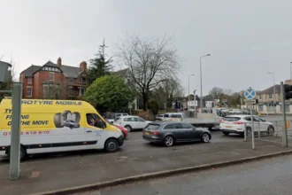
The short distance from Roath to the city centre is highly vulnerable to localized urban congestion. Key pinch points include the intersection of City Road and Albany Road, the Death Junction bottleneck where five roads meet, and the length of Newport Road. During off-peak periods, a car trip requires 5 minutes. During peak commuter windows, this same journey frequently extends to 15 or 20 minutes due to bus lane restrictions and traffic signal queuing.
Strategic Airport Commute Planning
Traveling to Cardiff Airport during peak periods requires navigating regional commuter choke points. The A4232 road experiences significant slow-downs near the Culverhouse Cross interchange due to merging traffic from the M4 motorway. Delays on this section add 20 minutes to an airport trip. Airline passengers traveling from Roath must allocate a minimum of 50 minutes of driving time during rush hour to ensure they arrive before flight check-in desks close.
What historical and geographical factors define these routes?
The modern transport pathways connecting Roath to the rest of Cardiff are defined by post-medieval agricultural boundaries, nineteenth-century industrial engineering, and natural river valley topographies. These spatial constraints dictate where roads, rail lines, and urban spaces exist today.
The Legacy of the Roath Brook and Local Parks
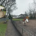
The geography of Roath is structured around the Roath Brook, a natural watercourse that flows southward toward the River Severn. In the late nineteenth century, the Bute Estate transformed this marshy flood plain into Roath Park, a public space featuring a 30-acre artificial lake opened in 1894. This large park network created a permanent north-south green barrier, forcing major road networks and transport links to wrap around the eastern and western edges of the suburb.
Industrial Infrastructure and Railway Line Placement
The railway infrastructure built to carry coal from the valleys to the southern docks permanently shaped the routes between Roath and the city centre. The construction of the Taff Vale Railway and the Rhymney Railway created physical embankments that isolated Roath from western districts. Today, vehicles must use specific historic bridge crossings, such as the bridges on Richmond Road and Albany Road, which concentrates traffic onto a limited number of roads.
How will future urban planning change these distances and times?
Future urban planning initiatives will reduce overall transit times and improve environmental sustainability through the South Wales Metro project, clean air zone frameworks, and active travel expansions. These structural changes focus heavily on reducing private car dependency across Cardiff.
The South Wales Metro Expansion
The South Wales Metro is an ongoing multi-million-pound transport upgrade led by Transport for Wales and the Welsh Government. The project involves electrification of the local rail network and introduction of brand-new light rail vehicles. For Roath residents, this infrastructure investment will increase train frequencies from Heath and Queen Street stations to four trains per hour. This change reduces the effective travel time to the city centre and speeds up connections to the airport rail link.
Sustainable Transport and Clean Air Initiatives
Cardiff Council continues to implement its Transport Strategy, which targets a significant shift toward public transport and walking. The expansion of Cycleway 2 along Newport Road will provide a fully segregated cycling path from the eastern boundaries of Roath straight into the city centre core. Additionally, future low-emission transport initiatives will prioritize zero-emission buses on Roath routes, maintaining fast transit times while permanently reducing urban air pollution.
How far is Roath from Cardiff City Centre?
Roath is around 1.5 miles (2.4 km) from Cardiff City Centre, depending on the exact starting point in the suburb and the destination in the city core. Because Roath borders the city centre side of east Cardiff, the journey is relatively short and can often be completed quickly by bus, taxi, bicycle, or on foot.