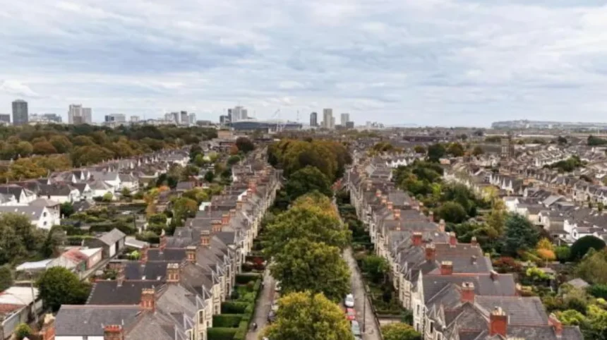
Pontcanna is one of Cardiff’s best-known inner-city districts, but its name predates the Victorian streets, villas, cafés and parks that now define the area. The name has a much older connection with a bridge, a local watercourse and the historic farmland west of Cardiff’s centre.
- What does the name Pontcanna actually mean?
- When does the name Pontcanna first appear in historical records?
- What was the historic bridge that gave Pontcanna its name?
- How did Pont Canna Farm influence the modern name?
- Was Pontcanna originally farmland rather than a residential suburb?
- What was Pontcanna Lane and why was it important?
- How did Sophia Gardens affect the development of Pontcanna?
- When did Pontcanna become a built-up Cardiff neighbourhood?
- What happened to the original bridge and Whitehouse Brook?
- Is Pontcanna named after Saint Canna?
- What does the historical evidence say about the “Canna” element?
- How is Pontcanna connected with Canton?
- How did Cardiff’s growth change the meaning of Pontcanna?
- Why does the name Pontcanna still matter today?
- What is the most accurate explanation of how Pontcanna got its name?
The modern district developed mainly during the nineteenth century. Before that expansion, Pontcanna was predominantly agricultural land. Historic records identify Pontcanna, Pont Canna Farm, Pontcanna Lane and related names before the modern residential district took shape. The survival of these names explains why the word Pontcanna remained attached to the landscape as Cardiff expanded.
The most direct modern explanation comes from Cardiff Council’s heritage research. It states that the name Pontcanna derives from Pont Canna Farm, which itself took its name from a bridge across the Whitehouse Brook, a former tributary of the River Taff. The bridge stood close to the area now associated with the junction of Teilo Street and Cathedral Road. The brook and bridge disappeared during the nineteenth-century development of Cardiff.
The historical evidence also shows that the name is considerably older than the modern suburb. The Glamorgan place-name database records forms including “bridge of Canne” in 1559, Pontganne in 1690, Pontganna in 1703, and Pont Canna in 1761. These records provide important evidence for understanding how the name developed over several centuries.
What does the name Pontcanna actually mean?
Pontcanna is generally understood as meaning “Canna’s Bridge” or “Pont Canna,” referring to a historic bridge associated with the area. Cardiff Council connects the name specifically with Pont Canna Farm and a bridge over Whitehouse Brook.
The first element is straightforward. Pont is the Welsh word for “bridge”. The second element, Canna, is less certain. Modern descriptions frequently connect Canna with Saint Canna, a traditionally recognised early Welsh Christian figure. Coflein, the online database of the Royal Commission on the Ancient and Historical Monuments of Wales, states that the name of nearby Canton originates from St Canna’s Town and notes that Pontcanna is also named after Saint Canna.
However, the historical evidence requires a careful distinction between established fact and later interpretation.
The Welsh Place-Name Society’s Glamorgan database records the early forms of Pontcanna without presenting the name simply as an unquestionable reference to the saint. It records “bridge of Canne” in 1559 and later forms such as Pontganne, Pontganna and Pont Canna.
Academic discussion also demonstrates that the meaning of Canna is not completely settled. Dylan Foster Evans of Cardiff University notes that Pontcanna appears in seventeenth-century evidence but that the precise explanation of “Canna” remains difficult. The discussion includes the possibility of a saintly connection and alternative interpretations associated with a small stream.
This distinction is important. The strongest evidence establishes the long-standing Pont Canna place-name and its connection with a bridge. The precise origin of “Canna” remains a separate historical question.
When does the name Pontcanna first appear in historical records?
The name has medieval and early modern roots, with recorded forms including “bridge of Canne” in 1559, Pontganne in 1690, Pontganna in 1703 and Pont Canna in 1761. These records establish that Pontcanna is centuries older than the modern Victorian suburb.
The chronology of the name is especially useful because modern Pontcanna looks largely Victorian. Large houses, planned streets and public parks dominate the visible landscape. The place-name, however, existed long before this urban transformation.
The Glamorgan place-name database provides a sequence of documentary forms. In 1559, a reference appears as “bridge of Canne.” In 1690, the form Pontganne appears. A 1703 record uses Pontganna, while a 1761 deed records Pont Canna. A newspaper reference from 1853 also records the name.
These forms demonstrate a clear historical continuity. The spelling changed over time, which is normal for Welsh place-names recorded by different writers and administrative systems.
The 1559 form is particularly important. It indicates that the bridge element was already central to the name more than three centuries ago. This evidence supports the interpretation of Pontcanna as a place-name connected to a bridge rather than a name created during nineteenth-century housing development.
The 1761 form is also significant because it presents Pont Canna as two words. The modern form Pontcanna represents the later consolidation of the name.
Place-name evidence therefore provides a direct route into Pontcanna’s history. The district did not receive its name because of modern streets or residential development. Instead, the modern district inherited a much older geographical name.
What was the historic bridge that gave Pontcanna its name?
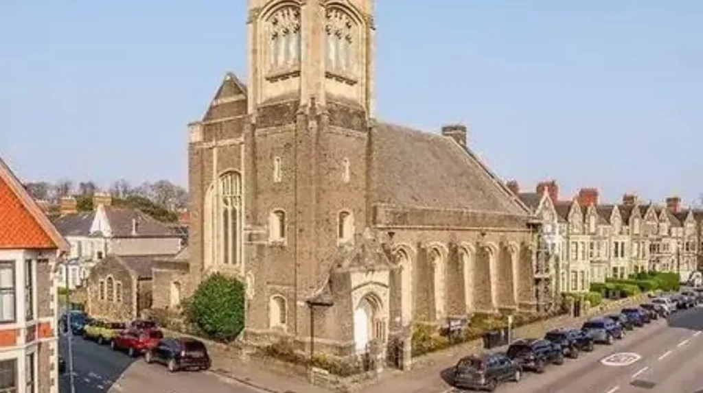
The historic bridge was associated with Whitehouse Brook, a former watercourse that flowed towards the River Taff. Cardiff Council places the bridge near today’s Teilo Street and Cathedral Road, where it served as the physical feature behind Pont Canna Farm’s name.
Whitehouse Brook was an important geographical feature in the historic landscape. Cardiff Council describes it as a former tributary of the River Taff that ran between Llandaff Fields and Riverside. The bridge associated with Pont Canna stood close to the modern junction of Teilo Street and Cathedral Road.
The stream was also known as Nant-y-Tŷ-gwyn, meaning White House Brook. Historical research into Cardiff’s lost watercourses identifies the brook as running towards the Taff near the historic Whitehouse area. The Welsh form connects the stream with Tŷ Gwyn, or White House.
The bridge was not a major river crossing comparable with Cardiff’s principal bridges over the Taff. It was a smaller local crossing associated with a watercourse. Its importance came from its role as a geographical reference point.
This explains a common feature of Welsh place-names. Small bridges, streams, farms and crossroads frequently became reference points for identifying particular areas. A name originally describing a specific physical feature could remain in use after the feature itself disappeared.
Pontcanna demonstrates exactly this process. The bridge vanished, the stream was covered, farms were redeveloped and roads were rebuilt. The name survived.
How did Pont Canna Farm influence the modern name?
Pont Canna Farm acted as the immediate geographical link between the historic bridge and modern Pontcanna. Cardiff Council records that Pont Canna Farm took its name from the bridge, while later roads and development inherited Pontcanna from the farm landscape.
The distinction between the bridge, farm and district is essential.
The original sequence is best understood as:
bridge → Pont Canna Farm → Pontcanna Lane and local references → modern Pontcanna district.
Cardiff Council’s heritage record states that the name Pontcanna stems from Pont Canna Farm, which was itself named after the bridge across Whitehouse Brook.
This means the modern district did not necessarily receive its name directly from the original bridge. The farm provided the immediate place-name link.
Historic mapping confirms the importance of Pontcanna Farm. A Coflein record concerning Pontcanna Fields states that the 1879 Ordnance Survey map still showed the area as farmland and identified Pont-cana Farm on the site of what later became associated with television studios.
The farm therefore remained a visible landscape feature into the period when Cardiff was beginning its major suburban expansion.
The farm name also helped preserve the older place-name at a time when the original bridge and stream were becoming less visible. This process is common in urban history. A physical feature disappears, but its name survives through landownership, farms, roads and property descriptions.
Was Pontcanna originally farmland rather than a residential suburb?
Yes. Modern Pontcanna developed from an overwhelmingly rural landscape. Until the late nineteenth century, the area contained farms, fields, market gardens and small rural properties rather than the dense residential streets associated with Pontcanna today.
Cardiff Council states that what is now Pontcanna was almost completely open farmland until the late nineteenth century. Cathedral Road was previously known as Pontcanna Lane, connecting Plasturton Farm in the south with Pontcanna Farm farther north.
This landscape helps explain why the old name survived.
The area was not an established urban neighbourhood waiting to receive a new name. It was an agricultural zone on the western side of Cardiff. Individual farms provided geographical identity, while lanes and bridges connected rural properties.
Coflein’s heritage record for Cathedral Road similarly describes the area in the late nineteenth century as containing market gardens and farms, including elements of Plasturton Farm and Pontcanna Farm.
The transformation accelerated as Cardiff expanded during the nineteenth century. Population growth, industrial prosperity and the development of transport infrastructure increased demand for new residential districts.
Pontcanna therefore represents a transition from rural landscape to urban suburb. Its name belongs to the earlier agricultural landscape.
What was Pontcanna Lane and why was it important?
Pontcanna Lane was the earlier name of the route that became Cathedral Road. It connected the rural farms of the area before the Victorian expansion of Cardiff, preserving Pontcanna as a recognised geographical name during the transition from farmland to suburb.
The modern Cathedral Road is one of Pontcanna’s defining streets. Its earlier identity was closely connected with Pontcanna Farm.
Cardiff Council identifies the road as formerly Pontcanna Lane, running between Plasturton Farm and Pontcanna Farm.
This road history demonstrates how place-names can move through the landscape.
The name Pontcanna was not restricted to a single building. It was attached to a farm, a lane and a wider locality. As urban development replaced the farmland, the name remained useful for identifying the emerging neighbourhood.
Cathedral Road was developed extensively during the late nineteenth century. Coflein records that the 3rd Marquess of Bute developed the road for Cardiff’s expanding professional and business population.
Large residential properties subsequently transformed the appearance of the area. The historical name remained while the physical environment changed dramatically.
How did Sophia Gardens affect the development of Pontcanna?
Sophia Gardens helped accelerate Pontcanna’s transition from rural land to an urban district. The gardens were established on the former Plasturton Farm site from 1854, creating a major public landscape beside the River Taff before large-scale Victorian housing expanded through Pontcanna.
Sophia Gardens is central to understanding Pontcanna’s nineteenth-century transformation.
In 1854, Lady Sophia, widow of the 2nd Marquess of Bute, began financing the creation of a 41-acre garden on the site of Plasturton Farm. Cardiff Council identifies this development as an important part of the area’s later transformation.
The gardens opened in 1858. Coflein records that they were laid out on the west bank of the River Taff by architect Alexander Roos.
This was significant because the new public landscape increased the attractiveness and accessibility of the western side of central Cardiff.
Pontcanna’s development followed the wider expansion of Cardiff during the Victorian period. Residential construction increasingly occupied land that had previously supported agriculture.
The historical name survived this transformation because it was already embedded in local geography.
When did Pontcanna become a built-up Cardiff neighbourhood?
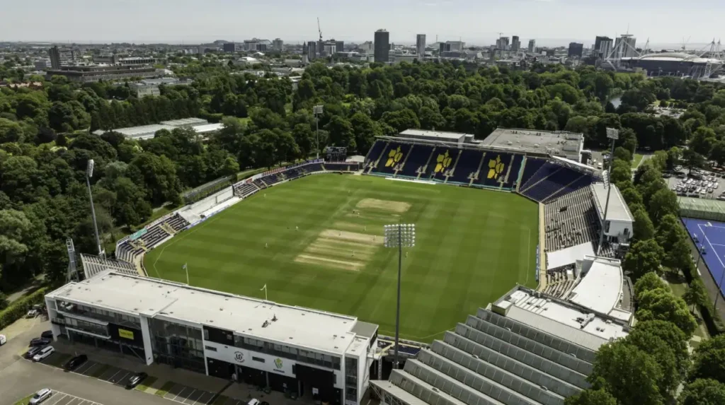
Pontcanna became substantially urbanised during the late nineteenth and early twentieth centuries. Large villas appeared along Cathedral Road from about 1885 to 1900, while streets and public spaces expanded around the older farms and lanes.
The most visible phase of Pontcanna’s urbanisation occurred between the 1880s and early 1900s.
Coflein records that the late nineteenth-century development of Cathedral Road occurred alongside Cardiff’s rapid economic expansion. The area shifted from farms and market gardens towards substantial residential properties.
Historical accounts place many of the large Cathedral Road villas between 1885 and 1900.
Pontcanna Fields also changed significantly. The 1879 Ordnance Survey map still showed farmland, while the 1901 map, surveyed in 1898–99, recorded Pontcanna Fields as a public open space.
This period transformed the meaning of Pontcanna.
Previously, Pontcanna referred to a rural locality associated with a farm and historic crossing. By the beginning of the twentieth century, it increasingly identified an urban district containing villas, public parks, roads and civic infrastructure.
What happened to the original bridge and Whitehouse Brook?
The original bridge disappeared during Cardiff’s nineteenth-century urban redevelopment. Cardiff Council records that the bridge was removed and Whitehouse Brook was covered in 1896, eliminating the physical feature that had originally given Pontcanna its geographical identity.
The disappearance of the bridge is one of the most important facts in Pontcanna’s name history.
Cardiff Council records 1896 as the year when the bridge was removed and the brook was covered.
This occurred during the construction and completion of the modern road network.
The disappearance of the watercourse did not eliminate its historical name. Instead, Pontcanna became a surviving linguistic trace of a landscape that had largely disappeared.
Research into the old Whitehouse Brook records earlier drainage problems. The stream was described as a nuisance and was filled in during 1874, with some traces surviving until the end of the nineteenth century.
The chronology therefore involves several stages of landscape modification rather than a single event.
The stream was progressively contained and covered. The bridge eventually disappeared. New roads replaced parts of the old rural network. The farm landscape was subdivided and developed.
Yet Pontcanna survived as a name.
Is Pontcanna named after Saint Canna?
Saint Canna is strongly associated with Pontcanna in modern historical explanations, but the documentary evidence does not establish the saintly interpretation as the only explanation. The bridge connection is firmly documented, while the precise origin of “Canna” remains debated by place-name researchers.
Saint Canna is traditionally described as an early Christian figure associated with Wales and Brittany. Her name is connected in modern sources with both Canton and Pontcanna.
Coflein states that Canton derives from St Canna’s Town and describes Saint Canna as the sixth-century saint after whom Pontcanna is also named.
The parish history of St Canna, Llangan, also associates Canna with Canton and Pontcanna. The local church tradition describes her as a Breton princess who came to Wales and later became associated with religious foundations.
However, historical place-name research requires caution.
Dylan Foster Evans’ discussion of Cardiff’s local names states that Pontcanna appears in seventeenth-century records but that the explanation of Canna remains difficult. The question of whether the element refers to a saint, a watercourse or another linguistic source remains part of the scholarly discussion.
Therefore, the most accurate SEO-friendly historical explanation is not simply “Pontcanna means Saint Canna’s Bridge.”
A stronger formulation is:
Pontcanna is a historic “Pont Canna” name associated with a bridge, while the precise origin of the Canna element has competing explanations, including a traditional connection with Saint Canna.
That wording reflects the available evidence more accurately.
What does the historical evidence say about the “Canna” element?
Historical place-name records prove that Canna formed part of the Pontcanna name for centuries, but they do not independently prove that every historical use referred to Saint Canna. Researchers distinguish the documented place-name from later explanations of its linguistic origin.
The surviving records provide a useful chronology.
The 1559 form “bridge of Canne” is especially important because it directly connects the name with a bridge. The later forms Pontganne, Pontganna and Pont Canna show continued use of the same basic name.
The evidence therefore establishes three facts.
First, the bridge component is ancient.
Second, Canna was already associated with the bridge-name by the sixteenth century.
Third, the exact etymology of Canna is less certain than the existence of the place-name itself.
This distinction prevents a common historical mistake. A traditional explanation can become widely repeated without becoming conclusively proven by the earliest documents.
For readers researching Cardiff history, the place-name evidence is therefore more valuable than a simplified legend.
Pontcanna has a documented bridge-name history. The saintly association remains an important part of the area’s cultural and historical identity, but the precise linguistic origin of “Canna” requires qualification.
How is Pontcanna connected with Canton?
Pontcanna and Canton share a historical connection through the name Canna. Canton is associated with St Canna’s Town in modern explanations, while Pontcanna contains the same Canna element alongside the Welsh word pont, meaning bridge.
Canton lies immediately beside Pontcanna and has a much older documented history.
Coflein describes Canton as a thirteenth-century manor in Llandaff and explains the name as deriving from St Canna’s Town.
Pontcanna and Canton therefore share a common historical naming landscape.
The relationship is significant because it demonstrates how one name element can appear in multiple neighbouring places.
Pontcanna contains Pont, meaning bridge, followed by Canna.
Canton’s Welsh form, Treganna, contains tref, meaning town or settlement, alongside Canna.
The two names consequently preserve different geographical descriptions built around the same Canna element.
Historical evidence also places both areas within the wider rural landscape around Llandaff before Cardiff’s rapid nineteenth-century expansion.
How did Cardiff’s growth change the meaning of Pontcanna?
Cardiff’s nineteenth-century expansion changed Pontcanna from a rural place-name into the name of an urban neighbourhood. The old bridge and farms disappeared, while roads, villas, parks and public facilities transformed the landscape around the surviving Pontcanna name.
Cardiff experienced rapid expansion during the nineteenth century because of industrialisation, port development and population growth.
The Bute family played an important role in the development of western Cardiff. The 2nd Marquess of Bute opened the first Bute Dock in 1839, while later development under the 3rd Marquess helped transform parts of the city.
Pontcanna benefited from this broader urban expansion.
The construction of Cathedral Road and the development of Sophia Gardens increased the area’s importance. Large houses replaced much of the agricultural landscape. Public open spaces became permanent features.
Pontcanna Fields also underwent major change. An extension from Sophia Gardens towards Pontcanna Fields was planned for athletic purposes in 1860 and completed in 1879.
By the end of the nineteenth century, Pontcanna no longer represented simply a farm and bridge. It had become a recognisable part of an expanding Cardiff.
Explore More Area Guide
History of Ely: From Roman Roots to Cardiff Community
Origins of Splott: Cardiff’s Medieval to Industrial History 2026
Why does the name Pontcanna still matter today?
Pontcanna preserves the memory of a lost bridge, watercourse and farming landscape within modern Cardiff. Its name provides direct evidence of how historic geographical features survived in language after Victorian urbanisation removed many of the original physical landmarks.
Modern Pontcanna contains roads, homes, businesses, public facilities and open spaces. Cardiff Council continues to identify Pontcanna as a distinct locality in current administrative and service information.
Pontcanna Fields remains a major public landscape. Cardiff Council identifies a dedicated Pontcanna Fields car park, while its youth programmes use the Cardiff Riding School within the fields.
The name also remains embedded in current street and planning terminology. Cardiff Council’s Pontcanna Central parking-zone documentation identifies streets including Pontcanna Street, Cathedral Road, Plasturton Avenue, Plasturton Gardens and Teilo Street.
These modern references demonstrate the durability of the historic name.
The original bridge is gone. Whitehouse Brook is no longer an open watercourse. Pont Canna Farm has disappeared as a working farm. Much of the former farmland has been developed.
What is the most accurate explanation of how Pontcanna got its name?
Pontcanna takes its name from the historic Pont Canna place-name, which was associated with a bridge over Whitehouse Brook and passed through Pont Canna Farm into the modern district. Saint Canna provides a traditional interpretation of the Canna element, but its exact origin remains debated.
The historical evidence supports a clear overall sequence.
The area contained a small watercourse known as Whitehouse Brook or a related historical name. A bridge crossed it. The place-name Pont Canna became associated with that crossing. Pont Canna Farm inherited the name. Pontcanna Lane subsequently carried the name through the rural landscape. Victorian development transformed the surrounding farmland into an urban district.
Historical records demonstrate the name by at least the sixteenth century. The 1559 reference “bridge of Canne” is the earliest form identified in the Glamorgan place-name database. Later records from 1690, 1703, 1761 and 1853 demonstrate continuity.
Cardiff Council provides the strongest modern heritage explanation by directly linking Pont Canna Farm to the bridge across Whitehouse Brook.
The saintly interpretation remains important because Saint Canna is traditionally associated with neighbouring Canton and Pontcanna. Coflein records this connection, while academic place-name research confirms that the exact meaning of Canna deserves caution.
The result is a historically precise explanation:
Pontcanna is an old Welsh place-name centred on “Pont Canna,” meaning a bridge associated with Canna. The name passed from an historic crossing to Pont Canna Farm and then into the modern Cardiff district.
That history explains why a neighbourhood now recognised for Victorian architecture, parks and urban living carries a name rooted in a much older rural landscape.
Pontcanna is therefore not simply a modern Cardiff suburb. Its name preserves a record of an earlier Cardiff, when small bridges, streams and farms defined the landscape and provided the names that later urban development carried into the modern city.
How did Pontcanna get its name?
Pontcanna takes its name from the historic Pont Canna place-name. The name was associated with a bridge over Whitehouse Brook and later with Pont Canna Farm. The farm and surrounding rural landscape helped preserve the name before modern Cardiff development.