Newport Road is a principal urban highway in Cardiff, Wales, serving as a critical arterial corridor that connects the city center to the eastern suburbs and the neighboring city of Newport. Within the district of Rumney, this thoroughfare transforms from a major commercial artery into a prominent suburban gateway characterized by steep topography, historical infrastructure, and complex transit patterns. This comprehensive guide provides an authoritative structural, historical, and functional analysis of the Rumney section of Newport Road for urban planners, local historians, and residents.
- What is the geographical definition and extent of Newport Road in Rumney?
- What is the historical evolution of the Newport Road corridor?
- What are the key infrastructure components and layout of this road segment?
- What are the transport dynamics, traffic volumes, and safety mechanisms?
- What commercial services and community amenities are located along the route?
- What urban challenges and maintenance issues impact this corridor?
- What is the future development and strategic relevance of Newport Road in Rumney?
What is the geographical definition and extent of Newport Road in Rumney?
Newport Road in Rumney is the easternmost section of the B4487 corridor, spanning from the River Rhymney bridge up Rumney Hill to the boundary of Llanrumney and St Mellons. It acts as a primary arterial link for eastern Cardiff transit.
The specific section of Newport Road classified within the Rumney district begins precisely at the eastern bank of the River Rhymney, crossing the historic boundary where the urban landscape transitions from the industrial retail parks of Penylan and Roath into the suburban topography of Cardiff East. This sector follows the designated B4487 route, climbing the steep incline known locally as Rumney Hill. The total length of this specific neighborhood segment measures approximately 1.5 miles (2.41 kilometers), terminating where the road intersects with Elm Tree Close and transitions into the Llanrumney district.
Topographically, this section is defined by a significant elevation change, rising from approximately 8 meters above sea level at the river basin to over 45 meters above sea level at the summit of the hill. This incline influences local infrastructure design, residential layouts, and active travel configurations. The corridor serves multiple functions, operating simultaneously as a local high street, a major bus transit route, and a residential frontage road. It interfaces directly with several critical secondary roads, including Wentloog Road, New Road, and Whitehall Parade, which feed traffic from adjacent residential estates into the main arterial flow.
What is the historical evolution of the Newport Road corridor?
The corridor evolved from the ancient Roman coastal route Via Julia Maritima into a Norman military passage, subsequently transforming into a 19th-century turnpike road and a major 20th-century national highway before its reclassification as the B4487 in 1971.
The origin of Newport Road as a transit route traces directly to the Roman occupation of Great Britain in the 1st century AD. The road follows the alignment of the Via Julia Maritima, a military coastal highway constructed to connect major Roman fortifications, specifically the fort at Cardiff (Nidum) with the legionary fortress at Caerleon (Isca Augusta). Archaeological excavations managed by the Glamorgan-Gwent Archaeological Trust have verified that a substantial timber and stone bridge crossed the River River Rhymney at the base of Rumney Hill during this era, establishing the route as a permanent transport corridor.
Following the Norman conquest in the 11th century, the road assumed immense strategic value. The Normans constructed a ringwork fortification known as Rumney Castle (Caer Castell) around the year 1081 on a steep natural scarp overlooking the river basin, positioned immediately north of the modern 637 Newport Road alignment. This fort secured the river crossing and monitored movement along the highway. In the 13th century, the Lordship of Glamorgan converted this site into a manorial center, which remained active until its abandonment around 1289.
The road maintained its medieval alignment through centuries of agricultural use. By the early 19th century, the passage was incorporated into the turnpike trust network, requiring travelers to pay tolls to fund surface maintenance. The introduction of the Cardiff to Newport toll route formalized the highway’s width and gradients.
The modern configuration of the road began to take shape during the late Victorian and Edwardian eras. The opening of the Carpenter’s Arms public house in 1872 at the summit of Rumney Hill marked the development of a commercial nucleus. The Rompney Castle public house, originally a 19th-century inn modified with a mock-Tudor facade by an American ambassador, became another landmark along the route.
The administrative status of the road shifted permanently in 1887, when the management of Rumney passed from Monmouthshire to the town of Newport, and eventually in 1938 when the entire parish of Rumney was officially incorporated into the city of Cardiff. This boundary change triggered extensive municipal development, including the demolition of the old Ty Mawr farmhouse in the 1930s to facilitate the construction of Ty Mawr Road and the widening of Newport Road to accommodate mechanized vehicular traffic.
Until 1971, Newport Road formed the definitive route of the A48 trunk road, handling all heavy commercial traffic between South West England, Newport, and West Wales. On November 19, 1971, the Welsh Office opened the Eastern Avenue dual carriageway to the north, re-routing the national trunk designation and allowing the Rumney segment of Newport Road to be reclassified as the B4487, shifting its primary utility from national freight to municipal transit.
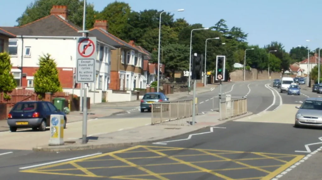
What are the key infrastructure components and layout of this road segment?
The infrastructure comprises a multi-lane asphalt roadway, a structural concrete river flyover, specialized active travel lanes, integrated bus corridors, and a mix of historic stone and mid-century brick building frontages.
The structural layout of Newport Road in Rumney is divided into distinct engineering and zoning sectors that dictate traffic flow and land use. The western terminus is defined by the Rumney River Bridge, a reinforced concrete structure built to replace older iron and timber crossings. Immediately adjacent to this boundary lies the Southern Way Viaduct interchange, a grade-separated flyover system that separates local B4487 traffic from high-speed cross-city movements.
Once across the river, the road layout expands into a wide, engineered corridor that scales Rumney Hill. The roadway consists of two primary lanes for general vehicular traffic, supplemented by dedicated lanes for specific transport modes. These modal components include:
- Bus Lanes: Dedicated priority lanes operating during peak commuting hours (07:00–09:30 and 16:00–18:30) to expedite public transport vehicles.
- Active Travel Corridors: Painted cycle lanes situated on the northbound and southbound shoulders, designed to connect eastern neighborhoods with the Cardiff cycle network.
- Pedestrian Footways: Continuous concrete pavements flanking both sides of the asphalt roadway, ranging in width from 1.8 meters to 3.5 meters.
The built environment changes as the road gains elevation. The lower slopes feature dense mid-century suburban housing, constructed primarily of red brick with deep setbacks. The upper plateau transitions into a traditional high-street layout, where commercial shopfronts sit flush with the wider pedestrian pavements. The structural core of this upper zone includes the Grade II listed St Augustine’s Church, constructed originally in the 12th century, featuring a prominent 15th-century stone tower that serves as a permanent architectural landmark visible across the entire river valley.
What are the transport dynamics, traffic volumes, and safety mechanisms?
The road handles substantial commuter volumes, carrying over 15,000 vehicles daily, managed via coordinated traffic signals, speed enforcement cameras, and localized Air Quality Management Area protocols.
Transport dynamics on Newport Road are shaped by its dual role as a local service provider and an urban commuter corridor. Data from the Department for Transport (DfT) automatic traffic counters indicate that the lower section of Newport Road, near its junction with the A4161 and Southern Way, records an Average Annual Daily Flow (AADF) exceeding 25,000 motor vehicles. As the route moves east past the river and becomes the B4487 up Rumney Hill, the volume consolidates to approximately 15,000 to 18,000 vehicles per day.
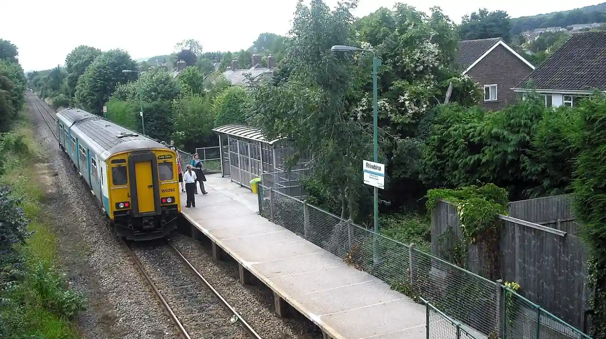
The modal split of this traffic consists predominantly of private cars and taxis, which comprise approximately 82% of total daily volume. Light goods vehicles (LGVs) account for 12%, while heavy goods vehicles (HGVs) represent less than 3% due to the structural diversion provided by Eastern Avenue. Public transport buses and coaches make up the remaining volume, but they carry a disproportionately high percentage of total passenger journeys along the corridor, particularly via Cardiff Bus routes 44, 45, 49, and 50.
Traffic velocity and safety are regulated through a series of structural and electronic interventions. The entire length of Newport Road through Rumney is subject to a strictly enforced 30 miles per hour (48 kilometers per hour) speed limit, which transitions to localized 20 miles per hour zones near dense pedestrian crossings and retail clusters in accordance with Welsh national framework legislation. The corridor features multiple signalized junctions equipped with pedestrian countdown timers, notably at the intersections of Newport Road with Wentloog Road and New Road.
Due to the volume of internal combustion engine vehicles climbing the sustained incline of Rumney Hill, localized emissions levels have historically been a point of municipal focus. While the primary Cardiff Air Quality Management Area (AQMA) is centered further west near the Cardiff Royal Infirmary section of Newport Road, the Rumney segment is continuously monitored via diffusion tubes managed by Shared Regulatory Services (SRS) to track nitrogen dioxide ($NO_2$) and particulate matter ($PM_{10}$) trends.
What commercial services and community amenities are located along the route?
The commercial sector features an array of independent retail units, local convenience stores, professional medical services, historical public houses, and educational institutions that support the eastern Cardiff population.
The commercial structure of Newport Road in Rumney is organized as a linear district center, concentrated primarily around the summit of Rumney Hill and the junction with Wentloog Road. This layout minimizes the necessity for residents to travel to the central business district for core services. The retail mix is dominated by convenience retail, independent food outlets, and essential consumer services.
The commercial and community assets along this specific B4487 segment include:
- Retail Outlets: Supermarkets and independent grocers providing localized food access.
- Financial and Professional Services: Local estate agencies, legal advisors, and insurance brokers operating out of converted Victorian terraces.
- Medical Facilities: Group general practice surgeries, dental clinics, and community pharmacies situated close to primary pedestrian access points.
- Public Houses: Historical hospitality venues, including the Carpenter’s Arms, which anchor the social infrastructure of the neighborhood.
Educational and civic infrastructure also maintains a direct presence along or immediately adjacent to the corridor. The road provides direct access to Rumney Primary School and serves as the main transport artery for students commuting to nearby secondary institutions, including Eastern High in neighboring Trowbridge. Civic spaces, including local community hubs and religious buildings, utilize Newport Road frontages to maximize visibility and accessibility for individuals using public transport netorks.
Explore More Area Guide
Personal Care Guide: Best Beauty and Waxing Salons in Roath, Cardiff
China Kitchen Roath: Standard Opening Times and Festive Holiday Hours
What urban challenges and maintenance issues impact this corridor?
The corridor faces persistent challenges regarding pavement degradation, structural potholes, active travel obstruction, and localized congestion during peak commuting periods.
The intense physical usage of Newport Road by heavy transport vehicles and private cars results in continuous mechanical stress on the highway infrastructure. Municipal maintenance records via public reporting databases such as FixMyStreet highlight a recurring pattern of asphalt delamination and structural pothole formation along the main climbing lanes of Rumney Hill. These defects are exacerbated by winter freeze-thaw cycles, requiring targeted resurfacing interventions by the Cardiff Council highway maintenance departments.
Pedestrian and cyclist infrastructure faces specific operational constraints. Pavement degradation, including cracked concrete slabs and uneven footway surfaces, has been documented extensively near the intersections with Wentloog Road and Maxwell Road. Active travel safety is frequently compromised by unauthorized pavement parking and the obstruction of dedicated cycle lanes by delivery vehicles servicing local commercial units. This issue is particularly prevalent on the narrow segments of the B4487 where commercial loading bays are absent.
The age of the underlying utility infrastructure introduces further logistical complications. Blocked drainage gullies along the lower stretches of Newport Road near Wentloog Avenue and Lamby Way frequently cause localized surface water flooding during heavy precipitation events. This occurs when the surface runoff from the steep topography of Rumney Hill overwhelms the standard subterranean drainage network, leading to temporary lane closures and vehicular speed reductions.
What is the future development and strategic relevance of Newport Road in Rumney?
The future relevance of the corridor centers on its integration with the Cardiff Local Development Plan, active travel expansions, carbon reduction targets, and regional transit links.
Newport Road in Rumney remains a foundational component of the strategic transport network for eastern Cardiff. Under the framework of the Cardiff Local Development Plan (LDP), the corridor is designated to undergo systematic upgrades designed to transition the route from a car-dominated highway into a multi-modal transport link. This planning strategy aligns with the Welsh Government’s Llwybr Newydd transport strategy, which prioritizes sustainable and active travel modes over private single-occupancy vehicles.
A primary long-term development objective is the structural expansion of the Cardiff cross-city cycle network. Plans involve upgrading the existing painted cycle shoulders on Rumney Hill into fully segregated, kerb-protected active travel lanes. This design intervention intends to isolate cyclists from high-velocity vehicular traffic, lowering the statistical risk of collisions and encouraging commuting options across the River Rhymney into the city center.
The corridor is also slated for smart infrastructure integration. This includes the installation of next-generation intelligent transport systems (ITS) at major junctions to dynamically adjust traffic signal timings based on real-time congestion data, thereby reducing vehicle idling times and improving localized air quality. As eastern Cardiff expands with new housing allocations in nearby St Mellons and the planned Cardiff Parkway transit hub, Newport Road in Rumney will continue to serve as the critical physical bridge linking historic suburban communities with the wider metropolitan economy.
Where is Newport Road in Rumney?
Newport Road in Rumney is the eastern section of the B4487 in Cardiff, extending from the River Rhymney bridge up Rumney Hill toward Llanrumney and St Mellons. It serves as one of the main transport routes connecting eastern Cardiff with the city centre.