Ely is a historic district and community on the western side of Cardiff, Wales. Its Welsh name is Trelái, and the area developed beside the River Ely. Today, Ely forms part of Cardiff, but its history reaches far beyond the modern city. Archaeological evidence records Roman occupation, medieval settlement, agricultural activity, industrial development, railway expansion, Victorian institutions, planned housing and twentieth-century suburban growth.
- What is the historical background of Ely in Cardiff?
- What evidence exists for Roman history in Ely?
- How did Ely develop during the medieval period?
- How important was the River Ely to the area’s history?
- When did industry transform Ely and its surrounding landscape?
- How did the railway change the history of Ely?
- What was Ely Common and why was it important?
- How did Victorian institutions affect Ely?
- How did Ely become a modern Cardiff suburb?
- How are Ely and Caerau connected historically?
- What role did the Ely Racecourse play in local history?
- How did Ely’s boundaries and administration change?
- What is Ely’s historical importance to Cardiff today?
- How can Ely’s history be understood as one continuous development?
The history of Ely is closely connected with neighbouring Caerau, Michaelston-super-Ely, St Fagans, Canton and Fairwater. The River Ely shaped settlement, transport and industry. Its surrounding farmland supported agriculture before urban expansion transformed the landscape. The district also became important during Cardiff’s nineteenth-century industrial expansion and twentieth-century housing development.
The archaeological record provides particularly strong evidence for the area’s ancient past. The Ely Roman Villa, recorded by the Royal Commission on the Ancient and Historical Monuments of Wales, was an extensive Roman-period complex. Occupation appears to have begun during the first century AD, while the principal house was constructed during the following century. Excavations took place in 1894 and 1922.
Ely therefore has a historical development measured in centuries rather than decades. Its present streets and housing estates represent only the latest phase of a much longer process.
What is the historical background of Ely in Cardiff?
Ely is a western Cardiff district whose history combines prehistoric settlement, Roman occupation, medieval agriculture, Victorian industry and twentieth-century housing. Its development followed the River Ely, neighbouring settlements, Cardiff’s expansion and successive changes in transport, industry, administration and land use.
Ely occupies an important position on the western side of Cardiff. The River Ely forms a major geographical feature of the district and influenced the location of settlements, roads, mills and agricultural land.
Before modern urbanisation, the area was predominantly rural. Farmland, commons, small settlements and agricultural holdings occupied much of the landscape. The transformation into a densely populated Cardiff suburb accelerated during the nineteenth and twentieth centuries.
The name Ely is associated with the River Ely. The modern Welsh form is Trelái. Historical place-name evidence also records settlements containing the Ely name, including Michaelston-super-Ely. The Royal Commission on the Ancient and Historical Monuments of Wales maintains the national archaeological record for many of these places.
Ely’s location also placed it close to important historic routes between Cardiff and western Glamorgan. Its proximity to Cardiff became increasingly significant as the port city expanded during the industrial period.
The district’s history therefore cannot be separated from the wider development of Cardiff. Cardiff’s population, industry, transport infrastructure and administrative boundaries progressively incorporated formerly rural communities into the urban area.
What evidence exists for Roman history in Ely?
Roman archaeological evidence in Ely includes an extensive villa complex excavated in 1894 and 1922. Occupation appears to have started during the first century AD, with the principal house constructed during the second century, demonstrating established Roman settlement and agricultural activity.
The Ely Roman Villa is one of the most important archaeological sites associated directly with the district. Coflein records the site as a Roman villa complex measuring at least approximately 92 metres east to west and 94 metres north to south. A further enclosure system was identified through geophysical survey.
The archaeological evidence indicates that occupation began during the 1st century AD. The principal house was constructed during the 2nd century AD. Occupation appears to have continued toward the end of the Roman period, although the exact duration remains an archaeological question.
The villa demonstrates that the Ely landscape was integrated into the Roman economy. Roman villas commonly functioned as rural estates combining residential buildings with agricultural production. The Ely complex provides evidence for an organised settlement rather than isolated occupation.
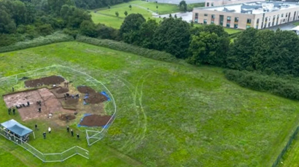
The nearby Caerau Hillfort provides an even earlier archaeological context. Coflein records Caerau as a 5.1-hectare Iron Age hillfort with three major ramparts and accompanying ditches. Archaeological investigations found evidence of occupation beginning around 600 BC, while later excavations identified activity extending into the Roman period.
Further excavation in 2013 and 2014 identified evidence reaching back into the Neolithic period. This places the Ely and Caerau landscape within a long sequence of human occupation extending thousands of years before the creation of modern Cardiff.
How did Ely develop during the medieval period?
Medieval Ely developed within a rural landscape connected to nearby Cardiff, Caerau, St Fagans and settlements bearing the Ely name. Agriculture dominated land use, while medieval estates, churches, roads and river crossings established patterns that influenced later settlement and transport development.
The medieval history of Ely is closely connected with the surrounding landscape rather than a single surviving medieval town centre. The district contained agricultural land and settlements associated with the wider ecclesiastical and manorial organisation of Glamorgan.
The Norman conquest of Glamorgan transformed political control across the region after the late eleventh century. Cardiff Castle became the centre of Norman authority in the area, while smaller fortified sites formed part of the surrounding network. Archaeological research records Caerau among the medieval defensive sites surrounding Cardiff.
The medieval landscape included Michaelston-super-Ely, whose name combines the dedication to Saint Michael with its geographical relationship to the River Ely. The Royal Commission’s Historic Place Names of Wales records Michaelston-super-Ely as a settlement and records the name from 1699, alongside earlier forms.
The neighbouring settlement also has an important medieval religious building. St Michael’s Church at Michaelston-super-Ely dates from the late twelfth or early thirteenth century and is a Grade II* listed building.
River crossings were also significant. A stone bridge across the River Ely existed at Leckwith by 1536, demonstrating the long-standing importance of crossing the river between western Cardiff and the surrounding countryside.
These medieval routes and settlements established geographical relationships that remained important as Cardiff expanded.
How important was the River Ely to the area’s history?
The River Ely influenced settlement, agriculture, transport and industry for centuries. Its water supported rural land use and later industrial activity, while bridges across the river connected Ely and neighbouring communities with Cardiff and western Glamorgan.
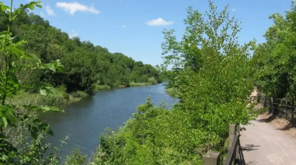
The River Ely is a defining geographical feature of the district. Its valley provided water, fertile land and a natural route through the western Cardiff landscape.
Before industrialisation, the river supported agricultural communities. Its surrounding land contained fields, farms and common land. As Cardiff expanded, the river became increasingly valuable for industrial purposes.
The historical bridge at Leckwith illustrates the transport importance of the river. Coflein records a stone bridge at the location from 1536. The surviving three-arched stone structure remains alongside a twentieth-century reinforced-concrete bridge opened in 1935.
The river also contributed directly to industrial development. The Ely Paper Works was established during the early 1870s. Samuel Evans and Thomas Owen took over the works in 1877, and by 1889 production reached approximately 145 to 150 tons of paper per week.
The paper works stood directly beside the river. Historical descriptions emphasised the suitability of the location because the stream passed through the works. The combination of water, transport access and proximity to Cardiff supported the expansion of papermaking.
The river consequently played different roles during different historical periods. It first supported agricultural settlement, then industrial production and transport, while its landscape later became part of Cardiff’s urban and environmental heritage.
When did industry transform Ely and its surrounding landscape?
Industrialisation transformed Ely during the nineteenth century through papermaking, transport infrastructure, waterworks and expanding Cardiff markets. The River Ely provided an industrial resource, while nearby Cardiff supplied labour, customers, transport connections and commercial demand.
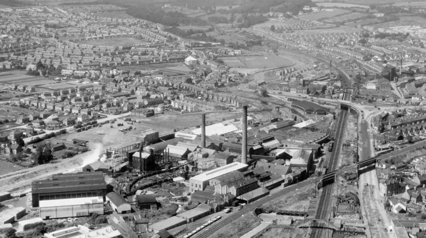
The nineteenth century represented a major turning point. Cardiff was expanding rapidly as a major coal-exporting port, and western districts increasingly became connected to the city’s industrial economy.
The Ely Paper Works became a significant industrial establishment. Its development from the early 1870s and expansion after 1877 demonstrate the growing importance of manufacturing in the area. Production reached between 145 and 150 tons of paper weekly by 1889.
Water infrastructure also developed. A pumping station was constructed at Ely Wells in 1850 by the Cardiff Waterworks Company. A piped water supply began in 1852. Cardiff Corporation purchased the undertaking in 1879 and expanded it during 1881–1882. The wells supplemented Cardiff’s water supply until 1926.
These developments demonstrate that Ely’s resources were increasingly integrated into Cardiff’s urban infrastructure.
Industrial development also affected employment patterns. Residents increasingly had access to jobs outside traditional farming, while Cardiff’s expanding population created demand for housing, services and transport.
The transformation was therefore both economic and geographical. Fields and rural land increasingly existed alongside factories, roads, railways, institutions and housing.
How did the railway change the history of Ely?
The railway connected Ely directly with Cardiff and wider South Wales from 1852. Ely railway station opened with the South Wales Railway, later handled substantial passenger and freight traffic, and finally closed to passengers in 1962 and freight in 1963.
The arrival of the railway was one of the most important nineteenth-century changes in Ely.
The South Wales Railway opened the Ely Main Line station on 2 September 1852. The station served the developing settlement and created a direct connection with Cardiff and the wider South Wales railway network.
Railway traffic increased as Ely developed. During the early twentieth century, the station issued more than 400,000 tickets annually, according to historical railway records cited in published railway histories. Its location near the Ely Racecourse contributed to passenger demand.
The railway also carried freight. Ely’s industrial economy generated traffic associated with the Ely Paper Mills and Creswell’s Brewery. Rail therefore served both residents and businesses.
The station was renamed Ely Main Line in 1924 following the grouping of British railway companies. Passenger demand later declined, and services were reduced during the post-war period. Passenger services ended in 1962, followed by freight closure in 1963.
The railway’s rise and decline reflect a wider pattern in British transport history. Railways initially accelerated industrialisation and suburban growth. Later changes in transport economics reduced the viability of some local stations.
Although the station disappeared, the railway remains an important part of Ely’s historical development because it helped integrate the district into Cardiff’s wider transport and economic system.
What was Ely Common and why was it important?
Ely Common was a substantial area of common land west of Cardiff. Cardiff Corporation acquired the Canton and Ely Commons in 1886, and part of Ely Common became Victoria Park between 1894 and 1897 after urban development reduced the original common.
Ely Common was an important feature of the pre-urban landscape. Common land provided open space and supported traditional rights associated with rural communities.
The expansion of Cardiff placed increasing pressure on common land during the nineteenth century. In 1886, Cardiff Corporation acquired the Canton and Ely Commons for public open-space purposes. Historical records state that more than £18,000 was required to settle payments associated with the acquisition.
The original Ely Common covered approximately 40 acres. Only 19 acres were ultimately allocated for park purposes. The remaining land became associated with housing development and urban expansion.
The surviving 19-acre area became Victoria Park, which was formally opened in 1897. Coflein records the park as a Victorian public park occupying approximately 19 acres or 7.7 hectares.
Victoria Park therefore represents a direct physical connection between Ely’s rural past and Cardiff’s urban development.
The transformation of common land into housing and public recreation demonstrates the changing priorities of Victorian Cardiff. Open agricultural landscapes were increasingly reorganised to provide residential land, roads and public parks for a growing urban population.
How did Victorian institutions affect Ely?
Victorian institutions changed Ely’s social history through organised poor relief, education and residential care. The Ely Industrial Schools opened in 1862 for poor and orphaned children and operated until 1903, reflecting nineteenth-century approaches to poverty and child welfare.
One of Ely’s most significant Victorian institutions was the Ely Industrial School.
The institution was established in 1862 as a Poor Law Industrial School for orphaned and impoverished children. Historical research held in Open Research Online records that the Cardiff Board of Guardians intended to separate pauper children from adults in the workhouse environment.
The institution reflected the Victorian Poor Law system. Poor Law authorities were responsible for supporting people experiencing poverty, while industrial schools were intended to provide children with accommodation, education and preparation for employment.
Changing attitudes toward child welfare eventually led to institutional reform. The Cardiff guardians adopted the Scattered Homes approach, under which children lived in smaller homes managed by foster mothers.
The two systems operated simultaneously for several years. The Ely Schools finally closed in 1903.
The original institutional buildings subsequently acquired different uses. The site became associated with adult accommodation and later healthcare provision. The history of the institution therefore illustrates changing approaches to poverty, childhood, social welfare and public administration.
Ely’s Victorian history cannot be understood only through factories and railways. Social institutions were equally important in shaping the community and its built environment.
How did Ely become a modern Cardiff suburb?
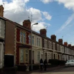
Ely became a modern Cardiff suburb through twentieth-century housing development, particularly the planned estate constructed during the 1920s. Cardiff’s expansion replaced much agricultural land with residential streets, schools, services and community facilities serving a rapidly growing urban population.
The twentieth century brought the most visible transformation of Ely.
By this period, Cardiff had expanded well beyond its historic centre. Demand for housing increased as the city grew, and planned suburban estates became a major part of urban policy.
Cardiff University research describes the Ely housing estate as a 1920s garden village designed as a desirable residential development. Researchers used original plans held at the Glamorgan Archives to examine the estate’s development.
The garden-village approach reflected contemporary British planning principles. Housing estates were designed with planned streets, open spaces and residential layouts that differed from dense nineteenth-century industrial housing.
The development changed the demographic and physical character of Ely. Former agricultural land was converted into residential neighbourhoods. Roads connected the new estate with Cardiff, while schools and public services developed alongside the growing population.
The twentieth-century estate also created a strong local identity. Modern Ely therefore represents the result of deliberate urban planning rather than simply unplanned expansion.
The housing development is particularly important because much of the district’s present urban form derives from this period.
How are Ely and Caerau connected historically?
Ely and Caerau share a long archaeological landscape containing prehistoric, Iron Age, Roman and medieval evidence. Caerau Hillfort, the Roman villa and later suburban development demonstrate that the two districts developed within the same western Cardiff historical environment.
Ely and Caerau are geographically close and historically interconnected.
The Caerau Hillfort is one of the most important prehistoric monuments in the Cardiff area. It covers approximately 5.1 hectares and is enclosed by three major ramparts and ditches. Archaeological work identified occupation beginning around 600 BC.
The hillfort was later connected with Roman and medieval activity. A medieval ringwork and the remains of St Mary’s Church are associated with the hillfort landscape.
The Ely Roman Villa provides complementary evidence from the Roman period. Together, the sites demonstrate sustained human occupation across the western Cardiff landscape.
Modern research has strengthened understanding of this relationship. The Caerau and Ely Rediscovering Heritage Project, known as the CAER Heritage Project, involved Cardiff University, Action in Caerau and Ely, local schools and residents. Archaeological survey, excavation and community research helped connect ancient archaeology with modern community history.
This research also demonstrates the value of studying Ely as part of a wider landscape rather than as an isolated suburb.
What role did the Ely Racecourse play in local history?
Ely Racecourse became an important recreational and sporting venue during the modern period and contributed to the popularity of Ely’s railway station. The site also hosted technological demonstrations, including an important 1911 wireless communication experiment involving aviation.
The Ely Racecourse was an important feature of the district’s later nineteenth- and early twentieth-century identity.
Its location near the railway station helped attract visitors to the area. Historical railway accounts connect the racecourse with the high passenger numbers recorded at Ely station during the early twentieth century.
The racecourse also became associated with events beyond horse racing.
On 22 September 1911, inventor H. Grindell-Matthews conducted a wireless telephony experiment involving aviator B. C. Hucks. Historical accounts describe communication being established between the inventor on the ground and an aircraft operating above the racecourse area.
This event demonstrates the variety of activities associated with Ely during the early twentieth century.
The racecourse eventually disappeared as Cardiff’s urban development progressed. Its historical importance remains connected to sport, transport, entertainment and technological experimentation.
How did Ely’s boundaries and administration change?
Ely’s administrative identity changed as Cardiff expanded and historic parish structures were reorganised. Older settlements belonged to separate ecclesiastical and civil jurisdictions, while twentieth-century boundary changes increasingly incorporated western communities into Cardiff’s modern administrative structure.
Historically, Ely did not possess the same administrative structure that defines the modern Cardiff community.
The surrounding area was divided among ancient parishes and local jurisdictions. Michaelston-super-Ely, St Fagans and other neighbouring parishes existed as distinct administrative units.
The nineteenth century introduced new registration and local-government structures. The Cardiff registration district included numerous Glamorgan parishes, including Michaelston-super-Ely from 1837 until 1922. In 1922, the parish was abolished and its territory was divided between Cardiff and St Fagans.
These changes demonstrate how administrative boundaries evolved alongside urban growth.
The incorporation of surrounding rural communities into Cardiff changed the relationship between countryside and city. Areas that had previously operated through separate parishes became increasingly connected to Cardiff’s municipal services, infrastructure and planning system.
Administrative change therefore forms an important part of Ely’s modern history. The present district reflects the cumulative effect of these reorganisations rather than a single historical boundary change.
Explore More Area Guide
Why Is Rumney Called Rumney? History of the Name Cardiff 2026
Origins of Splott: Cardiff’s Medieval to Industrial History 2026
What is Ely’s historical importance to Cardiff today?
Ely’s historical importance comes from its archaeological remains, River Ely landscape, Victorian institutions, industrial heritage, railway history, common land and twentieth-century housing. These layers demonstrate how western Cardiff developed from rural settlement into an established urban community.
Modern Ely contains evidence of several major phases of Welsh history.
The Roman villa establishes the area’s importance during Roman Britain. Caerau Hillfort provides evidence reaching back to the Iron Age and Neolithic periods. Medieval settlements and churches demonstrate the continuity of occupation after Roman rule.
The nineteenth century introduced industrialisation and infrastructure. The Ely Paper Works, Ely Wells pumping station, railway and institutional buildings connected the district directly to Cardiff’s expanding economy.
The twentieth century introduced large-scale planned housing. The 1920s garden-village estate fundamentally changed the area’s physical character and established much of the suburban landscape visible today.
Heritage research continues to document these changes. The Royal Commission, Cadw, Cardiff University, Glamorgan Archives and local heritage projects provide evidence for archaeological sites, historic buildings, maps and community development.
Ely’s history is therefore not limited to one monument or period. Its significance lies in the accumulated evidence of settlement, agriculture, industry, transport, welfare, housing and urbanisation.
How can Ely’s history be understood as one continuous development?
Ely’s history forms a continuous sequence from prehistoric occupation and Roman settlement through medieval agriculture, Victorian industrialisation, railway expansion, institutional development and twentieth-century housing. Each period changed land use while retaining geographical connections created by the River Ely and surrounding landscape.
The earliest evidence establishes long-term human activity. Caerau’s archaeological record reaches into the Neolithic period, while Iron Age occupation created a substantial fortified settlement. Roman occupation then introduced villa-based settlement and integration into the Roman provincial economy.
The medieval period reorganised the landscape through religious, agricultural and manorial systems. Settlements such as Michaelston-super-Ely and historic river crossings became part of a wider network around Cardiff and Glamorgan.
The nineteenth century brought a fundamental economic shift. Industry, water infrastructure and railway transport connected Ely more closely to Cardiff. The paper works became a significant industrial operation, while the railway provided passenger and freight connections.
Victorian social institutions added another layer. The Ely Industrial School reflected nineteenth-century approaches to poverty and child welfare before closing in 1903.
The twentieth century completed the transition from rural landscape to urban suburb. Planned housing estates replaced agricultural land and established the residential pattern associated with modern Ely.
Today, Ely remains a distinct Cardiff community with a historical landscape shaped by thousands of years of human activity. Its archaeology, historic infrastructure and surviving urban form provide evidence for the wider transformation of Cardiff from a small settlement into a major Welsh city.
What is the history of Ely in Cardiff?
Ely has a history stretching from prehistoric settlement and Iron Age activity to Roman occupation, medieval agriculture, Victorian industry and twentieth-century housing development. Its location beside the River Ely strongly influenced settlement, transport and economic development.