Cardiff’s neighbourhood names preserve centuries of Welsh language, medieval landholding, religious history, farming, industrial expansion and urban development. Names such as Roath, Cathays, Canton, Grangetown, Adamsdown, Penylan and Llanishen existed in different forms before modern Cardiff developed into a major industrial and administrative city.
- What do Cardiff’s neighbourhood names reveal about the city’s history?
- Why is Roath called Roath?
- Where does the name Cathays come from?
- Why is Canton called Canton?
- How did Grangetown get its name?
- Why is Adamsdown called Adamsdown?
- What does Penylan mean?
- Why is Llanishen named after Saint Isan?
- How did Splott get its unusual name?
- What do Llandaff, Whitchurch and other Cardiff names mean?
- Why do Cardiff’s neighbourhood names have both Welsh and English forms?
- How did industrialisation change Cardiff’s neighbourhood names?
- Why are Cardiff’s neighbourhood names still important today?
- What can Cardiff’s neighbourhood names tell us about the city’s future?
Place names are historical evidence. They identify former farms, fields, churches, estates, landforms, settlements and people. Some names have clear meanings. Others have several competing explanations because medieval spellings changed over time and surviving records are incomplete.
Cardiff also has an important bilingual naming tradition. Welsh and English have influenced the city’s place names in different periods. Some historic Welsh names disappeared from everyday use and later returned through standardisation and bilingual public naming. Cardiff University research has documented how this linguistic relationship shaped the city’s streets and neighbourhoods.
The modern administrative Cardiff contains neighbourhoods including Canton, Cathays, Grangetown, Roath, Splott, Adamsdown, Penylan, Cyncoed, Llanishen, Rhiwbina, Llandaff, Ely, Whitchurch, Llanrumney, Fairwater and Gabalfa. Cardiff Council’s current administrative material demonstrates the breadth of these established local identities.
Understanding their names reveals how Cardiff developed from a medieval settlement around Cardiff Castle and the River Taff into a major nineteenth- and twentieth-century city.
What do Cardiff’s neighbourhood names reveal about the city’s history?
Cardiff’s neighbourhood names reveal layers of Welsh language, medieval land ownership, religious foundations, farming, geography and industrial expansion. Their meanings preserve evidence of landscapes and communities that existed before modern streets, housing estates and administrative boundaries transformed Cardiff.
A place name is not simply a label. Historical place names often preserve information about how people understood land and settlements. A name describing a hill, church, farm, enclosure or woodland can survive after the original physical feature changes.
Cardiff contains particularly strong evidence of this process because urban expansion accelerated during the nineteenth century. Industrial growth connected the city to coalfields, docks, railways and expanding markets. Former farmland was progressively divided into streets and residential districts.
The survival of older names alongside newer names reflects this transition. Roath, for example, existed as an established parish and locality long before the dense Victorian terraces associated with modern Roath appeared. The old parish also covered areas that are now recognised separately, including Splott, Adamsdown, Penylan, Tremorfa and part of Cathays.
The same pattern appears in Adamsdown. Historical records show Adamsdown as a named parcel of land and farm long before nineteenth-century urban development. The Historic Place Names of Wales database records forms including Adams Downe Farm in 1665 and 1702 and Adams Down Farm in 1792.
This evidence establishes an important principle: many Cardiff neighbourhood names predate the neighbourhoods that residents recognise today.
Why is Roath called Roath?
Roath is an ancient Cardiff place name with medieval documentary forms including Raz and Raht. Its precise linguistic origin remains debated, with explanations connecting it to a fortified enclosure or the Welsh word rhodd, while its long historical use is firmly documented.
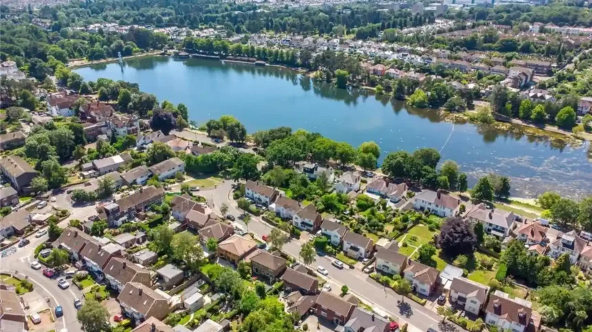
Roath is one of Cardiff’s oldest surviving neighbourhood names. The locality formed part of an extensive historic parish east of the medieval town.
Records collected by the Roath Local History Society document early forms of the name. A confirmation associated with Henry I in 1106 records “Raz”, while a later medieval charter uses “Raht”. These spellings demonstrate that the modern form developed through several historical versions.
The exact etymology remains uncertain. One traditional explanation connects Roath with the Irish Gaelic term ráth, meaning a fortified enclosure or rampart. Another proposed explanation connects it with the Welsh word rhodd, meaning “gift”. Local historical research presents these explanations as competing possibilities rather than a settled single origin.
Roath’s historical importance increased as Cardiff expanded eastwards. The old parish covered a substantially larger area than the modern district. Historical research identifies Splott, Adamsdown, Pen-y-lan, Tremorfa and part of Cathays within the former parish.
Modern Cardiff therefore contains several neighbourhood identities that developed from the same older administrative landscape.
The name Roath also survives through Roath Park, Roath Lake and numerous streets and institutions. These later uses demonstrate how an ancient locality name became embedded within the expanding urban geography of Cardiff.
Where does the name Cathays come from?
Cathays is an old Cardiff locality name recorded in forms such as Catt Hays from the seventeenth century. Its origin has competing interpretations involving Welsh cad, meaning battle, and Old English terms associated with wildcats and an enclosure.
Cathays was historically a rural area north-east of medieval Cardiff. Its Welsh name was Y Waun Ddyfal, while the English name Little Heath distinguished it from another area known as Great Heath.
The English form Cathays appears in documentary evidence as “Catt Hays” in 1699. The second element is generally connected with Old English haga, meaning an enclosure or protected area. The first element has received different interpretations.
One explanation connects the first element with Welsh cad, meaning battle. Another connects it with Old English catt, meaning wildcat. Historical place-name research therefore does not reduce Cathays to one universally accepted translation.
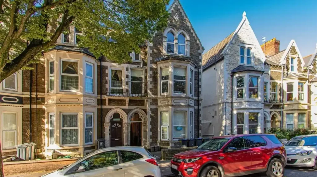
Cathays later became closely associated with Cathays Park, the civic and institutional district developed under the Bute estate. The First Marquess of Bute inherited substantial Cardiff property interests, while later estate development helped create the grand civic landscape associated with the area.
The transformation from rural land to an urban district illustrates how an old field or locality name can survive major physical change.
Cathays today is also associated with Cardiff University and a large student population. The modern social identity of the district differs substantially from its earlier agricultural setting, but the name retains its historical connection with the landscape north of the medieval town.
Why is Canton called Canton?
Canton is the English form of the historic Cardiff district whose Welsh name is Treganna. Medieval records contain forms such as Kanetune and Canetone, while traditional explanations associate the name with Saint Canna and the medieval manor of the locality.
Canton occupies land west of Cardiff’s historic centre and has a long association with Llandaff and Cardiff.
The Welsh name is Treganna. Current Welsh Government terminology lists Canton as Treganna in the official Cardiff electoral ward-name framework.
Historical records contain medieval forms including Kanetune, Canetune and Canetone. A traditional interpretation associates the name with Saint Canna, a figure connected with the early Christian period in Wales.
Canton’s historical development also involved the manor system. Medieval references identify people associated with the locality during the thirteenth century. A 1215 record refers to Lucia de Kanetune, while Walter de Canetune appears in a 1230 Cardiff charter. Later records include Richard de Canetone in 1290.
These documents show that the name existed centuries before modern Canton became a dense residential district.
The district expanded significantly during Cardiff’s industrial growth. Its location west of the centre placed it within the expanding urban corridor linking Cardiff with Llandaff and western suburbs.
The continued use of Treganna demonstrates another important feature of Cardiff’s naming history: English and Welsh forms can coexist as recognised names rather than one language simply replacing the other.
How did Grangetown get its name?
Grangetown takes its name from a grange associated with the marshy or moorland landscape south of Cardiff. The district developed rapidly during the nineteenth century, transforming former agricultural land into a planned residential suburb connected with Cardiff’s industrial expansion.
A grange was historically an agricultural estate or farm associated with a religious institution or larger manor. In Grangetown’s case, the name became associated with the Grange and the surrounding moor or saltmarsh.
Historical sources connect the locality with Grange Farm and the surrounding land. The area remained largely marshy and agricultural until nineteenth-century development transformed it into a residential district.
The name therefore reflects the physical and economic landscape that existed before dense urban development.
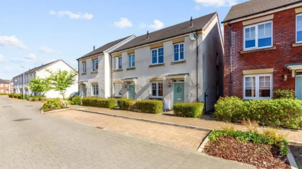
Grangetown’s nineteenth-century development was closely connected with the Windsor-Clive estate. Local historical research records major development phases beginning in 1857 and continuing through the later nineteenth century. Streets were laid out as the former rural landscape became a planned residential area.
The area’s street names also preserve connections with estate ownership. Examples include Clive Street, Paget Street, Worcester Street, Newport Street, Amherst Street and Sevenoaks Street.
Grangetown therefore contains two distinct layers of naming history. The neighbourhood name reflects the older grange and marsh landscape, while many streets reflect the people and estates responsible for Victorian development.
Cardiff University’s research also highlights the linguistic complexity surrounding Grangetown. Historian John Davies coined the Welsh name Trelluest, but Grangetown remains the established name used in many official and public contexts.
Why is Adamsdown called Adamsdown?
Adamsdown takes its name from an older parcel of land called Adams Down or Adams Downe. Historical evidence records the name from at least 1440, while local historians connect Adam with Adam Kyngot, a medieval porter of Cardiff Castle.
Adamsdown provides one of Cardiff’s clearest examples of a neighbourhood retaining the name of an earlier piece of land.
The Roath Local History Society records the first known mention of Adamsdown in an Inquisition of 1440 following the deaths of Isabel le Despenser and Richard Beauchamp, Earl of Warwick and Lord of Glamorgan. The name appears again in a 1492 rental survey.
Historical research connects the name with Adam Kyngot, who was associated with the role of porter or gatekeeper at Cardiff Castle. The second element, “down”, describes the open land associated with the name.
The Historic Place Names of Wales database provides additional documentary evidence. Adams Downe Farm is recorded in 1665 and 1702, while Adams Down Farm appears in 1792 and Adamsdown Farm in 1824.
These records establish that Adamsdown was a named rural locality long before modern housing estates and streets filled the area.
The urbanisation of Adamsdown formed part of Cardiff’s nineteenth-century expansion. Farmland and open land were gradually replaced by housing, institutions, roads and industrial infrastructure.
The historical name survived this transformation. Modern Adamsdown therefore retains a direct linguistic link to a medieval and early modern landscape that no longer resembles the dense urban district visible today.
What does Penylan mean?
Penylan is a Welsh place name generally understood from the elements pen and ylan, describing a head, end or summit associated with a particular landscape feature. The name existed within the historic Roath parish before modern residential development.
Penylan demonstrates how Welsh descriptive elements survived urbanisation.
The name is officially represented as Pen-y-lan in Welsh Government terminology. Cardiff’s current electoral ward-name list uses Penylan in English and Pen-y-lan in Welsh.
Historical local research places Penylan within the old parish and manor of Roath. The area was originally rural and developed later as Cardiff expanded eastwards.
Welsh place names frequently contain short geographical elements. Pen is widely used in Welsh to indicate a head, end, top or prominent point. The second element in Penylan has been associated with a landscape or woodland reference in local explanations.
The significance of Penylan lies in its continuity. The name was not created for a modern housing estate. It existed before the streets and houses that define the district today.
Urban growth accelerated around Cardiff during the late nineteenth and early twentieth centuries. Former fields were divided into building plots, roads and residential estates.
Penylan became integrated into this expansion while retaining its older Welsh name. This illustrates the persistence of Welsh geographical vocabulary within a rapidly industrialising and increasingly bilingual city.
The same pattern occurs across Cardiff. Names that originally described farms, hills, fields, churches and natural features became neighbourhood names after urban development changed the underlying landscape.
Why is Llanishen named after Saint Isan?
Llanishen is a religious place name derived from a church or settlement associated with Saint Isan. The Welsh element llan traditionally identifies an enclosure, church or Christian settlement, linking the neighbourhood to Cardiff’s early medieval religious landscape.
Llanishen is one of Cardiff’s clearest examples of a neighbourhood name with a Christian origin.
Local historical research states that Llanishen takes its name from Saint Isan, who is associated with a sixth-century Christian community. Tradition connects Saint Isan with Saint Edeyrn, another early Christian figure whose name survives in nearby Llanedeyrn.
The element llan appears throughout Welsh place names. It identifies a church, enclosure or Christian settlement and occurs in numerous Welsh communities.
Llanishen therefore belongs to a much older naming tradition than the modern Cardiff suburb.
After the Norman Conquest, land in Llanishen became associated with the Abbey of Keynsham. The present St Isan’s Church has medieval origins and is generally dated to the twelfth century in local historical accounts.
The name survived the area’s later transformation.
During the twentieth century, Llanishen became associated with large-scale housing, employment sites and infrastructure. The Royal Ordnance Factory was an important part of the area’s modern industrial history.
The survival of Llanishen’s name demonstrates how religious place names can remain geographically important after the original settlement pattern has changed.
It also shows why Cardiff’s neighbourhood names cannot be understood only through modern maps. The linguistic structure often points towards earlier religious, agricultural or administrative landscapes.
How did Splott get its unusual name?
Splott is an old Cardiff place name associated with former agricultural land between Roath and the coast. Its precise linguistic origin remains disputed, but historical interpretations commonly connect it with an English word meaning a plot or patch of land.
Splott’s name is among Cardiff’s most distinctive and most frequently discussed.
The modern district developed largely during Cardiff’s industrial expansion, but the name is considerably older. Historical descriptions identify Upper Splott and Lower Splott farms before the nineteenth-century construction of dense housing and industrial facilities.
Several explanations have circulated for the name. One popular story claims that Splott derives from “God’s Plot”, linking the land to medieval ecclesiastical ownership. Another explanation connects the name with Welsh ysblad, associated with land beside marshland.
Historical writer Martin Johnes identifies an old English interpretation as more likely, connecting “splot” with a plot or piece of land. He also notes that similar forms occur elsewhere in south Wales.
The uncertainty is important. Place-name history often contains traditional explanations that become popular without sufficient documentary evidence to establish them as definitive.
Splott’s physical history provides useful context. The district stood on low-lying land east of Cardiff’s centre and later became strongly associated with heavy industry, including the former steelworks.
Industrial development transformed the landscape. Fields and farms became terraces, factories, transport routes and commercial premises.
The old name nevertheless survived the transformation.
Splott demonstrates how a short rural field name can become the identity of a major urban community while retaining linguistic links to the agricultural landscape that existed before industrial Cardiff.
What do Llandaff, Whitchurch and other Cardiff names mean?
Llandaff, Whitchurch, Ely, Rhiwbina, Cyncoed and other Cardiff neighbourhoods preserve additional layers of religious, geographical and agricultural naming. Their Welsh forms show how older local landscapes continued into the modern city’s expanding administrative geography.
Llandaff is closely associated with the River Taff and Llandaff Cathedral. Its Welsh form is Llandaf, officially recognised alongside Llandaff in Cardiff’s bilingual naming system.
Whitchurch provides another clear religious example. Its Welsh name is Yr Eglwys Newydd, literally “the new church”. The Welsh Government’s terminology database recognises Yr Eglwys Newydd as the Welsh form of Whitchurch in Cardiff.
The name reflects a settlement historically identified with a church. Its English form, Whitchurch, carries the same broad religious meaning.
Rhiwbina is another Welsh name retained in modern Cardiff. Welsh Government terminology lists Rhiwbeina as its Welsh form.
Cyncoed also preserves a Welsh landscape-based name. Local historical research associates the modern district with Cyncoed Farm and explains the older name in connection with coed, the Welsh word for woodland.
Ely has a different historical trajectory. Modern Ely expanded significantly as a planned residential area, particularly after the First World War. Cardiff University’s CAER Heritage team conducted community research into the area’s garden village, Dusty Forge and twentieth-century development.
These examples demonstrate that Cardiff’s neighbourhood names come from different periods and naming systems. Some refer to churches. Others relate to terrain, farms, woodland, people or historic settlements.
Why do Cardiff’s neighbourhood names have both Welsh and English forms?
Cardiff’s bilingual place names reflect centuries of interaction between Welsh and English. Some names retained Welsh forms, some developed English forms, and others changed through translation, adaptation, official standardisation and renewed recognition of historic Welsh names.
Language is central to understanding Cardiff’s place-name history.
Cardiff University research identifies examples where historic Welsh names were replaced or displaced by English forms. Plwca Lane, for example, was associated with the Welsh word plwca, referring to muddy land. The street later became Castle Road and subsequently City Road.
The history of Heath is another example. Cardiff University researchers explain that Y Mynydd Bychan was an older Welsh name, while Y Waun was later created as a translation of “Heath”. The original form subsequently returned to wider use.
This process demonstrates that bilingual place names are not always simple word-for-word translations.
Names can change because of administrative decisions, language use, population movement, mapping conventions and changing attitudes towards Welsh.
Academic research on Cardiff street names also identifies mixed naming structures. Welsh elements were incorporated into predominantly English street-name systems during the expansion of districts built between approximately 1910 and 1940. Examples include Treorkey Street, Llantrissant Street and Dan-y-Coed Road.
Modern Cardiff continues this bilingual naming tradition. Cardiff Council officially manages road and street naming and numbering, while Welsh and English forms are incorporated into the city’s administrative naming framework.
Welsh Government research also demonstrates that contemporary place naming remains active. A national study surveyed 7,361 properties across seven Welsh localities, including Whitchurch in Cardiff, examining Welsh, English and mixed-language naming patterns.
Cardiff’s place names therefore represent both historical records and a continuing linguistic process.
How did industrialisation change Cardiff’s neighbourhood names?
Industrialisation changed Cardiff’s physical geography while preserving many older locality names. Victorian housing, docks, railways, factories and roads expanded around pre-existing farms, parishes and estates, turning rural place names into permanent urban neighbourhood identities.
Cardiff’s industrial transformation accelerated during the nineteenth century. The city’s docks became central to the export of coal from the South Wales coalfield.
Population growth followed industrial employment, transport investment and port expansion. Former rural areas became residential districts for workers and their families.
The names of older farms and estates frequently survived this transformation.
Grangetown retained its connection with the Grange. Splott retained its agricultural name. Adamsdown preserved the name of an older parcel of land. Roath continued as a major locality even as the old parish was divided into new urban districts.
This pattern created a layered city.
A nineteenth-century terrace could stand on land that had previously been a farm. A modern road could follow an older field boundary. A neighbourhood could retain a medieval name despite having no visual connection with the original settlement.
The historical record confirms this process. The old parish of Roath covered several areas that later became separate communities, including Splott, Adamsdown and Penylan.
Grangetown provides another clear example. Its residential development began through organised estate development from the 1850s, replacing agricultural and marshland uses with streets and housing.
The resulting urban landscape combined old names with new infrastructure.
This explains why Cardiff contains neighbourhood names from very different periods. Medieval and early modern names survived alongside Victorian development names and twentieth-century planned estates.
Explore More Area Guide
Cardiff Historic Tram Routes: Cardiff Corporation Tramways
Lost Buildings of Roath: Cardiff’s Forgotten Historic Sites
Why are Cardiff’s neighbourhood names still important today?
Cardiff’s neighbourhood names remain important because they preserve historical geography, support local identity, distinguish communities and maintain Welsh linguistic heritage. Official bilingual naming also ensures that historic and contemporary forms remain visible in public administration and everyday life.
Place names remain practical geographical identifiers.
Cardiff Council uses neighbourhood and ward names in planning, transport, childcare, active travel and other public services. Current council documentation lists communities and districts including Canton, Cathays, Grangetown, Llanishen, Penylan, Rhiwbina, Llandaff, Ely and Splott.
The names also provide continuity.
A resident of Adamsdown uses a name connected with medieval land. A resident of Llanishen uses a name associated with an early Christian figure. A resident of Grangetown uses a name linked to a historic grange and marsh landscape.
This continuity matters because urban environments change rapidly. Buildings disappear, roads are widened, railway lines close, industries decline and housing estates expand. Place names often survive these physical changes.
The Welsh language adds another layer.
Cardiff University’s research into place names shows that historic Welsh forms can disappear from everyday usage and later return through scholarship, cultural activity and official recognition.
Welsh Government research also demonstrates that Welsh naming continues to develop in contemporary Cardiff. Its research into Whitchurch found increasing visibility of Welsh street and property names alongside established English forms.
Cardiff’s neighbourhood names therefore function as historical records, administrative identifiers and elements of living linguistic culture.
What can Cardiff’s neighbourhood names tell us about the city’s future?
Cardiff’s neighbourhood names will continue to connect future development with earlier landscapes, communities and languages. As new housing and infrastructure expand the city, established names and bilingual naming practices will remain important tools for preserving geographical continuity.
Cardiff continues to grow and change. New housing, transport infrastructure, commercial development and public facilities alter the physical city.
The naming process remains formally regulated. Cardiff Council is responsible for naming roads and streets and for assigning official property addresses. New developments require formal naming and numbering before addresses receive official recognition.
This means future neighbourhoods will enter an established historical system.
The experience of older districts provides a useful model. Names that began as farms, fields, churches or estates became neighbourhood identities after urban development.
Future Cardiff will continue to contain this mixture of old and new.
The Historic Place Names of Wales database provides a substantial research resource for understanding this process. It contains tens of thousands of historical place-name records, including documentary forms connected with Cardiff’s former farms, fields, streets and settlements.
The continued documentation of names also supports historical research. Researchers can compare early spellings, maps, estate records and modern administrative forms to understand how Cardiff’s geography developed.
The result is a city where neighbourhood names provide a direct connection between present-day communities and earlier landscapes.
Roath, Cathays, Canton, Grangetown, Adamsdown, Penylan, Llanishen and Splott are not simply modern districts. Their names preserve evidence of Cardiff’s medieval settlements, farms, religious communities, estates, language history and industrial transformation.
Cardiff’s neighbourhood map is therefore also a historical map. Reading its names reveals how the city changed from a relatively small medieval settlement into the capital of Wales while retaining linguistic and geographical traces of the landscapes that came before it
What is the oldest neighbourhood name in Cardiff?
Roath is one of Cardiff’s oldest surviving neighbourhood names. Medieval records contain forms including “Raz” and “Raht”, showing that the name existed centuries before modern Cardiff expanded eastwards.