Cardiff has an extensive road network shaped by Roman routes, Victorian expansion, industrial growth, suburban development and modern transport planning. The city contains major east-west corridors, north-south routes and roads that continue beyond the administrative boundary into neighbouring areas.
- How are Cardiff’s longest roads identified?
- Why is the A48 important to Cardiff’s longest-road network?
- How does Newport Road fit into Cardiff’s longest roads?
- What makes Western Avenue one of Cardiff’s major long corridors?
- How important is Cardiff Road as a long-distance route?
- Why is Cowbridge Road important in Cardiff’s road history?
- What role does Penarth Road play in Cardiff’s road network?
- Which Cardiff roads have the strongest historical connections?
- How has Cardiff’s road network changed over time?
- How do Cardiff’s longest roads affect transport today?
- How have Cardiff’s speed limits changed on major roads?
- Which roads connect Cardiff with neighbouring areas?
- Why is it difficult to name Cardiff’s single longest road?
- What should visitors know about Cardiff’s major road corridors?
- What is the future of Cardiff’s longest roads?
- What are the key facts about Cardiff’s longest roads?
Cardiff Council maintains 1,132.22 kilometres of adopted highway. This network includes 92.2 km of A roads, 27 km of B roads, 112 km of C roads and 892.92 km of minor roads. The council also records 3,633 named streets.
There is no single Cardiff Council league table identifying the longest individual named street by kilometres. Road length also changes depending on whether a road is measured as one named street, a continuous route with different names, or an A-road designation extending outside Cardiff.
The most significant long-distance corridors associated with Cardiff include Newport Road, Western Avenue, Cardiff Road, Cowbridge Road East, Cowbridge Road West, Penarth Road and the A48 corridor. These routes connect the city centre with residential districts, employment areas, neighbouring communities and the wider South Wales transport network.
How are Cardiff’s longest roads identified?
Cardiff’s longest roads are best understood as extended transport corridors rather than a fixed official ranking of named streets. Cardiff Council’s highway statistics classify roads by highway type, while individual road lengths require route-specific measurement and can change with junctions, boundaries and road-name changes.
The distinction between a road and a road corridor is important. A named street can form only one section of a longer transport route. For example, the A48 operates across South Wales and passes through Cardiff, while different sections have different local names.
Cardiff Council’s adopted highway statistics provide the most useful official framework for understanding the city’s road network. The council maintains more than 1,100 km of adopted highway, demonstrating the scale of the network beyond the handful of roads familiar to visitors.
An adopted highway is a public road maintained by the highway authority. Cardiff’s highway statistics distinguish adopted roads from other routes and separately record public rights of way.
This means a comparison of Cardiff’s longest roads should focus on continuous urban corridors, strategic routes and historically important roads rather than claiming an unsupported exact ranking.
Why is the A48 important to Cardiff’s longest-road network?
The A48 is one of Cardiff’s most important long-distance road corridors because it follows a major east-west route through South Wales. Its Cardiff sections connect the city with Newport, Cowbridge, Bridgend and wider South Wales, reflecting centuries of transport development.
The A48 is substantially longer than any individual Cardiff street because it is a regional road designation. The route extends from the Gloucester area through Newport and Cardiff towards Carmarthen.
The Royal Commission on the Ancient and Historical Monuments of Wales records the A48 as a major road following closely the route of an original Roman trade route. Historically, it served as an important route across southern Wales.
Archaeological research also identifies Cardiff as an important crossing point on the South Wales coastal plain. Roads associated with the Roman settlement are thought to have run east-west roughly along the present A48 route.
The modern A48 is not identical to the ancient road. It has experienced realignments, bypasses and new dual-carriageway sections. The development of the M4 subsequently reduced the A48’s role as the principal long-distance route across South Wales.
Within Cardiff, the A48 is therefore best understood as a strategic road corridor rather than simply a single named street.

How does Newport Road fit into Cardiff’s longest roads?
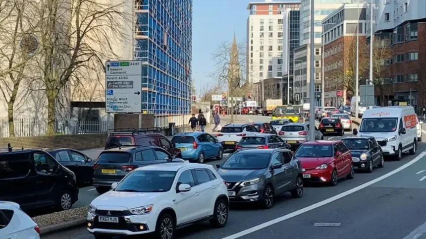
Newport Road is a major eastern Cardiff corridor linking the city centre with eastern neighbourhoods and the wider route towards Newport. Its importance comes from its length, connectivity, employment access, public transport role and position within Cardiff’s sustainable transport programme.
Newport Road runs east from central Cardiff through a succession of established urban areas. It forms part of the wider Cardiff-to-Newport transport corridor.
Cardiff Council’s current transport programme identifies the Newport Road corridor as a route connecting Cardiff city centre towards Newport and business development areas around Cypress Drive. The programme incorporates an eastern bus corridor, Cycleway 2 and controlled parking zones.
The city-centre section has also been incorporated into public-realm improvements. Cardiff Council describes the route from North Road through Boulevard de Nantes, Stuttgarter Strasse, Dumfries Place and Newport Road as part of Phase 1 of the sustainable transport corridor.
Newport Road therefore demonstrates why road length alone does not explain importance. Its function includes traffic movement, bus services, cycling infrastructure, pedestrian crossings and access to commercial areas.
The route also illustrates how Cardiff’s longest and most important roads continue to evolve as transport policy changes.
What makes Western Avenue one of Cardiff’s major long corridors?
Western Avenue is a major west-northwest Cardiff route serving traffic between central Cardiff and western and northern parts of the city. Its strategic function, junction network and connection with wider A-road infrastructure make it an important extended road corridor.
Western Avenue forms part of Cardiff’s wider strategic road system. It provides a connection between central areas and communities on the western and northern sides of the city.
The road’s significance is also reflected in Cardiff’s recent speed-limit review. Following the Welsh Government’s nationwide default 20 mph policy for built-up areas, Cardiff reviewed individual roads and proposed returning sections of four roads to 30 mph, including part of Western Avenue.
The council’s review demonstrates the different functions of major Cardiff roads. Speed limits are considered alongside road layout, traffic movement and the surrounding built environment.
Western Avenue is therefore not simply a long suburban road. It is part of Cardiff’s strategic movement network and connects several urban districts with other major routes.
How important is Cardiff Road as a long-distance route?
Cardiff Road is an established road name used on routes connecting Cardiff with surrounding communities. Its importance comes from its role as an outward route and its connection with historic settlement patterns rather than from an officially published ranking as Cardiff’s longest named street.
Road names such as Cardiff Road often indicate historical direction and destination. Roads connecting neighbouring settlements frequently retained names based on the place they led towards.
Cardiff Council identifies a Cardiff Road Conservation Area in Llandaff, demonstrating the historical and built-environment significance associated with the route.
Llandaff itself forms an important part of Cardiff’s historic urban geography. Roads through the district developed within a landscape that predates modern Cardiff’s expansion.
Cardiff Road therefore illustrates another issue in identifying the city’s longest roads. A road name can occur as a local section of a wider historic route, while modern administrative boundaries and road classifications determine how its length is recorded.
Why is Cowbridge Road important in Cardiff’s road history?
Cowbridge Road is an important western Cardiff corridor with a long history as a principal route across the River Taff and towards Cowbridge and western South Wales. Its history includes bridge construction, road realignment and changes in the A48 network.
Cowbridge Road East and Cowbridge Road West form a major route across western and central Cardiff.
The historic Cardiff Bridge is particularly important to the route’s development. The present bridge was constructed in 1859, widened in 1877 and substantially rebuilt in 1930–31. It replaced earlier bridges, including an 18th-century structure.
The bridge carries Cowbridge Road across the River Taff and historically formed part of the principal western route from Cardiff centre.
The route was formerly part of the A48. Later changes to the regional road network altered the role of the road as bypasses and motorway infrastructure were developed.
Cowbridge Road demonstrates how a road can remain important after its national road classification changes. Local traffic, public transport, businesses, housing and pedestrian movement continue to give the corridor a substantial urban role.
What role does Penarth Road play in Cardiff’s road network?
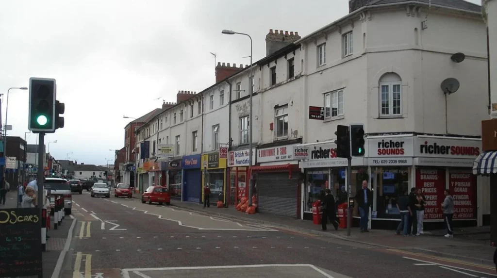
Penarth Road is a major southern Cardiff corridor connecting central Cardiff with Grangetown, Cardiff Bay and Penarth. It forms part of the city’s southward transport network and connects residential, commercial, waterfront and employment areas.
Penarth Road is particularly important because of Cardiff’s geography. The city centre lies north of Cardiff Bay, while Grangetown, the bay area and Penarth lie further south.
The road forms part of routes used for access between central Cardiff and southern districts. It also appears within major city events and traffic-management arrangements.
Cardiff Council’s published Cardiff Half Marathon route, for example, includes Penarth Road alongside Cowbridge Road East, Leckwith Road, Sloper Road and routes through Cardiff Bay.
Penarth Road also demonstrates the relationship between Cardiff’s road network and its waterfront development. Cardiff Bay has undergone substantial regeneration, increasing the importance of connections between central Cardiff, the bay and surrounding communities.
Its strategic position makes Penarth Road an important long urban corridor even though the road does not form part of the longest regional A-road designation.
Which Cardiff roads have the strongest historical connections?
Several Cardiff roads follow routes shaped by historic settlement and transport development. The A48 has Roman-route associations, Cowbridge Road developed as a western route, and roads around Llandaff and central Cardiff reflect older communities incorporated into the modern city.
Cardiff’s road network developed in stages. Roman transport routes established important east-west and north-south connections. Medieval settlement then shaped local routes, while turnpike roads and industrial expansion created improved connections between Cardiff and neighbouring towns.
The A48 provides the clearest documented example. Archaeological research identifies an east-west Roman road alignment approximately following the modern A48 corridor.
Later improvements transformed these historic routes. Turnpike roads improved long-distance movement before modern highway engineering introduced bypasses, dual carriageways and motorways.
The development of the M4 changed the hierarchy of roads across South Wales. The motorway became the principal long-distance route, while the A48 increasingly served regional and local traffic.
Cardiff’s longest road corridors therefore contain several layers of transport history rather than representing a single period of development.
How has Cardiff’s road network changed over time?
Cardiff’s road network expanded from historic routes into a large modern highway system supporting urban growth, industrial development, suburbanisation and regional travel. Motorways, bypasses, new junctions, public transport schemes and cycling infrastructure have progressively changed how major roads function.
Cardiff’s population and built-up area expanded significantly during industrialisation. The growth of coal exports, docks, manufacturing and railway infrastructure increased demand for roads connecting the city with surrounding communities.
The 20th century introduced major changes. Motor vehicles increased traffic volumes, while bypasses and dual carriageways separated longer-distance movement from some town centres.
The A48 illustrates this transition. The route has experienced several realignments and bypasses, while the M4 subsequently became the principal strategic route across South Wales.
Modern Cardiff is now managing roads for multiple transport modes. Cardiff Council’s Newport Road programme includes bus infrastructure, segregated cycling provision and improved pedestrian crossings.
This represents a shift from a road network designed primarily around motor traffic towards a multi-modal transport system.
How do Cardiff’s longest roads affect transport today?
Cardiff’s longest road corridors provide connections between residential areas, employment centres, shopping districts, schools, hospitals, transport interchanges and neighbouring communities. Their design directly affects buses, cars, cyclists, pedestrians, deliveries and emergency services.
Long corridors carry different types of movement simultaneously. Newport Road supports public transport and cycling investment. Penarth Road connects southern communities with central Cardiff. Cowbridge Road provides western access across the River Taff. Western Avenue supports movement through western and northern parts of the city.
Cardiff Council’s highway statistics show the scale of the network supporting these journeys. The authority maintains more than 1,038 km of urban adopted highway, alongside 93.8 km of rural adopted highway.
The city also records approximately 100.90 km of purpose-built cycleways and 102,650 metres of separate surfaced footpaths in built-up areas.
These figures demonstrate that Cardiff’s transport infrastructure extends beyond conventional roads.
Long road corridors also require coordinated maintenance. Junctions, drainage, crossings, bus stops, cycleways, parking restrictions and speed limits all affect the performance of major routes.
How have Cardiff’s speed limits changed on major roads?
Wales introduced a default 20 mph speed limit in built-up areas on 17 September 2023. Cardiff subsequently reviewed individual roads, with four routes proposed for 30 mph treatment: Hadfield Road, Newport Road, Ocean Way and part of Western Avenue.
The default 20 mph policy applies across Wales rather than only Cardiff. Cardiff Council subsequently reviewed roads where different speed limits were considered appropriate.
The council states that a legal Traffic Regulation Order, commonly abbreviated to TRO, is required to change a speed limit. The relevant process for the four Cardiff roads was completed, with signage changes planned for summer 2026.
This is significant for major road corridors because speed management influences traffic flow, road safety, pedestrian movement and cycling conditions.
It also shows why road classifications and road functions matter. A long road can contain sections with different speed environments depending on land use, junction design and surrounding development.
Which roads connect Cardiff with neighbouring areas?
Cardiff’s outward-facing road corridors include routes towards Newport, Penarth, Cowbridge, Llandaff and other surrounding communities. The A48 provides the clearest regional connection, while Newport Road, Cowbridge Road and Penarth Road provide major urban links towards the city’s boundaries.
Cardiff is part of a wider South Wales urban and transport system. Roads do not stop being important at the administrative boundary.
The A48 connects Cardiff eastwards towards Newport and westwards towards Cowbridge, Bridgend and further along South Wales.
Newport Road forms part of the Cardiff-to-Newport sustainable transport corridor. Cardiff Council’s proposals extend the wider corridor towards the county boundary with Newport.
Penarth Road connects Cardiff with Penarth and southern parts of the metropolitan area. Cowbridge Road provides the historic western connection.
These corridors support commuting, freight, public transport and local journeys, making them important beyond their immediate neighbourhoods.
Why is it difficult to name Cardiff’s single longest road?
It is difficult to identify one definitive longest road because Cardiff Council does not publish a ranked list of individual named streets by length. Road names, A-road classifications, administrative boundaries, junctions and renamed sections can produce different measurements for the same transport corridor.
A road can be measured from one junction to another, from one named section to another, or across its entire strategic route.
The A48 provides the clearest example of this problem. It is a regional road extending far beyond Cardiff, while individual Cardiff sections have local names and different physical characteristics.
Cardiff Council separately records 3,633 named streets, but this figure does not provide a public ranking of those streets by individual length.
For an accurate property, planning or legal assessment, official highway information is more appropriate than an informal internet ranking. Cardiff Council provides highway-status searches covering adopted public highways, public rights of way and related highway information.
The practical conclusion is that Cardiff’s “longest roads” should be discussed as major corridors unless a specific measurement methodology is defined.
What should visitors know about Cardiff’s major road corridors?
Visitors should treat Cardiff’s major roads as transport corridors connecting distinct districts rather than attractions in themselves. Newport Road, Cowbridge Road, Penarth Road, Western Avenue and the A48 provide useful orientation points for understanding how Cardiff’s neighbourhoods connect.
Road geography helps visitors understand Cardiff’s layout.
Central Cardiff forms the principal urban core. Roads extend east towards Newport, west towards Cowbridge and western Cardiff, south towards Cardiff Bay and Penarth, and north and northwest towards communities including Llandaff and surrounding districts.
Public transport and active-travel infrastructure increasingly form part of these corridors. The Newport Road programme includes bus improvements, cycling infrastructure and pedestrian facilities.
Visitors should also distinguish roads from public rights of way. Cardiff Council records around 200 km of public rights of way and bridleways, while its detailed highway statistics record 183,268 metres of public rights of way in their specific classification.
These routes provide a different form of movement and are governed by different legal arrangements.
Explore More Area Guide
Cardiff’s Highest Residential Areas: Pentyrch, Lisvane & Thornhill
Oldest Streets in Cardiff: Roman and Medieval History
What is the future of Cardiff’s longest roads?
Cardiff’s major road corridors are increasingly being redesigned around integrated transport, including buses, cycling, walking, parking management and motor traffic. The Newport Road corridor provides a current example of this approach, linking highway improvements with sustainable transport infrastructure.
The future role of Cardiff’s longest roads is therefore closely connected to transport policy.
The Cardiff-to-Newport sustainable transport corridor includes an eastern bus corridor, Cycleway 2 and controlled parking zones. Cardiff Council states that the programme aims to improve bus infrastructure, provide a high-quality cycle route and connect with other cycleways.
The Kingsway public-realm programme also forms part of the wider corridor strategy. It focuses on the upper Kingsway between Boulevard de Nantes and Greyfriars Road, linking central Cardiff with surrounding transport improvements.
Future road planning therefore involves more than extending carriageways. It includes reallocating road space, improving junctions, increasing pedestrian accessibility, expanding cycling infrastructure and strengthening public transport.
Cardiff’s longest roads will remain important because they connect large parts of the urban area. Their functions will increasingly be shared between different modes of transport.
What are the key facts about Cardiff’s longest roads?
Cardiff has no official public ranking identifying one longest named road. The city’s road network contains major corridors such as the A48, Newport Road, Western Avenue, Cowbridge Road and Penarth Road, supported by more than 1,132 km of adopted highway.
The most useful facts are:
Cardiff Council maintains 1,132.22 km of adopted highway.
The adopted network includes 92.2 km of A roads, 27 km of B roads, 112 km of C roads and 892.92 km of minor roads.
The council records 3,633 named streets.
The A48 follows a major historic east-west corridor through South Wales and has Roman-route associations.
Newport Road forms part of the Cardiff-to-Newport sustainable transport corridor.
Cowbridge Road has a documented historic connection with Cardiff Bridge, whose present structure dates from 1859 and was substantially rebuilt in 1930–31.
Cardiff’s default built-up speed limit changed to 20 mph on 17 September 2023, with subsequent reviews of individual major roads.
The city’s road network is therefore best understood as a combination of historic routes, strategic A-road corridors, major urban streets and modern sustainable-transport corridors. This approach provides a more accurate picture than assigning an unsupported numerical ranking to individual streets.
What is the longest road in Cardiff?
There is no official Cardiff Council ranking identifying a single longest named road. The A48 is one of the city’s most significant long-distance road corridors, while Newport Road, Cowbridge Road, Penarth Road and Western Avenue are major extended urban routes.