Cardiff’s lost villages and settlements reveal how Wales’s capital developed from a collection of rural communities into a major industrial city. Former villages, medieval hamlets, agricultural settlements and historic districts preserve evidence of older landscapes beneath modern roads, housing estates, industrial sites and expanding suburbs.
- What Were Cardiff’s Lost Villages and Settlements?
- How Did Cardiff’s Early Settlements Develop?
- What Were Cardiff’s Lost Villages and Settlements?
- How Did Cardiff’s Early Settlements Develop?
- Which Cardiff Villages Were Absorbed Into the Expanding City?
- Which Cardiff settlement genuinely disappeared rather than becoming a suburb?
- How did Cardiff’s industrial growth transform its historic settlements?
- How can historic maps reveal Cardiff’s lost settlements?
- John Speed’s map of Cardiff
- Tithe maps and nineteenth-century surveys
- How to investigate a suspected lost village
- What evidence helps historians distinguish lost villages from renamed neighbourhoods?
- Where can visitors explore the surviving traces of Cardiff’s older settlements?
- How did Cardiff’s changing boundaries affect the identity of former villages?
- What can Cardiff’s lost settlements tell us about future urban development?
- Why do Cardiff’s lost villages and settlements matter to local history?
The history of these settlements is closely connected to Cardiff’s transformation through the medieval period, the growth of the coal and iron industries, the development of the docks, and twentieth-century urban expansion. Some settlements became absorbed into Cardiff while retaining their names. Others lost their original buildings, fields and village boundaries as transport infrastructure and new housing changed the landscape.
Understanding Cardiff’s lost settlements requires distinguishing between villages that disappeared physically, settlements absorbed into the city, and historic communities whose original rural character gradually vanished. This distinction matters because a place that looks like an ordinary Cardiff neighbourhood today often preserves centuries of local history.
What Were Cardiff’s Lost Villages and Settlements?
Cardiff’s lost villages and settlements were rural communities, hamlets and historic clusters of buildings that disappeared, changed character or became absorbed into the expanding city. Examples include former agricultural communities around Llandaff, Whitchurch and Roath, where medieval origins and later urban growth shaped the modern landscape.
The term “lost village” does not always describe a settlement that vanished completely. In Cardiff, the expression also applies to communities that survive as neighbourhoods but have lost their former village boundaries, farmland, independent identity or historic buildings.
A hamlet is a small settlement that traditionally lacked the full range of services associated with a larger village. A parish is a historic ecclesiastical or administrative area, while a manor was a territorial unit associated with landholding and local economic organisation. These concepts help historians interpret Cardiff’s early settlement patterns.
Before Cardiff became an industrial and commercial centre, much of the surrounding area consisted of agricultural land, scattered farms, church settlements, mills and small communities. The River Taff, River Ely, lowland valleys and coastal routes influenced where people lived and worked.
Some settlements developed around churches and religious institutions. Others grew near mills, roads, river crossings and agricultural estates. Their later histories depended on land ownership, transport links, industrial development and changes in local government.
The modern city therefore contains several different forms of settlement history: places that were physically erased, villages incorporated into Cardiff, and communities that retained their names while their original landscapes disappeared.
How Did Cardiff’s Early Settlements Develop?
Cardiff’s early settlements developed around rivers, agricultural land, religious centres and defensible locations. Roman occupation established an important presence near the River Taff, while medieval Cardiff grew around its castle, church institutions and trading activity, connecting nearby rural communities to a developing urban centre.Cardiff’s lost villages and settlements reveal how Wales’s capital developed from a collection of rural communities into a major industrial city. Former villages, medieval hamlets, agricultural settlements and historic districts preserve evidence of older landscapes beneath modern roads, housing estates, industrial sites and expanding suburbs.
The history of these settlements is closely connected to Cardiff’s transformation through the medieval period, the growth of the coal and iron industries, the development of the docks, and twentieth-century urban expansion. Some settlements became absorbed into Cardiff while retaining their names. Others lost their original buildings, fields and village boundaries as transport infrastructure and new housing changed the landscape.
Understanding Cardiff’s lost settlements requires distinguishing between villages that disappeared physically, settlements absorbed into the city, and historic communities whose original rural character gradually vanished. This distinction matters because a place that looks like an ordinary Cardiff neighbourhood today often preserves centuries of local history.
What Were Cardiff’s Lost Villages and Settlements?
Cardiff’s lost villages and settlements were rural communities, hamlets and historic clusters of buildings that disappeared, changed character or became absorbed into the expanding city. Examples include former agricultural communities around Llandaff, Whitchurch and Roath, where medieval origins and later urban growth shaped the modern landscape.
The term “lost village” does not always describe a settlement that vanished completely. In Cardiff, the expression also applies to communities that survive as neighbourhoods but have lost their former village boundaries, farmland, independent identity or historic buildings.
A hamlet is a small settlement that traditionally lacked the full range of services associated with a larger village. A parish is a historic ecclesiastical or administrative area, while a manor was a territorial unit associated with landholding and local economic organisation. These concepts help historians interpret Cardiff’s early settlement patterns.
Before Cardiff became an industrial and commercial centre, much of the surrounding area consisted of agricultural land, scattered farms, church settlements, mills and small communities. The River Taff, River Ely, lowland valleys and coastal routes influenced where people lived and worked.
Some settlements developed around churches and religious institutions. Others grew near mills, roads, river crossings and agricultural estates. Their later histories depended on land ownership, transport links, industrial development and changes in local government.
The modern city therefore contains several different forms of settlement history: places that were physically erased, villages incorporated into Cardiff, and communities that retained their names while their original landscapes disappeared.
How Did Cardiff’s Early Settlements Develop?
Cardiff’s early settlements developed around rivers, agricultural land, religious centres and defensible locations. Roman occupation established an important presence near the River Taff, while medieval Cardiff grew around its castle, church institutions and trading activity, connecting nearby rural communities to a developing urban centre.
Roman Cardiff and the surrounding countryside
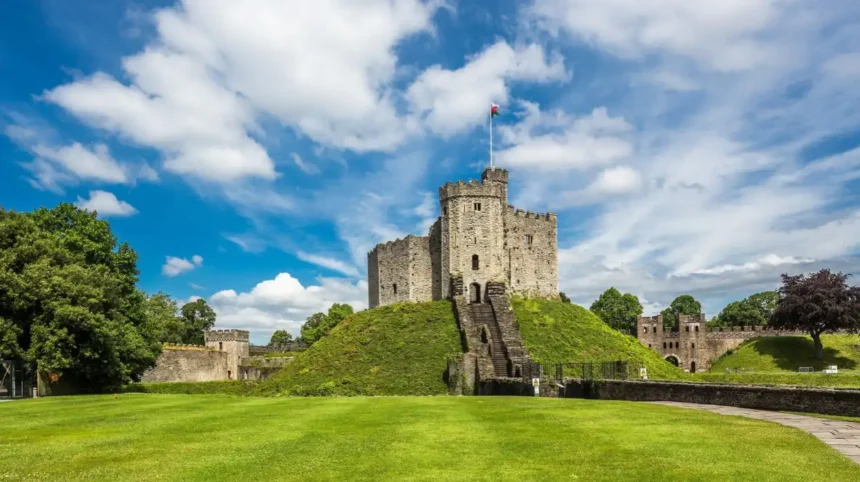
Roman Cardiff developed around a fort near the River Taff, close to the site of the present-day Cardiff Castle. The Roman fortifications formed part of the wider military and administrative landscape of Roman Britain.
The fort supported movement, defence and regional administration. The surrounding countryside contained agricultural settlements and routes connecting communities across what is now South Wales. Archaeological evidence from Cardiff and neighbouring areas helps researchers reconstruct this landscape, although individual settlements require site-specific evidence.
The Roman presence did not create the modern network of Cardiff villages. Instead, it established one important phase in the area’s long history of occupation and movement.
Medieval settlement patterns
Following the Roman period, settlement continued to evolve across the region. During the medieval era, Cardiff developed around its castle, market and religious institutions. Nearby communities maintained links with the town through agriculture, worship, trade and local roads.
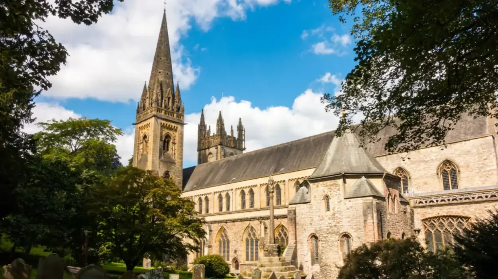
Llandaff became an important religious centre associated with Llandaff Cathedral. Its historic village character developed around the cathedral and the surrounding ecclesiastical community.
Other rural communities grew through farming and local landholding. Their buildings often included farmhouses, cottages, chapels, parish churches and agricultural outbuildings. These structures formed the physical core of settlements before nineteenth-century expansion transformed the region.
Medieval settlement history is not always visible in surviving buildings. Archaeological remains, historic maps, place names and documentary records often provide the strongest evidence of earlier occupation.
Which Cardiff Villages Were Absorbed Into the Expanding City?
Several historic communities now form part of Cardiff’s urban area rather than existing as independent rural settlements. Examples include Llandaff, Roath, Canton, Whitchurch and Llanishen, where older village centres, churches, street patterns and place names preserve evidence of settlement before modern suburban expansion.
Llandaff
Llandaff is one of Cardiff’s most significant historic settlements. Its identity developed around Llandaff Cathedral, the seat of the Bishop of Llandaff and an important centre of religious life in the region.
Although Llandaff now lies within Cardiff, its historic core retains a distinct character. The cathedral, surrounding streets and older buildings illustrate the settlement’s development before the city expanded around it.
Llandaff demonstrates why “lost village” can describe a place whose original rural setting disappeared without the community itself becoming extinct. Its historic identity survives even though modern urban development has transformed the surrounding land.
Roath
Roath developed from a historic community east of Cardiff’s central area. Its name remains associated with Roath Park, residential streets and districts that expanded during Cardiff’s industrial and commercial growth.
The older settlement landscape included agricultural land and historic buildings. As Cardiff expanded, housing, roads and public facilities connected Roath more closely to the urban centre.
Roath Park, opened in the nineteenth century, later became a major public landscape within the expanding city. Its presence reflects the transition from a predominantly rural district to an urban neighbourhood with planned recreational space.
Canton
Canton, known in Welsh as Treganna, developed west of central Cardiff. Its history reflects the interaction between rural settlement, roads and the expansion of Cardiff as a commercial and industrial centre.
Residential growth gradually connected Canton to neighbouring districts. The older village landscape became part of a continuous urban area, while the place name continued to define a recognisable community.
Canton is therefore better understood as an absorbed historic settlement than a completely vanished village.
Whitchurch
Whitchurch, known in Welsh as Tongwynlais? No. Whitchurch is commonly known in Welsh as Yr Eglwys Newydd. It developed as a settlement north of central Cardiff, with a historic village centre associated with its church and local roads.
Urban growth expanded the district through residential construction, commercial development and improved transport connections. Its former rural surroundings were gradually replaced by housing and other urban land uses.
Whitchurch retains a village-centre identity, but its modern built environment reflects Cardiff’s wider suburban expansion.
Llanishen
Llanishen developed as a historic community north of Cardiff. Its name, parish history and older buildings connect the modern district to earlier patterns of settlement and land use.
Suburban growth transformed the surrounding agricultural landscape during the nineteenth and twentieth centuries. Housing estates, transport routes and public amenities integrated Llanishen into the wider city.
Its history illustrates how a village can retain its name and local identity while losing much of the landscape that once separated it from neighbouring settlements.

Which Cardiff settlement genuinely disappeared rather than becoming a suburb?
Radyr Chain is a documented example of a deserted medieval settlement associated with the Radyr area of Cardiff. Archaeological excavations identified remains of a village probably founded in the late twelfth century and abandoned by the mid-fifteenth century, distinguishing it from surviving historic villages.
The archaeological evidence for Radyr Chain
The Welsh Historic Environment Record, accessed through Archwilio, records Radyr Chain as a medieval deserted rural settlement. Its entry identifies the site as a village probably founded in the late twelfth century and no longer occupied by the middle of the fifteenth century.
Excavations undertaken in 1975 uncovered remains associated with the settlement. Further archaeological publications documented investigations between 1975 and 1978. The site is important because it provides evidence of a settlement that disappeared as an inhabited village rather than simply becoming part of Cardiff’s urban area. Archwilio
The identification of Radyr Chain also demonstrates the importance of archaeological research. A deserted settlement does not always leave a recognisable village centre, standing houses or a surviving street name. Its existence is often established through buried remains, historical documents and specialist excavation.
The precise circumstances surrounding its abandonment require careful interpretation. The existence of the settlement and its approximate chronology are documented, but the available record does not establish a single definitive cause for its disappearance.
Why did medieval settlements disappear?
Medieval rural settlements disappeared for different reasons. Changes in landholding, agricultural organisation, population, access to resources and local economic conditions all influenced settlement survival across Britain.
However, these general explanations do not automatically establish why a particular Cardiff settlement vanished. Archaeologists examine individual sites to determine which explanations fit the evidence.
Radyr Chain therefore provides a useful case study in the difference between a confirmed archaeological settlement and a speculative lost-village story.
How did Cardiff’s industrial growth transform its historic settlements?
Cardiff’s industrial growth transformed surrounding settlements through coal exports, dock construction, railway development, employment and rapid housebuilding. Examples include Roath, Canton and Grangetown, where nineteenth-century expansion replaced agricultural land with streets, commercial premises and housing for a growing urban population.
Coal exports and the docks
During the nineteenth century, Cardiff developed into a major coal-exporting port. Industrial growth connected the city with coal-producing districts in South Wales and created demand for dock workers, transport workers, merchants, manufacturers and other occupations.
The development of Cardiff Docks changed the southern landscape. Industrial facilities, warehouses, railways and residential streets expanded across areas previously characterised by open land and smaller settlements.
Grangetown’s development was closely connected to the growth of Cardiff and its docks. The district became increasingly integrated into the urban economy, while older rural boundaries became less visible.
Railways and new roads
Railways improved connections between Cardiff, industrial communities and regional markets. Roads and public transport also made it easier for people to live further from their workplaces.
Whitchurch provides a clear example of transport influencing settlement growth. Cardiff Council’s historic appraisal records the importance of the 1767 turnpike road towards Merthyr Tydfil and the Glamorganshire Canal, completed in 1798. These routes contributed to development along the main road and helped create the village nucleus visible today.
Railway stations and improved road connections subsequently encouraged residential development in surrounding areas.
Housing and the loss of agricultural land
Industrial Cardiff needed more homes. Former fields, commons and estate land were increasingly developed for residential streets and public facilities.
A history published by Roath Local History Society records that approximately 20,000 houses were built across the relevant expanding areas between 1881 and 1902, excluding Llanedeyrn. This figure illustrates the scale of Cardiff’s housing transformation during the period.
The consequences extended beyond the disappearance of farmland. New streets divided older landholdings, village centres became connected to neighbouring districts, and historic communities increasingly shared the same urban infrastructure.
Some old buildings survived within the new streetscape. Others were demolished, leaving only place names, archaeological evidence or documentary references.
How can historic maps reveal Cardiff’s lost settlements?
Historic maps reveal lost Cardiff settlements by showing former village boundaries, farms, fields, roads, churches, commons and buildings before urban development changed the landscape. Examples include John Speed’s 1610 Cardiff map, nineteenth-century tithe maps and successive Ordnance Survey editions held by Welsh heritage and archival institutions.
John Speed’s map of Cardiff
John Speed’s historic map of Cardiff dates to 1610 and forms part of the cartographic record of the town and its surrounding historical context. The map is preserved through material associated with Glamorgan Archives and People’s Collection Wales.
Early maps help establish how places were named and represented before the major industrial expansion of Cardiff. They also provide a baseline for comparing later street networks and development patterns.
However, early maps have limitations. They do not show every farm, hamlet or building, and their scale and accuracy differ from modern mapping. Historians therefore compare them with archaeological and documentary evidence.
Tithe maps and nineteenth-century surveys
Tithe maps produced during the nineteenth century recorded land parcels and ownership-related information. Glamorgan Archives identifies tithe maps from around the 1840s as valuable sources for investigating land before the large-scale Ordnance Survey mapping of later decades.
Comparing tithe maps with later maps can reveal when agricultural fields became housing estates, when roads extended through open land and when individual farms disappeared.
Large-scale Ordnance Survey maps also record features such as buildings, boundaries, roads, watercourses and named farms. The Royal Commission on the Ancient and Historical Monuments of Wales explains that historic maps can help researchers trace settlement names, individual buildings and changes to rural landscapes. Royal Commission Wales
How to investigate a suspected lost village
A reliable investigation begins with a named location or a specific landscape feature. Researchers then compare available maps, archival descriptions, archaeological records and local histories.
The Welsh Historic Environment Record, accessible through Archwilio, provides information about archaeological sites and investigations across Wales. It includes records relevant to Cardiff and the wider Glamorgan area. Archwilio
A map showing a farm that no longer exists does not automatically prove that it was a village. Establishing the status of a settlement requires evidence about its buildings, population, chronology and historical function.
What evidence helps historians distinguish lost villages from renamed neighbourhoods?
Historians distinguish vanished villages from surviving or renamed neighbourhoods by comparing archaeological remains, historical maps, parish records, property documents and evidence of continuous occupation. Examples include Radyr Chain, which has archaeological evidence of abandonment, and Llandaff, which retains a historic centre within modern Cardiff.
Three types of evidence are particularly useful: archaeological, documentary and geographical.
Archaeological evidence includes building foundations, pottery, buried structures and other material remains. Such findings establish past occupation and help researchers estimate when a settlement developed or disappeared.
Documentary evidence includes deeds, estate records, parish registers, historical descriptions and old maps. These records can identify place names, landowners, tenants, buildings and changes in settlement status.
Geographical evidence includes roads, rivers, field boundaries and the relationship between old buildings and later development. A surviving church beside a modern road, for example, can indicate the location of an older settlement centre.
The strongest conclusions emerge when these forms of evidence support one another.
A place name alone is insufficient proof that a village once stood at a particular location. Similarly, the absence of visible buildings does not establish that a settlement never existed.
Researchers also distinguish between abandonment and administrative incorporation. A deserted medieval village such as Radyr Chain represents a different historical process from Llandaff, whose settlement identity survived urban expansion.
This distinction is essential for accurate local history. It prevents surviving Cardiff neighbourhoods from being incorrectly described as completely lost villages.
Where can visitors explore the surviving traces of Cardiff’s older settlements?
Visitors can explore Cardiff’s settlement history through historic village centres, churches, conservation areas, parks and archaeological records. Examples include Llandaff Cathedral, Whitchurch’s historic Church Road area, Roath’s older streets and the archival collections documenting former farms, roads and settlement boundaries.
Llandaff Cathedral and the historic village
Llandaff offers evidence of a settlement shaped by religious institutions, medieval streets and later residential development. The cathedral and surrounding historic centre help visitors understand why Llandaff developed as a distinct community before becoming part of modern Cardiff.
Whitchurch and Church Road
The Church Road area preserves evidence of Whitchurch’s historic settlement pattern. Cardiff Council’s appraisal describes the medieval core near the present Church Road area and explains how roads, the canal and later railway development influenced the village.
Roath and its historic street pattern
Roath demonstrates the transformation of a former village district into an urban neighbourhood. Older buildings and street patterns sit within a wider landscape shaped by Victorian housing, public parks and the expansion of Cardiff’s residential areas.
Glamorgan Archives and historic maps
Archival collections provide a way to investigate places that no longer retain visible village buildings. Early maps, estate records and historic surveys help researchers compare Cardiff’s former landscape with its modern streets and suburbs.
Visitors should distinguish between places with surviving historic buildings and archaeological sites that require specialist interpretation. Not every lost settlement has a publicly accessible excavation or a clearly marked location.
For historical walks, old village centres offer the most accessible starting points. For detailed research, archival maps and archaeological records provide more reliable evidence than assumptions based on modern street names.
How did Cardiff’s changing boundaries affect the identity of former villages?
Cardiff’s changing boundaries brought independent communities into a larger local authority while preserving many older place names and neighbourhood identities. Examples include Roath and Canton in the nineteenth-century expansion, Rumney in 1938, and Pentyrch following the 1996 local-government reorganisation. Cardiff History+1
The growth of Cardiff occurred through several stages rather than one single annexation. Each boundary change altered the relationship between the city and surrounding communities.
The 1875 expansion was particularly important because it incorporated established districts during a period of rapid industrial growth. Later changes extended Cardiff’s administrative area into additional suburban and rural settlements.
These changes affected how local services were organised, how roads and public facilities developed, and how communities related to the urban centre.
Administrative incorporation did not erase every local identity. Historic place names continued through churches, schools, streets, community organisations and local businesses.
The result is a city with multiple layers of belonging. Residents identify with Cardiff as a whole while maintaining connections to individual neighbourhoods whose histories predate their incorporation.
This distinction also explains why modern Cardiff contains areas with markedly different built environments. Historic village centres, Victorian terraces, interwar suburbs and more recent developments reflect different periods of expansion.
The history of Cardiff’s boundaries is therefore essential to understanding the survival of local identity alongside urban growth.
Explore More Area Guide
Historic Streets in Cardiff: Medieval Routes and Victorian Heritage
The Oldest Buildings in Cardiff: Historic Landmarks and Their Stories
What can Cardiff’s lost settlements tell us about future urban development?
Cardiff’s lost settlements show how urban growth transforms land use, historic boundaries and community identity. Examples include the replacement of farmland with housing, the integration of historic villages into continuous suburbs and the preservation of older centres within modern development, making heritage records important for future planning.
The historical record provides a practical context for managing Cardiff’s future growth. Former settlements demonstrate that urban development changes more than the number of buildings. It also affects landscapes, transport patterns, local identity and the visibility of archaeological remains.
Historic maps help planners and researchers identify older field boundaries, roads, farms and buildings that deserve further investigation. Archaeological records help establish whether proposed development sites contain evidence of past settlement.
Wales maintains a system of historic environment records to support research and understanding of archaeological and historic sites. Archwilio provides public access to information from the Historic Environment Record for Wales, including material relevant to Cardiff. Archwilio
This information supports more informed decisions about conservation, redevelopment and the interpretation of historic places. It also gives residents and visitors a clearer understanding of how modern neighbourhoods developed.
The study of lost settlements remains relevant because urban areas continue to change. Historic buildings are adapted, new housing is constructed, and infrastructure projects alter land use. Recording the historic landscape helps ensure that important evidence is not overlooked.
Cardiff’s settlement history is therefore not limited to the medieval past or Victorian expansion. It provides a continuing framework for understanding the relationship between development, place and heritage.
Why do Cardiff’s lost villages and settlements matter to local history?
Cardiff’s lost villages and settlements matter because they explain the city’s development from rural communities into a modern urban area. Examples include the deserted medieval settlement of Radyr Chain, Llandaff’s surviving historic centre and Whitchurch’s documented growth around roads, canals and railways.
Cardiff’s history is a layered record of settlement, economic change and urban expansion. Its historic villages reveal how people lived before the city became a major industrial centre, while its deserted settlements provide evidence of communities that disappeared centuries ago.
Radyr Chain demonstrates that genuine medieval village abandonment occurred within the area now administered by Cardiff. Llandaff shows how a settlement can retain its historic identity despite becoming surrounded by modern development. Whitchurch illustrates how roads, canals and railways transformed a rural community into a larger urban district.
Historic maps, archaeological investigations and archival documents make it possible to reconstruct these changes with greater accuracy. They also help distinguish documented history from unsupported claims about vanished villages.
For residents, researchers and visitors, Cardiff’s lost settlements offer a way to understand the origins of the modern city. The names of neighbourhoods, surviving village centres and traces of former agricultural landscapes all connect contemporary Cardiff with its past.
The most reliable account combines physical evidence with documentary research. This approach reveals not only which settlements disappeared, but also how surviving communities changed and why their histories remain important to Cardiff’s identity.
What are Cardiff’s lost villages and settlements?
Cardiff’s lost villages and settlements are former rural communities that disappeared, were abandoned or became absorbed into the expanding city. They include deserted medieval settlements and historic villages that retain their names but have lost much of their original rural character.