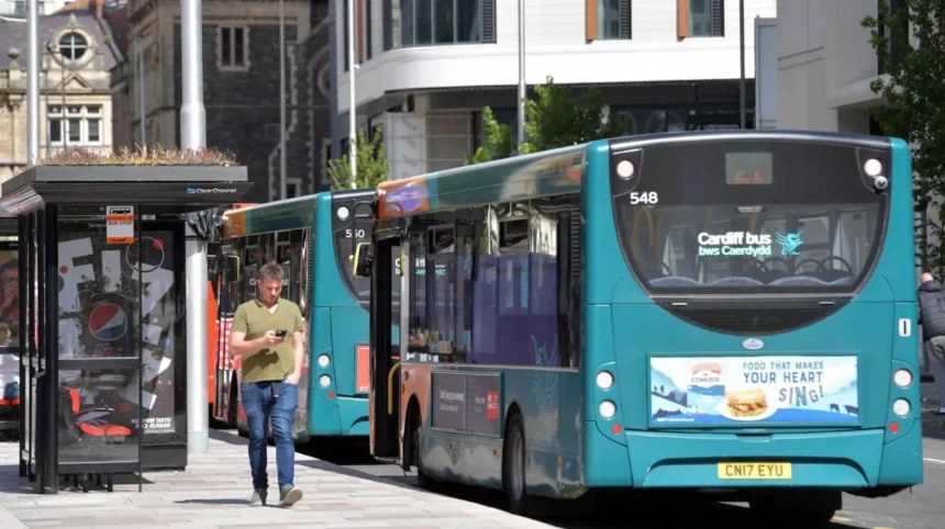
Cardiff has a dense bus network connecting the city centre with residential districts, hospitals, universities, shopping areas, employment zones, Cardiff Bay, Penarth, Barry and surrounding communities. Cardiff Bus provides the largest local network, with routes organised around major transport corridors rather than a simple radial pattern.
- What are Cardiff bus routes and how is the network organised?
- Which Cardiff bus routes serve the city centre and Cardiff Bay?
- Which Cardiff bus routes serve Canton, Ely, Fairwater and western Cardiff?
- Which Cardiff bus routes serve Cathays, Heath, Llandaff, Whitchurch and northern Cardiff?
- Which Cardiff bus routes serve Roath, Splott, Adamsdown, Tremorfa and eastern Cardiff?
- Which Cardiff bus routes serve Grangetown, Leckwith, Penarth, Dinas Powys and Barry?
- How do Cardiff bus routes connect hospitals, universities, shopping areas and major destinations?
- How should passengers choose the correct Cardiff bus route by area?
- How have Cardiff bus routes developed and what is their future significance?
This area-based approach makes route numbers easier to understand. Services such as routes 1 and 2 form a city circle, while routes 21, 23, 24, 25 and 27 serve northern Cardiff. Routes 44, 45, 49 and 50 connect eastern districts. Routes 92 to 96 provide important links between Cardiff, Penarth and Barry.
Cardiff’s transport network also reflects the city’s population and geography. The 2021 Census recorded 362,400 usual residents in Cardiff, making it the largest local authority by population in Wales. Cardiff’s population increased by 4.7% between 2011 and 2021.
What are Cardiff bus routes and how is the network organised?
Cardiff bus routes are scheduled public transport services linking neighbourhoods with central Cardiff and surrounding destinations. Routes use numbered services, established corridors, interchange points and circular links to connect residential, commercial, educational, healthcare and leisure areas.
Cardiff Bus currently publishes route information through its official routes-and-maps service. The network includes urban routes, cross-city services, regional services and specialist services. Examples include the City Circle routes 1 and 2, Baycar route 6, northern routes such as 21 and 23, eastern routes such as 44 and 45, and Vale services including 92, 93, 94, 95 and 96.
The Cardiff network is best understood geographically. Cardiff city centre functions as the principal interchange area. From there, buses travel west towards Canton, Ely, Fairwater and Pentrebane; north towards Cathays, Heath, Llandaff, Whitchurch and Llanishen; east towards Splott, Tremorfa, Rumney, Llanrumney, Pentwyn and St Mellons; and south towards Cardiff Bay, Grangetown, Penarth and the Vale of Glamorgan.
Not every service starts and ends in the city centre. Routes 1 and 2 operate as circular City Circle services. Route 54 connects St Mellons with Heath Hospital through Pontprennau, Pentwyn, Llanedeyrn and Cyncoed. Routes 101 and 102 provide a longer cross-city connection through western Cardiff, Heath, eastern Cardiff and St Mellons.
Cardiff Bus also publishes network data in TransXChange and GTFS formats. GTFS, or General Transit Feed Specification, is a standard digital format used for public transport schedules and journey-planning systems. Cardiff Bus states that its current network data covers stops, lines, journeys and schedules.
This digital structure matters because bus routes are not static maps. Roadworks, events, timetable changes and service diversions can alter individual journeys. The official Cardiff Bus service page therefore remains the authoritative source for current route information.
Which Cardiff bus routes serve the city centre and Cardiff Bay?
Cardiff city centre is the main interchange for local bus travel, while Cardiff Bay is connected by City Circle services, Baycar and routes through Grangetown. Examples include routes 1, 2, 6, 7, 8 and 9 for central and southern destinations.
Cardiff city centre provides the most extensive concentration of bus services. Routes from almost every major residential direction enter or pass close to the central area. Cardiff Bus Interchange is a major boarding point, while other central stops serve individual corridors.
Route 6, known as Baycar, provides a direct connection between Cardiff city centre and Cardiff Bay. It serves major destinations including the Wales Millennium Centre and the Senedd. Cardiff Bay is the waterfront district containing major cultural, governmental and leisure destinations.
Route 8 also connects the city centre with Cardiff Bay through Grangetown. Route 9 links Heath Hospital and the city centre with the International Sports Village area, travelling through Crwys Road, City Road and Grangetown.
Routes 1 and 2 form the City Circle. Route 1 operates clockwise, while route 2 operates anti-clockwise. Their corridors include Cardiff Bay, Grangetown, Canton, Cardiff Metropolitan University’s Llandaff campus, Heath Hospital, Albany Road, Tremorfa and Splott.
This circular arrangement is important for passengers travelling between suburbs without changing buses in the city centre. A journey from western Cardiff to eastern Cardiff can use the appropriate direction of the City Circle rather than requiring a central interchange.
The city centre also acts as the starting point for longer routes. Examples include route 13 towards Drope via Canton and Ely, routes 17 and 18 towards Canton, Ely and Caerau, routes 21 and 23 towards Rhiwbina and Whitchurch, and routes 49 and 50 towards Llanrumney.
Passengers should distinguish between route coverage and exact stopping points. A service listed as operating to a particular district does not mean every street in that district has the same stop. The official route map and timetable provide the stop-level information required for a specific journey.
Which Cardiff bus routes serve Canton, Ely, Fairwater and western Cardiff?
Western Cardiff is served by routes connecting the city centre with Canton, Ely, Fairwater, Caerau, Pentrebane, Llandaff and nearby communities. Examples include routes 13, 14, 17, 18, 32, 61, 62, 63, 64, 101 and 136.
Canton is one of the most important western transport corridors in Cardiff. Several services travel through Cowbridge Road and connect Canton with Ely, Caerau and the city centre.
Route 13 connects the city centre with Drope through Canton and Ely. Route 17 and route 18 connect the city centre with Canton, Ely and Caerau through Cowbridge Road East and Cowbridge Road West. Route 14 provides a connection between Caerau and Ely and Heath Hospital through Western Avenue.
Route 32 connects the city centre with St Fagans through Canton and Fairwater. St Fagans is home to St Fagans National Museum of History, while Fairwater is a large residential district in western Cardiff.
Route 61 serves Pentrebane from the city centre through Canton, Waungron and Fairwater. Pentrebane is a residential area west of the city centre, and the route provides a direct connection to central Cardiff.
Routes 62, 63 and 64 extend further west. Route 62 serves Rhydlafar, while routes 63 and 64 provide connections towards Pentyrch and Morganstown. These services travel through Penhill, Llandaff and Danescourt. Route 136 also connects the city centre with Pentyrch and Creigiau through Whitchurch.
Western Cardiff also benefits from cross-city services. Routes 101 and 102 travel between the city centre, western Cardiff, University Hospital of Wales at Heath, Llanrumney and St Mellons. Route 101 continues through the eastern side to St Mellons, while route 102 operates the reverse pattern.
The western network therefore combines radial and cross-city travel. Radial routes provide direct access to central Cardiff. Cross-city routes reduce the need for passengers to travel into the centre before reaching another outer district.
Which Cardiff bus routes serve Cathays, Heath, Llandaff, Whitchurch and northern Cardiff?
Northern Cardiff has a broad network linking Cathays, Heath, Llandaff, Gabalfa, Whitchurch, Rhiwbina, Llanishen and Thornhill with the city centre. Examples include routes 21, 23, 24, 25, 27, 28, 29, 35, 86, 101 and 136.
Northern Cardiff contains major educational, healthcare and residential destinations. The University Hospital of Wales at Heath is one of the most significant transport destinations in this part of the city.
Routes 21 and 23 connect the city centre with Rhiwbina, Whitchurch and Pantmawr through North Road and Birchgrove. These services provide an important northern corridor from central Cardiff into residential communities.
Route 24 connects the city centre with Whitchurch, Llandaff North and Llandaff through North Road. Routes 25 and 25A also connect central Cardiff with Llandaff, Llandaff North and Whitchurch, using Cathedral Road and Penhill.
Route 27 extends towards Llanishen and Thornhill. Its published route includes North Road, Birchgrove, Caerphilly Road, Templeton Avenue and Excalibur Drive. This corridor serves several northern residential districts and provides direct access to the city centre.
Routes 28 and 29 serve Roath Park and Llanishen, with route 28 continuing to Thornhill. Their corridor includes Albany Road and Lakeside. Albany Road is a major east-west urban corridor connecting central and eastern Cardiff with northern residential areas.
Route 35 links the city centre with Gabalfa. The route passes through North Road and Gabalfa Interchange before continuing towards Whitchurch Common. Gabalfa Interchange is an important northern transport point because several services operate along or near the North Road corridor.
Route 86 connects the city centre with Lisvane through Heath Hospital and Llanishen. This provides a useful link between the northern suburbs and one of Cardiff’s main healthcare destinations.
The northern network also demonstrates how Cardiff’s bus system serves different travel purposes simultaneously. Students, hospital visitors, workers and residents use overlapping routes. Services therefore connect residential streets with employment, education, healthcare and retail destinations.
Which Cardiff bus routes serve Roath, Splott, Adamsdown, Tremorfa and eastern Cardiff?
Eastern Cardiff is served by routes connecting central Cardiff with Roath, Adamsdown, Splott, Tremorfa, Rumney, Llanrumney, Pentwyn, Pontprennau and St Mellons. Examples include routes 1, 2, 11, 28, 29, 44, 45, 49, 50, 52, 54, 57 and 58.
Eastern Cardiff has several major corridors, including Newport Road, Albany Road and routes through Llanedeyrn and Pentwyn. These corridors support direct connections between central Cardiff and growing residential areas.
Routes 1 and 2 include Albany Road, Tremorfa and Splott as part of the City Circle. Their circular structure provides connections between eastern, central, northern and western parts of the city.
Route 11 connects the city centre with Pengam Green through Splott and Tremorfa. Pengam Green is an employment and industrial area in eastern Cardiff. The route therefore serves both residential and employment travel.
Routes 44 and 45 connect the city centre with St Mellons. Both use Newport Road before separating into different eastern corridors. Route 44 travels through New Road and Trowbridge, while route 45 serves Rumney and Llaneirwg Way.
Routes 49 and 50 connect the city centre with Llanrumney. Both travel through Broadway and Newport Road before using different streets in Llanrumney. Route 49 uses Llanrumney Avenue, while route 50 uses Ball Road.
Route 52 connects the city centre with Cyncoed through Albany Road and Ty Gwyn Road. The service also provides access to Cardiff Metropolitan University’s Cyncoed campus. Route 54 links St Mellons with Heath Hospital through Pontprennau, Pentwyn, Llanedeyrn and Cyncoed.
Routes 57 and 58 connect the city centre with Pontprennau. Both travel through Albany Road and Llanedeyrn, with route 57 continuing through Hollybush and route 58 serving Pentwyn Leisure Centre.
This eastern network is particularly significant because Cardiff’s population has grown. The Office for National Statistics recorded a 4.7% increase in Cardiff’s population between 2011 and 2021, reaching approximately 362,400 residents.
Which Cardiff bus routes serve Grangetown, Leckwith, Penarth, Dinas Powys and Barry?
Southern Cardiff and the Vale of Glamorgan are connected by routes serving Grangetown, Leckwith, Cardiff Bay, Penarth, Dinas Powys, Sully and Barry. Examples include routes 7, 8, 9, 91, 92, 93, 94, 95, 96 and 305.
Southern routes extend Cardiff’s bus network beyond the city boundary into the Vale of Glamorgan. Penarth, Dinas Powys and Barry are important destinations for commuters, residents and leisure travellers.
Route 7 connects Heath Hospital, the city centre and Penarth through Channel View and Llandough Hospital. This route is particularly relevant for journeys involving healthcare and residential communities along the southern corridor.
Route 91 is a seasonal service between Cardiff city centre and Penarth Esplanade. Cardiff Bus currently lists stops including Cardiff Bus Interchange, Cogan Leisure Centre, Windsor Arcade and Penarth Pier.
Routes 92 and 92B serve Penarth. Route 92 and route 92B operate towards Penarth via Cogan. Routes 93 and 94 continue farther towards Barry, using different corridors through the Vale of Glamorgan. Route 93 travels through Penarth and Dinas Powys, while route 94 travels through Penarth and Sully.
Route 95 provides a direct Cardiff-to-Barry connection through Leckwith, Llandough, Dinas Powys and Gibbonsdown. The route serves both Barry town destinations and Barry Island.
Route 96 also connects Cardiff with Barry, but follows a different western Vale corridor through Culverhouse Cross, Wenvoe, Winston Square, Barry Hospital, Barry College and Morrisons.
Route 305 connects Cardiff with Dinas Powys through Cardiff Bay, Penarth Marina, Redlands Heights and Llandough Hospital. It provides another cross-boundary connection between Cardiff’s southern districts and the Vale of Glamorgan.
These routes demonstrate that Cardiff bus travel is not restricted to the administrative boundary of Cardiff. The wider network connects neighbouring settlements that have strong economic, educational, healthcare and leisure links with the capital.
How do Cardiff bus routes connect hospitals, universities, shopping areas and major destinations?
Cardiff bus routes connect residential communities with major hospitals, universities, shopping districts, employment areas and visitor destinations. Examples include Heath Hospital, Cardiff Metropolitan University, Cardiff Bay, St Fagans, Whitchurch, Barry Island, Penarth Pier and the city centre.
Healthcare is a major component of Cardiff’s bus network. University Hospital of Wales at Heath is served by multiple routes, including routes 1, 2, 7, 9, 14, 54, 86, 101 and 102 through different corridors. This creates connections from western, northern, eastern and southern Cardiff.
Educational destinations also shape route patterns. Cardiff Metropolitan University’s Llandaff and Cyncoed campuses are connected by services including routes 1 and 2 around Llandaff and route 52 towards Cyncoed. The M1 MET RIDER service also links Cardiff Met Llandaff with Cardiff Met Cyncoed and is listed as returning in September 2026.
Shopping destinations are concentrated around central Cardiff and major suburban corridors. Newport Road, Albany Road, Cowbridge Road, Cathedral Road and routes through Whitchurch carry services that connect residential areas with commercial centres.
Leisure destinations are also integrated into the network. Cardiff Bay is served by routes 6 and 8, while St Fagans is served by route 32. Penarth Pier is served by route 91 during its listed summer operation, and Barry Island is included on route 95.
Sports travel is another important function. Cardiff Bus has published special arrangements for Cardiff City Football Club fixtures, demonstrating how major events can generate temporary route changes and additional buses. Scheduled services can therefore operate differently during large public events or road closures.
The key principle is destination-based planning. Passengers should identify the destination first, then select the route serving that corridor. This approach is more reliable than choosing a route solely because its number is familiar.
Explore More Area Guide
Every Cardiff Park & Ride Explained: Cardiff 2026
Best Children’s Playgrounds and Play Areas in Cardiff 2026
How should passengers choose the correct Cardiff bus route by area?
Passengers should identify their starting area, destination, nearest bus stop and required arrival time before selecting a route. The official Cardiff Bus network map, timetable, journey planner and live service updates provide the most reliable current information.
The first step is identifying the travel corridor. A passenger travelling from Canton to central Cardiff has different options from someone travelling from Canton to Heath Hospital. A passenger travelling from Llanrumney to Whitchurch also requires a different route strategy.
The second step is checking the exact stop. District names describe broad areas, while bus stops identify the locations where passengers board and leave services. The same route can serve several stops within one district.
The third step is checking the direction. This is particularly important for circular services such as routes 1 and 2. Route 1 operates clockwise and route 2 operates anti-clockwise, so the correct direction depends on the desired destination.
The fourth step is checking live service information. Cardiff Bus currently publishes disruption notices alongside route information. For example, the operator lists roadwork-related diversions affecting services 1 and 2 and temporary stop changes affecting services 11, 44, 45, 49 and 50.
Road closures can also affect Vale services. Cardiff Bus has listed temporary changes affecting routes 92, 93 and 94 around Rectory Road and Windsor Terrace. These examples show why a route number alone is not sufficient for time-sensitive travel.
Passengers should also allow additional time for connections. Cardiff Bus advises passengers to arrive at stops before the scheduled time and states that intermediate-stop times are estimates. The operator recommends allowing sufficient time because traffic and other conditions can affect journey performance.
For regular travel, Cardiff Bus provides current timetable information and downloadable network resources. Its open-data service also publishes GTFS and TransXChange network data, allowing digital journey-planning systems to work from structured route, stop and schedule information.
How have Cardiff bus routes developed and what is their future significance?
Cardiff’s bus network developed from horse buses and electric trams into motor buses, trolleybuses and today’s scheduled services. Its continuing importance reflects population growth, expanding suburbs, cross-city travel, digital journey planning and connections with neighbouring communities.
Cardiff’s public transport history extends to at least 1845, when horse bus services operated in the city. The Cardiff Tramway Company was established in 1870 and operated horse trams and buses before Cardiff Corporation took control of the system.
In 1902, the Corporation of Cardiff began operating electric trams between Newport Road and the city centre after taking over the private tramway company. This became the foundation of municipal urban transport in Cardiff.
Cardiff Corporation introduced its first motor buses in December 1920. The first six municipal motor buses operated on a route between St John Square and Monthermer Road in Cathays. They initially supported lightly used routes and provided feeder connections to the tram network.
Trolleybuses entered service in 1942. Cardiff’s network used both single-deck and double-deck trolleybuses because low bridges in the docks area restricted vehicle height. Electric trams ended in 1950, while trolleybuses continued until 1970.
Route 30 provides a particularly strong example of continuity. A bus service between Cardiff and Newport began in 1913. Cardiff Corporation acquired the service in 1924, and it received the route number 30 in 1929. Cardiff Bus describes the modern route as having operated largely unchanged for 80 years.
Modern Cardiff therefore combines historical corridors with newer transport demands. Residential expansion, employment areas, hospitals, universities and regional travel continue to influence route planning.
Digital transport information is now another important part of the network. Cardiff Bus publishes current GTFS and TransXChange datasets covering stops, lines, journeys and schedules. These formats support journey planners and other digital transport applications.
The future significance of Cardiff bus routes is closely connected to the city’s population. Cardiff had approximately 362,400 residents in the 2021 Census and remained the largest local authority in Wales by population.
A clear understanding of Cardiff bus routes by area therefore remains useful for residents, commuters, students and visitors. The network connects the city centre with every major geographic direction and extends beyond Cardiff into Penarth, Barry and other Vale communities.
For the most accurate journey, passengers should use the official Cardiff Bus route information immediately before travelling because scheduled routes, stops and diversions change in response to roadworks, events and operational requirements. The published network map provides the broad geographic structure, while the live timetable and service updates provide the journey-specific information.
What are the main bus routes in Cardiff?
Cardiff has a large network connecting the city centre with residential and commercial areas. Key services include routes 1 and 2 for the City Circle, 6 for Cardiff Bay, 21 and 23 for northern Cardiff, 44 and 45 for eastern Cardiff, and 92–96 for Penarth and Barry.