Cardiff is a compact Welsh capital where the city centre, inner neighbourhoods, parks, riverside routes and cultural districts connect through relatively short walking journeys. Walkability differs between neighbourhoods according to distance, street layout, green space, local services, pedestrian infrastructure and access to major destinations.
- What makes a Cardiff neighbourhood walkable?
- Which Cardiff neighbourhoods are closest to the city centre on foot?
- How does Pontcanna compare for walkability?
- How does Canton compare for walking?
- How does Riverside and Grangetown compare for walking?
- How does Cathays compare with other walkable Cardiff areas?
- How does Roath compare for walking?
- How does Llandaff compare with inner Cardiff neighbourhoods?
- How does Whitchurch compare as a walkable Cardiff neighbourhood?
- How do Cardiff’s walkable neighbourhoods differ in green-space access?
- How does Cardiff’s pedestrian infrastructure affect neighbourhood walkability?
- How do walkable Cardiff neighbourhoods connect with public transport?
- Which Cardiff neighbourhoods suit different types of walking journeys?
- How is Cardiff improving neighbourhood walkability?
- What should visitors and residents consider when comparing walkable Cardiff neighbourhoods?
- What is the overall comparison of Cardiff’s walkable neighbourhoods?
The Office for National Statistics (ONS) identifies Cardiff as the most densely populated local authority in Wales in Census 2021, while Visit Cardiff describes the capital as compact, largely level and easy to explore on foot. Many central attractions sit within roughly 15 minutes of one another.
Walkability therefore means more than simply being close to Cardiff city centre. A genuinely walkable neighbourhood combines useful everyday destinations with connected streets, pedestrian routes, parks, cafés, shops, public transport and accessible paths. Cardiff Council’s Active Travel Network Map also identifies routes for walking, wheeling and cycling and forms part of the city’s long-term transport planning.
What makes a Cardiff neighbourhood walkable?
A walkable Cardiff neighbourhood places homes, shops, food, parks, services, transport and community facilities within practical walking distances. Connected streets, level terrain, pedestrian crossings, footways, green routes and local destinations determine how useful walking is for everyday journeys.
Walkability has several measurable components. Distance is important, but it does not operate alone. A neighbourhood with a local high street, school, park and railway station within walking distance supports more daily journeys on foot than an area where destinations are separated by major roads.
Street connectivity is another important factor. Direct routes reduce walking distances between destinations. Continuous footways and safe crossings also improve pedestrian movement. Cardiff Council incorporates walking and wheeling into its Active Travel Network Map, with routes assessed against Welsh Government Active Travel Design Guidance.
Terrain also affects walking. Cardiff has a relatively level central area, which supports pedestrian movement between the city centre and nearby neighbourhoods. Visit Cardiff specifically describes Cardiff as compact, largely pedestrianised and level.
Green space adds another dimension. Parks and riverside paths provide recreational walking routes and alternative connections between neighbourhoods. Bute Park, Roath Park, Llandaff Fields and the River Taff corridor form important parts of Cardiff’s wider walking environment.
Which Cardiff neighbourhoods are closest to the city centre on foot?
Pontcanna, Canton, Cathays, Riverside, Grangetown and Roath all provide established walking connections with central Cardiff. Their published walking times range from about 10 to 30 minutes, while local destinations create additional short journeys within each neighbourhood.
Pontcanna sits immediately northwest of the city centre. Visit Cardiff describes it as around a 10–15 minute walk from central Cardiff, although its own access information gives approximately 20 minutes for a city-centre walking journey depending on the starting point.
Canton lies west of the centre. Visit Cardiff gives a 15–25 minute walking range and identifies the lower part of Canton as approximately 15 minutes from Cardiff Castle.
Riverside and Grangetown are south and southwest of the centre. Visit Cardiff gives a 10–20 minute walking range for the combined area. Riverside itself is approximately 20 minutes from central Cardiff, while Grangetown is also around 20 minutes from the city centre.
Cathays sits north of the central area and provides direct access to Cardiff University’s main campus area, Cathays Park and cultural venues. Visit Cardiff places the neighbourhood within a short walking distance of the city centre and identifies a 10–20 minute range in its neighbourhood overview.
Roath extends farther east. Visit Cardiff gives approximately 20–30 minutes between Roath and central Cardiff. The distance increases toward Roath Park and eastern sections of the neighbourhood.
These distances show why “walkable” does not mean identical. Pontcanna and Canton provide shorter central connections, while Roath provides a longer city-centre walk but a strong internal network of shops, cafés and park routes.
How does Pontcanna compare for walkability?
Pontcanna combines a short central walking distance with independent businesses, restaurants, parks and riverside connections. Cathedral Road, Pontcanna Street, Pontcanna Fields, Llandaff Fields and nearby Bute Park create multiple pedestrian destinations within and around the neighbourhood.
Pontcanna is one of Cardiff’s established inner-city walking districts. Visit Cardiff places it around 10–15 minutes from the city centre in its overview and approximately 20 minutes in its detailed access information.
The neighbourhood’s commercial activity is concentrated around streets including Cathedral Road and Pontcanna Street. This gives residents and visitors destinations that do not require a journey into the central shopping district.
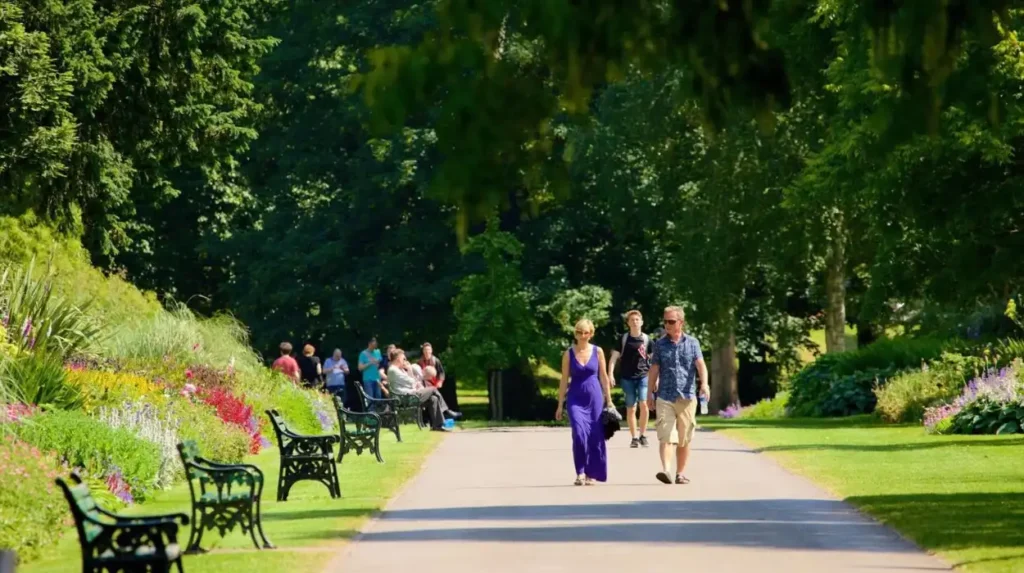
Green space is a major component of Pontcanna’s walking environment. Pontcanna Fields provides extensive open space, while Llandaff Fields stretches between Pontcanna and Llandaff with wide lawns and tree-lined paths suitable for walking and cycling.
Bute Park also sits close to the neighbourhood. The park extends north from Cardiff Castle and forms one of the city’s principal green corridors. Visit Cardiff states that Bute Park covers more than 130 acres.
Pontcanna therefore supports both practical walking and recreational walking. Its central location reduces the distance to major city destinations, while its parks provide routes away from busy commercial streets.
How does Canton compare for walking?
Canton combines a short walk to central Cardiff with a local high-street environment, independent businesses, cultural venues and Victoria Park. Cowbridge Road West and surrounding streets provide everyday destinations, while nearby parks add recreational walking opportunities.
Canton is positioned west of Cardiff city centre. Visit Cardiff gives the neighbourhood a 15–25 minute walking distance from the centre and describes its lower section as approximately 15 minutes from Cardiff Castle.
Cowbridge Road is a major local commercial corridor. Shops, cafés, restaurants and services reduce the need for every journey to continue into the city centre.
Chapter Arts Centre provides an important cultural destination. The venue presents visual art, performance, film and other cultural programmes, creating a significant local destination within walking distance of residential areas.
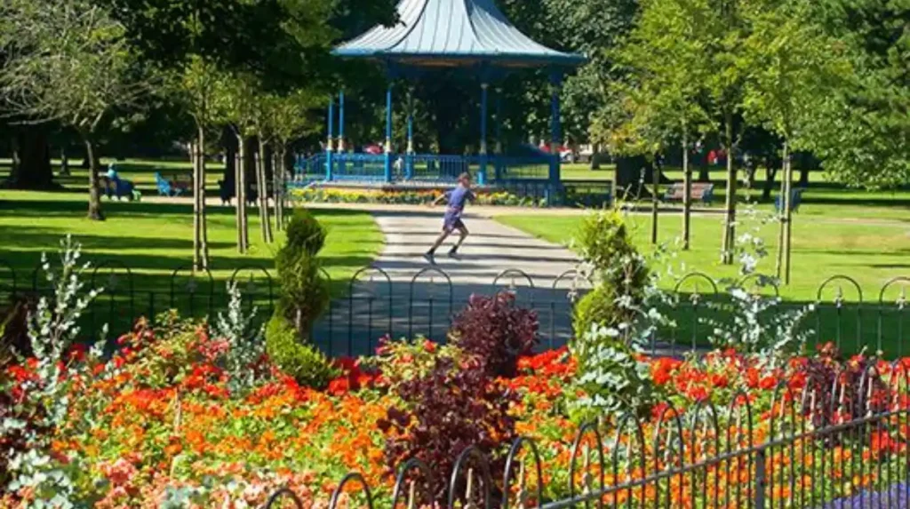
Victoria Park provides another major pedestrian destination. The Grade II listed park contains landscaped areas, recreational facilities and paths.
Canton also has a direct relationship with central Cardiff. Cardiff City Stadium lies farther west, while the lower part of Canton connects more closely with the city centre. This produces variation within the neighbourhood itself.
The result is a neighbourhood where walking works at two scales: short local trips around Cowbridge Road and Victoria Park, plus longer journeys toward Cardiff Castle and central Cardiff.
How does Riverside and Grangetown compare for walking?
Riverside and Grangetown combine short central walking distances with riverside routes, markets, local food businesses, cultural venues and railway connections. Riverside is especially close to the River Taff and Bute Park, while Grangetown connects central Cardiff with southern neighbourhoods.
Riverside sits alongside the River Taff, west of Cardiff’s central commercial area. Visit Cardiff describes the area as approximately 20 minutes on foot from the city centre and identifies the Taff embankment as a key local walking route.
The River Taff creates a continuous landscape corridor. Riverside also provides access toward Bute Park and central Cardiff. This gives pedestrians alternatives to conventional road-based routes.
Grangetown sits south of the centre and has a strong connection to Cardiff Central railway station. Visit Cardiff places Cardiff Central approximately 10 minutes from Grangetown on foot and identifies Grangetown railway station within the neighbourhood.
Local destinations include food businesses, Tramshed and DEPOT. These venues add reasons to walk within the neighbourhood rather than treating it only as a residential area.
The combination of railway access, central proximity and local amenities makes Grangetown particularly relevant for people who combine walking with rail travel. Riverside provides stronger riverside and park connections, giving the two adjacent areas different walking characteristics.
How does Cathays compare with other walkable Cardiff areas?
Cathays provides short connections to central Cardiff, Cardiff University, Cathays Park, theatres, cafés and restaurants. Its dense urban layout supports frequent local journeys, while Cathays railway station provides a further transport connection for longer trips.
Cathays is north of the city centre and forms part of Cardiff’s central university and civic area. Visit Cardiff identifies student life, independent food businesses and cultural venues as defining features.
Cardiff University has a substantial presence in and around Cathays Park. This concentration of educational buildings creates regular pedestrian movement between accommodation, teaching facilities, shops and central Cardiff.
The neighbourhood also contains cultural destinations including the Royal Welsh College of Music and Drama and Sherman Theatre. These venues create additional walking trips outside normal daytime activity.
Crwys Road and Cathays Terrace provide commercial destinations. Cafés, restaurants, convenience businesses and other services support short local journeys.
Cathays railway station provides another transport option. Visit Cardiff identifies the station as serving the neighbourhood, while Cardiff’s wider transport network includes walking, cycling, buses and rail services.
Cathays therefore has a strongly urban form. Walking is closely connected to education, culture, food, public transport and central-city employment.
How does Roath compare for walking?
Roath combines a longer walk to central Cardiff with strong internal walkability around Wellfield Road, Albany Road, Roath Park and surrounding residential streets. Its green spaces and independent businesses create substantial local walking opportunities beyond the city-centre journey.
Roath is east of central Cardiff. Visit Cardiff places it approximately 20–30 minutes from the city centre. The area becomes more recreational toward Roath Park and its lake.
Wellfield Road provides cafés, restaurants and independent businesses. Albany Road also forms an important commercial corridor. These streets give residents local destinations without requiring regular journeys into the city centre.
Roath Park is the neighbourhood’s major green-space asset. The park includes a 30-acre lake, gardens, a conservatory and walking routes. Visit Cardiff identifies the park as one of the defining features of the neighbourhood.
Roath Park also has a significant historical dimension. It officially opened on 20 June 1894 after work began in 1889. In 2026, Visit Cardiff highlighted a new ten-step heritage trail explaining aspects of the park’s history.
The neighbourhood therefore illustrates an important distinction in Cardiff walkability. A longer journey to the city centre does not eliminate local walkability. Roath has an extensive collection of everyday and recreational destinations inside the neighbourhood itself.
How does Llandaff compare with inner Cardiff neighbourhoods?
Llandaff is farther from central Cardiff than Pontcanna, Canton or Riverside, but its historic core has concentrated destinations around Llandaff High Street and Cathedral Close. Parks, heritage sites and local services support internal walking within the neighbourhood.
Visit Cardiff places Llandaff approximately 45–60 minutes on foot from Cardiff city centre. The neighbourhood therefore has a different relationship with central Cardiff from inner districts such as Pontcanna and Riverside.
Llandaff’s strongest walking characteristics are concentrated locally. Llandaff Cathedral, Cathedral Close, High Street and Insole Court provide major destinations within the neighbourhood.
Llandaff Cathedral has medieval origins. Visit Cardiff identifies architectural history dating from around 1107–1120, reflecting the area’s long-standing religious and civic significance.
The neighbourhood also connects to Llandaff Fields and the wider River Taff landscape. Llandaff Fields forms a green connection between Llandaff and Pontcanna.
Llandaff is therefore better understood as a self-contained walkable neighbourhood rather than simply an extension of central Cardiff. Local destinations are accessible on foot, while journeys to the city centre involve substantially greater walking distance.
How does Whitchurch compare as a walkable Cardiff neighbourhood?
Whitchurch has a village-style walking structure centred on Merthyr Road, where independent cafés, restaurants, shops and services cluster. Forest Farm and the Glamorgan Canal add recreational walking, although the neighbourhood sits farther from central Cardiff.
Whitchurch is approximately four miles from Cardiff city centre. Visit Cardiff describes it as a neighbourhood where local shops, cafés and restaurants sit within practical walking distance.
Merthyr Road forms the commercial core. The concentration of businesses creates a compact local destination network that supports everyday walking.
Forest Farm provides a different walking environment. The area connects with the Glamorgan Canal and offers quieter routes away from the commercial centre.
Whitchurch also has access to rail through nearby Llandaff station, which Visit Cardiff places approximately 10 minutes away on foot. Cardiff Bus route 24 also provides a public transport connection to the city centre.
The neighbourhood demonstrates how local walkability can remain strong even when a district is not close enough to central Cardiff for short city-centre walks.
How do Cardiff’s walkable neighbourhoods differ in green-space access?
Green-space access varies substantially across Cardiff. Pontcanna connects with Bute Park and Llandaff Fields, Roath centres on Roath Park, Riverside follows the River Taff, Canton contains Victoria Park, and Whitchurch connects with Forest Farm and the Glamorgan Canal.
Green space is a major component of Cardiff’s walking environment. Cardiff Council maintains a citywide network of parks and play areas, while Visit Cardiff highlights walking routes through parks, riverside corridors and Cardiff Bay.
Bute Park is central to the western and northern walking network. Its position beside Cardiff Castle makes it a direct link between the city centre and river corridor.
Roath Park serves the eastern side of the inner city. Its lake, gardens and paths create a large recreational walking destination.
Llandaff Fields connects Pontcanna and Llandaff. The wide lawns and tree-lined paths provide a continuous open-space environment close to central Cardiff.
Victoria Park supports walking in Canton. Forest Farm and the Glamorgan Canal perform a similar role in Whitchurch. The River Taff provides another major linear walking corridor through Riverside, Pontcanna and beyond.
How does Cardiff’s pedestrian infrastructure affect neighbourhood walkability?
Cardiff’s pedestrian environment is shaped by footways, crossings, active-travel routes, pedestrianised streets, traffic management and accessibility standards. Cardiff Council’s network planning evaluates route quality, connectivity, destinations, safety and proximity to residential areas.
Cardiff Council’s Active Travel Network Map covers walking, wheeling and cycling routes. Existing routes are assessed against Welsh Government Active Travel Design Guidance. Routes that do not meet required quality thresholds are not displayed as approved existing active-travel routes.
The council also uses a 15-year approach to future walking and cycling infrastructure. The updated network map is scheduled for submission to Welsh Government in December 2026 following the 2026 consultation.
Prioritisation considers several factors. These include proximity to residential areas and destinations such as transport interchanges, education, retail, leisure, health facilities and community centres. Safety and collision data also form part of the assessment.
This approach means neighbourhood walkability is an infrastructure issue as well as a geographic issue. A short distance becomes more useful when the route has suitable footways, crossings, accessibility features and connections with other modes of transport.
How do walkable Cardiff neighbourhoods connect with public transport?
Walkable neighbourhoods in Cardiff work alongside buses and rail rather than replacing them. Cathays, Grangetown, Riverside, Canton, Pontcanna, Roath and Llandaff have different levels of access to stations and bus routes, creating varied walking-and-transit combinations.
Cardiff Council identifies buses, trains, walking and cycling as interconnected parts of the city’s transport system. Traveline Cymru provides journey planning information for public transport, while Cardiff Council provides walking and cycling information.
Grangetown has a railway station and sits around 10 minutes on foot from Cardiff Central according to Visit Cardiff. This creates a direct walking-to-rail relationship.
Cathays has its own railway station and sits close to central Cardiff.
Pontcanna does not have a railway station inside the neighbourhood, but Cardiff Central is approximately a 20-minute walk away according to Visit Cardiff. Bus routes provide another connection.
Roath’s nearest railway stations include Heath High Level and Heath Low Level, which Visit Cardiff places around 20 minutes away on foot. Bus services provide additional connections.
These differences matter because walkability often includes the ability to complete part of a journey on foot and another part by public transport.
Which Cardiff neighbourhoods suit different types of walking journeys?
Different Cardiff neighbourhoods support different walking purposes. Pontcanna and Canton connect closely with central destinations, Roath combines local commerce with major parkland, Riverside and Grangetown support riverside and transit journeys, while Llandaff and Whitchurch provide stronger village and heritage environments.
For city-centre walking, Pontcanna, Canton, Riverside, Grangetown and Cathays provide relatively short connections. Published Visit Cardiff walking estimates place these neighbourhoods within approximately 10–30 minutes of central Cardiff depending on the area and route.
For park walking, Roath, Pontcanna, Canton and Llandaff provide strong green-space connections. Roath Park, Pontcanna Fields, Llandaff Fields and Victoria Park each create distinct recreational walking environments.
For rail-linked walking, Grangetown and Cathays have stations within their neighbourhoods, while Llandaff and Roath provide access to nearby stations.
For heritage walking, Llandaff has Llandaff Cathedral, Cathedral Close and Insole Court, while Roath Park offers a formal heritage trail introduced in 2026.
For local high-street walking, Canton, Roath, Cathays and Whitchurch provide concentrations of cafés, restaurants, shops and services.
How is Cardiff improving neighbourhood walkability?
Cardiff is expanding and reviewing active-travel infrastructure through long-term transport planning. The programme covers walking, wheeling and cycling, with proposed routes prioritised around residential areas, transport, education, retail, leisure, health, safety and community destinations.
Cardiff’s Active Travel Network Map provides the framework for existing and future routes. Cardiff Council describes the future network as a 15-year plan for walking, wheeling and cycling.
The council’s Local Transport Plan also includes walking and cycling infrastructure, bus improvements, junction changes, 20mph limits and road-safety schemes.
Specific projects demonstrate the focus on pedestrian infrastructure. The proposed Northern Bus Corridor improvements include continuous footways across most side streets on the City Road section. Cardiff Council states that the scheme aims to make walking and wheeling safer and easier while improving bus reliability.
The Newport Road corridor programme also includes safer pedestrian layouts, better transport integration and improved walking, cycling and bus infrastructure.
These projects show that Cardiff’s walkability is an ongoing infrastructure programme rather than a fixed characteristic.
Explore More Area Guide
Best Places to Work Remotely Outside Cardiff City Centre
Cardiff Neighbourhoods with the Best Cafés and Coffee Shops
What should visitors and residents consider when comparing walkable Cardiff neighbourhoods?
The most useful comparison considers central distance, local destinations, green space, route quality, terrain, public transport, accessibility and street connectivity together. Cardiff’s neighbourhoods perform differently across these factors, so walkability depends on the journey being made.
Distance from Cardiff city centre is the clearest starting point. Pontcanna, Canton, Riverside, Grangetown and Cathays provide short central connections, while Roath, Llandaff and Whitchurch sit farther away.
Local destinations then determine how often walking replaces other transport. Shops, cafés, restaurants, schools, parks, cultural venues and community facilities create practical reasons for short journeys.
Green corridors influence recreational walking. The River Taff, Bute Park, Roath Park, Llandaff Fields, Victoria Park, Forest Farm and the Glamorgan Canal provide different walking environments across Cardiff.
Accessibility also requires attention. Cardiff Council’s active-travel assessment considers issues including path widths, dropped kerbs and traffic conditions. Routes with significant deficiencies are not treated as compliant existing active-travel routes.
Finally, walking should be considered alongside public transport. A neighbourhood with good pedestrian connections to a railway station or frequent bus route supports longer journeys without requiring a car.
What is the overall comparison of Cardiff’s walkable neighbourhoods?
Cardiff’s walkable neighbourhoods form a connected spectrum rather than a single category. Pontcanna, Canton, Riverside, Grangetown, Cathays, Roath, Llandaff and Whitchurch combine different distances, amenities, green spaces, heritage assets and transport connections.
Pontcanna and Canton have short central connections and strong local destinations. Riverside and Grangetown combine inner-city proximity with river, market, cultural and rail connections. Cathays has a dense educational and cultural environment close to the centre.
Roath provides a longer central walk but substantial internal walkability around Wellfield Road, Albany Road and Roath Park. Llandaff provides a historic village environment with local destinations and green-space connections, while Whitchurch operates as a more distant village-style centre around Merthyr Road.
The comparison therefore depends on the purpose of walking. Cardiff’s compact central geography supports short journeys, while its neighbourhoods provide distinct combinations of local services, parks, cultural destinations, riverside paths and public transport.
Cardiff Council’s continuing active-travel programme is also changing the pedestrian network. The 2026 update process and longer-term 15-year network planning provide the framework for further improvements to walking and wheeling routes across the city.
For visitors, this makes walking a practical way to explore Cardiff beyond the central shopping streets. For residents, it provides a framework for understanding how neighbourhood design, local services and transport connections influence everyday journeys on foot.
Which Cardiff neighbourhood is the most walkable?
Cardiff has several highly walkable neighbourhoods, including Pontcanna, Canton, Riverside, Grangetown and Cathays. Their proximity to the city centre, local shops, parks, cultural venues and public transport supports frequent journeys on foot.