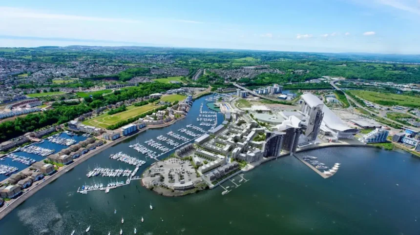
Cardiff has experienced substantial physical, economic, demographic and transport change since 2000. The transformation is strongest in Cardiff Bay, Butetown, the city centre, Grangetown, Adamsdown, Splott, Canton, Riverside and parts of Ely and Caerau. These areas combine major regeneration projects, new housing, transport investment, public-space improvements and changing population patterns.
- Why has Cardiff changed so much since 2000?
- Which Cardiff area has changed the most since 2000?
- How has Butetown changed since 2000?
- How has Cardiff city centre changed since 2000?
- What changes have taken place in Grangetown since 2000?
- How has Adamsdown changed since 2000?
- What has changed in Splott and Tremorfa since 2000?
- How has Canton changed since 2000?
- How have Riverside and Pontcanna changed since 2000?
- What has changed in Ely and Caerau since 2000?
- How has Cardiff’s population affected changes across different areas?
- Which Cardiff areas have experienced the biggest transport changes?
- How has regeneration changed Cardiff’s older neighbourhoods?
- Which areas are likely to remain important in Cardiff’s future development?
- What does Cardiff’s transformation since 2000 mean for residents and visitors?
The scale of change is also visible in Cardiff’s overall population. The city had approximately 310,100 residents in 2001, rising to 346,100 in 2011 and approximately 362,300 in 2021. That represents an 11.6% increase between 2001 and 2011 and a further 4.7% increase between 2011 and 2021. Cardiff remained the most populous local authority in Wales in 2021.
The most changed areas are therefore not defined only by new buildings. Change includes the conversion of former industrial land, redevelopment of transport hubs, new residential neighbourhoods, improvements to streets and parks, demographic shifts and stronger connections between previously separated districts.
Why has Cardiff changed so much since 2000?
Cardiff changed rapidly after 2000 because regeneration, population growth, waterfront redevelopment, transport investment and new housing transformed former industrial and underused land. Cardiff Bay, the city centre and inner southern districts experienced the strongest combined physical and economic changes.
The foundations were established before 2000, particularly through the Cardiff Bay Barrage, which opened in 1999. The 1.1-kilometre barrage transformed the tidal bay into a 200-hectare freshwater lake and created approximately 13 kilometres of waterfront. Cardiff Harbour Authority describes the £220 million barrage as the catalyst for around £2 billion of regeneration across the old docklands of Cardiff and Penarth.
After 2000, this waterfront transformation continued through residential development, cultural facilities, public spaces, leisure destinations and commercial investment.
At the same time, Cardiff’s population expanded. Between 2001 and 2011, Cardiff recorded population growth of 11.6%, the highest percentage increase among Welsh local authorities listed in the 2011 Census comparison.
The following decade brought another 16,200 residents, taking the population from around 346,100 in 2011 to 362,300 in 2021. Cardiff’s population increased by 4.7%, compared with 1.4% for Wales as a whole.
This growth increased demand for housing, schools, public transport, roads, cycling infrastructure, employment space and community facilities.
Which Cardiff area has changed the most since 2000?
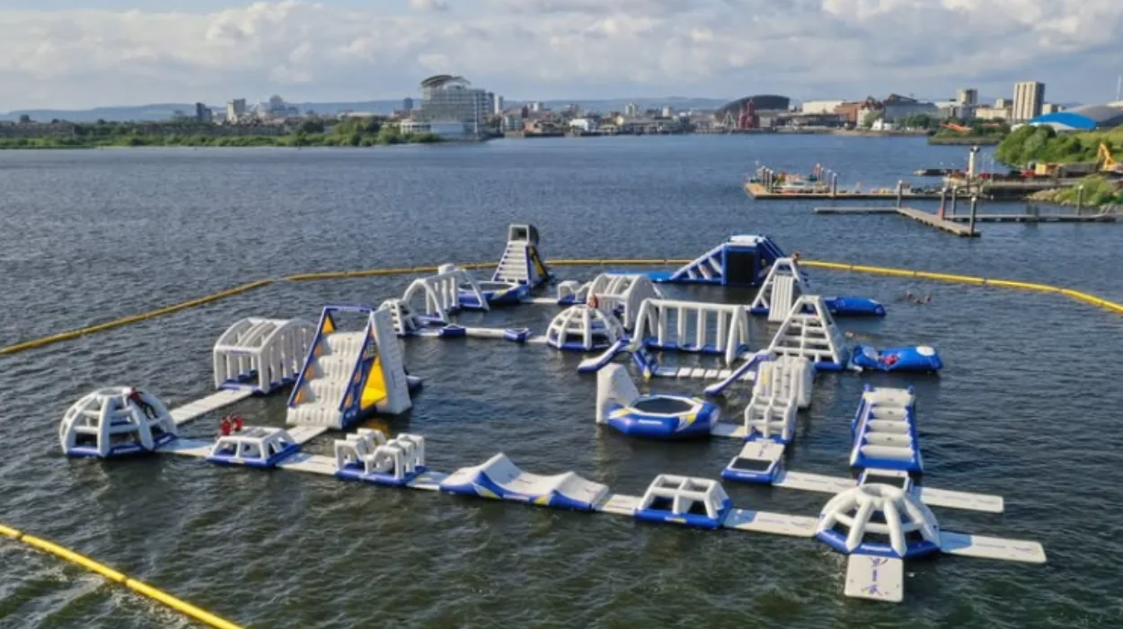
Cardiff Bay has experienced the most dramatic physical transformation since 2000, changing from a predominantly dockland environment into a major waterfront district containing housing, cultural attractions, leisure facilities, public spaces, offices and transport connections.
Cardiff Bay is the clearest example of long-term urban regeneration. The former docks had declined substantially as traditional port activity reduced. The barrage created the physical foundation for a new waterfront economy.
Since 2000, the Bay has developed as a mixed-use district. The area contains Wales Millennium Centre, the Senedd, Mermaid Quay, residential developments, offices, restaurants, public promenades and recreational facilities.
The transformation is significant because it changed the function of the land. The docklands were historically connected to coal export, shipping and industrial activity. The modern Bay is strongly associated with culture, tourism, housing, leisure and services.
Cardiff Harbour Authority’s 25-year timeline identifies the opening of the barrage in 1999 and the creation of Cardiff Harbour Authority in 2000 as major milestones in the waterfront’s modern development.
The change also affected nearby Butetown and Grangetown. New streets, buildings and public spaces altered connections between the city centre and waterfront.
The transformation continues. Cardiff Council identifies Atlantic Wharf as a strategic regeneration priority. The redevelopment includes a new 16,500-capacity indoor arena, alongside economic initiatives intended to increase business activity and footfall within Butetown.
This makes Cardiff Bay and its surrounding districts one of the strongest examples of sustained urban change in Wales.
How has Butetown changed since 2000?
Butetown has changed through waterfront regeneration, new housing, public-space investment, transport improvements and commercial development. Its historic dockland identity remains important, while new cultural, residential and leisure uses have increased the area’s connection with central Cardiff and Cardiff Bay.
Butetown sits between Cardiff city centre and the waterfront. Its location made it central to the regeneration strategy that followed the Cardiff Bay Barrage.
The area has experienced significant redevelopment alongside the preservation of important historic and community characteristics. New residential buildings have appeared beside older streets and historic structures.
The development pattern is not limited to private housing. Cardiff Council operates local regeneration and housing programmes across the area, while Loudoun Square remains an important community focal point.
Transport investment has also strengthened the relationship between Butetown and the city centre. Cardiff Council’s Crossrail-related proposals include changes involving the Cardiff Bay railway line and the Grade II listed railway overbridge between Bute Street and Lloyd George Avenue.
The next phase of change is linked to Atlantic Wharf. The proposed arena and associated regeneration are intended to generate additional visitor numbers, employment and business activity.
Butetown therefore demonstrates a combination of historic continuity and modern redevelopment, rather than complete replacement of the existing neighbourhood.
How has Cardiff city centre changed since 2000?
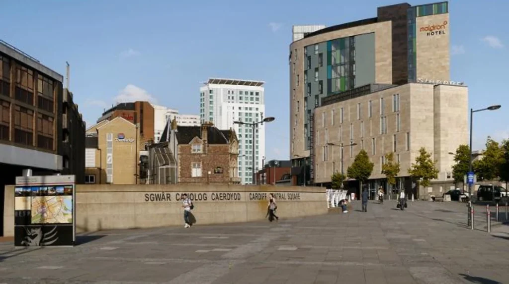
Cardiff city centre has changed through major redevelopment of transport infrastructure, public spaces, retail districts, offices, housing and pedestrian routes. Central Square has become one of the clearest examples of how Cardiff reorganised its urban core around modern transport and commercial activity.
Central Square has undergone a particularly visible transformation since the early 2000s.
The area around Cardiff Central railway station has developed into a major transport and commercial gateway. The redevelopment has included new buildings, redesigned public spaces and improved connections between the railway station, bus services and the city centre.
The transport function is important because Cardiff has a high population density. ONS identified Cardiff as the most densely populated of Wales’ 22 local authorities in 2021.
The council’s current transport and clean-air strategy continues to prioritise Central Square. Its plans link the area with the transport interchange and wider city-centre improvements, while also seeking to provide more road space for public transport and active travel.
Other parts of the city centre have also changed. St David’s shopping district, The Hayes, Mill Lane, Central Square and the railway station area have experienced substantial investment since 2000.
The centre has consequently shifted from a primarily retail-focused environment toward a broader mixture of retail, hospitality, offices, tourism, residential development, transport and cultural activity.
What changes have taken place in Grangetown since 2000?
Grangetown has experienced gradual regeneration rather than a single redevelopment project, with housing improvements, street upgrades, community gardens, pedestrian measures, transport changes and proximity to Cardiff Bay reshaping parts of the neighbourhood.
Grangetown is one of Cardiff’s most important inner-south neighbourhoods. Its location places it between the city centre, Cardiff Bay and southern transport corridors.
Cardiff Council reports that more than 400 homes in North Grangetown have benefited from external repairs and boundary-wall improvements through neighbourhood regeneration activity.
The changes extend beyond individual houses. Projects have included Gerddi Courtmead Gardens, new pavements, street trees, road surfacing, raised junctions and improvements to Somerset Street developed with local residents and Sustrans.
These projects demonstrate a different type of urban change from Cardiff Bay. Grangetown has not been rebuilt as a new district. Instead, existing residential streets have received targeted improvements.
Its location has also become more strategically important because Cardiff Bay’s regeneration expanded southward and westward.
Current transport programmes continue to focus on Grangetown. Cardiff Council’s highway programme includes footway improvements and resurfacing projects in the area, demonstrating that regeneration remains an ongoing process rather than a completed event.
How has Adamsdown changed since 2000?
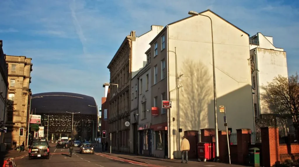
Adamsdown has changed through housing renewal, education investment, public-space improvements, transport planning and increasing pressure from inner-city population growth. Its location near the city centre has made it increasingly important within Cardiff’s wider regeneration strategy.
Adamsdown lies immediately east of central Cardiff. Its streets contain substantial Victorian and Edwardian housing alongside newer developments.
Regeneration has focused on improving existing neighbourhood infrastructure rather than replacing the entire district.
Cardiff Council reports that its neighbourhood regeneration programme has completed 57 projects across Cardiff since 2000/2001. These projects include improvements to homes, streets, public spaces and community facilities.
Adamsdown has also experienced changes to education infrastructure. Cardiff Council’s 21st Century Schools programme included plans to increase Willows High School capacity from 1,121 places to 1,200 places and relocate the school to new accommodation at Tremorfa Park. Baden Powell Primary School was also planned to increase capacity from 420 to 630 places.
These investments reflect the changing needs of a growing inner-city population.
Parking and transport pressures are another indicator of change. Cardiff Council’s city parking strategy identifies Adamsdown among the inner-city areas prioritised because of limited parking availability.
The district therefore shows how population pressure, housing demand and transport requirements have altered established inner-city neighbourhoods.
What has changed in Splott and Tremorfa since 2000?
Splott and Tremorfa have changed through industrial-land redevelopment, education investment, transport improvements, housing renewal and changing employment patterns. Their transition reflects Cardiff’s wider movement from traditional industrial land uses toward mixed residential, commercial and community functions.
Splott and Tremorfa form part of Cardiff’s eastern inner-city area. Their historic development was closely connected with industry, railways, manufacturing and employment sites.
Since 2000, parts of the area have experienced changes in land use and community infrastructure.
Cardiff Council’s business-support network currently includes Splott Workshops on Portmanmoor Road, demonstrating the continued presence of employment and enterprise activity alongside residential uses.
Education has also been a major part of neighbourhood investment. Plans for Willows High School and Baden Powell Primary School included new facilities at Tremorfa Park.
Transport connectivity has become increasingly important. Cardiff’s planned Cycleway 2 connects the city centre through Adamsdown, Newport Road retail areas, Rumney, Llanrumney and St Mellons Business Park.
This demonstrates how Splott and neighbouring districts are being integrated into Cardiff’s broader active-travel network.
The area’s future identity is therefore increasingly linked to connectivity, housing, local enterprise and community facilities rather than its earlier industrial role alone.
How has Canton changed since 2000?
Canton has changed through residential investment, independent businesses, public-realm improvements, transport changes and increasing demand for inner-city housing. Its established Victorian streets remain prominent, while Cowbridge Road East and nearby commercial areas have become stronger mixed-use destinations.
Canton has not experienced the same scale of physical redevelopment as Cardiff Bay. Its change is more incremental.
The district has benefited from its position west of the city centre and its connections to Riverside, Pontcanna, Llandaff and central Cardiff.
Cowbridge Road East remains a major commercial corridor. Residential streets surrounding it have experienced housing refurbishment and changing household demand.
Canton also forms part of Cardiff’s current active-travel planning. Cardiff Council’s Active Travel Network Maps cover Canton as a separate ward and connect the wider district to the city’s planned walking and cycling network.
The area illustrates why measuring urban change only through major construction projects gives an incomplete picture. A neighbourhood can change significantly through property renovation, retail turnover, transport behaviour and demographic change without being physically rebuilt.
Canton’s proximity to the city centre has also contributed to continued pressure on parking. Cardiff Council’s parking information includes dedicated parking provision in Canton, reflecting the district’s established commercial and residential activity.
How have Riverside and Pontcanna changed since 2000?
Riverside and Pontcanna have changed mainly through residential demand, local commercial growth, transport pressures, public-space management and active-travel planning. Their historic housing stock remains dominant, but their relationship with central Cardiff has become increasingly important.
Riverside sits between Canton, Pontcanna and the River Taff. Its location gives residents relatively direct access to the city centre and Cardiff’s western neighbourhoods.
Pontcanna has similarly retained much of its historic residential character while experiencing increased pressure from parking, traffic and local services.
The current proposal for a Pontcanna Central parking zone demonstrates the intensity of parking demand in the district. Cardiff Council states that the proposed zone responds to difficulty finding suitable parking and is designed to manage demand for residents, visitors and businesses.
Transport policy has also changed. Cardiff’s proposed cycleway network includes routes connecting the city centre with Riverside and onward to Ely and Caerau.
These changes show that modern Cardiff planning increasingly focuses on reducing dependence on private vehicles while improving connections between residential areas and employment centres.
The key change in Riverside and Pontcanna is therefore intensification of urban use and transport demand, rather than wholesale redevelopment.
What has changed in Ely and Caerau since 2000?
Ely and Caerau have experienced neighbourhood-focused regeneration, improved community facilities, housing investment and stronger transport planning. Their transformation is less concentrated in large commercial developments and more focused on improving established residential communities.
Ely and Caerau are located in southwest Cardiff. They contain extensive residential estates and have historically faced different regeneration challenges from the waterfront and city centre.
Cardiff Council’s neighbourhood regeneration approach includes estate regeneration, environmental improvements and projects designed to improve safety and quality of life.
The Ely and Caerau Hub also forms part of Cardiff’s community infrastructure, providing local services alongside other neighbourhood hubs across the city.
Transport planning is becoming increasingly significant. Cardiff Council’s proposed Cycleway 5 connects the city centre with Riverside, Ely and Caerau.
Highway investment is another continuing feature. Current Cardiff Council programmes include resurfacing work on roads in Ely and Caerau.
The areas demonstrate that regeneration does not always involve high-rise buildings or major commercial schemes. Improvements to streets, public services, transport, housing and community infrastructure also represent substantial urban change.
How has Cardiff’s population affected changes across different areas?
Cardiff’s population growth increased demand for housing, transport, schools and services across the city. Population change was particularly important in inner-city districts, where existing housing stock, limited land and proximity to employment created stronger pressure for urban intensification.
Cardiff’s population increased from approximately 310,100 in 2001 to 346,100 in 2011, representing an 11.6% increase. By 2021, the population reached approximately 362,300, another 4.7% increase.
The demographic profile also changed. Between 2011 and 2021, Cardiff’s median age increased from 33 to 34 years. The number of residents aged 65 to 74 increased by nearly 6,200, representing growth of 27.2%. At the same time, the population aged four and under fell by more than 3,300, a decrease of 14.8%.
These figures have implications for urban planning.
Older neighbourhoods require investment in housing quality, accessibility and community services. Growing employment areas require transport connections. Inner-city districts require careful management of parking, pedestrian movement and public space.
The population increase therefore provides an important explanation for why change has occurred across Cardiff rather than in one regeneration zone.
Which Cardiff areas have experienced the biggest transport changes?
The city centre, Cardiff Bay, Butetown, Adamsdown, Grangetown, Riverside, Ely and eastern Cardiff have experienced significant transport planning changes since 2000. Modern investment increasingly prioritises public transport, walking and cycling alongside conventional road infrastructure.
Transport policy has become a central component of Cardiff’s urban development.
The city centre has required new arrangements around Central Square and the transport interchange. Cardiff Bay has required better connections between the waterfront, central Cardiff and surrounding residential districts.
Cardiff Council currently proposes six strategic cycleway corridors. These include connections from the city centre to Roath Park, northeast Cardiff, St Mellons, Cardiff Bay, northwest Cardiff and Caerau.
The proposed network demonstrates the changing approach to Cardiff’s transport system. Instead of treating roads only as vehicle corridors, modern planning gives greater attention to walking and cycling connections.
Parking policy also reflects the transformation. Cardiff Council received more than 6,000 responses to its 2024 city parking-plan consultation. The revised strategy divides the city into three parking-management areas and prioritises inner-city locations including Cathays, Plasnewydd, Riverside, Adamsdown and Grangetown.
Transport change is therefore both a consequence of Cardiff’s growth and a mechanism shaping future development.
How has regeneration changed Cardiff’s older neighbourhoods?
Regeneration in older Cardiff neighbourhoods has focused on repairing homes, improving streets, upgrading public spaces, strengthening community facilities and improving safety. This approach preserves established communities while addressing physical conditions created by ageing housing and infrastructure.
Cardiff Council defines neighbourhood regeneration as updating areas so they meet current needs. Its work includes housing, streets, public spaces and local services.
The council’s neighbourhood regeneration programme provides evidence of long-term investment. Since 2000/01, 57 projects have been completed across Cardiff, including external repairs, boundary-wall improvements, street upgrades, parks and community-space improvements.
North Grangetown provides a clear example. More than 400 homes benefited from external repairs and boundary-wall improvements. Other projects improved pavements, junctions, street trees, road surfaces and community gardens.
This model differs from large-scale waterfront regeneration.
Cardiff Bay involved major land-use transformation and new development. Neighbourhood regeneration involves smaller interventions distributed across established communities.
Both forms of investment have shaped Cardiff since 2000.
Explore More Area Guide
Cardiff’s Richest Heritage Neighbourhoods: History & Landmarks 2026
Cardiff Garden Suburbs: The Story of Rhiwbina
Which areas are likely to remain important in Cardiff’s future development?
Cardiff Bay, Butetown, the city centre, northwest Cardiff, eastern Cardiff and established inner-city districts will remain important because of planned housing, employment, transport, regeneration and infrastructure investment. The strongest future changes will continue around strategic development and transport corridors.
Cardiff Council’s Local Development Plan identifies eight strategic sites containing either at least 500 dwellings or significant employment uses. These sites are intended to help meet Cardiff’s requirements for homes and jobs.
The identified development areas include the Central Enterprise Zone and regional transport hub, former Gas Works at Ferry Road, northwest Cardiff, land north of Junction 33 of the M4 and other strategic locations. The northwest Cardiff strategic site alone has a minimum allocation of 5,000 homes with employment and community uses.
This development model connects housing with infrastructure. Cardiff Council states that strategic sites are planned alongside sustainable transport corridors, schools, community facilities and green spaces.
Atlantic Wharf is another major future development zone. Its new indoor arena and associated economic initiatives will add another layer of change to Butetown and Cardiff Bay.
The result is a city continuing to evolve through several different forms of development rather than one single regeneration project.
What does Cardiff’s transformation since 2000 mean for residents and visitors?
Cardiff’s transformation has created a more connected, densely populated and mixed-use city, with major changes to the waterfront, centre and inner neighbourhoods. Residents experience new infrastructure and services, while visitors encounter a city shaped by culture, leisure, business and modern transport.
For visitors, the most visible transformation is concentrated around Cardiff Bay and the city centre. The waterfront provides cultural venues, restaurants, public spaces and attractions that were not present in their current form at the start of the 2000s.
For residents, the changes are broader. Housing renewal, new schools, improved streets, active-travel routes, parking management and community facilities affect everyday life.
Cardiff’s growing population has increased pressure on infrastructure. In 2021, Cardiff had approximately 362,300 residents and remained the largest local authority by population in Wales.
The city’s transformation since 2000 is therefore best understood as a combination of major regeneration and continuous neighbourhood change.
Cardiff Bay represents the most dramatic physical transformation. Central Cardiff represents the strongest transport and commercial transformation. Grangetown, Adamsdown and Splott demonstrate neighbourhood renewal and infrastructure investment. Canton, Riverside and Pontcanna demonstrate gradual residential and transport intensification. Ely and Caerau demonstrate community-focused regeneration.
Together, these areas show how Cardiff has moved from a city shaped strongly by its industrial and dockland past toward a more diversified urban economy based on housing, culture, services, education, tourism, transport, technology and mixed-use development.
The change remains ongoing. Cardiff’s strategic development sites, active-travel network, neighbourhood regeneration programme and Atlantic Wharf investment indicate that the city’s physical and demographic evolution will continue beyond 2026.
Which Cardiff area has changed the most since 2000?
Cardiff Bay has experienced the most dramatic transformation since 2000. Former dockland areas developed into a mixed-use waterfront containing homes, cultural venues, restaurants, offices, public spaces and leisure facilities.